COROS has begun rolling out a new firmware update today that adds in more exacting time splits for certain sports, as well as a new waypoints-like feature for outdoor route navigation. In addition, the running track mode now supports structured workouts.
These updates are available for the COROS VERTIX, APEX Pro, and PACE 2, with the APEX coming a bit later this week. Note that while the rollouts began this morning, they are typically staged, which means it won’t necessarily show up on your device instantly – but may take a few hours/days. Also, you’ll need the latest COROS smartphone app to both update and utilize these features.
Here’s the full list of what’s in this update:
- Adds 0.01s to Run, Track Run, Bike, Pool Swim, and Rowing
- Adds checkpoint feature that allows users to record a point before, or during the outdoor workout under route navigation [Not for COROS Pace 2, as it doesn’t support navigation]
- Workout program supports track run
- App workout details include weather info: temperature, humidity, and wind
- New map layer options in the app from Mapbox: outdoor terrain, winter, and dark
Got all that? Good. Essentially all COROS watches get this update save the original COROS Pace, which is great! COROS is still mostly early enough in their existence as a company that it’s relatively easy for them to support all watches for firmware updates. But as we saw with the original COROS Pace, eventually it becomes challenging to plan hardware wise for things years down the road. While that’s easier on high powered devices like a phone (or an Apple Watch), it’s far more challenging on endurance wearables that are designed to eke out every little bit of battery performance (at the expense of system capacity).
New Navigation Bits:
I wanted to briefly talk about the new routing/navigation features related to so-called ‘Checkpoints’. Ultimately, these ‘checkpoints’ are actually just called waypoints by all other apps/platforms/standards, though, the actual nuance of how they are implemented is different than what other platforms do.
In talking to COROS about it over the last few days, they see this as a starting point for deeper features around navigation and waypoints.
First though, let’s establish the core new features here to begin with, bullet-point style:
A) Ability to view checkpoints in the COROS smartphone app atop an existing GPX route within the COROS app
B) Can then transfer that route/course to your watch, inclusive of the checkpoints
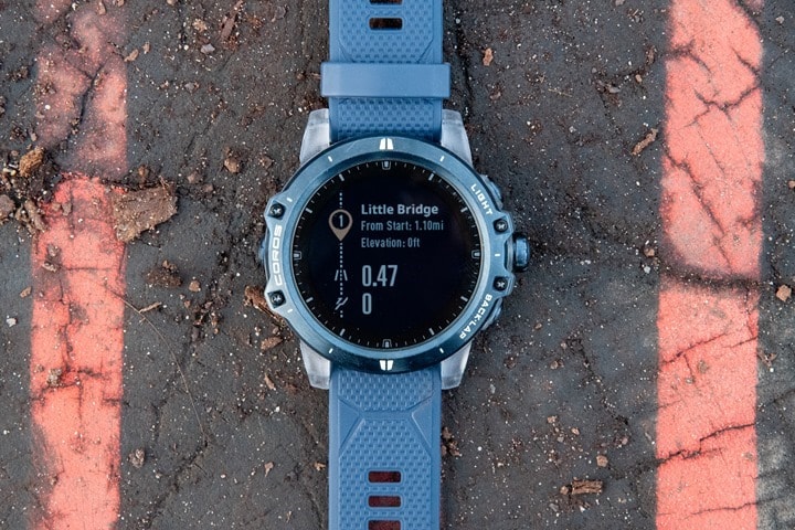
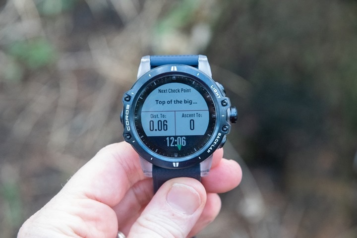
C) On the watch you’ll see the distance and elevation remaining to the next checkpoint
D) You’ll also see the checkpoints listed on the breadcrumb and elevation profile pages
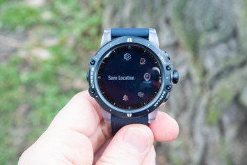
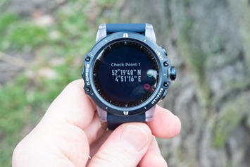
E) While out on the trail you can then save a new waypoint/checkpoint at any time
F) That waypoint is then added to the file and synced back to the smartphone app
Now, before I show this – the big-ticket item that’s *NOT* here though is the ability to navigate to a newly saved checkpoint on your watch, such as using the compass. Meaning, if you save a waypoint next to a given spot, you can’t then later on navigate back to that spot. There’s no menu for navigating to a new checkpoint on the watch. But COROS says that type of functionality is in the queue to implement.
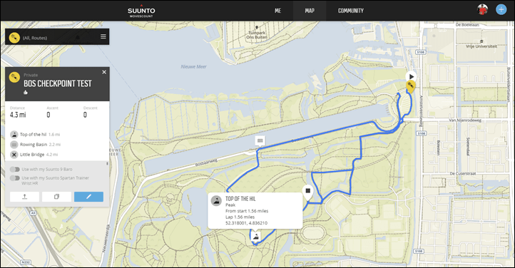
To get started you’ll need a GPX file *WITH WAYPOINTS* defined in it. Unfortunately this isn’t something you can create in the app (either the route or the waypoints in the route). So you will need to use a 3rd party app to do that.
Side note: This turned out to be a solid pain in the ass to do purely web-based. Strava doesn’t create waypoints, and while Komoot creates waypoints, they don’t export them in the GPX file. Next, Garmin Connect allows waypoint creation, but doesn’t actually put them in the .GPX file upon export. Google Maps only allows KML/KMZ export. Easy Route, which I typically use, can’t create waypoints. Other apps I tried could create waypoints, but then sucked creating routes because they didn’t leverage auto-trail following. Ultimately, ended up using Suunto Movescount. #NotKidding.
(Another side note: According to this page, I’ve got a mere one week left till Movescount wouldn’t allow me to do this either. Shame. Long Live Movescount!)
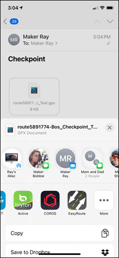
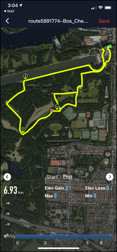
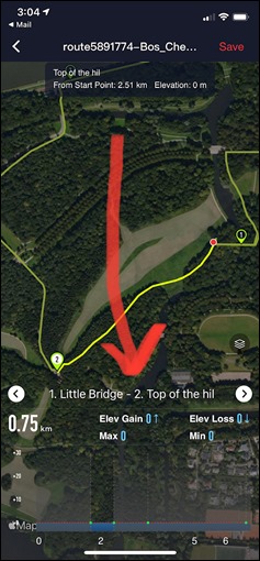
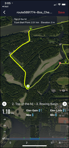
Ok, with that file created, I e-mailed it to myself and told my phone to open it using the COROS app. From there I could see the route, and it even shows me the waypoints (thank god, given how long I spent trying to get to this point). Also, each time you click on a waypoint it’ll show how long between points and the elevation.
In this case, while there is actually a mere 15m of elevation gain to the top of the hill – Suunto Movescount doesn’t quite show it, thus, COROS doesn’t show it. Look, by this point in the post you’re lucky you’re getting any example data at all given how much time I burned trying to create a functional file.
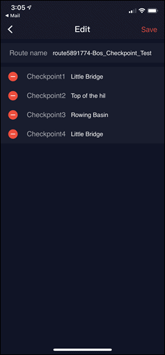
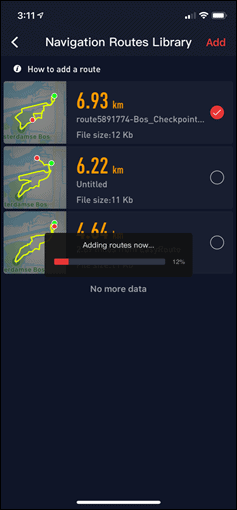
You can edit the waypoints, handy since you’ll have noticed I managed to spell ‘Hill’ wrong earlier. So I fixed that down below. Then, I sent it off to the watch to sync to the Vertix:
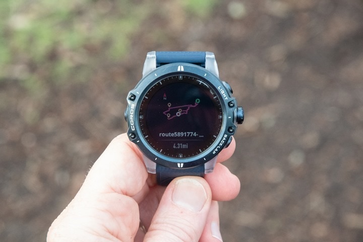
After that’s done, load up your route on the COROS watch of choice, and you’ll see the waypoints showing up as little orange icons:
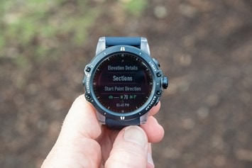
There’s also a new menu item called ‘Sections’, which lists the sections between each waypoint. This is pretty handy to be able to break-up the course, showing the same sections as seen earlier on the app:
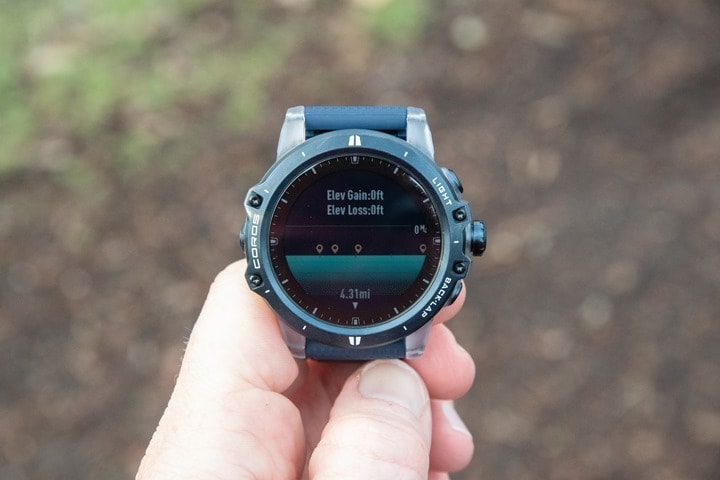
And if you look in the elevation field, you’d likely see the elevation profiles of each one. But as discussed earlier, my file produced null elevation data and it’s Monday and lunch should have been three hours ago. Maybe on a Wednesday I might have tried harder.
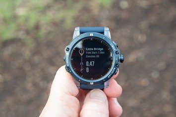
Next, as I start, it’ll show me the segments and how much distance to each segment. This is pretty darn cool – I like it!
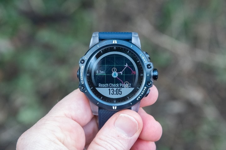
And you’ll also get a notification upon each checkpoint/waypoint you arrive at – ‘Reach Check Point 2’ – as seen below. After that, though not immediately, it’ll update to show the next checkpoint. It seemed to wait about 100-150m after I left the checkpoint before it triggered showing details to the next checkpoint.
There isn’t any way to navigate to an existing checkpoint after you’ve gone past it. So you can’t pull open checkpoint #2 after you’ve gone to #4. Which in some ways hints at how COROS sees this feature used: Race checkpoints. They outlined a scenario where a race director posts a .GPX file of the race with the various aide stations or – literally – checkpoints in the file. Hence the rebranding of waypoints to checkpoints.
As I mentioned earlier you can save waypoints at any time, and even see them on the map mid-route too once saved:
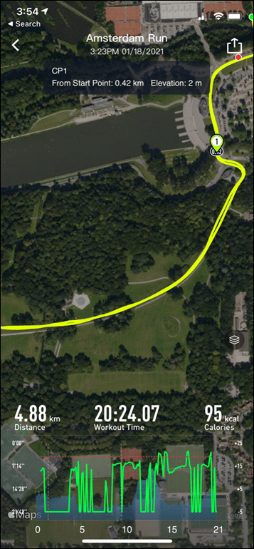
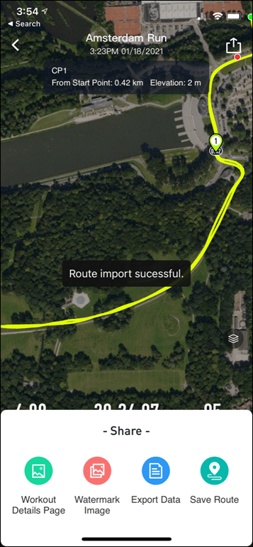
However, these are not accessible to route to within this section. Instead, they’re accessible afterwards on the COROS smartphone app in your completed activity, you’ll see the little icon added to the screen (#1 below), and then if you save that specific route it’ll save that checkpoint for your next workout. However, it won’t convey over any of the existing checkpoints from that previous run/ride/whatever. Meaning, the checkpoints that I defined from the earlier GPX file aren’t carried through to the new route if I add a new checkpoint.
Note that it’s not possible at this time to do both a structured workout and navigation at the same time.
And with that, you know everything there is to know about checkpoints on COROS watches.
Overall, it’s good to see COROS expanding their navigational aspects here. And it’s clear they’re starting to build the foundation for more features, as they themselves noted in my chat with them. I really like the segmenting of chunks between checkpoints, that makes a lot of sense – and fills in the two core metrics most people care about (distance to next point and elevation gain to next point).
Given this is their first slice at this, it won’t have anywhere near the depth of features of watches that have been around a decade. And I think if one looks at my feedback to COROS over the last year, I’ve been pretty consistent that they need to focus on polish on the app/platform side. To that end, we have been seeing that. Aside from the super-well executed COROS Pace 2 this past fall, almost everything else has been updates for existing watches – which is great. However, I think my attempt to write this post inadvertently exemplifies some of the opportunities COROS has to simplify the platform side further. In my ideal world I’d simply have authenticated my COROS account to Strava or Komoot or whomever, pulled in the route I created there, and then added any waypoints quickly using the COROS app. No messy files to create, e-mail to myself, edit, and so on.
But ultimately, no vendor boils the ocean overnight – and COROS has shown they can keep heating up the water each month. As always, looking forward to seeing what they add next.
With that – thanks for reading!
Found This Post Useful? Support The Site!
At the end of the day, I’m an athlete just like you looking for the most detail possible on a new purchase. These posts generally take a lot of time to put together, so if you're shopping for the COROS Pace 2, COROS APEX Pro or COROS Vertix or any other accessory items, please consider using the affiliate links below! As an Amazon Associate I earn from qualifying purchases. It doesn’t cost you anything extra, but your purchases help support this website a lot.
And of course – you can always sign-up to be a DCR Supporter! That gets you an ad-free DCR, access to the DCR Quarantine Corner video series packed with behind the scenes tidbits...and it also makes you awesome. And being awesome is what it’s all about!



Is navigation improved? The arrow is always behind. I often have to go back because I missed the turn. I tried in city, open fields, forests and did all updates. It’s just not good enough. On daily base I wair coros, also for running. But when I do a navigation route I change to Garmin. But this sucks.. rather have 1 good watch.
Arrow still seems a bit laggy.
why u cant use just Garmin only?
Very interesting! Thanks for this information. I use the iOS App MapOut which can mix waypoints into a gpx file and then export it to every app that supports import functions. Could you give that App a try? Unfortunately In don’t own a Coros watch but if this setup will do the job I think of buying one.
Ha! Didn’t notice that I could test the App without having a watch. Works perfect!!! So here is my recommendation: MapOut. Very cool! :-)
You should try plotaroute.com
You can add directions there and they will export with the track as waypoints. And elevation problem you had with movescount exported route is probably because of the “bug” present for almost a year in movescount when it lost the elevation data completely. Plotaroute doesn’t have this problem and their gpx can be imported with waypoints to other services without problem. Great site!
Not sure but I think AllTrails might be the tool you needed to help create waypoints and GPX files.
I don’t recall if it requires to to purchase a subscription but it is great at creating maps.
Cool, Coros has breadcrumb navigation for courses/routes on all their devices?
Except the COROS Pace/Pace 2.
Does anyone know where is this feature, cos I don’t have it ?
“A) Ability to create checkpoints in the COROS smartphone app atop an existing GPX route within the COROS app”
Yup, I’d agree that’s not working either for me. I’ll tweak it for now just to view.
I’ve checked free version of AllTrails and confirm that routes with waypoint created here work in Coros app and watches.
try afstandmeten.nl for route planning
Hi, thanks for the article and as always great content. I’d be very interested to hear what the top 5-10 things I’d miss if I transition to Coros from my deeply beloved Felix 6, being an ultra runner. I could of course simply test myself, but it’s no small step. :)
Everyone values different features differently. So, I’ll just talk about the core feature I’d miss if I was converting over:
1) ClimbPro
2) Route sync from Strava/Komoot/etc automatically
3) Having to deal with the dial (I know three people like it, it’s the thing I absolutely despise on COROS watches…which…is totally personal, but I hate it).
4) Training load metrics that are meaningful/cohesive
5) Data metrics via Garmin Connect mobile (the depth of a lot of the 24×7 stuff is just far deeper and more cohesive than the COROS App)
6) Native access to the .FIT files on the watch when plugging in
7) Better/custom watch faces
8) Ability to change data pages on the watch itself (sans/app)
9) WiFi sync
There’s lots more little things (WiFi sync might fall under ‘little things’). And that’s why I say it’s death by a thousand cuts for Garmin competitors, especially for more advanced users. Which again, isn’t to say COROS is doing bad – hardly, as I’ve said their Pace 2 is astoundingly good. And they do things better there in some areas than Garmin (see: running power). But the transition at the top-end of COROS’s watches is a much tougher gap (Vertix/etc…) given the price similarities.
And again – those are just my off the top while sitting down having a coffee list. I haven’t sat here and thought about it for 45 minutes, so I’m probably missing some. Notably, you won’t see music or contactless payments on the list. While I do use those, I do so far more rarely than the things I’ve listed above.
Thank you for your insights on this! BR Oscar
Hi,
Hope someone is still reading this. Please is this thing working fine for you?
I used plotaroute, added points, and everything looks fine in coros app. I sync and have all in watch fine. But when tracking starts, that watch screen how much distance/height to next segment on watch. Like it updates every 10 minutes or so, hard to tell so you never know how much there is distance and length to next check point.Is there a way to make this work fine? Like I said when i upload route to app before sending to watch everything looks fine and I tried to put waypoints on route as much precise I can.
many thanks
I’m having this issue too. I reported it to Coros, maybe other’s can do the same.
Hopefully they will fix it soon. It seemed to me like it was distance based to trigger the data refresh event. Also if I leave it on that check point data page it stays current as long as displayed. Once you move off the page (which most will do) it stops updating and that old data is what you will see when you return to it.
For me this was the only issue with the whole process (I used plotaroute as recommended by Coros), but I do consider this issue major and is a show stopper for me for now (and a possible reason to hold off purchasing or return).
Tell me please, which method you used to do that. Did you used directions like described on Coros page, or you used Waypoints/ annotations. I later came to official directions Coros guide. I used waypoints and that does not work, and I hoped directions might work after reading Coros page. Which one you used? You know when you download, on bottom he asks you about waypoints, you can chose None, POIs,Directions. Like I said I used POIs, wonder does Directions might work?
I used POIs to avoid all the directions it generates. I just want the waypoints I added. So GPX Type = Track, WAYPOINTS = POI’s. The key is to add a symbol to the waypoints you create. This makes it a POI when downloading the GPX file. Also be warned that it will truncate the text to 10 characters. Hope that helps.
I did the same, used POI. But later found out that there is in settings of plotaroute “Generate Directions (with Auto-Plot only)”, you can turn that off. So now he does not create directions automaticaly. You plot a route, hit hills now you got your route profile, hit somewhere on hill map, new menu pops out for you to put direction and you enter direction name like “water1”. And you add directions that way. And when downloading you select “directions” not POI.
I wonder will that maybe do wonders here and make this start working?
Cool looking forward to testing this out, Ray do you know what happens if you pass a waypoint multiple times in a route? Does it repeat or know it’s different sections, like what happens if you place it in a fork (trailhead) and your route passes by more than once.
I’m trying the checkpoint nav, mainly for trail running. Using Gaia I created my waypoints with names like “fork left”, “2nd right”, etc… and this is all what shows up in the sections/coros app. But then when I actually navigate it I instead get “Reached check point 3” – that is… utterly pointless and useless? Hell if I even remember which checkpoint #3 is. Am I missing something?
I’m having an issue with the checkpoints connecting to other checkpoints. If I open the same GPX file with CalTopo, the route comes up perfectly, but everytime I open it with COROS I get those long straight lines connecting a checkpoint back to the start/finish when no one asked it to do this.