Today we’ll continue the once in a long time series of quick app reviews. As you know, I generally dislike doing app reviews, mainly because apps change so quickly that any criticisms I make are immediately addressed in the next revision. Then for some reason app companies usually demand I immediately update my reviews/posts to account for their mistakes/fixes. Thus, I solve this problem by just not doing app reviews. I’m a practical kinda guy.
But as seems to be the case – every 6-8 months I get curious enough down a rabbit hole and decide to publish one. A quick one, like always. Well, quick is all relative.
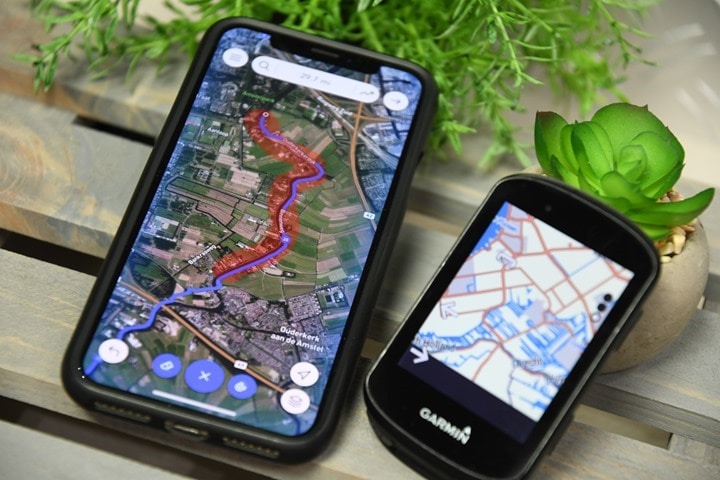
In any case – Footpath is basically the ‘inspiration’ behind Strava’s finger route planner that was introduced a few months ago. The company later showed that ‘inspiration’ basically means Strava copied it and did a poor job of covering their tracks (no pun intended, but seriously, read that article). In talking with the Footpath’s creator, they noted how much better their solution was than the rendition presented by Strava. And the truth is – yes and no. Yes, they’re a far deeper solution, but you’ve gotta pay for that depth. The free version is very basic and not super useful for most fully connected athletes, as it doesn’t allow exporting. And for accuracy of finger-dragging? Well, that too depends a bit.
Oh – and you may be wondering why you’d want an app like this. And the answer is simple: Both Garmin and Wahoo’s route planning options suck. In the case of Garmin, it’s newly rolled out smartphone route creation app functionality is incredibly clunky. I dare you to try and create a 50KM route with it. And Wahoo? They don’t have one at all. You can only do point A to point B routes, nothing with any stops/loops/etc… Thus, time to find alternatives.
Creating the route:
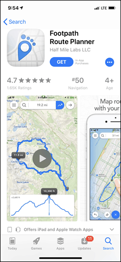
In any case, let’s dig in. Obviously, first you need to install the app. It’s unfortunately only available on iOS. Sad panda. Though – happy panda in that the developer says you’ll see it come to Android a bit later this summer. Woot!
Still, for those iOS users, I presume you know how to install apps on your phone. If not…umm…welcome to May 2019. We also have airplanes and robotic vacuum cleaners. Folding phones though are still Jetsons black magic.
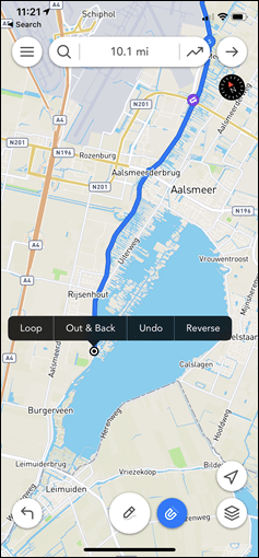
Once installed it walks through a super quick tutorial on the basics of the app. It’s easy-peasy. When it comes to creating a route, the key thing that Footpath allows is the ability to just swipe your finger in a single movement for where you want to go. Like circling a lake or park, and then it’ll do the work of figuring out the exact path (so you don’t have to trace the specific road).
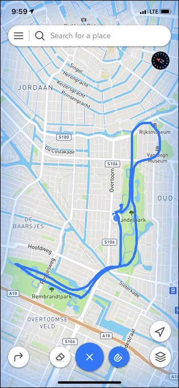
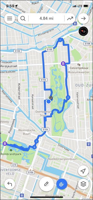
To do that you’ll tap the little pencil icon once, and then just swipe away with as much swipage as you can swipe in one fingering. Below at left you see my finger work. At right, what it came up with.
Again – the point of this app and these concepts is that you don’t have to be precise. It’s supposed to figure out the best running/riding route based on all the data it has in it. It’s supposed to be your local guide.
Ultimately, what I found was that Footpath wasn’t super good at following directions when giving it too much information. Like trying to tell my dog too many tasks, it gets lost after the first one.
The good news is that you needn’t get super crazy and try and complete your artwork with just one finger swipe. I tried variants of going around the famed Vondelpark (both by itself and as an addendum) numerous times, and only a fraction of those times would it actually follow the crazy-popular perimeter path. That’s because unlike Strava’s attempt at this concept, Footpath allows you to both edit your swipes, and build them together.
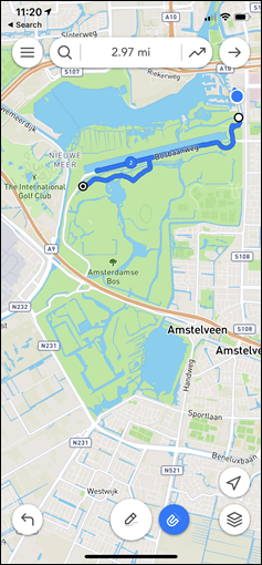
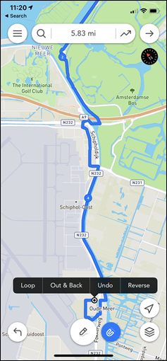
So instead I set out to create my ride for the day. This time to a place I’d never been to. I roughly knew a few of portions of the route, but not the whole thing. It’d be a 50KM route (something that’s essentially impossible on Strava’s finger dragging platform). I started off, and just swiped roughly across the roads I wanted. Each successive swipe simply added more length to my route.
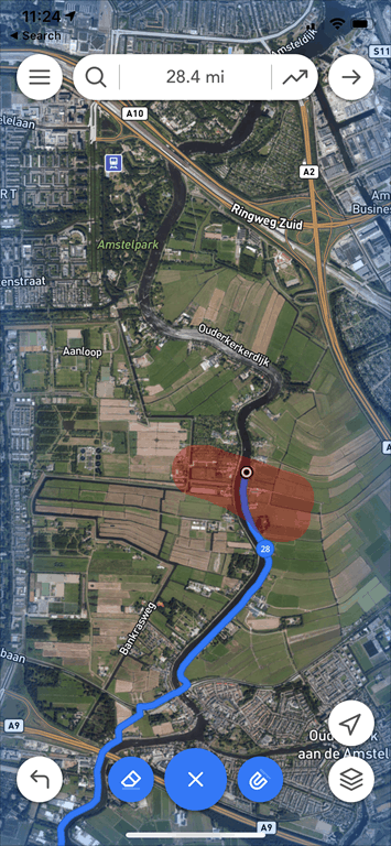
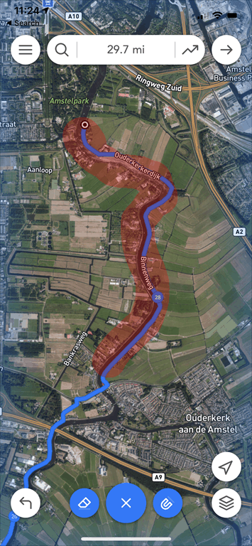
This actually worked fairly well, though I did find cases where it would just do weird things to the path. Like, random distractions into a neighborhood/trail for a moment or something (see upper left screenshot for example of that). The good news is that it’s easy to fix those. You can break out the eraser tool and just highlight what you don’t like/want:
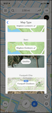
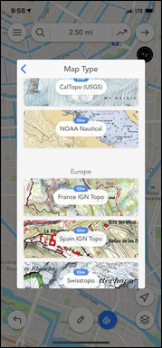
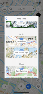
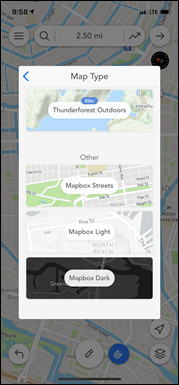
Then simply re-draw it and you’re all set. Also of note is that the platform supports a mind-bogglingly impressive number of map overlays. With the free version you can do the straightforward map (in light and dark), as well as an outdoors topo-driven option. Plus the satellite view. Then there’s all sorts of options for Elite subscribers that you can see below.
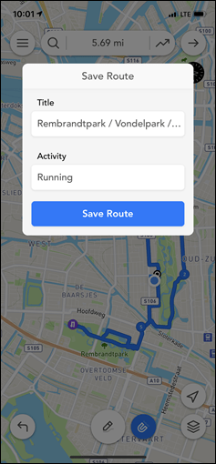
Once you’ve got your route you can save it. You can save up to 5 routes in the free version (but you can delete ones you don’t want). And you can give it a name and have it in your digital locker – none of which requires creating an account or subscription.
Transferring the route:
Let’s be super clear upfront: In order to get the route anywhere, you’ll need to pay up.
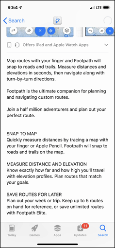
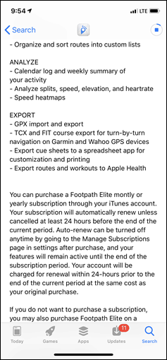
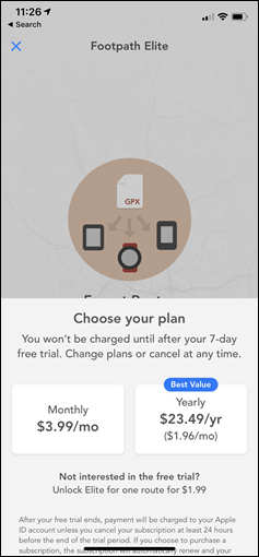
Unlike the free Easy Route, Footpath requires either their ‘Elite’ subscription membership or a one-time payment for a single route. The costs are seen below – $4/month or $23.49/year. However, there’s also the not so obvious $1.99 option listed in the text down below. That’s what I selected – just one route only. This meant that I got all the ‘Elite’ features for just a single route in my collection.
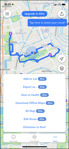
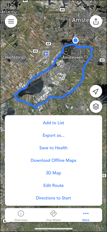
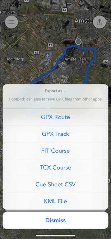
So armed with my two buck chuck of sorts I had my route and was ready to do some exporting. You can see it unlocked the new features on this route when I tapped ‘More’, and then I had a theoretical 6 options after I hit ‘Export as…”:
I tried to export as .FIT first. That didn’t work. Nothing happened. Then I tried .TCX. Nothing happened. Then I tried .GPX Route – Yay! Success! (Note: I contacted the developer and they found the bug and it’ll be fixed in the next app update.)
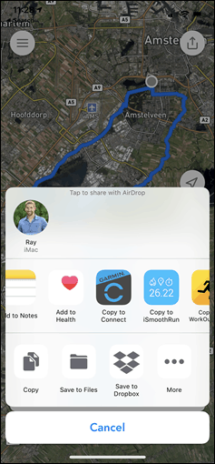
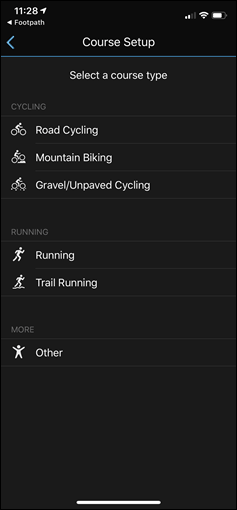
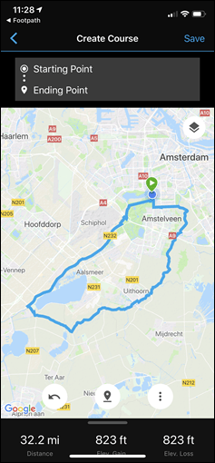
From there I selected to open it up with Garmin Connect mobile. The same concept works for Wahoo ELEMNT/BOLT/ROAM users – though only with the non-functional .FIT/.TCX options. That’ll immediately open the ‘course setup’ wizard on Garmin Connect Mobile, which shows you the course you imported and has you select the course type.
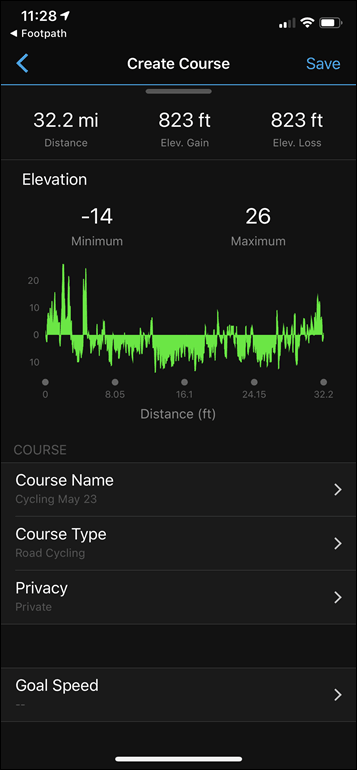
At that point you can review the course and give it a name, as well as tweak a few other minor things. Most importantly, you can then send/transfer it to your device (any Garmin device that supports courses – even really old stinky devices).
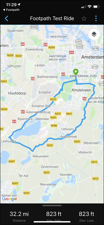
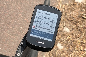
In my case I transferred it to the Edge 530. I had titled it ‘Footpath Test Ride’, as seen below. Then off I went, following the route just as normal like any other routes.
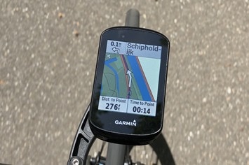
It worked perfectly fine – I saw no issues during my test ride. Well, except these sheep. And that it was sorta off-road:
But I can’t exactly blame Footpath for that. To its credit – it tried numerous times when I was creating this portion of the route to put me on a different path/road, but I keep overriding it. Obviously, I knew better. Or not, as it seems. On the bright side, miles of sheep dodging along a river on a beautiful sunny day was actually kinda enjoyable.
Wrap-Up:
There’s no question that what Footpath is doing is far beyond Strava’s first knock-off attempt of it. And, for the most part, Footpath works well when used in moderation. Don’t try and tell it too many things with your finger, and it’ll get your route done for you pretty easily. From there, most 3rd party GPS bike computer & wearable apps support opening these file types and transferring them to the device of your choice.
I think my challenge is really just the pricing model. To me – $24/year just seems a bit too much for what the app provides. I’d much rather pay a one time fee of $9.99 for the app (and would happily do so tomorrow), than a $24/year fee. I totally get those are two obviously different valuations, so I’m just saying what my threshold is. I’d say even up to $11.99 or so maybe. I don’t know – ask me tomorrow and I’ll give you a different answer on the exact price, but I’ll still tell you I’m growing tired of signing up for subscription services (and yes, I know I offer two different subscription services).
Still, I will say that the number of features they offer within their Elite bundle is impressive – especially things like the mapping options if you live in areas where you want those custom map types. And I also like the eraser bit a lot – that’s really well executed.
In any case – I suspect I’ll continue to use the free Easy Route as I have for years (though, I would pay a one-time fee there to unlock more map/routing options). Maybe I’m just a creature of habit, or perhaps because I’m just someone who likes simple things that just work day in and day out without having to create more accounts.
With that – thanks for reading!
FOUND THIS POST USEFUL? SUPPORT THE SITE!
Hopefully, you found this post useful. The website is really a labor of love, so please consider becoming a DC RAINMAKER Supporter. This gets you an ad-free experience, and access to our (mostly) bi-monthly behind-the-scenes video series of “Shed Talkin’”.
Support DCRainMaker - Shop on Amazon
Otherwise, perhaps consider using the below link if shopping on Amazon. As an Amazon Associate, I earn from qualifying purchases. It doesn’t cost you anything extra, but your purchases help support this website a lot. It could simply be buying toilet paper, or this pizza oven we use and love.



I’ve had footpath on my phone for a long time. I really like it, but I’ve neglected as it was (used to be…) too much work to really get it somewhere I could actually use it. That new trick of being able to load the route into Garmin Connect directly is a major game changer. Thanks for the heads up!!
I actually don’t mind too much the new Garmin option. I agree that it’s a bit cumbersome to add waypoints but after you’re done. No exporting, importing, etc. You send it over to your device and done.
Hi,
I use the (in my opinion) quite similar service from https://dynamic.watch since long time. It is not that of a hassle to create routes on the smartphone (or PC). I use it on business trips and vacations to create roundtrips for running or cycling. The automatic routing options are amazing. Back then I decided to give them a one time payment for the lifetime access and did not since.
It theoretically also gives you maps on the Fenix 5 but this did not work to well in my test. This app might be one of view reasons why I am thinking of upgrading my Fenix 5 to a Plus with Maps.
Anybody some benefits of footprint in comparison to dynamic?
greetings from Austria
Andreas from http://www.pamdasdoitbetter.blogspot.com
I also use dynamic.watch with a lifetime license of $30. I mean that dynamic.watch is by far the best routing service/app in the market. It uses OpenStreetMap and routing from Graphhopper (foot, touring bike, racer, mtb) and the map is more detailed than that in Strava. The way you draw your route is so easy and changes during drawing, adding way points and so on are the best. Press save and start your Garmin Edge and the route shows up. No cables/exporting needed. There is a feature coming up allowing you to overlay your own map. I will show a layer with paved roads. Try it!
It’s strange that some I expect some things to be subscription based and some just shouldn’t be. I think when I’m paying for access to a platform (Training Peaks, Strava, Zwift) it makes sense. When I’m paying for an app, like this, I just don’t want to pay a subscription. If I was convinced that they will continue to offer me more and new features that’s when I’ll subscribe and when they stop adding or supporting features I’m interested in I’ll cancel. When I just want it to keep doing the one thing it already does I expect to only pay for it once. I don’t want my route creating app to add more features I just want it to keep creating routes. Maybe getting a bit faster, friendly, or flexible overtime but nothing more.
I thought this app looks really cool and I’d glad pay $10-$15 for it one time. Maybe even $25 one time but not $25/year.
I’m in the same boat. Subscription model for that kind of app and with with pricing level sounds ridiculous to me.
Subscription model is the almost inevitable outcome of “lifelong” free updates. Remember when software came in a box? You’d likely buy the same more than once, with different major version numbers, creating recurrent revenue. Successful pay once apps cause a big, short cash influx while the market saturation curve is steep, then nothing. During this period the company usually overexpands, then is forced to either pursue other projects and abandon the app to pay the bills or do things like adding a subscription on top of the full price you already paid, or even supershady things like including malware for money.
Also, you *are* accessing a platform for routing. All the map and routing “data supply chain” is an ongoing process, access to maps, particularly to fancy bonus maps is an ongoing per-user cost (or per use cost) and most likely the routing is done server-side anyways.
The only issue that remains is price, there’s no way I’d pay “half a Netflix” for a slightly different routing experience. I do have some annual sub-five annually subscriptions and I’m perfectly fine with that. I also happily paid the one week option for ridewithgps on multiple occasions when planning a vacation, but no way I’d go “half a Netflix” continuously. (The single route option for footpath is too limiting imho, there needs to be a time window for applying fixes, retrying on connectivity issues etc)
“””
In the case of Garmin it’s newly rolled out smartphone route creation app functionality is incredibly clunky.
“””
Can someone tell me what this app is?
thanks.
It’s in the Garmin Connect app: Menu, Training, Courses, Create Course.
I could not get it to do anything worthwhile, but give it a shot and see if it works for you.
Thank you
I’ve used the Garmin routing for running, both the in—app round trip runs and the web based waypoint versions. I find they generally work well though the round trip I may have to try several lengths and directions before I get something usefull. But I use it a lot.
How is it compared to Komoot?
I’d like a comparison with Komoot too. Invested in Komoot worldwide maps a few months back and am generally impressed with its biking and hiking routing, as well as route planning method/UI.
I’m paying GB 10 pounds per year for Veloviewer, which does about 100 times more things, and I use it at least once a week. So I’m happy supporting it.
The challenge for Footpath planner is really “how often would I use it” divided by the annual cost. This makes their one-time fee seem fair, but being asked to pay a one-time fee while sitting on my bike with no wallet seems like a stretch.
I only pay $14.99 per year. I must have been grandfathered in? Bought a yearly subscription last October. Anyway… Love it! I travel so much internationally to new cities and always plan my morning runs with it. I use it all the time.
I have to agree on the pricing model. I think there is a heavy moment to simplify your life. People are dumping cable and such because of the fees, etc. They will pay fees for what they deem fee worthy (cell phones etc), but most things aren’t. I think the app market started out as pay and done. Trying to revert that to a pay as you go model, I think won’t work. That horse has left the barn.
I know myself, I am against paying monthly fees for just about everything.
My problem with the Garmin Connect route creator is that the format requires a larger screen, and of course Garmin can’t be arsed to build an iPad version of their app.
(The same thing applies to the Strava app.)
Thats too rich for my blood. The subscription model on this provides no long term value to me. Looks like a great app that will price itself out of market share.
Just want to thank you for introducing me to Easy Route some time ago. It made things so much easier for me. Works great to transfer to Garmin Connect app, then off to the Edge in no time, with no fuss of file transfers on the computer.
When exporting a route to the wahoo elemnt, will this app insert in the turn-by-turn instructions like Komoot and Easy route? Or on the elemnt will I just get a breadcrumb?
Not sure why I would want to pay $25/year for this when Komoot is a $30 one-time payment for life.
Ps thanks Ray for these app reviews… even if they are relatively short, I enjoy them, please consider doing more :)
Tested it, but I’m not overly positive. Routing is sometimes a bit awkward Pricing is not competitive to say the least.
When I’m on holiday without a laptop, I tend to use Gpsies from the browser (desktop version). Works quite well.
Has anybody managed to use the Garmin course creator to create a route which doubles back on itself? I just can’t get it to add a waypoint on the same road/path that I’ve gone out on.
Create a new waypoint/endpoint somewhere else, then drag it on top of the existing route. Press, wait, drag, lift.
When doubling back, (or going on the road a second time) I click just off the route (just a few pixels), this is with the Popularity Routing, or Follow Roads, and it’ll put the waypoint on the route. Also this is doing it on a computer, not on a phone.
In the app you can just use Personalized tracks option to create a course point by point. I found it pretty good.
An app like this has to be really good to cost anything. If it costs a lot (like this) it should be superior.
Komoot improved a lot during last year. Now it has lots of recommended routes and I actually found many new and really good routes during last trip to Mallorca.
For basic planning ridewithgps does the job well and same price as komoot (free)
“Subscription model”.
…
That’s gonna be a hard pass from me dawg.
I agree that the subscription model doesn’t apply here. I already own Footpath (paid $6 a few years ago) and must be grandfathered in, b/c I don’t pay anything and I can export files. i think paying $10-15 for 2-3 years of use seems reasonable.
What about the Garmin Explore App? I have it and it is difficult to use. Plus my Garmin F5X doesn’t even like the files sent to it, which is weird.
Scosche R24 review? It would be great if that thing could off load HRM data post swim!
I haven’t played much with the Garmin Explore app. Sorta on my to-do list. Kinda like the R24 review. Though, I don’t think they’ve added the swim offload yet…still.
I use MapOut since many years. It has nearly the same features and you only pay once when you buy it on the Appstore.
I use footpath in combination with maps.me. Great! I spend the month of september in Norway on my motorbike and drew routes up to 350 km in footpath on my ipad, also offroad, exported it as a KML file and imported it in an old 5S Iphone that i fixed on my handlebar with a waterproof cover (that was very usefull in Noraway!) and it works perfect. Planning a 4×4 offroad trip in Namibia and Botswana in 2020 and will do exactly the same. No need for internet, just make sure you have all maps downloaded, prepare already some waypoints and off you go!
Footpath is not free to use the turn by turn navigation, so when walking it is pretty useless as you have to keep refering to the map.
You can upgrade but it is not a fixed price to purchase but a monthly charge.
I’ll find something else thanks.