When the Wahoo ELEMNT was first announced last fall, it included the claim of being able to do ‘Turn by Turn’ navigation. That capability gives your bike computer the ability to tell you to ‘Turn left on Main Street’, rather than a more typical breadcrumb trail or similar non-aware route overlay. It also means a unit can recover from a navigation failure (even if it’s your fault) and get you back on track.
However, when the ELEMNT shipped this past spring, it was lacking that functionality. Instead, it had the ability to download routes from Strava and RideWithGPS, but not the ability to do Turn by Turn (TBT) navigation on those routes. As a result you had to simply leave the navigation page open at all times, and then keep an eye on upcoming changes to your route. While I did use it for a number of navigationally challenging routes – it wasn’t as ideal as having alerts/prompts.
So bring the latest Wahoo ELEMNT firmware update, which now introduces that capability to the unit. I had a chance to try it out a bit over the last few weeks, and wanted to give a brief overview of how well it works (and where it stumbled a bit).
Creating the route:
Now the first step in using the ELEMNT routing is that you have to create the route somewhere else. Or download someone else’s route. Either way, it all happens on a non-Wahoo platform. While the ELEMNT supports downloading routes from Strava and RideWithGPS, it only supports TBT navigation today on RideWithGPS routes. So it’s off to RideWithGPS.com to create our route. Note that you need not have a paid RideWithGPS.com account for this. A free account (like mine) is fine.
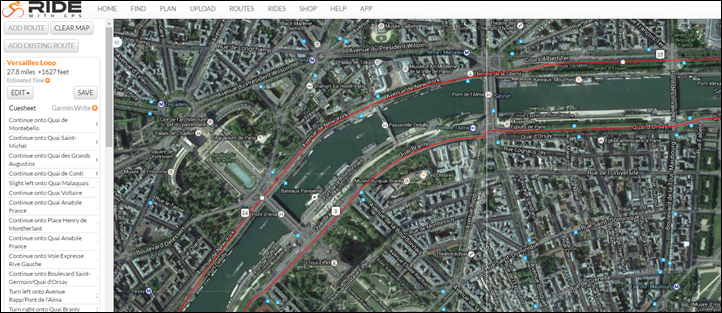
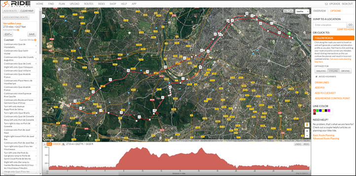
You’ll do the click and map thing just as you would on pretty much any other mapping program for the last decade or so. Along the bottom it’ll also create an elevation plot, so if you want to see how painful the route is, it’ll show that here.
As with other services you can click to ‘Follow Roads’, or go rogue. I often will turn it on/off throughout the route depending on what I plan to do.
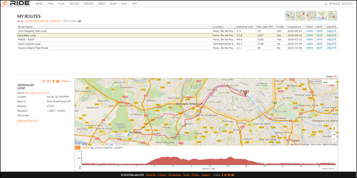
Once that’s all done you’ll simply save it to your account, which the ELEMNT will pull down the next time you sync your account on the ELEMNT. You can view all of your saved routes (be it ones you’ve created or others you’ve ‘borrowed’) within your account on RideWithGPS.com:
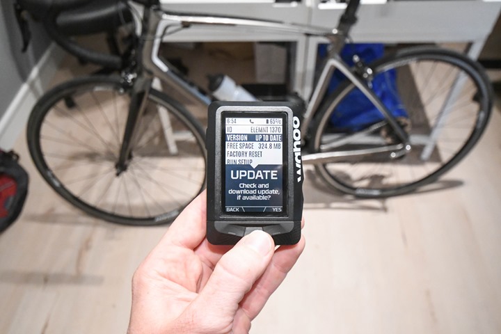
If you haven’t done so already, you’ll want to first update your Wahoo ELEMNT’s firmware. Simply go into the settings and tell it to check for updates. It’ll connect to the WiFi’s and pull down some magic:
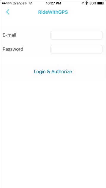
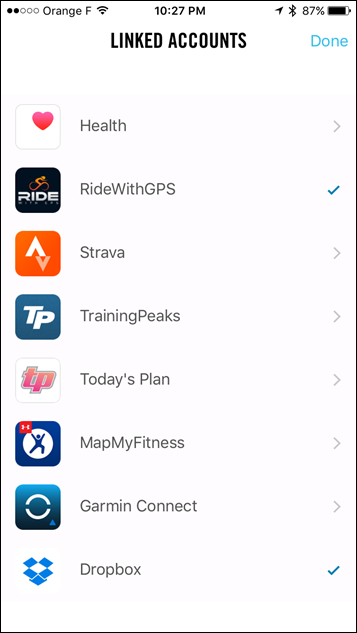
After which you’ll want to validate you’ve authenticated your RideWithGPS.com account to the ELEMNT (if you haven’t done so already). To do that you’ll use the Wahoo ELMENT companion app on your phone, which handles the authentication setup pieces. It only takes a second:
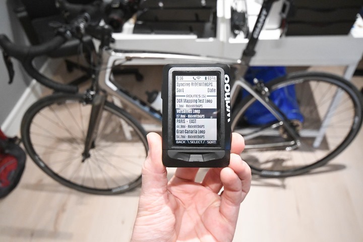
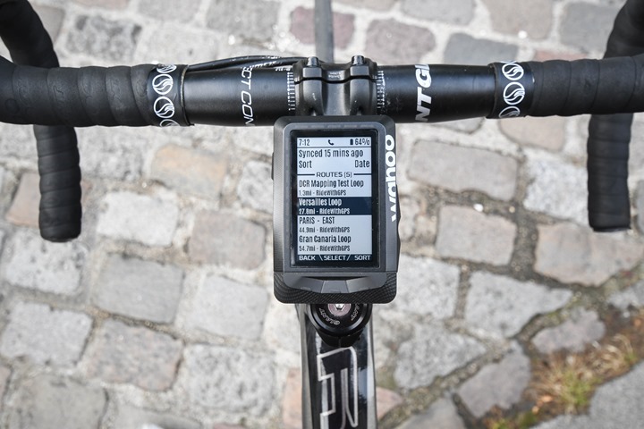
Before heading out you’ll want to briefly validate the route is on the unit, since it uses WiFi to sync said routes. So if you forget, you’re kinda hosed. Note the top line status and wait till it’s finished.
Ok, now…let’s go ride.
Out on a Ride:
Now that we’ve got the route created and sync’d it to the ELEMNT, we’ll crack open the ‘Routes’ menu and choose it:
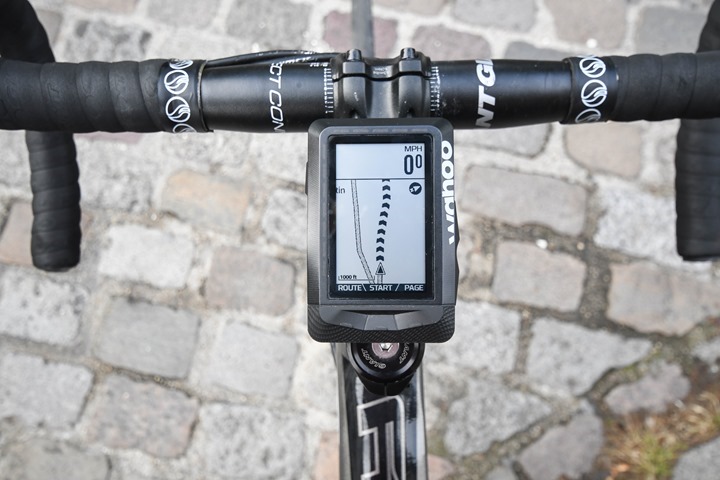
It may take a second or five for the unit to load the route and corresponding map tiles. Once it does you can press ‘Start’ like normal.
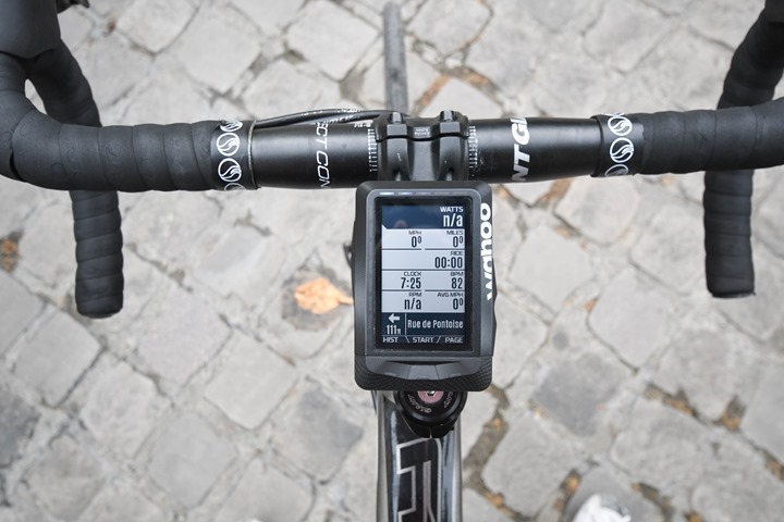
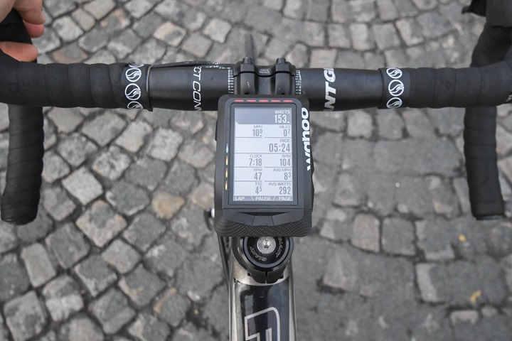
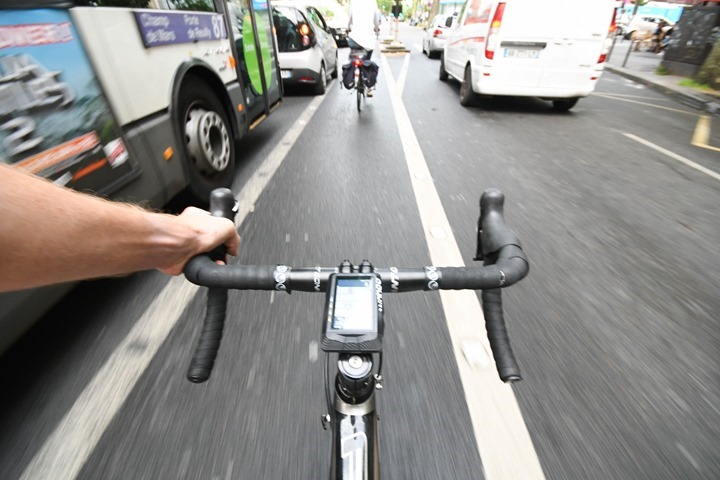
While riding you’ll get instructional information on any data pages you have – assuming you have something that you need to do. Meaning that if you’ve got 10 miles on the same road, then those instructions on the non-map pages will disappear. They’ll reappear as you approach a turn or other bit of insightful navigational information.
You’ll also get both visual alerts using the LED’s, as well as audio alerts. Right now the audio alert’s a bit quiet, though Wahoo noted they plan to increase the loudness in a near-term firmware update.
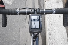
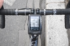
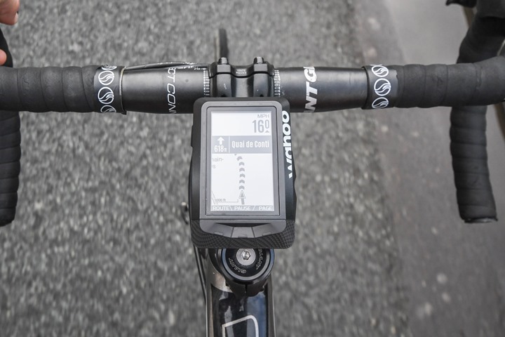
The turn by turn road instructions display slightly differently depending on which page you’re on. For example, on the map page they display as a banner mid-way across the screen, whereas on the elevation plot and regular data pages they’ll appear on the bottom. Here’s a mini-gallery of the different ways the data is shown (click to expand any).
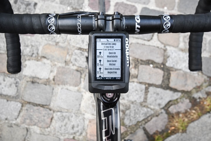
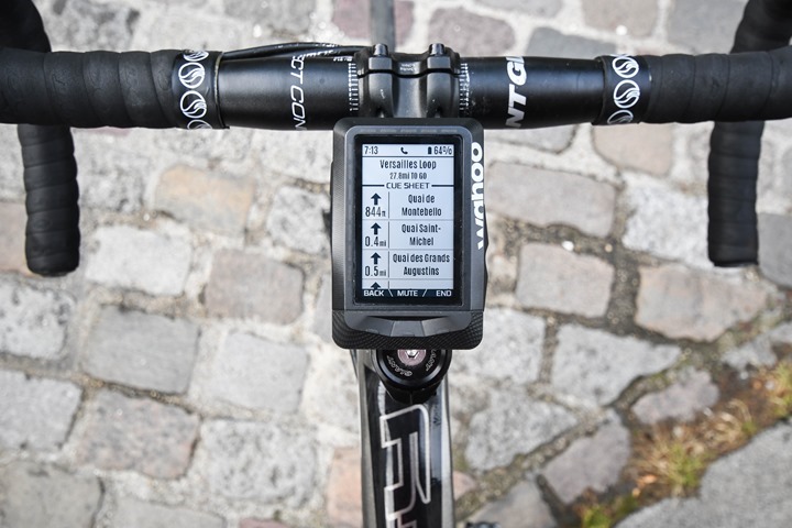
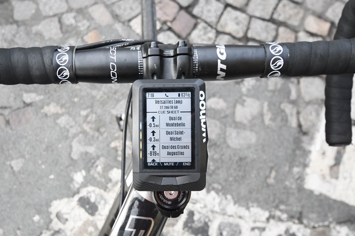
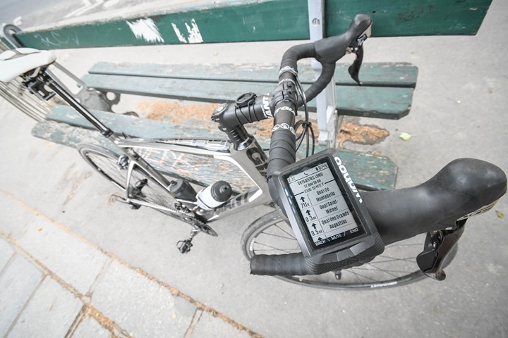
You can also get a Cue Sheet listed as well at any point in time, which is kinda neat. You can scroll up/down within it. This sheet shows any turns or street name changes and is accessible from the route page. This page also allows you to mute the route guidance as well as straight-up end the route guidance. So you can effectively de-couple routing from your workout itself, without one impacting the other.
All of which is pretty straightforward. It’s worked well for me thus far, even in cases where I’ve gone off-course briefly and had to get back to the course (though, more on that in a second). For example, there was construction closures on one road, so I use a parallel road next to it. Once I resumed back on the correct road a mile later, it was all happy again.
But there are some caveats. For example, unlike the Edge series the ELEMNT can’t do anything for you when you go off course and need assistance getting new routing instructions. It doesn’t re-calculate the route. It just gives you some blinking red lights – the international symbol that you’ve f’d up in an irreconcilable way.
It’s up to you to figure out how to fix your screw-up. All it will show is your steps with negative distances next to them, indicating you need to go find them yourself.
Also, none of this gets you the ability to randomly search out locations like a nearest eatery or a specific address, both of which other units on the market can do. It’s basically only going to route you from Point A to Point B, using the directions pre-canned by RideWithGPS. Go afoul of that and the ELMNT looks back at you with confusion and a blinking red light.
Thoughts on Integration:
Now I would say that while Wahoo has made a bit of a business out of making software ‘other people’s problem’ by making their platform fairly open, I think it’s going to be a challenging point going forward to truly compete with Garmin. By that I mean that Wahoo really needs to make it easier to create routes from a mobile phone and be wholly within a Wahoo app in doing so.
I think it’s great that they have extended integration with 3rd parties, but at the same time I don’t really want to be dependent on 3rd parties for what I believe should be 1st party functionality. For example, if we fast forward to workout creation – will that be done internal to a Wahoo app, or offloaded to another 3rd party? Before you know it you’ll find every function requires a different 3rd party. Just like viewing your workout does today.
Don’t misunderstand me though – I want the option to have 3rd party integration, but I feel like it should be just that: an option. Not a requirement for core functionality.
Still, all of this works better than creating/moving/downloading routes on Garmin Edge devices. After all, you can’t really use a mobile device to do that today. Instead you have to manually create the route on Garmin Connect using a desktop computer, then sync it afterwards. Plus, you can’t easily get routes from 3rd parties to Garmin Edge devices unless you plug them in to a physical computer. And don’t even get me started on adding maps to a Garmin device, free or otherwise…
ELEMNT’s Next Steps:
So now that Wahoo’s got that one knocked off their list, what’s next on the update agenda?
Well, you’ll remember there were a bunch of features/plans that were on the longer term list, so I checked in with them yesterday to see where those stood. Here’s the run-down:
ANT+ FE-C Trainer Support: Planned ‘prior to trainer season’ – meaning, the northern hemisphere trainer system. Remember that today Wahoo supports the KICKR/KICKR SNAP, but not non-Wahoo trainers like Tacx, Elite and CycleOps. So this would bring them in line with being able to support any trainer with the ELEMNT. Within my review I noted that the ERG trainer control on the ELEMNT is without question the best implementation I’ve seen on a head unit in terms of trainer control.
Strava Live Segments: This would enable a user to compete on a given segment and receive updates in real-time (live) on their ELEMNT. While his had been slated for the June timeframe (when I last checked in March), it didn’t quite make that. This is still planned and sounds to be nearing completion. Wahoo would only note that it’s “coming soon”.
Structured workout support: This is planned for the fall, to coincide with the northern hemisphere trainer season.
More Detailed Live Tracking: Right now live tracking is merely a dot on a map, with no context of speed, distance, or where you went. It sounds like by next spring they’ll have a richer experience on this.
GoPro control support: While this was planned for later this year (2016), it sounds like it’s going to slip beyond that as the company is instead focusing on various trainer integration with ELEMNT features.
ANT+ Lighting control: They don’t have a specific timeline, but they are evaluating various lights, including the Bontrager light sets. At this point I believe only Garmin and Bontrager make ANT+ lights.
Obviously, there are numerous other smaller items that didn’t make my question list (or my train of thought), that will undoubtedly be added in. One merely has to look at the ELEMNT change log to see they are moving very quickly on both adding features, but also fixing bugs. They spent a fair bit of time over the past few months trying to track down an odd hardware sensor dropping bug that some people were seeing, which sounds like it deferred some resources available to work on new features. Hopefully with that issue behind them, the company is able to dedicated more resources for new features.
With that – thanks for reading!




I think Wahoo are on it and give them some time and they sort it.
Maybe they should look into an app on IOS called ‘EasyRoute’ and either acquire it or build something similar all it needs is cues to be exported with the .gpx file and voila all you need no PC needed.
Great work so far Wahoo, look forward to much more..
Thanks for the heads up on EasyRoute. A handy wee app
I have emailed the creator and asked if they could add cues, not sure if and when they do that it would work with Elemnt but if it did would be totally awesome. For now it’s a very convenient way of getting a breadcrumb route onto it.
It’s funny, I love Easy Route. Probably one of my favorite apps out there.
And it’s even funnier you mention it: As I mentioned the exact same thing to Wahoo – just buy that and call it done.
Hi guys,
Is that Easy Route from Fernando Albernaz (free) or EasyRoute from John Famiglietti (not free) ?
Thx
Steph
The one I use is: “EasyRoute” – John Famiglietti.
Cool, thx
I have both EasyRoute and Route Mapper on my iPad and always end up going with Route Mapper. Love it. Very easy to use, export etc.
Ray, I love your site, so you saying that about my app really makes my day!
Talking about funny things…
Funny that EasyRoute would be mentioned in a post about turn-by-turn navigation because that is what I’m currently working on. I think I came up with a way to add it that makes sense. I’ve been field testing it and it mostly works, but there are still some things to iron out.
Also funny is the idea that EasyRoute and Wahoo are a good match because Wahoo has indeed hired me! I’ll be joining them as an employee soon! I’m very excited!
Congratulations, and good luck John.
Congratulations. Does this mean EasyRoute will become Wahoo branded? Or will that remain yours and you will be creating something even better and grander at Wahoo?
Never heard of it, but I just purchased EasyRoutes. Looks fantastic!
I will have a direct impact on some of the things Ray discussed in this article and even though it looks like EasyRoute itself will remain mine, a lot of its personality will turn up on the Wahoo side.
Awesome John,
Loved your app for a couple of years now, I have recently got an Elemnt and it works perfectly for getting the breadcrumbs trail onto it.
I did recently email you to look into adding cue points that would export with the .gpx so this is great news to hear, Looks like the future could be bright for EasyRoute/Wahoo.
Looking forward to great things from you guys…
Hope it doesn’t end up like Cruise Control. Wahoo bought that and now it seems dead
Is Easyroute available on Android? Been trying to look for it but cant see it.
Sorry, EasyRoute is not available on Android. No religious objections to Android over iOS, it just started on iOS and working on it by myself in my spare time, there wasn’t time to port it.
Ok thanks for replying John.
just popping in to say that I also purchased easy route after hearing about it here today. just tinkering with it at my desk and I am very impressed. Good Luck!
Ray – I disagree on your route creation comment. I don’t think that a Wahoo app is required to do this at all. I far prefer Strava route creation to the Garmin Connect equivalent. And once a route is saved, it just appears on my ELEMNT. Perfect as far as I am concerned – and works with what my cycling buddies & I do (Dave creates some routes on Strava, we abuse them so he makes some more. Then we pick the first one he did anyway!)
Workouts – I don’t know of any 3rd party apps to create workouts, so maybe this is something Wahoo need to do themselves? I would have thought this is an easier thing to write though.
That said, I am keen on TBT from Strava routes (any idea when that is expected?) and some intelligence to get back to your route on the ELEMNT itself should be done.
Overall, though, I am very happy with my ELEMNT & Wahoo have been very good at addressing the issues.
I think TBT from Strava routes is a Strava issue rather than ELEMNT.
If you create a route on Strava, export as a TCX file and look at the contents using an XML editor, it doesn’t contain CoursePoints with the actual TBT directions like “Turn Left on xxxx Road”.
If you do the same on RidewithGPS, the TCX file contains CoursePoints with TBT cues.
When you create a route on Strava it does create a cue sheet with TBT directions but at the moment it doesn’t seem that Strava exports these within the TCX file.
Personally I’m happy with the ELEMNT TBT implementation. There are a few more things they could add like additional data fields for TBT and POI but they have been good at adding more functionality and fixing bugs. I used to have a Garmin Edge Touring Plus and hated how it recalculated routes every time it though you were off route. The ELEMNT map is very clear and I find it easy to navigate back to a marked route.
RE: Workout Creation
Lots of apps do 3rd party creation, usually through ERG files for trainers, and some even do interesting stuff with route files for courses (BestBikeSplits being one) and turning them into workout guidance.
All of which is cool – but it’s tough to explain to someone why to setup an ELEMNT you need:
A) Create a Wahoo account to save settings
B) Create an account on RideWithGPS to create the route
C) Then create a 3rd party account on Strava, TrainingPeaks, or some other platform to actually view your activities after completion
Again – 3rd party integration is great for extending features. But to me, these seem like pretty core features.
I hadn’t heard of EasyRoute before so just downloaded it and gave it a go – as the name implies, it was easy to create a route!
As mentioned though, TBT needs a route with cues and I’m guessing that adds complexity
Ever looked at the work out creation that is possible in Cyclemeter? Really good and am surprised that not more is ever said about it or the app itself for that matter. Now if Wahoo bought Cyclemeter…..
Prompted/Queued turn-by-turn data is not available in Strava routes. That is why Wahoo is using RideWithGPS.
If you just want to followa breadcrumb, which works fine (I do it all the time), it’s great.
However, if you want the additional functionality of being prompted to turn via audible and visible queues, and having a list of upcoming ‘events’, you’ll need to create your routes in RideWithGPS.
I’ve created routes in both, and both tools are great, but after spending some time with it, i’ve found the RideWithGPS interface preferable. It also seems to do a better job of creating bike-friendly routes ‘automatically’, as opposed to having to force it to take a preferred bike friendly road, as often happens in Strava (for me).
I also found a couple of situations where I was creating routes in Strava in a very rural area, using forest service roads and such,and found that Strava would often refuse to let me cross a bridge or some other barrier, and forced me to route around it, whereas RideWithGPS seemed to allow me to use use some of those things.
My sample size is small (I probably have 15-20 long routes in both RWGPS and Strava). I’ve just found that RWGPS works better for me.
I don’t really depend heavily on the prompting and such, but if you are sharing routes with others, this might be a critical feature for those folks.
Do the elemnt isn’t actually doing turn by turn calculations and requires the actual turn directions to be in the file? True TBT should take the breadcrumb and using its own map data tell you what turns to take
DCR – Really appreciate your comments and your site. Your in depth reviews are the benchmark. I agree with your comment on the physical size of the Elemnt.
Regarding the 3rd party vs in house app arguments, I think Wahoo is doing exactly what they need to do for Wahoo. They have recognized that making a device is much easier, more profitable, and more aligned with their core competencies than developing a whole new end to end ecosystem.
Think if it this way… How many billions of dollars did Microsoft and Nokia waste trying to introduce the Windows phone ecosystem and where are they now? 1-2% market share and billions poorer.
Why should Wahoo try to recreate Garmin Connect, Strava, RidewithGPS, etc. to support the 2% market out there that cannot figure out how to import a TCX or workout file. All of their users are smart phone owners by design so they are already technically savvy.
I’ve been combing though the comments for days trying to decide if this is the next device for me and aside from you, I see no one else unhappy with the fact Wahoo doesn’t have an in house, integrated mapping and workout software platform. Everyday cyclist just ride around their home most of the time and all they do is upload their ride to some “server” to look at it once. Some want to see how they compare and maybe look at it twice. Even fewer might use it to track monthly and yearly mileage.
Those that ride competitively and maybe even have a coach already have established ways of saving and sharing their workouts and data. Why is a new platform needed? As for mapping, racers don’t need it. Courses are marked. People who ride one day rallies don’t need it for the same reason. Those that tour for multiple days probably fall into two categories – self contained and participants in a tour package, the latter of which don’t need to create maps because they are given maps and most tour operators mark the daily routes anyway.
Yes, this is probably not the device for a racer training hard core with a specific workout regimen. At least not yet. And probably not the device for the hard core cycling tourist who plans their own tours and goes out alone for days. At least not yet. It’s exactly the device for the everyday cyclist who just wants something that consistently works and a company willing to listen to and engage their customer base when they have problems. I’m sure Garmin used to be that way somewhere in the distant past.
As a point of reference, I would LOVE the features you talk about. I just completed a week of riding alone in Italy. I’ve never done that before. Someone there sent me TCX files unfortunately with no route guidance. I used RidewithGPS and traced and saved routes with TBT guidance. I downloaded them to my Garmin 510 and being the planner I am, I also downloaded the RidewithGPS iPhone app and bought an iPhone mount, local SIM card and loaded the routes on my iPhone and carried a power bank in my jersey pocket. Who wants to get lost alone somewhere in a foreign country where you don’t speak the language? 2 miles in to day 1 I quickly discovered that TBT voice guidance on the iPhone with the RidewithGPS app was far superior to anything the Garmin could provide. By day 3, I didn’t even need the iPhone screen on. I could count on the voice prompt… “Turn right 1/4 mile ahead”.
My point is this: My phone was perfect for that application. But I t was only a week of riding in a whole year. And I’m fortunate enough to be in the 2% that would need something more. Back home I would never strap that huge phone on my bike. I already know the roads! Wahoo is on the right course.
Together with structured workouts (which actually I think are pretty useless as nobody is going to train indoor controlling the trainer via the small cyclocomputer) I’d love to see stuctured workouts for outdoors, and also power courses (like the one exported from BestBikeSplit.
And since wahoo is pretty open in general, I’d love to be able to write “apps” for the ELEMNT, like Garmin allows already
Has any cyclist ever planned a route relying on their Garmin to find them a cafe stop?
Surely the job of a cycling computer with tbt is just to follow the pre planned route and most cyclist would know where they a going to stop so built this into said route.
To this ends the Elemnt now does this great, there is definitely room for improvement especially with roundabouts and complicated staggered junctions but for a first release awesome.
I do agree that having to go to a 3rd party to get tbt routes is a little bit of a ball ache but considering my club post their rides on FB from RwGPS it’s all seems very convenient right now :D
Surprisingly a number of cyclists will plan routes with POI’s on them, but they’re usually longer routes. They could be rest stops, things to check out, etc… It’s very common in touring.
(I don’t personally use them, but a number of folks do.)
+1 for POIs. I use them exactly like you mention for touring and plot things like cafes, pubs and places to eat. I don’t necessarily create a route to them but I like to know when they are nearby and may decide to make a detour at the time.
I asked Wahoo about support of POIs and Murray replied saying that POIs on RwGPS routes are actually synced to the ELEMNT at the moment – it just doesn’t do anything with them. Murray said they’d like to display them on the map and do things like proximity alerts. So somewhere on the backlog but no timescales yet.
If I create a RwGPS route with POIs, I can view these on the RwGPS app (which also supports offline viewing if there is no data connection) but it would be nice to see them on the ELEMNT screen.
+1 for POI
That is the reason is still ride with a 10year old GPSmap. With a more recent openstreemap it will do turn by turn navigation just fine and the screen is also easy to see in sunlight. It is also fine for following a bread crumb track.
They way i often use it on the MTB is to have downloaded the MTB trail as a bread crumb track and then rely on the GPSmap to route me to the beginning of it.
On the road cycle i very often just decide my route by a number of waypoints and let the GPSmap route my there.
I then use a 920xt to log things
Could just buy an edge 1000 to get everything in a nice small package but have a tendency to not just replace gadgets until i gain some significant advantages. A weight penalty of a few hundred g’s does’nt count as i’m not racing – just out having fun ….
Another feature I’d like to see (which I home will come with the structure workouts) is possibility to see power zones on the left LEDs like it now happens for HR zones.
Does this work with routes created on gpsies.com? Used it for old Garmin 705 to reduce number of points in a route as it didn’t support more than 500 of it.
It has even a feature to set the distance of the cue from the actual turn.
I haven’t used gpsies.com before but I just gave it a go, created a simple route and exported as a TCX file and it does contain CoursePoints with TBT directions.
One point to note is that gpsies TBT just had cues like “Right” and “Left” while RwGPS TBT has more information like “Right onto York St” and “Left onto Baker St”.
However, I believe the only way to get this route onto an ELEMNT at the moment is to import the TCX route into RwGPS, then sync with the ELEMNT.
The ELEMNT has various ways of importing GPX routes including email attachments and dropbox, but these are only for GPX files, not TCX files.
For TBT, I believe you need a TCX file. In theory I think a GPX file can contain TBT cues but I’ve been told that in practice, very few applications support this and the ELEMNT doesn’t either.
So if you wanted to use gpsies routes on an ELEMNT, at the moment it looks like you would need to import the gpsies route to RwGPS, then sync.
You could ask Wahoo if they plan to support syncing from gpsies (if don’t know if it has the APIs for this) or alternative, support import of TCX routes with TBT similar to how it imports GPX routes.
So not map based turn-by-turn at all then. Just course based navigation with the ability to display cue points. No UI to pick a POI and route to it? No “Go Home” UI? It knows it should show this picture when it’s here, but it doesn’t know that there are roads on this picture.
There are many long threads on the Garmin forums explaining how to do “turn-by-turn navigation” with Garmin devices that don’t support maps at all (Fenix 3, 920xt, 735xt, etc.), and RideWIthGPS is always involved, since it puts cue points in the track file. I wish there was a better term, since, to me, turn-by-turn navigation is what devices that understand there are roads on the map and how to route on them do, like Nuvis, many Edges, smart phones, etc.
Course based routine has its advantages. It’ll never frantically tell you to make U-turns because a cue point is misplaced. (On a ride where my intention was to turn right on Long Lane, my Edge 800 told me to go 200 ft past the intersection, do a U-turn, and turn left on Long Lane. All because I misplaced a cue point.) But it can’t actually navigate. It’s not an ability that I use often, but I like it to be there. I’m not adverse to giving up Garmin (after the Epix fiasco, I’d even welcome it), but you’ve got to compete with the abilities of Garmin devices first.
This makes it sound like the Elemnt is like the Edge 520 for navigation purposes, just much easier to load a route onto the device
Yes, the Garmin 520 and ELEMNT don’t have “routable” maps meaning that you need to load a route onto the device, it won’t calculate a route itself. The Garmin Touring, 810, 1000 have routable maps.
I don’t know if Wahoo plan to implement routable maps at some time. Personally, it isn’t on my wish list for ELEMNT features. I never had a good experience with routing on the Garmin Touring and continual recalculation of routes when it thought you were off course was annoying. I don’t know if Wahoo would be able to do a much better job. It appears to me that bike GPS is inherently more complex than car GPS because of the much greater range and type of routes available.
I doubt that Wahoo can, since people from Wahoo in the past said how much trouble they had “cramming” the entire map of the world onto it. They probably stripped out all of the metadata that allows a true navigation device to understand that there are roads (and what types of roads). They’ve stripped out street names, for example. So they fake “turn-by-turn” the same way that you can on a Fenix 3, but not the way it occurs on a true cycling navigation device that does understand the map and the metadata.
As for Garmin, I’ve often wondered about them and routing. My wild *ss theory is that they treat their routing algorithms as their crown jewels, and don’t let the lesser beings in their outdoors and cycling sections to mess with them. So they never get improved to handle properly things like loops, starting and ending at the same location, out and back, etc., that don’t occur when all you care about is routing a car from point A to point B.
You need to pay an extra $50 a year to ridewithgps for the Basic Plan
Export the gpsies route as a TCX
Import the TCX as a ride in ridewithgps
Convert the Ride to Route
And follow this instructions: link to ridewithgps.com
If you ask me, 50$ a year is a lot of money (250$ may be for the lifetime of the Elemnt Bolt) for a 250$ product
You end up paying way over the price of a Garmin 820, and you get a fraction of the functionality
Or use the free version of RWGPS for routes with TBT. Free.
Or use Strava routes (no TBT) also free.
Or import routes using the ELEMNT app. Also free.
I feel like the decision to use 3rd party services for route creation was a very smart one by Wahoo. It saved them a ton of development time/effort and I can’t imagine it cost them anything. When you’re a company playing catch-up to the market leader, you have to take a few shortcuts.
I wonder if it’s possible for them to interface with your phone and Google/Apple Maps for some off-route capability. Use those API’s to get you TBT to get you back on your planned route. I know some people will complain about how they don’t want to carry their phone with them, but no offense to Wahoo, I’m sure Google and/or Apple can probably do better on-the-fly routing than they can.
I think 5 or 7 years ago, this would be an amazing product at this price. ($330) But if I need a computer or a smart phone to set up the route, why do I need the Elemnt?
I could mount my phone and be done. There are plenty of water proof or resistant cases, and at least a few dunk proof phones.
I can get Ant+ support with several phones and any number of bridging devices or I can just go bluetooth. Weight vs a smart phone? Sure this is lighter, but on a ride where you need a route, are you realistically going to leave your phone behind?
You could mount your phone on your bars – many people do. However for a bike GPS, you ideally want the screen on all the time and the screen backlight is a huge drain on phone batteries. Again, not a problem for shorter rides but for longer rides you would need to get some sort of external battery pack so things are starting to get a bit messy.
You’re also assuming that there’s cell service everywhere. There isn’t. Phones aren’t always the answer.
A number of mapping apps including RwGPS support offline maps so you can download the maps in advance and continue to use them even where there is no mobile coverage.
The ELEMNT is definitely better in that respect as it has maps for almost all the world already pre-loaded.
It was one of the things that swung me in favour of the ELEMNT over the Garmin 520 as it has relatively limited space for maps and if you plan to cycle in different areas, you may need to change the maps. As Ray mentions in the article, don’t get me started on Garmin maps…
So far Elemnt’s biggest selling points over a cell phone are a longer battery life and GPS without cell service. I would have thought there would be a more compelling case for it.
If the Elemnt was under $100 and did routes it would be a compelling product for me.
BTW, you don’t actually need a cell signal to use the A-GPS on cell phones, but having them does lower the satellite acquisition time and reduces power consumption when near a cell tower.
I’ve ridden with my phone on my handlebars, using a Wahoo RFLKT and an ELEMNT. I can say that the phone on handlebars solution has the issue of battery life. Simply put, with your phone screen on all the time, your battery won’t last long enough for anything other than short rides, so if like me you want to see your numbers as you ride, then it’s useless. If you only care to see maps every now and then, and just record for Strava et al., it’s a fine solution.
The RFLKT was the perfect solution for those who want to use their phones as their bike computers, but wanted always-on numbers like speed, cadence and power. It’s major downside was the lack of any mapping, you had to reach into your pocket for your phone to look at maps.
I bought the ELEMNT on a whim, mainly as I’m invested in Bluetooth sensors and didn’t want to have to buy new HR and cadence sensors to go with a Garmin. Other than a larger screen and a neat UI, the realtime map display is really what it gains you over a RFLKT. That said, I think it’s a great unit and I’m enjoying using it, it’s a little expensive, but so far no buyers remorse.
I was using an iPhone 5S in a durable case mounted to an out-front mount as a cycling GPS, and was pretty happy with it. There are a couple decent GPS apps that I used, BikeGPX and OsmAnd in particular. Both have offline routing and turn-by-turn functionality, and BikeGPX has settings to dim the screen between cues. The biggest issue I had is with the operating temperature range of the iPhone. The phone would shut down without warning when the temperature approached 32 degrees. This does not work well with winter riding in New England, and so I moved to the Elemnt.
Maybe this will make Garmin put some effort into making TBT work reliably on the Edges.
Garmin’s alps support something called “turn guidance” and they use this on routes that don’t have true TBT. With turn guidance, the Garmin looks out for changes in direction of the route and decides if there is a turn. So at a crossroads, it may tell you to turn left or turn right but it won’t tell you to go straight on.
I’ve never found turn guidance to work that well, particularly at roundabouts or if one road forks from another with a very gentle bend. I don’t know if Garmin can do that much to improve this given how turn guidance actually works.
Since I got my ELEMNT I’ve been on a couple of rides where I was able to shout out a wrong turn to the ride leader who was trusting Garmin turn guidance.
With my 810 i used to be able to plan a route, export to GPX and then ride while having the unit tell me to make the pre-planned turns. Several firmwares ago this became something that only worked occasionally, and now it just flat out doesn’t work at all. This past weekend I planned a 50 mile route and the only way I knew I missed a turn was it all of a sudden saying “off course”. Otherwise I was left to watch the map for upcoming turns. Disappointing.
Sounds like you have turn guidance turned off. There’s a check box. Look for it and turn it on. It’s a per route setting. On an 800, you reach it by Menu->Courses->->Wrench. When it’s off, it defaults to course based navigation (only prompts when you leave the course). When it’s on, it provides map based turn by turn (assuming you map is routable). Being Garmin, it doesn’t work perfectly.
“Garmin’s alps support something called “turn guidance” …” I used to get this occasionally on my old Edge 705 when I was using the wrong maps in RoadTrip to construct the route. When I started navigating on the 705, it prompted nearly every bend in the road, and didn’t know about road names. Highly annoying because of the endless prompting, but it didn’t steer you wrong. When turn-by-turn worked right on the 705 (i.e. I set the route up with the correct maps) it’d only prompt actual turns and it knew about roads on the maps. Being Garmin, it had its own quirks (it loved to try to repeat loops in a route, for example).
Interesting, I will take a look. I did not disable but wonder if an update did it for me.
So, for multiday/week touring the Garmin devices (I was thinking the 810 as I can get it at half price) would be a better bet?
The Garmin Edge 800 (get a refurbished one for $170 including a new case and battery) is currently the least bad option for bike computers when you’re not familiar with where you’re going.
In theory the 810 and 1000 could be nice; although the 810 software is not as stable and I wouldn’t risk it on the newer 1000.
Apart from the Garmin Edge 810 and Edge 1000, nothing else
1. Supports .tcx files with custom cue sheet entries for things like optional water stops
2. Has “turn guidance” where it beeps and switches to the map screen .1 miles before a turn and highlights which of several potential left turns you want to take. You get another beep at the turn, and afterward it switches back. The turn is highlighted with a white arrow; although that wouldn’t be necessary with the ELEMNT’s visible chevrons. That gives you a full data screen when you don’t need navigation, and hands-free operation.
3. Has pannable maps with street names. While the ELEMNT has maps, there are no street names (“aha! that line is SkyLine”) for potential detours, when you zoom out good secondary roads for cycling aren’t visible, and there’s no way to pan the maps.
4. Has data fields for next turn guidance turn, distance to next course point, and distance to next turn guideance turn (yes, that’s stupid). You can glance periodically at your main screen and be motivated you’re approaching the top of a peak or need to pay more attention because a turn is coming up.
5. Can navigate you to points of interest like drinking water.
Just be sure to split your ride up into multiple segments, periodically end your rides and power-cycle your computer, and join the .fit files later using something like fitfiletools.com.
Otherwise you risk crashes and data loss – my 800 crashed after 140 miles on its first long ride, and lost all the data back to mile 20 where I accidentally power cycled it.
Obviously I’m anxiously awaiting more mature ELEMNT software so I can try again – it’s getting close.
Before buying my 800 I bought an ELEMNT then an 810. I returned the 810 because it crashed and lost data on short rides the first week I owned it.
While I don’t like splitting my rides up (50 miles rounded to the next town) on the 800 it still beats the alternative.
Re: phone on handlebars: works for short rides, until your phone cooks in the sun and you get the ‘your iPhone is too hot’ error and it shuts down. No way it’s lasting more than 40-50miles battery wise, then you’re up a creek if you need it for navigation. I think most serious cyclists would prefer a dedicated bike computer on their handlebars and not a big honking smartphone. the ELEMNT needs a phone for setup (which is super convenient) but can operate independently on (and after) rides.
Wifi only for routes- I’ve used my iPhone 6 as a hotspot out on a ride and it syncs fine. I do think routes transferred via BT would be much simpler, but the hotspot works. A little tricky to setup but once setup it works well.
RWGPS: I hear you, DCR, about relying on third party for a big feature, but I also get ‘don’t reinvent the wheel.’ Most of my routing has been on either RWGPS or Strava pre-ELEMNT, our local ride clubs and organizers use the same services as well. Plus I have a Garmin connect account from my edge 500 days. The last thing I want is yet ANOTHER workout tracker/routing login. I could go either way. I do think for a feature as critical to a GPS computer as routing probably should have a first party option, so users aren’t crippled by someone else’s problems. If I could create a route, with cues, and send them over to my ELEMNT from my iPhone or iPad that would be pretty slick. So I get your point but it’s not a deal breaker for me.
I’m going to go checkout that app…
I love my ELEMNT, especially after the last three updates!
The main issue here will probably be feature split between RwGPS and Strava:
– TbT is offered through RwGPS
– Strava Live segments is on Strava
At least … I can imagine that SLS will only be available while riding a Strava route or can this be mixed with a RwGPS route?
Besides, RwGPS has its own segment system, but Strava’s is more commonly used, I think.
….. not that I give a rat’s &*&^^ about segments, but many do.
Ive read with the update that the map workout page can have up to 6 data fields as well. Sorry if this sounds a bit dumb, but does this mean that if I’m following a route on the map page that i can have 6 data fields instead of just 2? Or does it mean something else that I’m missing?
Only I’ve been waiting for a long time to be able to see the map but have more than 2 data fields on show at the same time.
One thing I think that has not been mentioned in this discussion is the positive aspect of relying on Ride With GPS route data for turn-by-turn cues: it allows for very clean cues. I find myself very often, “sanitizing,” route cues to eliminate a lot of extraneous cues and to keep only the important ones. I’ve found that with some GPS units that create/generate their own cues, there are oftentimes very confusing extraneous cues that can potentially throw me off route just for following them. This is particularly the case in navigating intersections where the street doesn’t perfectly line up on both sides of the street being crossed, for example. By taking only the cues in the source route file, these extraneous cues can be left out. A good example of an intersection that can cause this sort of nonsense is attached/below.
That being said, the ability to generate routes on the fly and the ability to navigate back onto the route/reroute to the destination would be nice to have. I’m still trying to decide for myself if I want to finally make the jump to a standalone computer. Am using iPhone+RFLKT so far, but sorely miss a really good implementation of turn-by-turn navigation with this setup (will be testing Ride With GPS’ RFLKT integration later today).
Sorry, to be clear, I already sanitized the cues in the screenshots, hence it doesn’t show the originally useless left and then right turn cues that I removed.
I’m in
Yeah … moved all my routes from Strava to RwGPS. Very nice tooling.
Off the topic off TbT navigation — sorry — but on topic of Elemnt features/capabilities.
Does the Elemnt record the “advanced pedaling metrics” provided by the PowerTap p1 pedals (smoothness and effectiveness)? Afaik, these data must be recorded via Ant+ and saved in a .FIT file.
I don’t trust PowerTap to answer this. They provided incorrect inf. on (their own?) CycleOps Joule+GPS unit (_not_ the Joule+GPS+), which cannot record these data.
Thanks.
The E is $70 less
But, the Garmin 820 is out now at $399
What are the main diff w the E vs 820?
All the prev comparisons had the the Garmin 520
Decisions….looking for a dedicated bike unit still
Thanks!
Finally I could test my ELEMNT on a real tour. I own my ELEMNT since early May, so I was able to experience the many software improvements over the past months.
I did a tour last Saturday: 184km and my ELEMNT was active during 6 hours and 45 minutes. I am very content with this device, especially with all the latest updates. Below my findings.
-> Battery life Turn-by-Turn navigation Sensors <-
I took the ELEMNT from my bike on the designated stops when I got my coffee or water refills. My Wahoo Blue S/C connected without any help as if I hadn't been out of Bluetooth range at all. Nice.
I also had no sensor drops or anything weird all that time.
*Post submit failed, repost*
Finally I could test my ELEMNT on a real tour. I own my ELEMNT since early May, so I was able to experience the many software improvements over the past months.
I did a tour last Saturday: 184km and my ELEMNT was active during 6 hours and 45 minutes. I am very content with this device, especially with all the latest updates. Below my findings.
[Battery life]
Was my main concern at first. Battery drain was substantial, so I had my doubts using it on longer trips without a battery pack.
I’m not sure if the battery is trained after some charging sessions or if the software is more efficient, but I started riding on 100% and I shut it off with 50% left, after 7 hours of activity. So, a 12 hour ride should be possible.
– I had a route active with some turn-by-turn cues set in RideWithGPS to warm me for upcoming hills (mental preparation and moving from 53 to 39).
– I changed pages on numerous occasions (general data, map page, elevation page etc).
– Pausing/resuming ride for a break and traffic lights.
So I actually used the device during those hours. I never needed the battery pack and am very content now with the ELEMNT’s power supply.
[Turn-by-Turn navigation]
The tour was guided, so TbT wasn’t 100% neccessary, but loaded the route onto the ELEMNT anyway.
– The main reason was that I enriched the route file (downloaded from the organization’s site) with some extra cues using the RidewithGPS site.
For example, I wanted a heads up when a more intense climb was coming up. This way I could prepare for it; mentally, but also go back to the 39 chainring.
– Secondly, the ELEMNT beeps and flashes when I go off route when I missed a direction sign. One time I did need the map to see where I went wrong. That’s information enough for me for tours with signs.
I must say that a (Garmin) function to guide me back to the route would be a nice addition, but not more than that. The current set of functionality is fine for me.
[Sensors]
I took the ELEMNT from my bike on the designated stops when I got my coffee or water refills. My Wahoo Blue S/C connected without any help as if I hadn’t been out of Bluetooth range at all. Nice.
I also had no sensor drops or anything weird all that time.
You stated the following in regards to a downloaded course from a mapping service:
“For example, unlike the Edge series the ELEMNT can’t do anything for you when you go off course and need assistance getting new routing instructions. It doesn’t re-calculate the route”
Make no mistake, the Edge 820 does nothing of the sort with a pre-plotted route created through Garmin Connect or any other 3rd party mapping service. The ONLY way it will re-route you is if you use the device itself to plot a route between two points. This is straight from Garmin’s support team, not just anectdotal evidence.
I currently have an 820 and an ELEMNT on my bars trying to figure out which one pisses me off the least so I can return the other one, so far the jury is out.
Of note:
A) This was written before the Edge 820 came out, and was certainly true then, as all previous units did so.
B) I’ve just sent Garmin an e-mail over on clarification on the 820. I saw your support notes, but that doesn’t mesh with what engineering is telling me it should be doing.
Ok.
Got back from Garmin already, apparently the feature will be re-introduced in an upcoming update. It was previously there is all earlier Edge mapping units.
Simon,
Did you ever make a final decision on which unit you’re going to keep? On on the fence whether I’m going to keep my edge 1000 or trade it in on the Elemnt.
I decided to stick with the Garmin (though I did exchange it for a new unit in the hopes that the problem was with the first unit I had).
I stuck with the Garmin mainly because I have like $200 in K-Edge mounts that I’ll be damned if I’m going to replace just because Wahoo decided they had to be different. If they were just regular K-Edge mounts I’d have no issue just replacing the puck but they are the mounts with the GoPro mount underneath and the ELEMNT pucks won’t work with that.
Aside from that, things I prefer with the Garmin:
1. Size, the ELEMNT is comically large. If you think the Garmin 1000 is a fine size then you won’t agree with me on this.
2. Color screen, just easier to see things.
3. The Garmin map/routing is just better. Don’t get me wrong, that Garmin of all companies can have the issues I’ve seen in regards to routing is ridiculous, but it is an overall better experience.
If I was to make a choice just on which one pissed me off the least on the function alone, I’d probably pick the ELEMNT. Throwing in the mount situation definitely pissed me off enough to just stick with the Garmin.
The second best update ever just happened (first being the release of turn by turn)!!! We can now sync routes over Bluetooth instead of needing WiFi and we can generate turn by turn routes on the fly with the phone and immediately load them to the ELEMNT!!!
I just did this today, it works great.
Wahoo Elemnt is easily the best Cycling unit i have ever used.
I recently got a Bolt and tried TBT yesterday. All seemed fine apart from roundabouts, where I didn’t get any notification of which way to turn at a roundabout. Just the fact that a roundabout was approaching!! Everything else worked fine, telling me to turn left or right at the correct points.
I’d created the route in Strava, exported it as GPX then imported into Komoot to get TBT and sent it to the Bolt.
Is this a feature or am I doing something wrong?
There is excellent way to create a route just before you are about to ride – from the phone (assuming you have internet connection). Just select the location and wahoo app creates a very efficient route, bypassing busy roads and using all known bike roads. I have used this in London and it works just fine. The route is then loaded to the device and could be used in turn by turn mode.
It this feature has already been covered by Ray then I missed it.