One of the most common questions I get is how you can create routes and maps that you can follow on your Garmin device. Many of the most popular devices support this feature – including the 305/310XT/500/705 – however most folks never use it. So, I set out to create an easy to follow guide for how to most efficiently create a route and get it on Mr. Garmin.
First, let’s site with the easiest site out there for creating routes – MapMyRun.com/MapMyRide.com. Here’s how it all goes down:
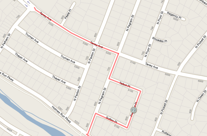
1) You select to create a new route. You can create an account if you’d like to save them handy for future reference, but you don’t have to – or simply choose one of a bajillion already out there (technically that’s 1,831,610 routes). From there you simply map out your route like you’d normally do:
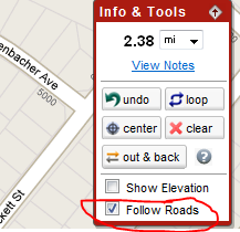
2) Note a couple of things – you have the little option to ‘follow roads’, you can turn this on or off mid-route. For example, if you divert onto a trail, you’ll want to deselect this for that brief portion, then turn it back on.
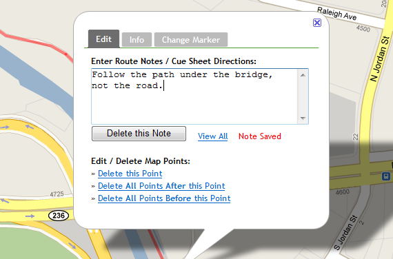
3) Also note you can add points to create a printable cue sheet – or create markers with things like ‘water’, ‘aide’, ‘turn left’ etc… I was hoping these would show up on the devices, but they don’t. :( Just for printing (I always have a backup printable cue sheet just in case for long rides).
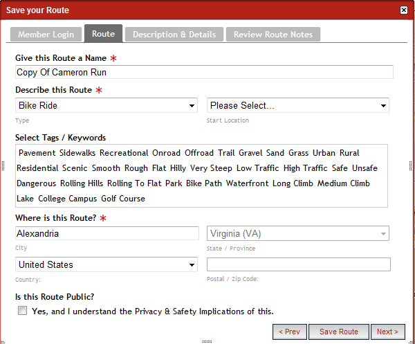
4) Once you’re done creating your masterpiece, you need to save the route. You can make it public, private, stored in your account and assign it a ton of options. The key here is you have to save it before you can export it to Mr. Garmin – otherwise the option to export won’t appear. You don’t have to create an account though to save a route.
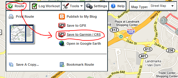
5) Ok – all saved? Good. Now comes the fun part. Click the little route button, and then click ‘Save to Garmin/CRS’.
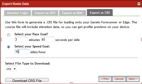
6) You’re then able to choose a speed or pace which will trigger the Virtual Partner feature on your device – which is useful for pacing (particularly on runs). Once done, click Download CRS file and save it away somewhere where you won’t forget it for at least 8.5 seconds (I suggest the desktop…).
7) Now crack open Garmin Training Center, and select to Import the Course file you just created. It will show up then under Courses.
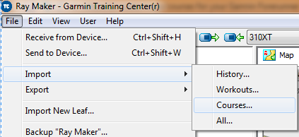

8) Then just click the little blue button to sync it to your device (next to the text ‘310XT’ above). Zip! A moment or ten later, it will be on your device (Ok, I’m going to assume you’ve connected the device…otherwise now is an opportune time to do that…)
Let’s get on the bike!…or the run!
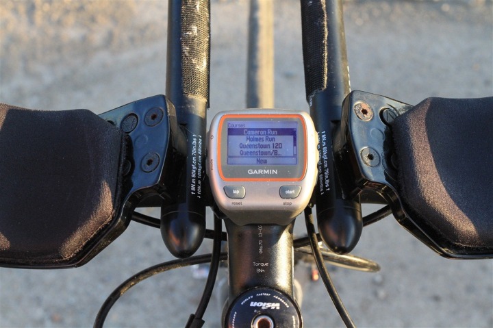
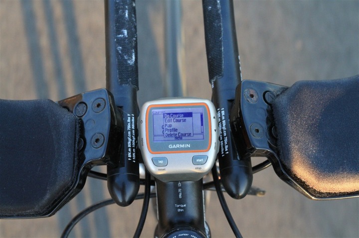
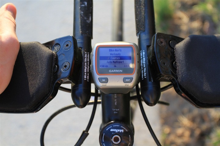
9) Ok, go ahead and start your device and navigate down under Training to Courses. It will vary slightly by device – but all of them generally have it in the same rouge place. I’m using the Garmin Forerunner 310XT as an example…mostly because the orange looks pretty in pictures.
10) Once you’re there, you can choose your course – the one I’m using here is named Cameron Run.
11) If you select it, you’ll get a few options, including do course, show map, and show course profile. Here’s what the elevation looks and map looks like – all data included in the course file. The map is pretty basic – just a simple outline on a blank slate – but it works. That ‘Edit Course’ option you see…well that’s mostly useless. It’s just to change the name of your course.
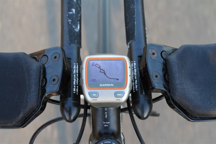
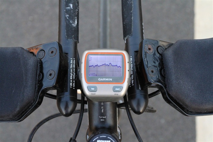
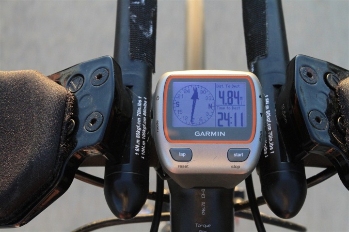
12) Ok – enough looking at the maps! Time to ride! Click ‘Do Course’, which then gets things moving. Now – unlike your average Car GPS, this won’t show you street names, or tell you to take a turn in 200 feet (though, the Garmin Edge 705 will do those things). This is more like Boy Scout orienteering. It’s not perfect, but I’ve done some 120 mile rides in the middle of nowhere with it, and it is functional. It follows a breadcrumb trail of little dots – many of them, thousands of them – getting you to your destination.
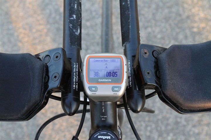
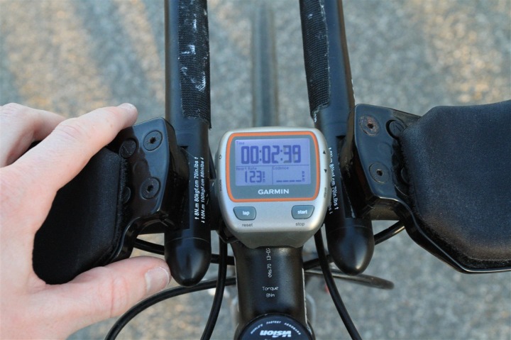
13) The cool part is the virtual partner page is easily accessible, and will show you how far ahead or behind you are with respect to your goals (you can see the ‘little man’ below that you’re trying to beat):
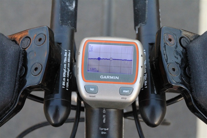
If you want to see where you are and where your little friend is on the elevation map – you can do that too:
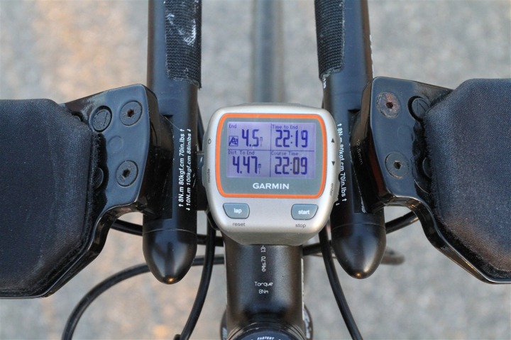
Finally – you can also see all the usual ride/run information that you would normally configure – along with data about the overall course following progress.
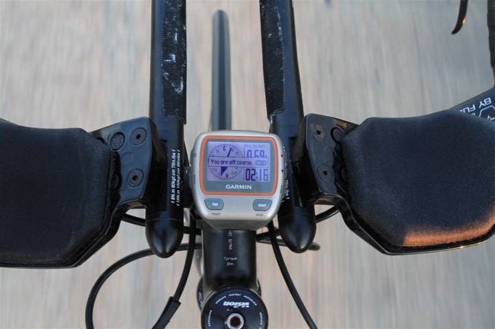
14) Last but not least, if you stray off course, the device will warn you, and tell you how to get back on course:
PS – For those curious, the above Garmin 310XT above is actually using the Edge 500 mount with the 310XT Quick Release Kit base piece. I personally find this the best combination, as the Edge 500 mount is a nice easy non-Ziptie solution (uses industrial rubber bands) that you can quickly move between bikes without any tools (scissors). The kit includes two bikes worth of Edge 500 mounts, so you really can’t go wrong.
So – with springing now sprunging – go forth and conquer those new routes – without fear of getting hopelessly lost with all new new birds and bees out there. 
(Tonight…sunset – on a 70*F day in DC…finally – spring has sprung!)
FOUND THIS POST USEFUL? SUPPORT THE SITE!
Hopefully, you found this post useful. The website is really a labor of love, so please consider becoming a DC RAINMAKER Supporter. This gets you an ad-free experience, and access to our (mostly) bi-monthly behind-the-scenes video series of “Shed Talkin’”.
Support DCRainMaker - Shop on Amazon
Otherwise, perhaps consider using the below link if shopping on Amazon. As an Amazon Associate, I earn from qualifying purchases. It doesn’t cost you anything extra, but your purchases help support this website a lot. It could simply be buying toilet paper, or this pizza oven we use and love.

![IMG_4463[4] IMG_4463[4]](https://media.dcrainmaker.com/images/2010/03/how-to-create-mapscourses-for-your-garmin-forerunner-35-thumb.jpg)


First time I see clearly written how to use this feature of 310XT. I tried it some time ago but using .tcx files and it did not work. Today I will try it with the .crs file and I am sure it will work.
Do you know what is the diference between .tcx and .crs files?
Thanks for your post.
You should take a look at this:
link to bikeroutetoaster.com
I think it works far better!
You can also use the Training Center Software to enter the turns. The Garmin will then give you turn by turn instructions instead of just telling you if you go off course. That feature is pretty cool alone..
I’m assuming this is not possible with the 405?
A great guide! I’ve been thinking of doing this for a while instead of just running/biking wherever the road took me. I just hope this works with Swedish maps and I’ll go make some nice routes for the weekend!
Stephen: the biketoasterthingy won’t work, downloads only to gpx and tcx.
DCRainmaker: is the 500 able to show a compass like this?
link to lh6.ggpht.com
Virtual partner is useless function on bike.
Can I use this also on a 500? (I read it in the beginning I can, but on the net I find opposites answers on riding route on an E500)
Thanks for the info
Hi Jarno-
Sorry for the delay here.
It doesn’t exactly show a compass like that on the Edge 500. But it instead shows a bit more of a ‘directional mini-compass’ of sorts. Sorta like a northwards pointing arrow on the screen. It’s much smaller and not quite as useful to be honest.
But yes, in short – you can do courses on the Edge 500 just fine, just not as pretty as on the 310XT. I show some screenshots in my Edge 500 review:
link to dcrainmaker.blogspot.com
Thanks all!
Opps, forgot one.
Hey Jandercito-
A TCX file is typically used to record data – such as a rides history, whereas a CRS file is used to record course information.
http://www.gpsies.com IMHO has less ads and is nice too!
Regards from Germany
Thanks, another really useful blog post!
I’m interested to know what’s going on on page 15 of the Garmin 500 User Manual (link to www8.garmin.com). The image centre left shows “Straight”, “Turn” and “Right” arrows, associated with distances & times.
It’s not clear whether this is the Garmin 500 recognising road junctions (can’t imagine that, if there’s no map data associated), or whether you have to put those “instructions” in as route point data somehow…
Anyone know?
Finally, you might be interested in a Google Maps bookmarklet here: link to the-yosts.com
This means you can use Google Maps to create your initial route, making use of its route-dragging/re-routing facility too (not sure you can do that on Bikely)
G
I just started playing with http://www.ridewithgps.com as an alternative to mmr. Much faster interface for creating routes.
Thanks for the comment. Although I only bike and not run, I might look to buy a 310XT instead of an Edge500…
Or maybe a 305? I don’t know anymore :p
Hey Giles!
RE: Course Points/directions
I just poked around a bit. In Garmin Training Center, if you open up a course (the .CRS file, such as one from MapMyRun/Ride), then select the icon that looks like a flag – Course Point Tool – it will allow you to insert any number of little icons (including the ones on that page – left, right, etc..), plus a one-line instruction.
Hi Jarno!
RE: You can’t go wrong with really any of those watches, though I prefer the 310XT to the 305, simply because of the additional waterproofing (not having to worry as much), and the 310XT’s Power Meter compatibility.
Great post man. I’ve been trying to figure this out for a while. This worked like a champ!
Nice article. I’ve been using bikeroutetoaster for some time to send courses as .tcx files directly to my 310XT, and I can promise y’all that it works perfectly, and is quicker than the method you describe as it lets you skip going through TC. The file is transferred direct to the ANT agent then transferred to the watch the next time the dongle sees it. It also has the nice feature of being able to add course points like warnings 200ft before turns, though the 310 doesn’t have a lot of memory for these and you can run out pretty fast on long routes.
Has mapmyride.com changed? I don’t see a Route – Send to Garmin section anymore…
I’ve been using the exact same method as you, DC rainmaker (mapmyride technique). One thing I noticed, though – I’m using software version 2.9, and my unit keeps crashing when I have several courses loaded. I can usually keep it from crashing by loading one course at a time (I was doing a 12 day trip @ 100 miles per day, but fortunately, had the laptop in the SAG vehicle for loading courses each day). The other problem I noticed is that there is a pretty healthy lag time updating the map on the screen. I usually leave it zoomed in at 800ft, so the boy-scout-orienteering isn’t so hard – but if you are clipping along at 18mph, you can easily go way past a turn without ever having see it on the screen (just says, “drawing”). I think this problem occurs more frequently with longer routes. Have you experienced either of these problems, or am I alone here?
Just found your blog today while researching for a possible upgrade to my Forerunner 201. Phenominal amount of info here.
Is this course uploading feature possible on the FR 201? I know it creates a bread crumb track of where you’ve been, but I am not sure if it can accept uploaded courses. I’d love to use it for planning very long bike rides. I may have to consider looking for a 310XT.
Hi!
First, I really want to thank you for the great site your created and all the information you share, this is awesome!!!
I want to share my experience loading navigation into my Edge 500. Here’s my process:
1. Create your map using http://www.bikeroutetoaster.com I tried mapmyride, but can’t add navigation using it. Also, bikeroutertoaster creates course navigation cue list that I can edit to keep/add only relevant ones.
2. Save as TCX file.
3. Import into Garmin Training Center and do final edits on navigation points, if needed, as only symbol and 10 characters from name will display on the Edge 500. The description doesn’t show up.
4. Transfer to Edge 500 and Do Course.
Enjoy!
Francois.
PS: bikeroadtoaster seams to support direct update into Garmin Edge 500, but I didn’t try and took the safe path though Garmin Training Center.
I know this thread is a little old but I have a question. When I chose to “Do Course” with the Garmin 500 can I still do the auto scroll with the other information the computer has (speed, cadence, etc.)?
Hi Rccrisn.
At least wirh the Forerunner 310XT you can do the autoscroll and any other thing with the screens while making a course. I guess it will be the same with the 500.
Regards,
Alex
I’m trying to decide between the 310, the 500, or if I risk the fallout from my wife, the 800 ($$).
For those that claim you can make the 500 show a turn arrow and “name” of the turn, can you post a screen shot? Can the name of the turn just be the street name? So as you approach the turn, you’ll see an arrow to the right with the words “Main Street?” That would tell even a idiot like me to turn right on Main Street.
Would that be possible on the 310?
I’m new to this whole biking/running/fitness thing. Extra inspiration is that my wife just learned she (we) has/have MS.
So, since I plan to do some MS150 bike rides, I’d like a unit that I could use for the whole 2 day ride with directions to keep from getting lost.
mapmyride seems to have taken out the export as crs option, how can I do this now?
Thanks,
Matt
Thanks’ for your detailled instructions. Makes using my Forerunner 310XT an even greater experience.
As MapMyRun doesn’t do the proper export anymore i’ve used http://www.gpsies.com like Sebastian suggested. Super fast and easy alike.
HI! Do you ever use ridewithgps?
Can you take a look at this and tell me how you would upload courses (both made on there and favorites found on there) to the garmin 310xt?
Also, the bike cadence, does that automatically sync when I put it on ( if I can figure out how to put it on of course :) )
Thanks Jessica
Fastest way I’ve found that works without any issues…
Go to: Mapmyride
Create course
Download as a .gpx
go to: GPSies.com
Convert to .crs
done.
hello, here is other way how to make course:
(1) open Google Earth software (google it!)
(2) draw lines of your course
(3) save *.klm file
(4) open program (freeware) TCX Converter (google it!)
(5) import *.klm and save as *.crx
(6) open GarminTraingingCenter, import *.crx, send to your watch
(7) enjoy!
When actually biking a course that I’ve inputted, is the time/speed that I’m racing against the actual time–e.g., meaning my actual time when I got to 3 miles for example–or is it just a comparison to my average speed over the whole course?
Hi,
first, thanks for all the information you’re sharing with us.
Things seem to have change, the export as CRS option appears disabled (coming soon!). Any suggestion?
Hello, thank you for giving this guide, but as another commenter mentioned, things have changed on Mapmyrun & I can’t find the button for saving it as a file to send to Garmin. Any chance you can work your magic and check on a new solution to making courses for the Garmin 405? THANKS! -Kate
For those waiting on the “Coming Soon” for CRS, check this out: link to sotyred.wordpress.com
Excellent site. Thanks for the info about how the course navigation actually works and a “real” example. I have been searching for this type of information for the past few days.
Many thanks for all the hard work. You are my “go to resource” for all things 310XT.
Have a 15K mountain run event coming up, so have loaded the course to stop me getting lost. If you dont hear back from me …. I got lost!
Hi,
I am very confused: what is the name of this feature in Garmin’s docs ? What models currently support it ?
Thanks !
ray,
how do you export as a .crs in the new version of MapMyRide. All I can do is export as a .gpx and those don’t play nice with garmins in my experience. anyway, hope you enjoy paris!
To get a course from mapmyride now it looks like you need to do an additional conversion step. If you export the .kml file, then use the file converter on gpsies.com, you can export the .kml to a .crs. I haven’t tried to send this to my 310xt yet, but it does import to Garmin Training Center.
Hello,
Is it possible to auto scroll between the map, the compass bearing pointer, and the data field pages?
I can only make autoscroll work within the data field pages. The map and and compass direction will not autoscroll.
Tomas
Seems map my run can’t produce CRS or tcx files now. Does anyone know of a package that can?
I am looking to load courses onto a Garmin Edge 500.
Also several packages i have tried produce files called example.tcx.gpx. does anyone know if these are proper tcx files? At the moment I haven’t been able to get these to work…
Great review. I picked up a 410. How many courses can I transfer to the unit via Garminconnect? I created 3 courses loaded one last night. Then this evening I loaded up 2 additional courses and it removed the first one. So I decided to load up all 3 before I actually synced now all 3 are there. But if I create a new course, why would it remove the others?
Please tell me, how smart this course feature is. If i’ll ride not exactly to the next point of course, but near this point (10 meters left, for example). Will it show me arrow to the point after this, or it will show me “out of course” message and arrow to go back?
Hi, When I’m doing a Course on forerunner 305 (exactly as described), the heart rate monitor doesn’t work! It is normal? Thanks!
Paulo
Hope this hasn’t been asked elsewhere around here: concerning the 500 and the course function, can I first start recording my workout, head for the vicinity of the trails I want to ‘navigate’ and then activate the ‘Do Course’ function? (I have some new trails I want to discover about 10kms away from home) Is the 500 able to do both things, recording my ride and then showing me the Course page?
Thx !
Apart from MapMyRun apparently no longer supporting the CRS format, I was turned off the first time I tried with all the 20 second wait windows trying to upsell you the MVP membership so I gave up and went in search of a more reasonable solution. Turns out you can convert your existing files from almost any native format you have using http://www.gpsies.com, so now you have to freedom to use a more robust program of your choice to create your courses.
Sorry after posting the above I saw there were a few links to that site previously anyway in the previous threads. I also note someone referred to a handy utility which I just downloaded but have not tried, but this link is still active: link to niniu.com. I’ll probably try it to convert the exisitng files I have created on my Android device with Locus Pro and see how it goes.
Sorry, after posting the above comment #43, the situation reported normalized. Not quite figure why, but its ok now. Thanks
So we have a 910XT, we created a course on Garmin connect but when we hit “send to device” it does not appear on the 910. Is map my run a better way to upload a course? We are new to this so any pointers would be great.
Thanks for this and for Tom Sellers comments. I’m finally getting some good use out of my Forerunner!
I don’t use Garmin Training Center (anymore) but connect.garmin. Does somebody has a solution to upload a course to connect.garmin?
Unfortunately there isn’t a way to – but in many cases, you can find others on there and then copy it.
You can put routes on a Garmin by copying a gpx file to the **hidden** NEWFILES folder on the removable storage. When you disconnect they are converted into a FIT file and stored on the device in the COURSES folder. If you were to copy this file to the ACTIVITY folder it would be treated as an activity and sync with the device. You could therefore copy your activity in gpx format to the NEWFILES folder, disconnect, update, convert to a course in the COURSES folder then copy the resulting FIT file to the ACTIVITY folder. When you next sync it should appear on Garmin Connect.
Groan!
The alternative would be to bin the Garmin and get a Suunto Ambit 3 which are a snip at the moment. Suunto have a much more permissive software ecosystem and you can upload and download to the cloud as you please.
do you think one day Garmin will put all the functions in Garmin connect like upload courses?
thanks in advance
paco
It’s there today. This article was written previous to that. Enjoy!
Its like you read my mind! You seem to know so much about this, like you wrote the book in it or something.
I think that you can do with some pics to drive the message home a
bit, but instead of that, this is magnificent blog. A fantastic read.
I’ll certainly be back.
Thank you! I’ve had (and loved) my Forerunner 305 for years and never quite new how to do this. This is super accessible and enables a very useful feature. You’re the man!
Great step by step guide – only issue i’m having is that i cannot uplaod to my 310xt via traning centre or connect – i can download data with no issue, but does not recognise my device for uploads – not sure if the ANT+ link is intermittent adn therefore deosn’t see the device. Have uninstalled and re-installed everything on numerous occasions, but to no avail….any thoughts would be greatly appreciated!!
Hi Mike, did you manage to get this sorted? I’m having the same problem.Regards Richard
Mike did you manage to sort this problem as I am having similar issues where I can’t load courses to my 310xt?
Do you have any advice for a post Garmin Express world where the communicator plug in is a thing of the past?
Useful post with good examples, thanks! If interested, I suggest trying link to gpx2kml.com , a free converter for making gpx to kml format and kml to gpx formats.
Hey Ray,
I recently just got a Garmin FR 310xt for christmas, and wanted to import my maps from mapmyrun to my watch, but it seems that they’ve changed the website a bit, so the way you had it didn’t work. Is there a way I can export my maps from mapmyrun to my watch?
Thanks!
Hi there, mapmyrun has changed it’s graphics and layout. Is there any way to do what you have done above using the new layout?
Is there a way to use this same sort of course mapping on any of the new Garmin watches? I’m thinking the Forerunner 230/235, 630, or vivoactive/HR.
If so, it would be killer! I’m just trying to get by with a combination of the Hike and DWMaps Apps. I just did a run following a course I made on DWMaps, but I got far off course – if I had arrows to point me to the next major turn, it would be so much better.
Hi there,
I have an old FR410 and just bought a FR235 for the wife.
I follow tracks in the 410, just by converting de gpx to crs and import to the watch using training center (without adding any arrows or notes). The difference for the 310 is tha there is no map but it displays arrows when arriving the a tight corner and warnings+compass if off course. Does the same when tracking back to start. I this device the back to start follows the saved path of the workout In reverse sense.
The wife convinced me to buy her the 235 with the existing apps to “navigate” but haven’t tried yet (she would do just fine with a cheaper watch).
If the apps developers would just duplicate the 310 or 410 software, we would be very happy.
Regards
Hey DC Rainmaker,
Love the reviews….i’ve used them to purchase My Edge and Forerunner.
Question…I’m unable to load a course from Garmin Connect to my FR230. I follow all the steps and when i hit load to device, my device isn’t there on the next screen. I’ve followed all troubleshooting.
Any advice, i’m sure the 230 allows courses to be uploaded, no?
thanks in advance
SB
DC Rainmaker
Hi love your reviews, any chance of updating the content for Garmin Express/Connect, as Training Centre is no longer supported by Garmin. Ideally I would like to to use Memory-Map to create courses then export them via Connect to Forerunner 310xt MM can export gpx and tcx files but l keep getting error messages when l try to to send them via Connect to Forerunner 310xt
Michael
Hi Ray
Greetings from Denmark
I know this is an old post, but I really would like to be able to put a course on to my old 310.
I have the same problem as above post Sheldon Bussey described.
Regards Jannick
MONTE Do you know Dennis Cambell by chance? he lives hear you Buckmaster RepTINK
I am struggling to send courses to my device via TC. I can send from my 310xt to TC but not visa verse. Any tips?