
Garmin’s Edge 540 is part of a twofer of new cycling GPS units, alongside the touchscreen enabled Edge 840 that was concurrently launched. These two units are nearly identical in software features and functionality, while their core hardware difference is that the Edge 540 doesn’t have a touchscreen. But both units got a slate of new software and hardware features, with the most notable being a new free-style ClimbPro mode that doesn’t require that courses be loaded to get information about upcoming climbs in real-time. And on the hardware side, both models got multi-band (dual-frequency) GPS/GNSS, USB-C charging, and the option for solar panels.
But alongside those headliner features, there are a literal slate of smaller features. Many (if not all) arrived on the Garmin Edge 1040 series last summer, and now have arrived here, making the Edge 540/840/1040 near identical in terms of features, and really only separated by hardware differences.
And unfortunately, it’s those hardware differences that have challenged my use of the Edge 540. Specifically, the button-only configuration compared to the touchscreen-equipped Edge 840 sibling. While button-only had never been a problem for me on the Edge 530, it doesn’t feel like the new user interface layout is ready for a button-only configuration yet. But, more on that as we roll.
Garmin sent over media loaners to test out. As usual, this review is not sponsored (nor does any company get to preview anything I review), and I don’t take any advertiser money from any companies I review. Once this unit goes back, I’ll go out and buy my own for any future testing needs. If you found this review useful, you can use the links at the bottom, or consider becoming a DCR Supporter, which makes the site ad-free, while also getting access to a mostly weekly video series behind the scenes of the DCR Cave. And, of course, it makes you awesome.
What’s New:

It’s been almost exactly four years since the previous Garmin Edge 530 came out, then alongside the sibling Edge 830. During that time, the 530/830 received an astonishing number of feature updates, alongside the Edge 1030 and then Edge 1030 Plus. My goal in this ‘what’s new’ section isn’t to compare to the Edge 530/830 devices at release, but rather, to compare what’s new on the Edge 540 as of now. Meaning, taking into account all those firmware updates.
With that in mind, the vast majority of newness here, software-wise, has already been seen on the Edge 1040 since last summer. There’s really only a couple of features (Freeride ClimbPro & anytime sensor/device profile transfers) that are actually new-new here. And those are also coming to the Edge 1040 in a firmware update shortly. Here’s all the new things:
– Added solar panels for Edge 540/840 Solar editions
– Added multiband/dual-frequency GPS
– Added USB-C connection for charging/sync
– Made it slightly chubbier to accommodate solar panels (non-Solar edition is also same new dimensions)
– Completely revamped the user interface everywhere (matches Edge 1040)
– Added Power Guide race/training pacing feature
– Added ClimbPro Free-Ride mode, which automatically triggers ClimbPro without a route
– Added Climb Explorer dashboard for finding nearby climbs
– Added Connect IQ Widget Glances to Homepage/Dashboard
– Added Training Status 2.0
– Added full automatic race/event suggested workouts using a periodized/phased daily plan leading up to event, inclusive of any Garmin wearable data shifts (e.g., automatically reducing planned workout if you got no sleep on a redye flight)
– Added Course Demands to compare course features to ride needs
– Added Real-Time Stamina to show energy/distance/duration left during workout
– Added Location Search Widget
– Added ‘Recent Finds’ from navigation panel (so things you recently searched for)
– Added new ‘Bike Shops’ & ‘Water Stops’ categories for navigation search (and completely re-did other categories to mostly get rid of auto stuff)
– Added Post-Ride ClimbPro Splits on device
– Added re-scheduling of primary workouts
– Added support race/event driven Daily Suggested Workouts (expanded from initial Edge 1040 launch)
– Added paired sensor information to summary page (even for non-Garmin sensors)
– Added support for Shimano STEPS sensor type (eBike component)
– Added new consolidated post-ride Highlights screen with PRs
– Added estimated battery remaining when toggling Battery Saver mode
– Added manual WiFi sync all button (a ‘do it now’ option, but removed single-ride upload option)
– Added phone-based config of data fields/data pages
– Added ability to use phone for typing text on Edge
– Added ability to manually transfer sensors and device profiles to Edge from phone at any time (not just first setup)
– Added ability to transfer courses to Edge from phone mid-activity
– Added Garmin Connect IQ App Store on-device marketplace
– Changed nearby POI/Things search to be virtually instant
– Far faster route calculation/recalculation times
– Increased ClimbPro coloring to show more gradient definition
– Now automatically changes map popularity type to match activity (i.e., Road vs. MTB)
– Changed screen background default from black to white for improved “readability”
– Removed horrifically unreliable duplicate Bluetooth pairing process for phones
– Removed Varia Vision sensor support
– Removed device transfer (sharing between units)
– Same 2.6” size/resolution as before, however, Garmin says it has improved contrast ratio and color filters
– Weight is 85g for Edge 540 solar
– Battery life up to 48 hours non-solar, 78 hours solar. Up to 34 hours with Multi-Band GPS mode with Solar (battery chart lower down)
– Simplified Bluetooth phone pairing to single connection (versus previous dual legacy BT and BT smart)
Additionally, while this is offered on the Edge units, it came much later, but it is still present on the newer units, and I wanted to call it out:
– Paired sensor transfer from existing Garmin Edge units
– Activity Profile settings transfer from existing Garmin Edge units
In total, there are three SKUs/variants for both the Edge 540 & Edge 840, they are as follows (which include basically a $50+ price increase over the previous generation):
– Edge 540 base: $349/€399/£349
– Edge 540 Solar: $449/€499/£449
– Edge 540 Performance Bundle (which includes heart rate strap, speed sensor, cadence sensor): $449/€499/£449
– Edge 840 base: $449/€499/£449
– Edge 840 Solar: $549/€599/£549
– Edge 840 Performance Bundle (which includes heart rate strap, speed sensor, cadence sensor): $549/€599/£519
And the short version of how the Edge 540 vs 840 differs is actually surprisingly simple:
1) The Edge 840 has a touchscreen display, the 540 does not (both have full sets of buttons)
2) The Edge 840 has 32GB of storage versus 16GB on the Edge 540
3) The Edge 840 comes pre-loaded with two regions, the Edge 540 with one pre-loaded (but you can swap/download others after for free)
4) The Edge 840 can search on-device for specific street addresses and GPS coordinates, the Edge 540 cannot.
5) The Edge 840 has Trailforks maps pre-activated, versus with the Edge 540 you need to manually activate it once (also free)
6) The Edge 840 can manually build a multi-step structured workout on-device (using touch), on the Edge 540 you need to send from app/3rd party/daily suggested workouts, or use interval builder on-device
7) The Edge 840 editions cost $100 more
(Side note: If you’re trying to build a complex multi-step workout on-device, something in your day/life/cycling world has gone horrifically wrong, you really don’t want to do this, even on the Edge 840. Trust me, nothing good comes from that rabbit hole.)
Honestly, the only two things that really matter in that above list besides price, for 99% of the people are the touch (and that’s a big deal here), and the bigger storage size if you frequently fly across the pond (any pond).
Phew, got all that? Good, let’s crack it open.
In the Box:
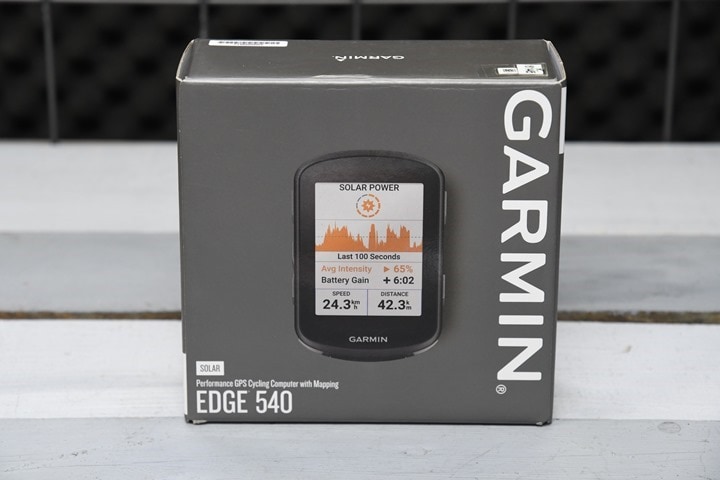
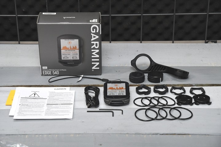
As is usually the case, Garmin has launched a few different options for the Edge 540. You can get the base version, the solar version, or a bundle that includes the base version plus a few extra sensors. In my case, I’ve got the Edge 540 Solar variant. Physically though, both variants are identical from a case/size standpoint, and share identical features. The solar panels themselves are the only difference between the two models.
Here’s all the parts tossed elegantly onto a table:
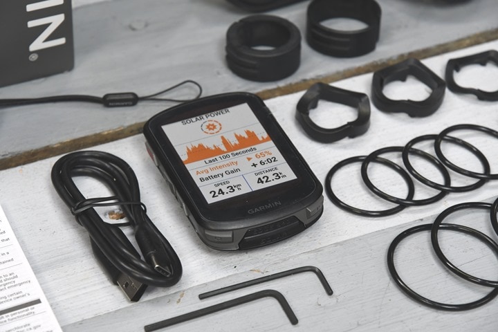
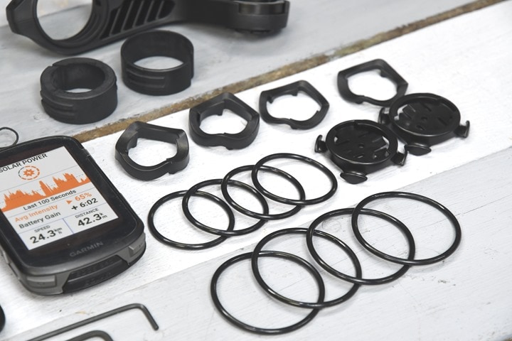
Inside the box is the Edge 540 unit, a lanyard if you don’t trust the mount, and a small hex wrench in case you want to remove the innards of the included mount to swap it to Garmin’s battery pack/power bank.
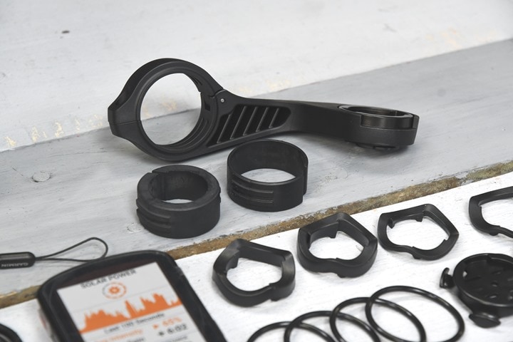
You’ll see that out-front mount included. While it’s plastic, it’s beastly, so it’s virtually impossible to break. If you break that mount in a crash, frankly, that mount is the least if your breakage issues. In the box you’ll find a few different collars for handlebars of varying sizes.
There’s also a handful of the Garmin rubber quarter-turn mounts that most people use. These have been used on Garmin bike GPS units for about 15 years now, and are my go-to on all my bikes. They work great, are secure, and easy to switch between bikes (and cheap if you need more!). There’s a few rubber band sizes in here too.
Oh – and the big ticket item, a USB-C charging cable. Of course, you can use any USB-C charging cable you want, such as a laptop charging cable or such, it works just fine.
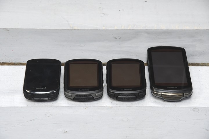
The weight of the Edge 540 Solar is 85g, 840 Solar is 90g, and 1040 Solar edition is 134g. And if you were to compare it to the Edge 530/830, you’ll see it chunked up a bit width-wise, presumably to fit the solar panels in there (Left: Edge 830, Edge 540 Solar, Edge 840 Solar, Edge 1040 Solar)
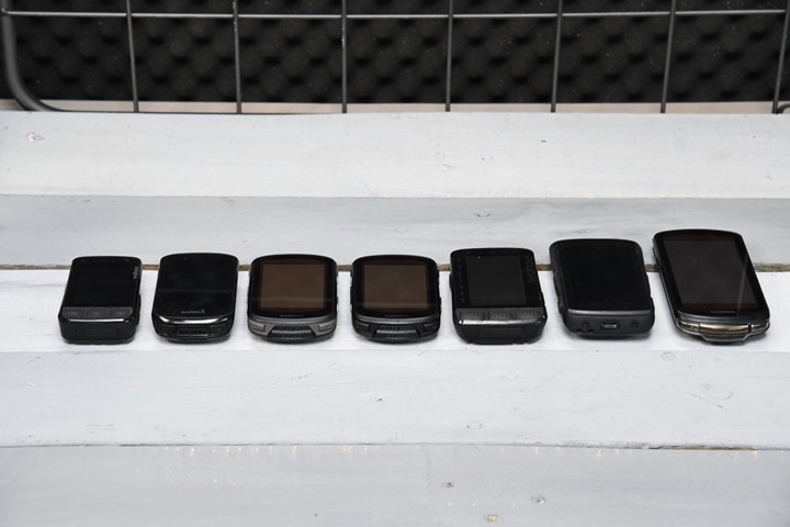
And for fun, here’s a lineup with a bunch of units: Wahoo BOLT V2, Edge 830, Edge 540 Solar, Edge 840 Solar, Wahoo ROAM V2, Hammerhead Karoo 2, Garmin Edge 1040 Solar.
Next is getting it all configured and covering some of the basic usability bits.
Basics and Configuration:
The Edge 540 is a completely button-driven operation. There is no touchscreen like on the Edge 840 or Edge 1040 series, which combined with the new user interface can take some getting used to in certain operations.
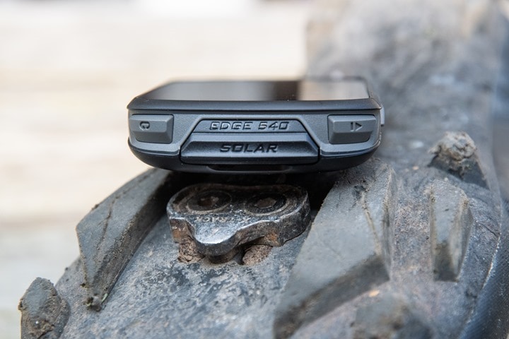
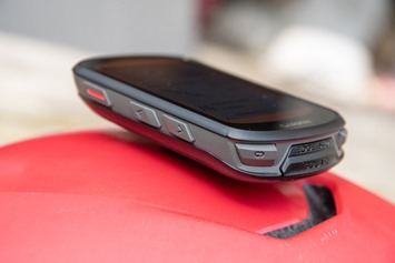
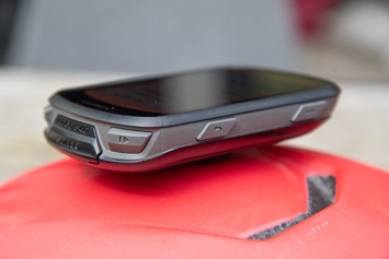
The Edge 540 has 7 buttons in total. The side buttons are for navigation/confirmation in menus, whereas the front/bottom ones are for stop/start/lap. Those bottom buttons are almost never used in any menus at all, it’s really only ever for starting/stopping a ride.
Additionally, there’s long-presses to move around the menus more efficiently. For example, you can long-hold the lower right button to get back to the main dashboard while riding. Or you can sometimes long-hold the upper right button to save or confirm a settings page. Though it can sometimes be confusing as to which ones are single-tap, and which ones are long-hold, despite the pop-over icons.
My usage of the buttons on the Edge 540 has left me both a bit perplexed and somewhat unsure. I’ve long-recommended the Edge 5xx series over the Edge 8xx series. For example, the Edge 510/520/530 over the Edge 810/820/830, mostly because of the option to have buttons in case the touchscreen wasn’t working for you, whereas the higher-end Edge 8xx series didn’t have the full set of buttons. Now though, the two units are identical button-wise. And more critically, with the revamped user interface, it somehow just seems more cumbersome on the Edge 540.
However, to understand this, you need to look at basically three scenarios of usage:
1) Pre-ride setup or menu meandering/post-ride menu usage: This is fine, no real issues, all works well.
2) During the ride normal usage: This is great too, assuming all you do is start/stop/lap, or change between data pages
3) During the ride changing anything else: This is where my head hurts
See, it’s the part where you have to get back into the menus during a ride, that’s messy. Want to adjust any setting at all? Like display settings, or navigation settings, or a really anything. That first requires a long-press on the lower right button, then it drops you into the dashboard, where you need to go via combination of ups/downs plus more confirmations. Plus, often-times I find the menu highlighter just disappears randomly, so you’re actually not sure where you are, and have to press up/down a bunch so it resets.
What I’m not sure about is whether or not I’ve just gotten used to touch over the last year with the 1040 and other devices, or if the transition from the old user interface to the new previously launched Edge 1040-driven user interface is just messier with buttons now in certain cases. I’m getting better at it with each successive ride, but on the whole it’s frustrating when you need to do any sort of mid-ride change.
And if it’s frustrating for me, I think it’s going to be challenging for most others. This is area where companies like Wahoo have really excelled at keeping it easy and flowing, even changing settings mid-ride. And while the Edge 530 previously wasn’t perfect, it just felt better UI-wise with buttons than the Edge 540 does today. Hopefully that’s something they can tweak.
Finally, aside from any current UI design issues, there’s just a eff-ton of button related bugs. Like, I literally can’t get to some menu options sometimes. It’s incredibly frustrating, yet I’m trying to separate ‘bugs’ from ‘bad UI design’, if that’s somehow possible.
The next major change is Garmin has switched over to USB-C! Of course, if you’ve got the Solar edition you can charge via that too – but frankly it’s gonna be tough to charge purely via solar. It’s far faster to just charge via USB-C, where it takes literally a minute or two to charge via outlet, compared to many hours of solar time.
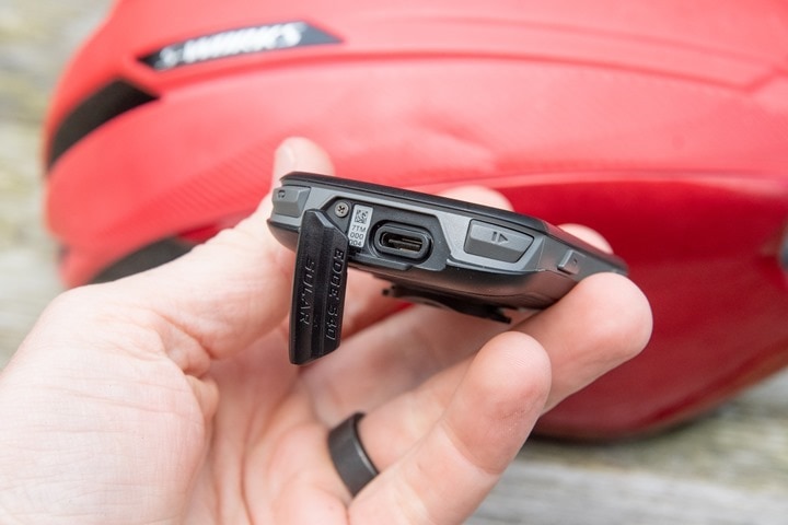
The port has a little cover, but it’s also internally waterproofed to IPX7. That means you can crash into a shallow canal (up to 1 meter deep), and then you’ve go 30 minutes to fish it out. Obviously, if you find yourself in that situation, the Edge is probably the least of your concerns. Here’s also a lanyard hole next to the cover,which the Edge 540 includes in the box as well.
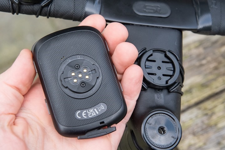
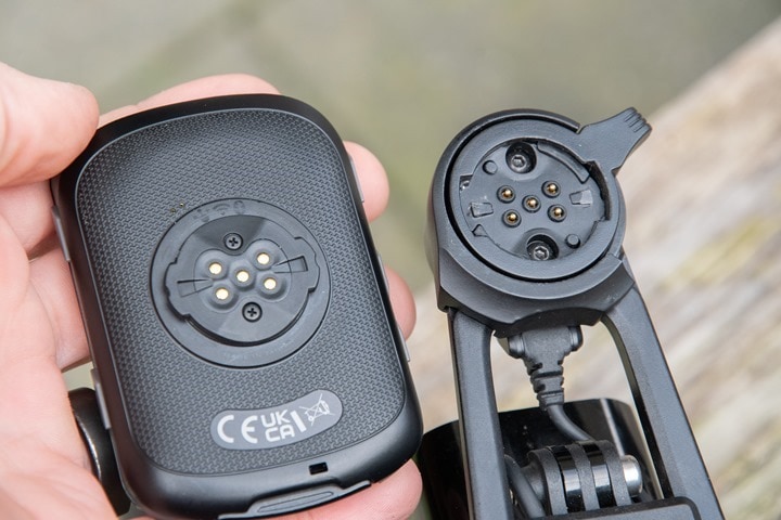
Meanwhile, the back-side of the unit is the same Garmin quarter-turn mount that’s been standard on Edge devices for the past 15 years.You’ll find that mount on tons of 3rd party mount accessories and even a number of bikes have it built-in these days:
You might have noticed the small power pins on the back of the mount. Those are compatible with Garmin’s 7-year old battery pack, as well as their brand new Garmin Edge Power Mount from last summer (if your bike has power in it, and can power items forever). I’ve used it with the power mount and it worked just well. When used with the power mount, it’ll disable solar charging. I presume the same for the battery pack.
Don’t worry, we’ll talk about battery burn at the end of this section.
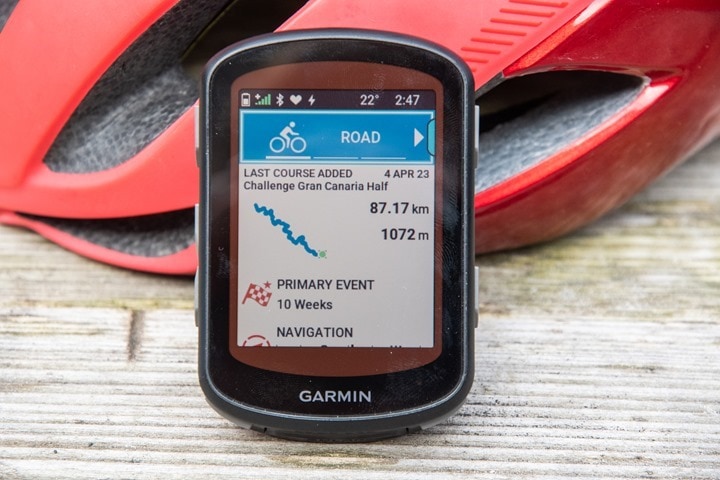
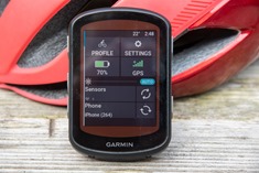
If you haven’t turned it on already, you’ll do that via the upper left button. Immediately on the front page you’ll se your ride profiles. These are by default Road/Mountain/Indoor, but as always you can tweak/customize these to whatever you want. You can change the colors, all the data pages/settings behind it and a gazillion other settings I promise you never knew existed in there. The benefit of that though is that you can have different settings for different cycling types – for example you may want mountain bike data pages different from road cycling. Or, have a separate profile for a specific bike, or a race profile that you use.
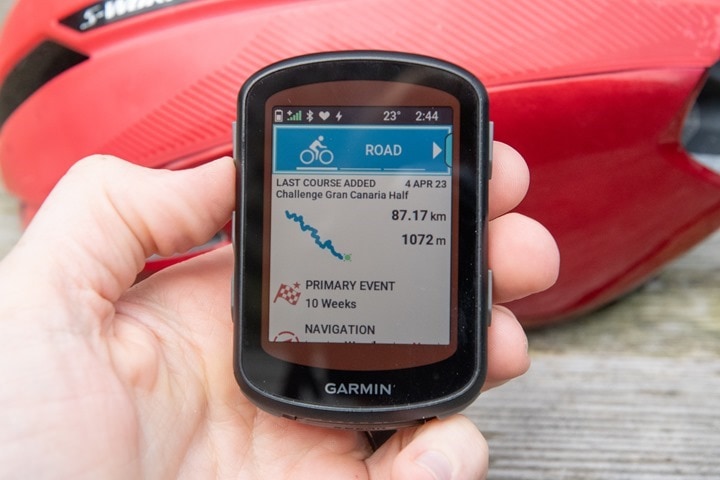
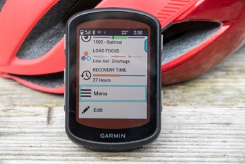
Below the cycle profiles is essentially a “What’s New” panel. This first chunk shows you the last thing that happened to your Edge. For example, if you just synced a course there, it’ll show that. If you just completed a ride, it’ll show that. If you have a structured workout scheduled and haven’t synced anything else in the last few minutes, it’ll show the upcoming structured workout. It’s generally a pretty handy way to quickly get to whatever it was you probably wanted to do:
As you iterate down this list, each item is a widget glance, and within it you can open it up to get more information. Cracking open the Navigation widget (which also acts as a mini-compass you’ll never use there), shows you a new menu to load courses up, browse a map, navigate to saved locations, and so on. I cover all of this in the Navigation section down below.
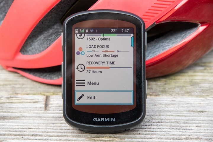
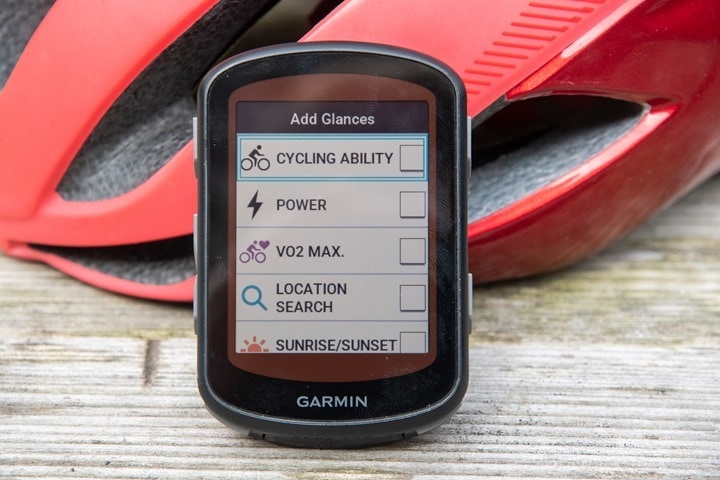
You can customize all of these widgets, either adding or removing items, including 3rd party ones. In my case I added Acute Load, Training Status, and Load focus to my widget glances.
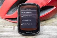
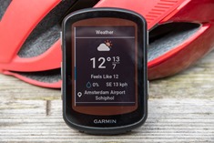
Meanwhile, up top are a set of controls menus. Sorta quick-access menus of sorts. For example, you can disable/enable GPS/settings, change brightness, dork with sensors, and more. You can start/stop/select structured workouts or courses from here, turn on/off bike lights, and see the weather. This is also where you access dedicated pages for nearby Strava Live Segments and nearby Climbs.
To access this on the Edge 540, you’ll press the up arrow, and then you’ll be in a sub-menu set that lets you press the down arrow to iterate through each page, before tapping to select a given page to activate and edit it. This is probably the biggest example of an area that’s just kinda clunky to use on the Edge 540 compared to being a breeze to use on the Edge 840/1040. It’s just a lot of button pressing for otherwise very simple actions on the touchscreen units.
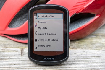
Anyways, back on the main page, if you scrolled down a bunch, you’ll find the ‘Menu’ option, which then lets you crack into all the settings:
This includes not just the Activity Profiles (for data pages/data fields), but also areas like sensor pairing, WiFi & phone pairing, Battery Saver, and your physiological stats. Plus the Connect IQ App Store and general unit settings.
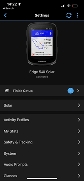
The cool part though is that virtually every setting on the unit itself can be done via your phone now with Garmin Connect Mobile. Like with the Edge 1040, you don’t have to tap-tap-tap-tap a million times on the Edge unit to configure things, you can quickly do it on your phone.
In fact, if you had an older Edge device, then all of these would have migrated over as part of the Activity Profile migration setup process that’s offered when setting up a new device. And, even more notable is that new to the Edge 540/840 (and coming to the Edge 1040), has the ability to do both a sensor transfer and activity profile transfer whenever you want, not just during initial setup.
The same migration process also applies to your sensors. Sure, you can manually set them up on the Edge 540 itself. Or, you can just simply migrate over all of your paired sensors automatically from past Garmin Edge devices. In fact, you can even do this ad-hoc down the road. From a sensor compatibility standpoint, the Edge 540/840 supports:
– Heart Rate (ANT+/Bluetooth)
– Speed/cadence (ANT+/Bluetooth)
– Garmin VIRB Action Cam (ANT+)
– ANT+ Cycling Lights (front or rear)
– ANT+ Cycling Radar Sensors
– Power meters (ANT+/Bluetooth)
– Garmin inReach Satellite communicators
– Garmin Edge remote controls
– Shimano STEPS
– eBike (ANT+)
– ANT+ Shifting (Campagnolo/SRAM)
– Shimano Di2 (proprietary ANT)
– Garmin Tempe Sensor (ANT+ temperature sensor)
– ANT+ FE-C Cycling Smart Trainers/Bikes
– ANT+ Extended Display
The above list is the same list as before. However inversely, note that it no longer supports the Varia Vision heads-up display sensor type. This is different from the ANT+ Extended Display, and was a product Garmin made many years ago that almost nobody bought.
As for sensors, like before, you can pair up multiple sensors of the same type (for example, three different power meters on three different bikes), and you can customize each of those, giving them their own unique names for easy remembering later on.
During all my testing, I haven’t had any issues with sensors or connectivity with the Edge 540. On the power meter side, I’ve specifically paired it with the Stages LR, Garmin Rally, Garmin Vector 3, Zwift Hub, and a Power2Max NG. Meanwhile, for radar I’ve paired with the Garmin RVR-315 and Magene L508. And for heart rate I’ve paired it with the Polar H10 & Garmin HRM-Pro Plus. All of these worked as expected.
Lastly, you’ve got live tracking and incident detection. Unlike in years past, these actually work reliably these days (and have for the past 2 years or so on other newer Edge devices). When enabled, these will automatically notify a predefined list of friends and family and then send them an e-mail with a LiveTrack link. This allows them to find you in the canal (or pub), in case you don’t come home. In my case I have it set up to automatically notify my wife each time I start a ride.
The e-mail/link she gets includes both my current location as well as the route/course I’ve loaded. She’ll see my sensor data, including heart rate, power, cadence, speed, and elevation. Plus of course bits like time and distance. As I said above, historically this has been a joke of reliability. But about two years or so ago, Garmin revamped the entire platform (both on-device and behind the scenes), and it’s pretty darn reliable. Both myself and my wife use it daily, and don’t really have much in the way of issues. It just works – set it up once, and forget about it.
And linked in with that is Incident Detection, which triggers when you crash your bike (or, I suppose, if you crash your friend’s expensive bike that you’re borrowing). Additionally, it’ll trigger when some sort of big impact occurs. Essentially the algorithm is using accelerometers and gyros, in conjunction with your speed. It’s looking for a big g-force type event/impact, in concert with your speed going to zero. If you just had a big impact but your speed remains the same, then it’s probably just a monster but normal Belgium pot-hole and won’t trigger. Whereas if the speed flat-lines, then you might have too.
I haven’t had any false-positives with the Edge 540/840 unit, though I do tend to average 1-2 per year, usually when I drop off a sidewalk edge or something and then immediately stop quickly at a light (such as to get around cars/traffic/construction blocking a bike lane). That tends to trip the conditions above. You’ve got 10-15 seconds to cancel the notification before it sends a very dire text to your loved ones telling them things have gone poorly. It’ll continue tracking your location in the text it sends to them, in case you’re then brought to a hospital, they know where to find you.
Given that positive note, let’s head outside and start riding with it.
Riding with it:
With all that setup stuff behind us, it’s time to ride with it. Which involves sticking it on your bike and turning it on. At which point you’ll select the ride profile by either accepting the default one (e.g. Road), or selecting a different one from the top.
If you planned to follow a course, now’s the best time to do it. You can actually skip the activity profile selection at the top, and instead scroll down to ‘Navigation’, and then from there choose the course. Alternatively, if syncing a course is the last thing you did, then you’ll see it on the ‘What’s New’ panel up top. All of this also applies for structured training. In general I tend to load the course first, then the structured training, but it really doesn’t matter which order you do it in.
As for courses, when you load it up, it’ll offer to route you to the start of the course if you aren’t there already. I usually skip this though unless I legit don’t know how to get there. Also, note that some of these photos might have a bit of glare to them, apologies, that’s on me. In real-life there’s no issues seeing the screen, but as is often the case with some displays (from numerous companies), getting the right camera angle can be tricky.
With that done, you can press the start button and begin riding. It’ll actually at this moment correct your elevation to your current GPS or map elevation (depending on what you have configured). This seems a bit wonky, as it doesn’t do it till you actually press the start button for some reason, versus just doing it in the background (so your elevation may show weird until you press start). Also note that if you forget to press start and begin pedaling (or driving), it’ll chirp a bunch and alert you. Inversely, by default, auto-pause is enabled on the Edge 540, so if/when you stop somewhere, it’ll pause the timer. You can change this in the settings if you want (as I do).
As you’re pedaling along you’ll see data pages per what you’ve configured. You can change the data pages by pressing the up/down button on the left side, which iterates from page to page. There’s a bunch of default pages that you have enabled, a bunch of default pages not enabled, and then whatever pages you’ve configured/customized. Some of these pages can be duplicates of each other. For example, there’s an ‘elevation’ page on the Edge series devices that shows quite a bit of the elevation profile, but this is sorta a duplicate of ClimbPro in most scenarios (some edge cases it isn’t, but for most it is).
Now, one of the big new hardware features on the Edge 540 (and 840) is the multiband/dual-frequency GPS/GNSS. This essentially means higher accuracy, but at the cost of a bit of battery life in that mode. This mode is the default now, and is best suited for mountains, cities, or any sort of off-road tree-type adventure. That said, there’s no harm in using it day-to-day, knowing you’ll burn battery a bit faster. In fact, you can even go to the also brand-new Auto Select mode, which is Garmin’s SatIQ technology that basically switches the GPS modes based on the conditions in real time. If you’re in a canyon, you’ll automatically switch to Multiband. Whereas if you’re in flat treeless farms forever, it’ll decrease it.
Either way, you can access this by tapping down from the controls menu, or by changing it on any given activity profile (e.g., different settings for road vs mountain). The little “+” next to the GPS icon indicates Multiband.
Next, if you want to set up any timers or alerts, you can do that from the activity profile. This includes things like distance/power/time alerts, but also hydration and nutrition alerts. You can even configure a ‘turn-around’ reminder after a set distance. I tend to use the hydration ones, set for every 20 minutes
These alerts will automatically appear during rides as below. You can also configure so-called ‘Smart’ alerts, which will automatically figure out the calories and hydration based on the current weather conditions.
Next, if you’ve got a Strava subscription, you’ll get Strava Live Segments. These segments will automatically appear for any segments you’ve flagged, as well as a set of automatically selected segments nearby. Note that while the Edge 540 will show Strava Live Segments with a course loaded, it’ll only do so if that course/route is from Strava. Else, you won’t get it – which is a gap in Garmin’s lineup that’s been that way for years (despite others like Hammerhead and Wahoo having it).
From a display visibility standpoint, I had no issues viewing the screen in either bright sunny conditions or dark/dreary/rainy conditions. Like the Edge 1040 Solar that came out last year, if you get the Edge 540 Solar, the display is just a tiny bit darker appearing than the non-Solar Edge 540 edition. This is due to the solar panel being laid atop the screen (which is over the entire screen at a 15% photovoltaic level). You can’t see the solar screen over the display portion, but you notice that it’s a slight bit darker. In some conditions I found it helpful to just slightly bump-up the backlight from the default ‘Auto’ setting. Not a huge amount, just a tiny bit to equalize out the slight darkness from the solar panel.
Here’s a comparative shot outside, with the same backlight settings, courtesy of my friend DesFit. The non-solar unit at left, the Solar unit at right:
With your ride complete, the unit will show you two sets of new summary pages. The first collection is things like PRs (most ascent/time/distance), followed by training load metrics (e.g., Acute Load), and then some solar metrics (if applicable), and finally a list of paired sensors. Then the second summary page set is more focused on your ride data. This includes elements like a course outline, total stats for the ride, power meter data, and then more power meter, and then yet more power meter data. Then there’s your lap data, structured workout data (if applicable), and then ClimbPro per-climb data. You’ll basically scroll for like 9 years.
Of course, you don’t need to do it all here on this screen. You can just close that page and then see all this same stuff on Garmin Connect. All of this syncs virtually instantly via Bluetooth or WiFi (or a USB cable if you don’t have a phone/WiFi), and then pushes onwards to 3rd party apps like Strava, TrainingPeaks, and more. Here’s an example of one of my rides on Garmin Connect:
So with the ride complete, what about battery life? First, let’s glance at the official charts for the Edge 540/840 units:
If I look at all my data, for the rides I wasn’t doing any sort of screen recording, I was generally floating in the burn rate of 25-40 hours, inclusive of some solar gains, but typically not much. If I compared my rides to the above chart, they were midway between ‘Mid’ and ‘Demanding’. Most of my rides had multiband enabled, 1-second recording, and 2 sensors (power/HR), plus sometimes either a structured workout or navigation. I generally did not hang out on the map page (as that burns faster). I also had LiveTrack enabled and Auto backlight usually on/stays on.
These results basically matched what I saw on the Edge 1040, in terms of Garmin’s battery claims. Meaning that I actually got *better* burn rates than Garmin’s claims. In other words, Garmin was rather conservative in their battery claims, which tends to be the case these days (they got burned somewhat badly a few years back with confusion around claims on the Edge 130, and since have substantially changed how they present battery claims – all in a good way).
In fact, Garmin’s battery burn rates were so good that even when I had extensive debugging/logging enabled with screen recording (which burns a lot of battery), it basically still met Garmin’s battery life claims. So kudos there. Note that we’ll dive into the solar-specific pieces in that section down lower.
ClimbPro & New Free-Ride Mode:
The biggest change software-wise on the Edge 540/840 is the introduction of free-ride ClimbPro, which no longer requires you have a pre-planned course/route loaded to get upcoming/real-time climb information.
ClimbPro was something Garmin first introduced back on their wearables (the Fenix 5 Plus in 2018), followed by the Garmin Edge 540/830/1030 shortly thereafter. The main point of ClimbPro was that if you had a course loaded you could see the full profile of the climb as you approached it, and then you got real-time stats on how much of the climb remained as you ascended. This included elements like average gradient remaining, ascent remaining, distance, and more.
It’s hands-down my favorite Garmin feature they’ve ever created, both on wearables and cycling computers. It makes it so easy to glance and see how much suffering is left.
But up till now, that required a course or route be loaded (or doing a pre-set navigation action). That was great for planned rides, but not ideal for just regular riding where you knew the route and didn’t need a course loaded. Last spring we saw their cycling GPS competitor Hammerhead remedy this gap with their own free-ride mode, allowing you to just approach a climb on the Karoo 2 bike computer, and see the same climb stats as if you had pre-planned it.
And now, with the Edge 540/840/1040, Garmin has joined that camp too. You no longer need a route/course loaded. Now it’ll automatically figure out the climb details based on what lies ahead on the current road, and then show you that climb profile. The Edge 1040 got a public beta firmware update in the past few days with this feature, which should then make its way to production shortly.
I’ve been testing this side-by-side with the Edge 540/840 in free ride ClimbPro mode, compared to the Edge 1040 with a course loaded. And then concurrently with the Hammerhead Karoo 2 and Wahoo ROAM 2, to see what differences exist.
To begin though, a quick look at how regular ClimbPro mode works, as there’s still some good reasons to use that if you know the course. First, it’ll show you all the upcoming climbs, and the number of climbs remaining. Also, as you’ll see, it tends to be more precise, because it actually knows where you’re going. In Garmin’s world, there’s a specific threshold for what’s considered a climb, which is:
“3% gradient and 500m length, with both needing to be satisfied.”
This threshold is identical be it free-ride ClimbPro, or course-based ClimbPro. However, there is a slightly higher threshold for the separate Climb Explorer widget (more on that in a second, used for finding nearby climbs). And note that you can also configure ClimbPro to not show smaller climbs, and only show larger climbs, which can be configured on a per-activity profile setting.
With a course loaded, you’ll see the number of climbs in the route, and the specs for each climb. You’ll also see how long till the next climb (and actually, all remaining climbs). You won’t get this in free-style mode, because it can’t read your brain that far out.
Next, as you approach the climb, the unit will show a warning about 100-150m from the start of the climb, and begin counting down the distance.
And then, as you cross the start of the climb, it’ll switch fully into the new ClimbPro page, which includes stats about the climb, as seen below. Note that here in route-based mode, it’s a much larger climb page, versus the smaller free-ride ClimbPro page you’ll see in a second.
Now, this all worked great for me on both the Edge 540 and Edge 840. I tested both with courses and without courses, and the ClimbPro detection worked with both variants. Additionally, while there have been some issues lately for some people with specific Strava routes and ClimbPro being offset by a few hundred meters, that hasn’t happened to me on any of my routes. This sounds like this is hyper-specific to certain climbs, and for whatever reason, I haven’t stumbled on those climbs. Garmin also says they’re tracking down the issue with Strava to sort it out.
So, with that, let’s talk about all the new bits related to climbs then. The first is the new Climb Explore option, which lets you see nearby climbs. You’ll access this via the controls panel, and then down to the ‘Climb Explore’ menu. From here you’ll get a list of 150 nearby climbs. Seriously, it’s a massive list, which is populated instantly.
From any of the climbs listed, you can scroll down and select one to see more details about it, and then also choose to route directly to it.
Further, back on the Climb Explore page, you can select the three dots to expand out a menu item, allowing you to filter the list a bit more, or expand the search radius if you happen to live in a very flat place.
Now as I mentioned above, this list populates near-instantly. And you can even see this in my review video. So, this is where we’ll get a bit geeky. The reason it populates instantly is that Garmin has substantially increased the size of their mapset (in GB) to pre-cache/create all of these climbs. It’s actually kinda mind-boggling when you think of it, but this ensures that the data is fast and responsive, versus much slower (compared to creating a ‘Round-Trip’ course/route on demand, which takes forever). However, one minor thing to note is that the minimum threshold here is slightly higher than the 3% for ClimbPro as a whole. At present, the minimum threshold is 3.5% for the Climb Explore feature. Garmin says that this threshold might change over the coming months, pending user feedback.
But there’s a downside to this: It’s doubled the map sizes. Technically it’s actually a separate ClimbPro file, but at the end of the day, the space required has now doubled.
As such, you can no longer fit North America + Europe on the Edge 540 like you could with the Edge 530, both with 16GB of storage. In fact, you can barely fit Europe alone on there. It’s a tight squeeze. Whereas the Edge 840 and Edge 1040 have 32GB, and Edge 1040 Solar has 64GB, making them more able to accommodate multiple regions if you travel internationally. Realistically Garmin just needs to bite the bullet and allow per-country (or state) downloads like all their competitors do. And while they’re at it, they need to allow this over WiFi like their competitors do (and like Garmin’s own wearables do). There’s simply no reason I should *have* to plug into a computer for this.
In any case, ClimbPro free-ride mode…out on the road. As you ride, the climb instantly enumerates as you approach it. It just starts counting down. And then, just like course-based ClimbPro, it’ll show you stats to the top. At left, the Edge 540 while mountain biking, and at right, the Edge 840 out on the road. These two views are identical between the units.
For comparison, here’s the free-style ClimbPro layout, next to the course-based ClimbPro layout. I’m showing the 840 here, but it’s 100% identical on the 540.
However, as you can see, it’s not exactly the same. First, visually, it’s a smaller screen than the regular ClimbPro one and has added map information, though I kinda like it. But I do also wish for the longer climbs where you’re gonna be there an hour and there’s nowhere else to go, that it showed the full-size ClimbPro.
The other difference is that it doesn’t know where you’re going, and as such, may not know where the top of the climb is. For example, two weeks ago I went riding in Belgium, up many of the famed cobbled classic climbs. In that case, those are very crispy start/finish climbs. There’s no ambiguity, and having a course loaded on an Edge 1040 vs the climbs in free-style mode on the 540/840, they matched identically.
However, the week before, when riding the climbs of Mallorca, it was a bit more mixed. In some cases, the climbs matched precisely, namely for climbs where again the top was crispy and clear. For example – climbing up Sa Calobra, the end is one known/clear spot with a sign and all. A few meters later, it goes downhill on the other side of the pass. That’s easy.
But getting to the backside of Sa Calobra from the flatlands? Well, that’s messier. There are multiple routes up, and most of them contain what is mostly regarded as one big climb, followed by some rolling flats for a while, before one more moderate climb. In this case, I saw differences for how it split this up. Coming via Lluc for example, in free-ride mode, it split the climb up at Lluc. I understand why it did this, because the road descends a bit first, then turns there and flattens out – before going back up. But that’s not the way most people define that climb. Most cyclists would say the top is up a bit higher near the road junction. Hammerhead’s free-style mode got this right, as did Garmin’s course variant – but not Garmin’s free-ride ClimbPro.
A few times, it started a climb too early, for example, on some very flat sections that were only 1-2% in gradient, hundreds of meters (or even kilometers) before the actual climb. Sure, I was barely going up, so on a technicality this is correct, but not from an accepted cyclist’s perspective (which again, in ClimbPro course mode it detected all of these correctly). Here’s an example of that just this past weekend back in the Netherlands on a mountain bike climb where it actually included a few hundred meters long section going downhill as the starting point:
That’s clearly incorrect, whereas the others are more ‘interpretation’ type things: Who decides exactly where a climb starts in a false-flat type scenario? If you’ve got 2KM of riding from town at 1-2%, is the start of the climb as you leave town? Or is it when the road clearly pitches upwards at 10%? Most riders would say 10%, but technically 1-2% is correct. Like I said, it’s messy. The good news though is that the overwhelming majority of the time it got it right. About 80-90% of the time. And in those cases it got it wrong, it rarely ‘undercut’ the climb. Rather, it just included this false-flat extra stuff at the beginning, but it was clearly shown as such.
Still, for the moment, Hammerhead’s free-ride mode does a better job at detecting the specifics of the start/end points. Inversely, Hammerhead’s CLIMBER mode is far inferior when it comes to the gradient data inside the feature. Meaning, it’s very often wrong about the upcoming gradient – and severely so. A very long-term problem that’s been going on for years, due to bad underlying data. I guess a case of pick your poison.
Now, all that said, I will point out two notable ClimbPro free-ride failures. Both of these were on the Edge 840 rather than the Edge 540, but since they share the same code, had I been riding with the Edge 540 that day, they would have occurred here too. I discuss them in more depth in the Edge 840 review, but they were:
1) A climb where it slowly increased remaining average gradient to 105%, Garmin found bad underlying map data for this climb
2) A climb where it told me to go onto a hiking trail to keep climbing. Garmin fixed this as a terrain bug in the next firmware update.
Either way, overall I’m pretty happy with the free-ride mode, but it’s also clear it’s early days for it. Like with Hammerhead when they launched their free-ride mode, Garmin too says they expect to be tweaking it over the coming months as they get feedback from users. Which is actually exactly what they did when they launched ClimbPro the first time around years ago – over the first few months things changed a bit in terms of what triggered climbs and how they triggered.
So finally, what about reaction time of the gradient display itself? Meaning, set aside ClimbPro – and focus just on how fast the unit responds to gradient changes. To be really clear here (cause there’s a lot of confusion), this is *100% totally separate from ClimbPro* – the two have literally nothing to do with each other. ClimbPro is all about showing expected gradient based on known map data as you ride it. Whereas the internal sensors are responsible for showing the current gradient, and how fast it responds to situations.
A common complaint of the Edge 1040 is that it’s historically responded too slowly for some tastes, namely in sharper/steeper climbs. I actually did an entire video/post on it a year ago. In that video, I basically found that there are cases where it’s slower than their competitors, but also cases where the inverse was true. And further, as noted above, if you did take into account ClimbPro or Hammerhead’s CLIMBER, then those instant gradient differences were mostly moot when looking at ClimbPro.
Nonetheless, I’ve spent an inordinate amount of effort and time trying to document the differences between these units: Garmin Edge 540/840/1040, Hammerhead Karoo 2, and Wahoo ROAM V2. Basically, doing side-by-side rides of both long-term/slow climbs, but also fast/sharp/steep climbs, with cameras and screen recording going. You can see a tidbit of this in my main review video, with a longer breakout video to come; I just needed the screen recorder fully operational on the Edge 540 to include those videos (which is why you don’t see it in this screenshot from three weeks ago).
The long and the short of it though is that the Edge 540/840 seem to act slightly faster than the Edge 1040 in some cases, but about the same in others. In relation to the Karoo 2 and ROAM 2, the Karoo 2 is by far the fastest responding gradient changer. In 90% of those cases, it gets it correct far faster, but every once in a while it’ll be suspectable to some wonky gradient response that doesn’t align to reality. The Wahoo ROAM V2 is sorta the middle-ground, generally neither super-fast nor super-slow. Just sorta middle-bear.
Then you’ve got the Edge units. In cases of more normal climbs, you’re almost never going to notice the differences between all of these units (compared to Karoo/Wahoo), they all slowly increase to match the slowly increasing gradient. However, in short/steep climbs where the road bucks upwards and you swear a bunch, you’ll typically see about 5-10 seconds of lag on the Garmin units. There’s some speculation that this is because Garmin has a 15-second weighted smoothing average in place, likely to reduce errors from things like vibrations or even wind (in fact, I saw some of this impact the Karoo 2’s and Wahoo ROAM’s normally faster responsiveness on a recent ride on cobblestones). This somewhat evens out in that as you flatten back out, it’s still showing higher gradients because of that lag.
But yeah, if you are frequently riding roads that are basically yelling FU at you, then you might carry that forward to the Garmin Edge series when it shows 0% and you’re actually at 20%. For better or worse, I don’t have any of those roads anywhere around me, perhaps not even in this entire country. I had to travel to Belgium and Mallorca over the past few weeks to find some of those, along with some mountain bike climbs too. All of which is documented above.
Still, it’s important not to overthink some of these issues. While there are vocal critics of Garmin’s gradient responsiveness, the overwhelming majority of people don’t seem to notice/care. Make of that what you want. Would I like it to be faster? Of course. If I had to balance faster responsiveness for brief FU climb gradient changes (Karoo 2) versus more accurate ClimbPro data (Garmin), I’m going to choose the more accurate ClimbPro data every time, since that’s the thing I’m actually looking at for the next 15-75 minutes of climbing. But to each their own – maybe some day we’ll get both.
Navigation & Mapping:
For this chunk it’s all about navigating with the Edge 540, and digging into the included maps. To baseline, the Edge 540/840/1040 all include pre-loaded maps, as well as the ability to download free cycle maps (via computer). However, each unit has a different amount of storage:
– Edge 540: 16GB
– Edge 840: 32GB
– Edge 1040: 32GB
– Edge 1040 Solar: 64GB
Functionality-wise, the map sets are identical between them (except for address search, which I’ll cover in a second), but how much space you have limits how many map regions you can download.
Prior to the Edge 540, you could basically download both Europe & North America onto a 16GB unit. But now with the Edge 540/840/1040 increased map sizes for free-style ClimbPro, you can only get away with a single one of those regions on the smaller 16GB Edge 540.
Just for context, here’s a look at the European map set sizes now (previously this was about 7-8GB):
- The core cycle map pieces: Roughly 7GB
- The ClimbPro pieces: Roughly 6GB for Europe Central+West
Plus atop that there’s a small map for Trailforks, of roughly another few hundred MB. In other words, you’re only gonna fit one of these bigger regions. As I said up above, it’s really time for Garmin to re-think how this works a bit, especially for units like the Edge 540 with smaller storage (or heck, just Garmin’s bandwidth/transfer bill every time they update the maps, which requires a full 14GB download again). As I said before, I get Garmin’s desire to sell the higher end Edge 840, but without the ability to download smaller regions like all their competitors, this is a solid pain in the ass when you travel to delete your maps, load the new location maps, and then undo it all when you get back home (and remember, it all requires a computer and USB cable).
Now, the second biggest difference between the Edge 540 and Edge 840/1040 is that the Edge 540 does not permit you to search for a specific street address. Garmin (probably rightly) assumes that it’s too much of a pain to type out a full address with buttons, so this feature isn’t offered on the Edge 540.
And to be really frank, I’ve never once in my life had a real-world use for searching for a specific street address on an Edge bike computer. Aside from being miserable to type out, it’s just not how I ride/route. Plus, if you really had to, you can search for POIs instead (like a hotel/restaurant/café/train station), and unless you’re trying to get to your friend’s château in the mountains, that’s more useful anyway.
And tied in with that is one nifty new Edge 540/840 feature, which allows you to use your phone to type things in. If Garmin Connect is on your phone, it’ll prompt you to enter the text using your phone keyboard instead if you want, which is usually much faster for people. That said, it seems a little hit or miss as to when it shows up. Still, I appreciate when it does.
Now like the Edge 1040 before it, the Edge 540 also features a revamped POI search database, making it easier to find bike-specific things now. Instead of car-focused things like gas stations, you’ll see stuff like bike shops, water stops, restrooms, coffee shops, and more. Of course, you can still search for other things like hotels, restaurants, transportation, and more. But Garmin has prioritized bike stuff over car stuff.
You can also use the map to simply browse around and choose a spot to route to. This is useful if you just want to get to a beach, and don’t really know the name of the beach or whatever. You just drop the center over it and call it done, and it’ll give you turn-by-turn directions to it.
However, 99.99% of the time, you’re likely going to be following a pre-loaded course or route. There are countless ways to create courses, from doing so on Garmin Connect itself (or even on the Edge 540), or with 3rd party platforms like Strava & Komoot, plus of course, loading up GPX/TCX/FIT files you’ve downloaded. You can also re-ride past activities. However, no matter the choice you make, once you load some courses, you’ll see the course listing screen, and then if you select it, a course overview:
In my case, almost all my courses are created on Strava or Komoot, with a smaller handful on Garmin Connect itself. Though in the case of Strava/Komoot, these will ultimately sync via Garmin Connect and then onto the Edge 540. It happens automatically as soon as I hit save in Strava/Komoot, taking about 1-2 seconds to show up on Garmin Connect, and a few seconds later on the unit.
After you’ve selected a course, you’ll see stats about it, such as an overview of the elevation, and any climbs via ClimbPro:
From here you can select to start riding the course, which begins navigating (after you press the start button to start recording). You’ll automatically get notified as you approach a turn, regardless of which data page you’re on:
Of course, you can always just stay on the map page if you want to, but that burns a bunch more battery (and also limits your data page options a bit). Instead, the mini-map will overlay, as seen above, as you get within about 150m of the turn. It will also notify you of dangerous upcoming turns (i.e., a hairpin turn), even when not following a route.
If you miss a turn and end up off-course, you’ll get two basic options: Pause Navigation, or Re-Route. The unit will give you a timer to choose one of those options, and then if you keep ignoring it it’ll automatically re-reroute you to rejoin the route in a way that generally makes sense. If there’s no method to re-join, it’ll have you backtrack instead. And finally, within the Re-Route options, it’ll even give you a few different choices if applicable.
All of this is new to the Edge 1040 and now on the Edge 540/840. The big item here is really the quick access to pause navigation, which is super useful if you go off-course to take a photo of that grizzly bear down the road, it won’t start trying to re-route you automatically.
And of course, you can change how all this works if you want. There’s a slew of settings deep in: Activity Profiles > Profile > Navigation > Routing > Route Recalculation and Course Recalculation.
Having used this new navigation/re-routing style since the Edge 1040, I haven’t had any issues with it there, or here on the Edge 540. It just works a heck of a lot better/faster.
As far as the actual routing/re-routing goes, I’ve had no problems with going off-course and it re-routing me gracefully in all cases (in three different countries now). Even here in Amsterdam, with one of the most bike-lane dense locations on the planet, it handles it without issue (which is a challenge for many bike computers).
In terms of the initial route ‘Calculating’, that now happens almost instantly. The reason is that Garmin has mostly changed how this is done, or at least how it appears to you. Previously it would calculate the entire route while you waited (you actually didn’t need to wait, but you thought you did). Now though, that happens behind the scenes. The reasoning is simple: It calculates the route in order from start to end, and realistically, you can’t out pedal how fast it calculates. Thus, why bother to show you the calculating happening in 75KM? This makes it seem instant to you, and lets you focus on riding. Win-win (and also, what all their competitors do).
As with my Edge 840 review, the one area I’d like to see Garmin improve a bit in the navigation realm is just how all these courses are organized. At this point it’s getting a bit unwieldy. For example, if I simply update a Strava or Komoot route, it won’t update the underlying Garmin Course. Instead, I’ll need to append a new name to the Strava route (e.g., “Big Ride V2”), so that it gets re-pushed to Garmin. Yet the old route doesn’t get deleted. Fast forward a few months and you have a slate of both old and new routes, some of which you do or don’t need, from local and travels. All without any meaningful organization – it’s a mess.
While Garmin has course sorting options, that’s not super useful when you have lots of courses starting from home, you really sort of need either some sort of folder system or multi-filtering system. I don’t know what the solution is, but I know it needs something.
Still, that quirk aside, Garmin’s navigation continues to be ultra-reliable here on the Edge 540/840/1040 series, and is easily the leader in terms of overall navigation options. Nothing comes close in breadth or depth. However, the Hammerhead Karoo 2 does have a prettier display option, which some find easier to understand from a navigation standpoint (and is largely equal from a core navigation realm). It’s funny how the choice somehow always ends up being form or function.
Structured Training & Power Guide:
A number of the new features on the Edge 540 are within the category of structured training, or adjacent realms like Training Load & Recovery. A number of them are seen on other Garmin watches/devices launched in the past 18 months, but most of these new features were previously launched on the Edge 1040 last summer. These features are aimed at making you a faster cyclist, either through support in pacing a race (Power Guide), or more focused training load/recovery, or simply giving you an exact schedule to follow for that event you’re doing.
Of course, this is in addition to long-existing features like using structured workouts from 3rd party platforms such as TrainingPeaks, TrainerRoad, Today’s Plan, and more.
To begin, there are a number of the newer data stat pieces, which can be found under the ‘My Stats’ section on the unit. Additionally, you can add them as widget glances like I have below. With Garmin’s new Unified Training Status, if you have another Garmin device (like a watch), these should all be in sync. Should, being the operative word here.
Next, there’s Training Status 2.0, which has two core components of VO2Max and Acute Load. In my case, my VO2Max has been broken in Garmin-land since last November. Garmin is indeed looking into it, but despite massive increases in training volume, huge increases in FTP, and just becoming a far fitter cyclist, my VO2Max has remained the same oddly-low value since November (lower than normal).
The singular challenge with my VO2Max value being stuck/broken, is that since it’s not rising, it’s very challenging for me to get anything other than ‘Maintaining’ as my training status (such as ‘Productive’). On the flip side, I use Acute Load as arguably the single most important number I look at in terms of training load, as it allows me to roughly baseline my total volume. The green section is my normal training load, called the ‘Tunnel’.
Next is Exercise Load. This chart is basically a way of breaking down your training load for the past 7 days, categorizing the types of load/workouts:
Then there’s Load Focus. This data page is essentially a 28-day version of the previous 7-day Exercise Load chart:
Following that, there’s the newer Cycling Ability. This page gives you a score in each of the three categories you see. The idea here is that you can then load up any course in the Edge unit, and see how well you’ll do on that course. The goal here is to see whether your skills match up to that specific route.
Here’s an example of this for this Belgium cobbles course I did, by looking at the ‘Course Demands’ section:
Next, if you’ve been in warm weather or higher in altitude, you’ll get heat and/or altitude acclimation information. Neither tend to apply to me here in the Netherlands, so it’s only really when I travel.
After that, there’s Recovery Time. This one is pretty straightforward. Remember this is to the next ‘hard workout’, and in my case, I had just done a big interval run a few hours prior, then another ride this afternoon, along with a big week of training in the previous two weeks.
Lastly, there’s FTP. In my case I’d manually set the FTP, and then let it auto-detect after that:
There’s also additional metrics like Fitness Age, Intensity Minutes, Stress Score, and more – all buried in the menus that you might not ever see. However, let’s skip to the good part: Power Guide.
Power Guide is used for pacing a race/event, or even a workout. It’s designed to take a specific course/route, and then automatically overlay power targets atop it based on your FTP. With it, it’ll give you not just a predicted finish time/range, but also specific power targets during the ride to follow. You can customize the intensity (suffering) level, to get different results.
The easiest way to start this process is by first having a course loaded in Garmin Connect, and then going into the Power Guide option and selecting said course. From there you can adjust the intensity slider, which changes the estimated finish time, as well as all of the split components seen down below.
Once the course is in there, the Edge takes the course and divides it up into sections based on gradient. Thus, here in Amsterdam, when I use Power Guide, it’s basically one single segment, since everything is pancake flat. Whereas a few weeks ago in Belgium on a hilly course, it’s got tons of segments – for each climb/section. With that, it’s constantly changing power targets for the ups/downs/flats.
Out on the bike with the course and guide loaded up, you’ll see the targets for each section. In my case, I generally hit the targets correctly for each section, however, my overall averages were brought down in the pursuit of constantly stopping and taking 1,382 photos for this review.
I like the concept, and am tempted to use it for a longer race later this spring. I’ve used it in training, and it works well. As the name implies, it does require a power meter, and is mainly for people who don’t have a coach that’s going to give them a specific race plan. Thus, if you have a canned/semi-canned training plan, this actually might work well if that plan doesn’t/didn’t include a race day plan too. The only downside is that the estimated finish window is pretty massive, compared to that of Best Bike Split (which is basically down to the minute/second, but with waaaay more variables). On the flip side, the Garmin Power Guide is super easy to adjust mid-activity if the race isn’t going well.
Next, if you don’t have a training plan at all, the Edge 540/840/1040 can now do that too, from start to finish (heck, even after finish, with specific/planned recovery days too). The Edge 1040 gained this ability last fall to a degree, but it’s been more fully implemented over the last few months atop changes in Unified Training Status, accounting for things like sleep and other training load factors.
To start, you’ll create your exact event on Garmin Connect, which includes uploading the specific course/route as well as the date/time. With that information, combined with your existing Garmin training load knowledge, it’ll create a specific training plan for that event.
It’ll create a training plan with a periodized schedule, including a base, build, peak, and taper phase:
Each day it’ll give you specific workouts to do, which can be executed on the unit outside, or to also control a smart trainer. If you’ve got a Garmin wearable, it’ll pull in that sleep (and other workout) information, and then automatically adjust accordingly. For example, if you have too little sleep on a redeye flight, it’ll likely re-schedule things and give you an easier day. You can also tweak which day your long rides are on as well.
Of course, not everyone is going to use Garmin’s training plan. For example, I’ve been using TrainerRoad this season for a race, and thus, it has daily structured workouts, which automatically sync with Garmin and then show up on my Edge. This is the same from TrainingPeaks, Today’s Plan, and countless others.
Once I head outside, it’ll walk me through each step of the workout. Here’s one from the last week or two, with a set of lovely 8-minute above-FTP intervals. You can see the power targets, as well as current lap averages. The other pages are configurable as well.
This feature hasn’t changed any from the Edge 530/830, but I figured I’d show it here. Note that like with the Edge 1040, you can skip/rewind steps from the unit itself – so if you find yourself 20 seconds into a 10-minute interval outside when a flock of geese blocks your path, you can rewind and start that interval again.
Solar Power:
As with the Edge 840 and 1040, there are two versions of the Edge 540: One with solar panels, and one without. The physical size of the unit is identical, except that on the Edge 540 Solar, the bezel area has solar stuff in that space. This part of the review is entirely for the Edge 540 Solar. Garmin’s goal here (aside from a $100 up-sell), is that you’ll get extra battery power while either riding or sitting around, via the sun. Whether or not that’s worth the upcharge is the better question.
To begin, let’s look at the solar panel itself. There are basically two portions to it. The first portion is the obvious solar panels around the outside edge (the reddish section, mostly top/bottom). This is the visible portion of the solar panel system, and has a photovoltaic level of 100%. In the most simplified explanation, 100% of the sun’s goodness that hits this portion of the panel gets converted to extra juice (there’s a lot of technical nuances to that, but again, simplicity here).
But in addition to that, there’s also a secondary solar panel you can’t see. This one covers the entire display of the Edge 540, and has a photovoltaic level of 15% (which is higher than Garmin’s Fenix 7/Forerunner 955/Instinct 2 panels which are at 7%). Now this main panel is obviously far larger than the upper/lower panels, but harvests less energy since it’s just 15% versus 100%. Of course, the benefit is that it’s basically invisible to you.
As you ride along, you’ll see a dedicated page for obsessing over your solar goodness, showing time gained in minutes:seconds, plus a little graph of your solar power. You’ll also see a little sun icon, divided up into a 10-part section showing each chunk as you work your way towards full beach weather:
And then, upon finish, you’ll see a report of the same thing, with a chart of the solar power, average intensity, elapsed time, and time gained. Here’s one from a 3-hour sunny ride in Belgium (below), where I gained a total of 40 minutes:
Now to put that in perspective, here’s another ride on a dark and overcast day here in Amsterdam, where after 1 hour and 40 minutes, I only gained a total of 2 minutes and 54 seconds:
All of this information is also shown in Garmin Connect as well, where you can see total ride time gained during the day (both riding, and in sleep mode). However, it’s important to remember that you’re burning battery while riding. Meaning if you ride for 3 hours, and ‘gain’ 30 minutes, you still burned 2 hours and 30 minutes of battery, and are still ‘down’ total battery level by 1-2%.
Garmin’s solar battery claims are based on 75,000 lux conditions (a measure of brightness), which is another increase over their previous baseline claims of 50,000 lux conditions for their Fenix/Instinct/Forerunner units. This is actually a more useful change, because 50,000 lux conditions really aren’t that high. Even in the winter, on a sunny day in the Netherlands I can hit 70,000 lux. So it’s less about a hot day, and more just about direct sun.
So what happens when not riding? Well, let’s dig into that. If you tap the upper left button, you can choose to go to sleep or power off. When you press the sleep button, it shows the current solar intensity and current battery life. Here’s me putting it (and the other Solar units) to sleep in the Netherland’s April sun for a few hours.
I came back 3 hours later, in this case about 2 hours of that was mostly unbroken clouds (1:56pm till 4:59pm). The remaining hour was high/thin clouds. In total, here’s what it showed:
Garmin Edge 540 Solar: 39% to 42%
Garmin Edge 840 Solar: 79% to 79%
Garmin Edge 1040 Solar: 97% to 97%
Then again two days later, from 1:15PM till 4:08PM in strong direct afternoon sun – apparently gaining almost nothing. I have no idea why one unit above/below gains one day, and not the other. And vice versa. I would say having the Edge 1040 in the upper 90’s may impact charging, since most devices tend to slow-down charging rates above 90%, but I have no idea here.
Garmin Edge 540 Solar: 75% to 75%
Garmin Edge 840 Solar: 74% to 75%
Garmin Edge 1040 Solar: 89% to 89%
For the times where I’d I’d gain a couple percent, that does basically translate to about 1-2%/hour riding time. Meaning, if you leave it there an entire day, you could easily get a few hours of actual riding time.
(I’ve been trying the last week to do more of these tests, and literally every time I stick the darn things outside, within 90 minutes it goes from beautiful cloudless blue skies to overcast…so I’ll keep trying.)
Note that on the Edge 1040 Solar, there is/was a threshold where really hot days (like summer days), if you left it in the sun when not riding (e.g., on a table) it’d overheat and not solar charge anymore (to be excruciating clear: This only impacts solar charging when it overheats, not operation of the unit, further, this virtually never happens while riding due to the cooling effect of your bike speed). Unfortunately, being April right now, I haven’t had any of those hot days to test the 540 Solar or 840 Solar for the same thing.
The point being that, in theory, you could leave your Edge unit by the window in sleep mode and gain battery time the other 8-10 hours of the day it’s sunny out, and theoretically never have to charge your unit. In practice though, I’ve found that a bit tricky. Also, in reality, you could just plug it in for like 5 minutes and get the same as a day of solar. But hey, if you’re doing some crazy bike-across-Africa challenge, then sometimes every little bit matters.
Accuracy:
Now, I’m gonna save you a bunch of time – GPS accuracy is basically perfect here. There’s literally nothing of concern in all the riding I’ve done, including in the mountains, through rock canyons, cities, and more. This mirrors what we’ve seen on the Edge 1040 since it launched last summer with multiband GNSS. Like that unit, both the Edge 540 & Edge 840 mirror it in performance, and also slightly best the competition – both the Hammerhead Karoo 2 (no multiband), and the Wahoo ROAM 2 (multiband). It’s usually very very minor differences, but you can see it here and there with just slight cutting of corners by Wahoo/Hammerhead on occasion.
Getting right into things, we’ve got a ride in Belgium as I bounced around the cobbled classics for a number of hours, this is relatively easy GPS conditions in the grand scheme of life, though, sometimes easy can still be challenging. However, I was actually more interested in the elevation accuracy here. More on that in a second. First, the GPS side of the house:
If we look at famed cobbled climbs like the Koppenburg, it’s identical across all units:
So then we try something more tricky, going under a railroad, to see if there’s any crazy wonk in the tunnel. Nope, essentially a wash (maybe a smidge bit of an extra meter or two on some tracks, but nothing to get upset about):
Even going around this roundabout in town, it correctly nailed the track – under a railroad mind you, where I took the inside curve:
As for elevation? All within +/- 3 meters of each other the entire time. The Karoo 2 oddly lost the plot about an hour in, for no clear reason. It was totally part of the gang, and then it became an offset outcast for the remainder of the time. I don’t remember seeing that elsewhere, so…ok. I guess I did something to offend it.
Next, we’ll wrap up with another boring iteration in the GPS plots. This time here in Amsterdam:
Starting off in a section with some tall buildings on both sides. No issues from the Garmin, though a slight blip from the Karoo 2:
But looking at various twists and turns, including in some towns, showed no problems:
Or again out in the middle of nowhere:
Now, let’s look at a mountain bike route. Yes, mountain biking exists in the Netherlands. And yes, ‘mountain’ is all relative here. But hey, they make the most of their dunes and trees.
Here’s a quick look at the overall course, which is done twice on this GPS track (meaning, you’ll see two loops, a great way to judge how things compare loop over loop).
In the tall pine trees, this is mostly what it looks like. The two Edge units with multi-band enabled are basically identical in most cases. The Amazfit T-Rex is usually the furthest afield, and then the Wahoo ROAM V2 and Garmin Instinct 2X are generally in the same ballpark as the Edges, though usually not quite with as much precision (all of these have multiband).
Again, the Edge 540/840 units are very close here, with only negligible differences. We do see a bit more Wahoo slight corner cutting, which matches what most people see on it in MTB conditions since launch. It’s never bad, but it’s just not quite as perfect as Garmin’s multiband GPS tracks.
When I break out into the wide-open sand dunes, all of the tracks mostly snap together, with only slight variance from the Amazfit unit.
And then inversely, back into the deeper woods as I descend quickly down the main Col, we see more deviation from the Amazfit and Wahoo units.
Lastly, let’s look at the elevation chart. This is actually really fascinating. There’s so much we can talk about in this chart. First, unrelated, is the Instinct 2X – which obviously has an offset the entire time (of about 10 meters). In theory, this should get an initial GPS elevation and then calibrate based on that initially, then from there it’ll run with its own internal altimeter. Likewise the Edge 540/840 would also use either map or GPS elevation for the initial fix, and the barometric from there (since the ‘Auto Cal’ parameter is enabled on them). Then there’s the Wahoo ROAM, which initially disagrees with the two Edge units, but then within 5 minutes matches them. And finally, there’s the Amazfit T-Rex Ultra, which not-so-gracefully drifts the entire ride. Do keep in mind that because this is mountain biking in the Netherlands, the scale here really isn’t that big (for any of this). It’s the literal definition of making a mountain out of a molehill.
As with the Edge 840 review, I could keep creating more and more charts based on all my rides to date with it, but honestly, they all look the same. Virtually all the data plots I’ve looked at are virtually identical/perfect. We might finally be arriving at the point where for cycling GPS units, it’s going to be harder and harder to find GPS faults. Don’t worry though, running GPS still seems to be more challenging.
(Note: All of the charts in these accuracy sections were created using the DCR Analyzer tool. It allows you to compare power meters/trainers, heart rate, cadence, speed/pace, GPS tracks, and plenty more. You can use it as well, more details here.)
Wrap-Up:
The Edge 540 aims to replace Garmin’s incredibly popular Edge 530 unit. For as long as Garmin has been making bike computers, it’s been the Edge 5xx series that’s had the most widespread appeal – a blend of functionality and affordability. And historically, it’s the series I’ve most strongly recommend, as the buttons made it a literal easy-button to recommend. And in theory, with the new free-ride ClimbPro, revamped user interface, Power Guide, and all the new features that have been well-loved on the bigger Edge 1040 series since last summer, this would be another easy-button recommendation.
The problem is, the unit simply isn’t baked yet. Sure, Power Guide works great – as do the training load/recovery features. Same goes for the multiband GPS/GNSS system. And sure, the new free-ride ClimbPro feature will continue to get some tweaking over the coming months as Garmin settles on the ‘definition’ of how/when to trigger these climbs, largely based on user feedback.
But that’s actually not what I’m worried about.
Instead, it’s the usability in the Edge 540 button-only configuration. It’s just not good. On the Edge 840, it works super well with touch, and then you can use buttons when you absolutely need to. But on the Edge 540 there’s two groups of problems: Bugs, and unrefined design. In the bug category, there are literally things you can’t do yet on the Edge 540 because someone overlooked a way to get there with just buttons (no touch). For example, you can’t actually get to select a scheduled structured workout if it’s on the Training Calendar page (and not homepage). The cursor just skips over it. Likewise, the buttons don’t save any changes to certain data pages (like ClimbPro & Power Guide pages). And then there’s countless times I literally can’t get back to the ride itself from the menus/controls pages. The selection cursor simply disappears – the only solution is to keep randomly pressing buttons for 15-20 seconds, hoping it shows up.
Garmin is aware of these issues and says they’re working to solve them quickly. And I’m sure in a few weeks/months it’ll largely be fine button-bug-wise, but how long it’ll take to turn the ship to make this Edge 840/1040 touch-driven interface really sing in a button-only Edge 540 configuration, is another question. I just don’t think enough people/testers spent enough time using the Edge 540 model specifically day-to-day, and gave their feedback strong enough.
In any case, outside of my button-pushing bugs and issues, the unit works great. Once you’re riding, and if you don’t dork with anything mid-ride, it’ll get you to where you want to go, help you when you turn down the wrong street, do so with solid GPS accuracy, and ultimately work well within the rest of the Garmin ecosystem syncing all your metrics.
With that – thanks for reading!
Found This Post Useful? Support The Site!
Hopefully you found this review/post useful. At the end of the day, I’m an athlete just like you looking for the most detail possible on a new purchase – so my review is written from the standpoint of how I used the device. The reviews generally take a lot of hours to put together, so it’s a fair bit of work (and labor of love). As you probably noticed by looking below, I also take time to answer all the questions posted in the comments – and there’s quite a bit of detail in there as well.
If you're shopping for the Garmin Edge 540 or any other accessory items, please consider using the affiliate links below! As an Amazon Associate I earn from qualifying purchases. It doesn’t cost you anything extra, but your purchases help support this website a lot.
Here's a few other variants or sibling products that are worth considering:
And finally, here’s a handy list of accessories that work well with this unit (and some that I showed in the review). Given the unit pairs with ANT+ & Bluetooth Smart sensors, you can use just about anything though.
And of course – you can always sign-up to be a DCR Supporter! That gets you an ad-free DCR, access to the DCR Quarantine Corner video series packed with behind the scenes tidbits...and it also makes you awesome. And being awesome is what it’s all about!
Thanks for reading! And as always, feel free to post comments or questions in the comments section below, I’ll be happy to try and answer them as quickly as possible. And lastly, if you felt this review was useful – I always appreciate feedback in the comments below. Thanks!


![clip_image001[6] clip_image001[6]](https://media.dcrainmaker.com/images/2023/04/clip_image0016_thumb-1.png)
![clip_image001[8] clip_image001[8]](https://media.dcrainmaker.com/images/2023/04/clip_image0018_thumb-1.png)
![clip_image001[10] clip_image001[10]](https://media.dcrainmaker.com/images/2023/04/clip_image00110_thumb-2.png)
![clip_image001[12] clip_image001[12]](https://media.dcrainmaker.com/images/2023/04/clip_image00112_thumb-1.png)
![clip_image001[14] clip_image001[14]](https://media.dcrainmaker.com/images/2023/04/clip_image00114_thumb-2.png)
![clip_image001[16] clip_image001[16]](https://media.dcrainmaker.com/images/2023/04/clip_image00116_thumb-1.png)
![clip_image001[18] clip_image001[18]](https://media.dcrainmaker.com/images/2023/04/clip_image00118_thumb-1.png)
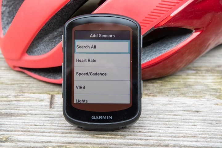
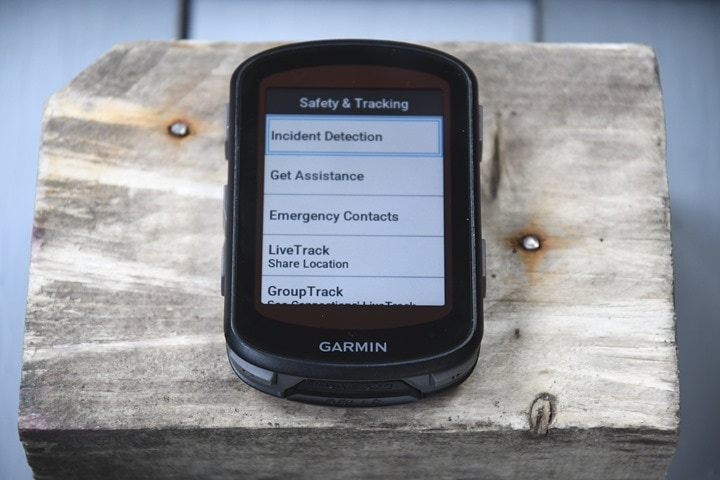
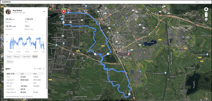
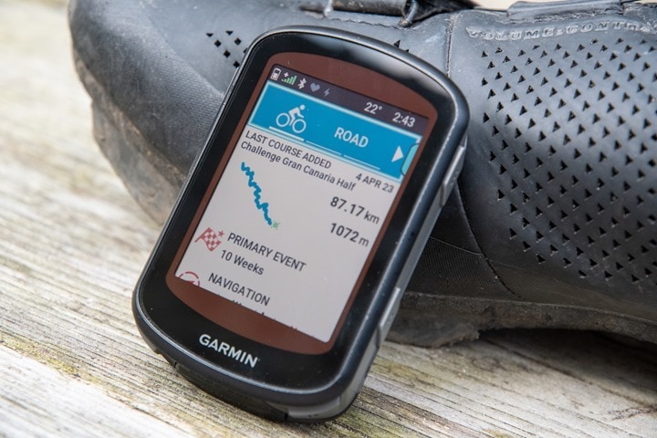
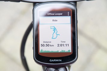
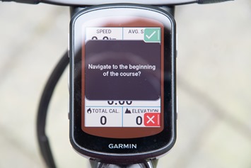
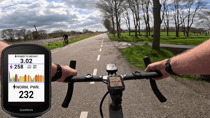
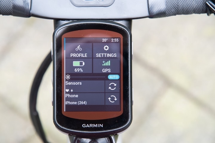
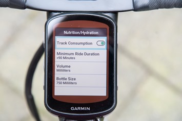
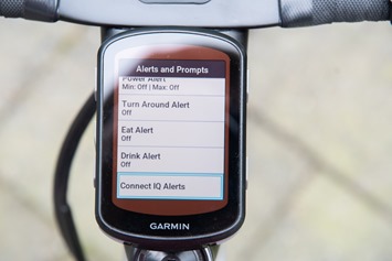
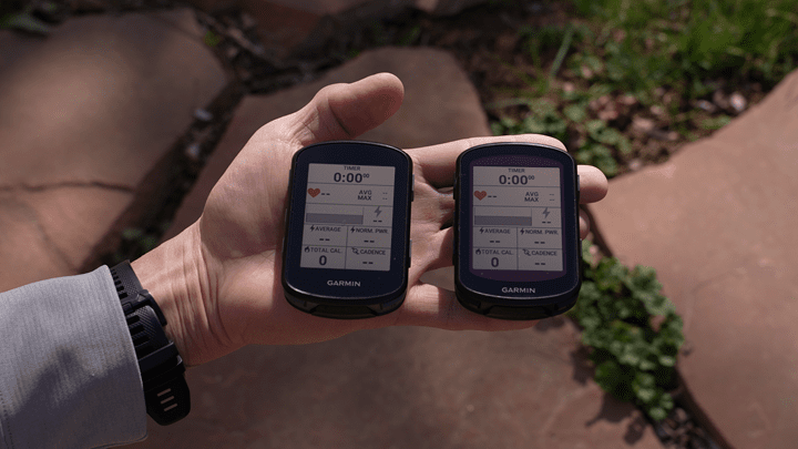
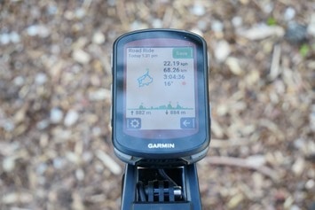
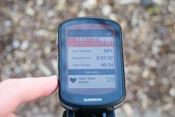
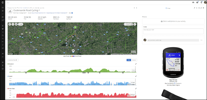
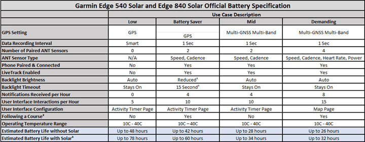
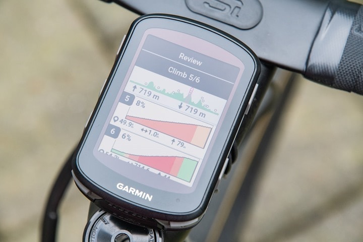
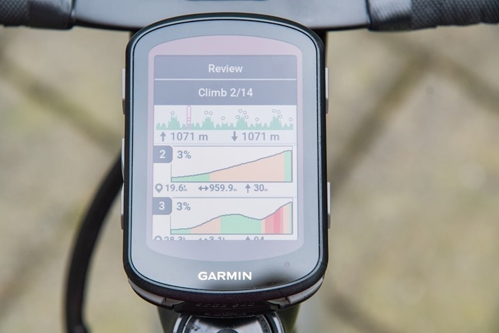
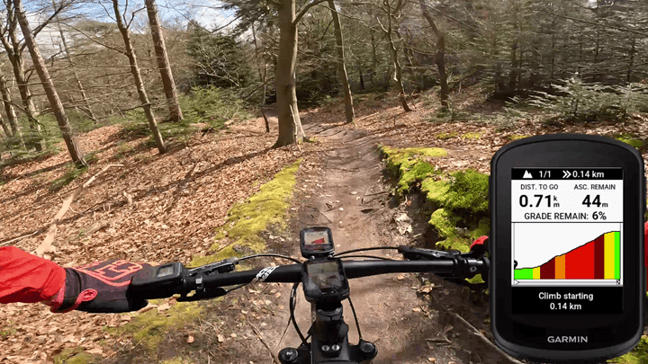
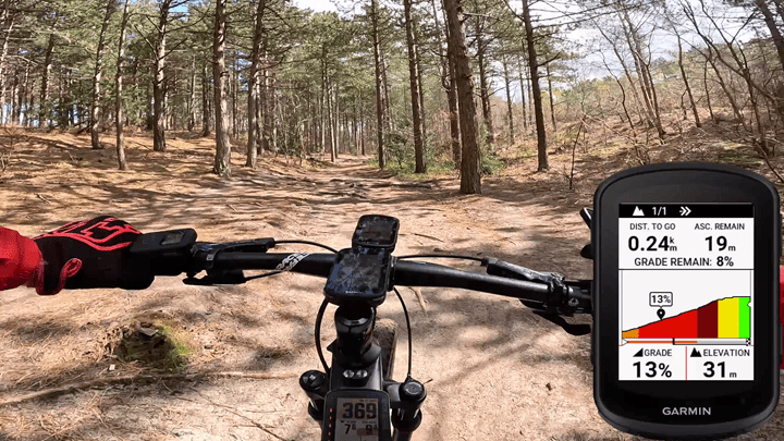
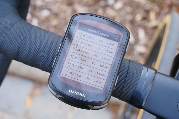
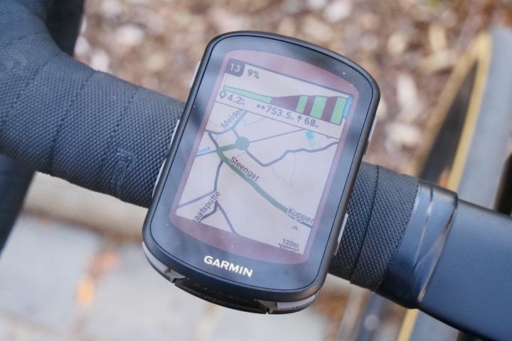
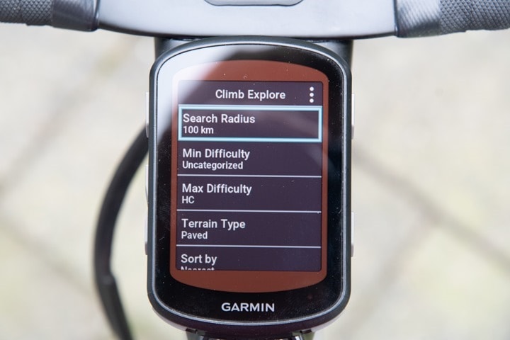
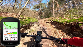
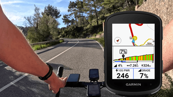
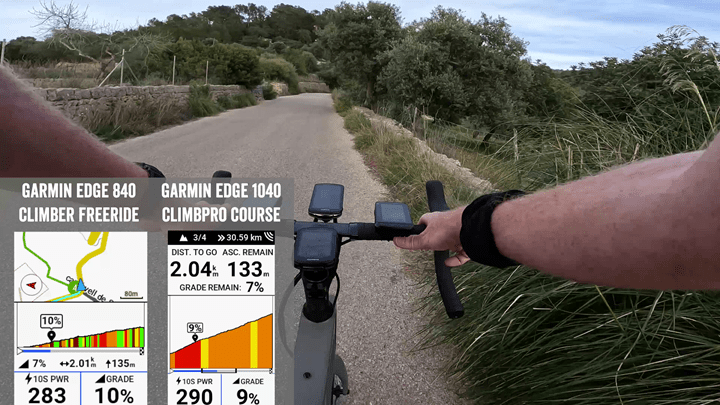
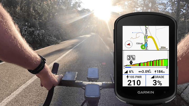
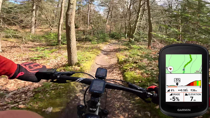
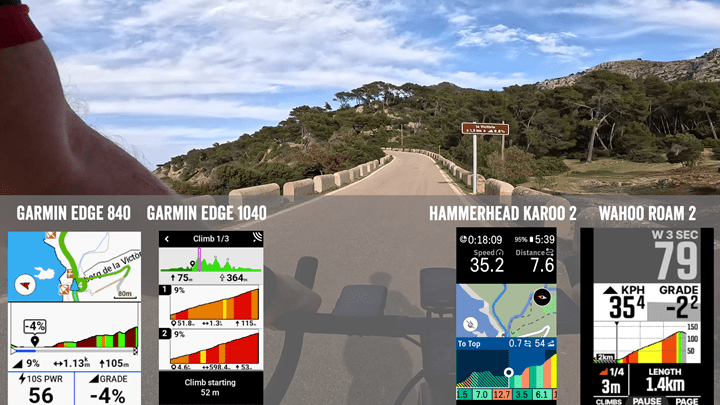
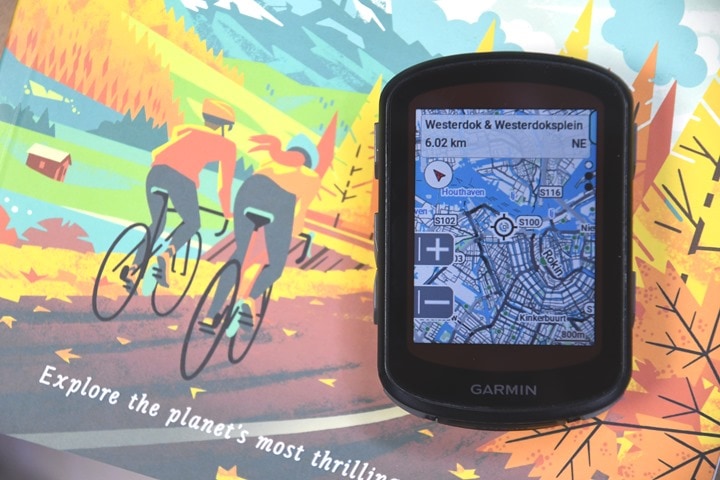
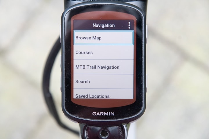
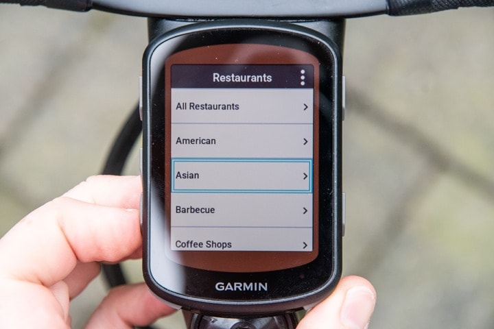
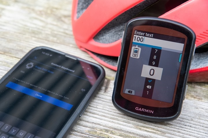
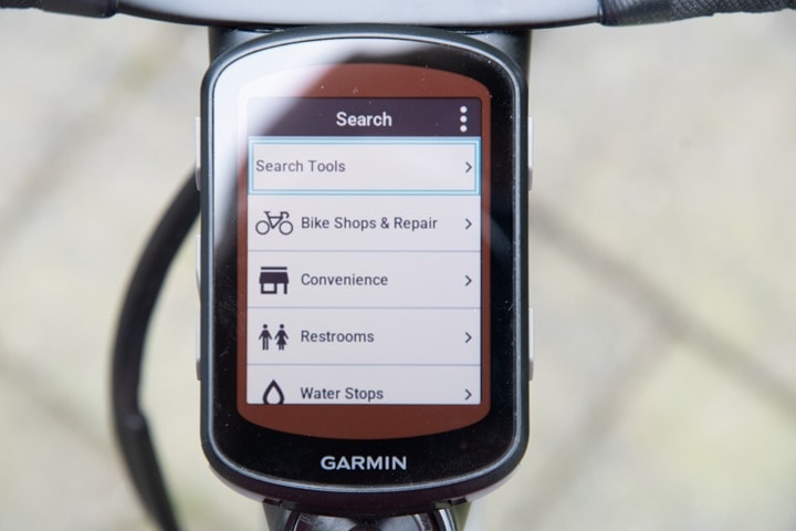
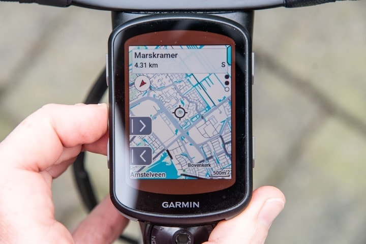
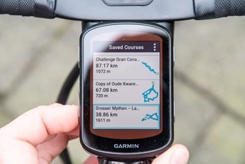
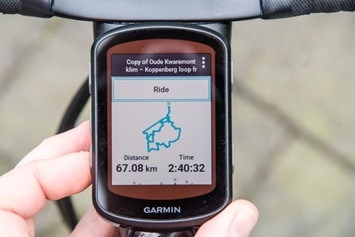
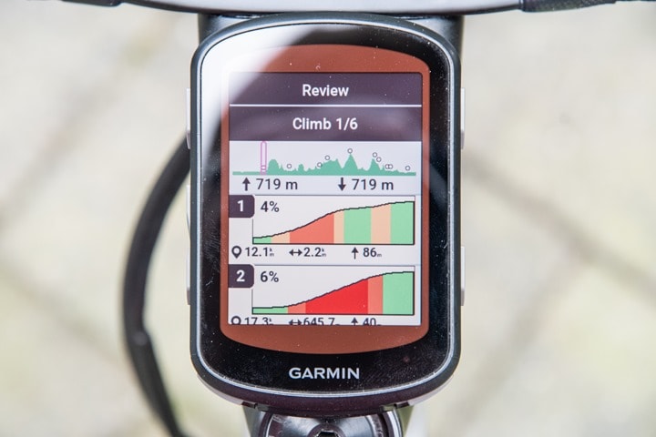
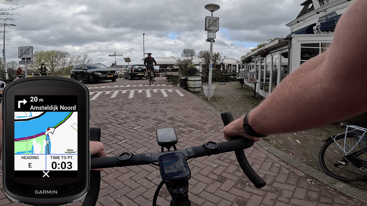
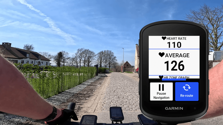
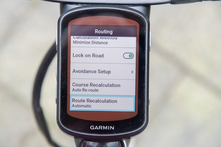
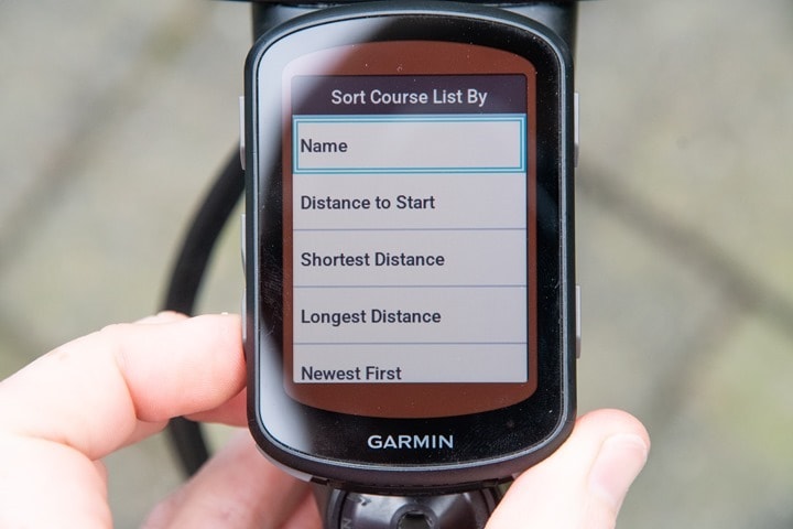
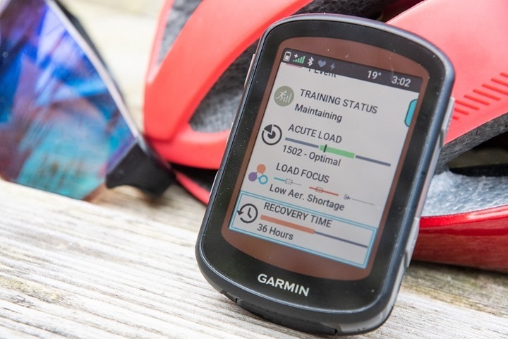
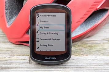
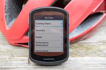
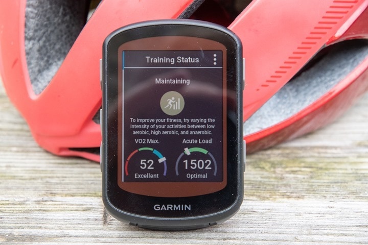
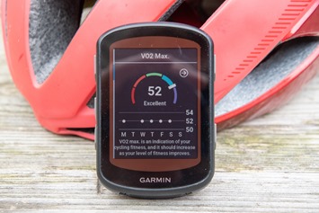
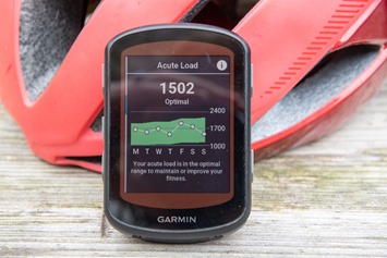
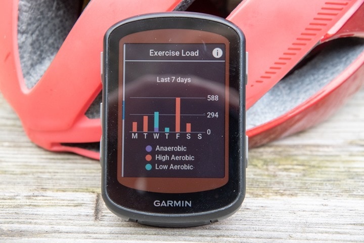
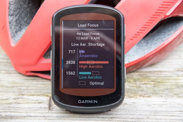
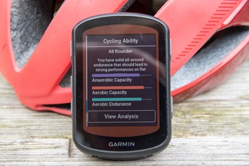
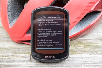
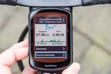
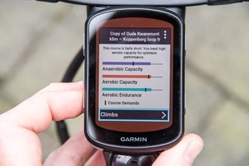
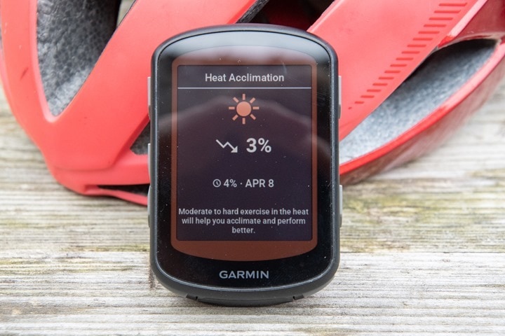
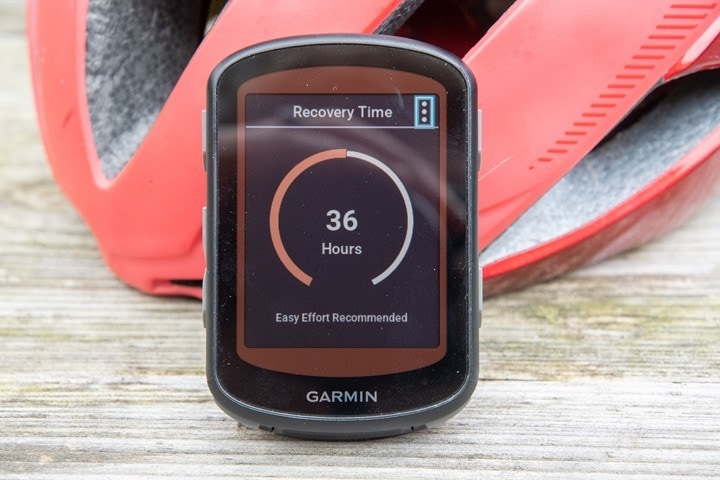
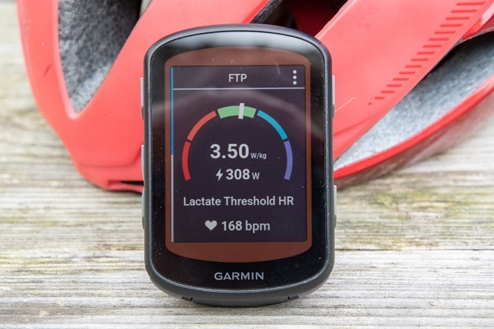
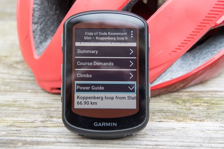
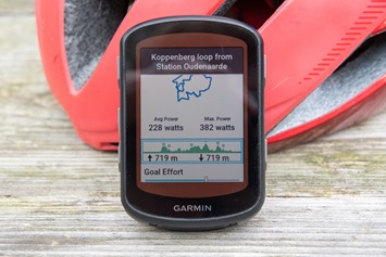
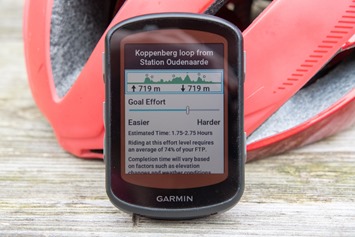
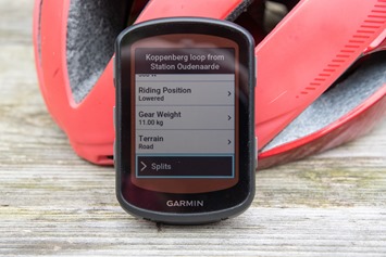
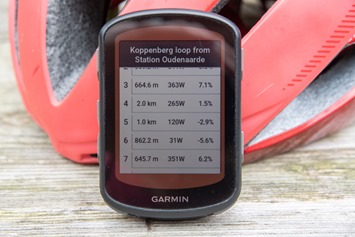
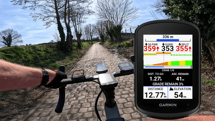
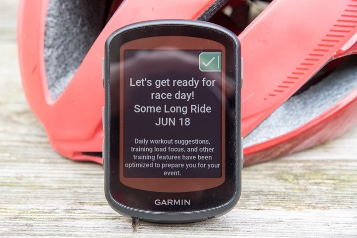
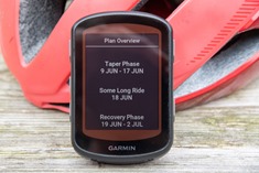
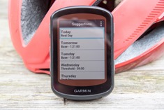
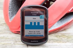
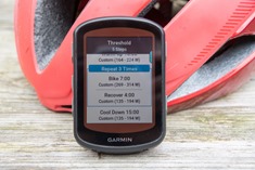
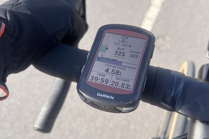
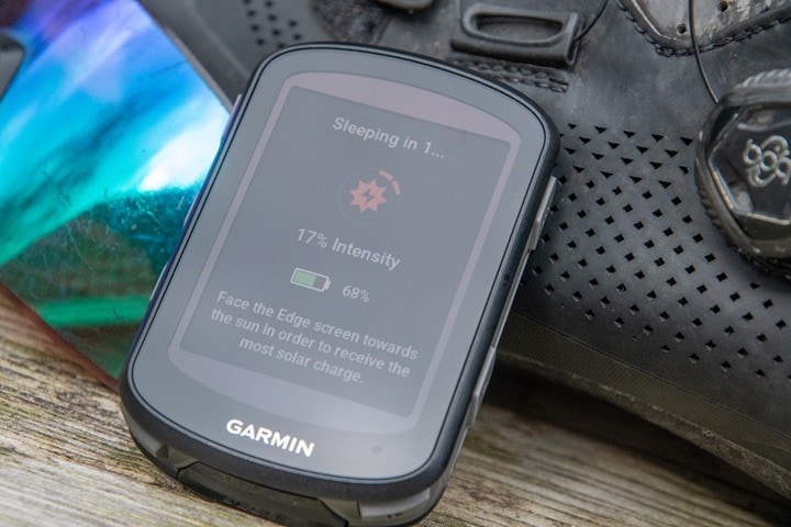
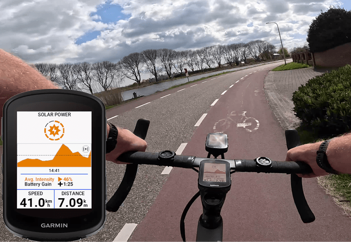
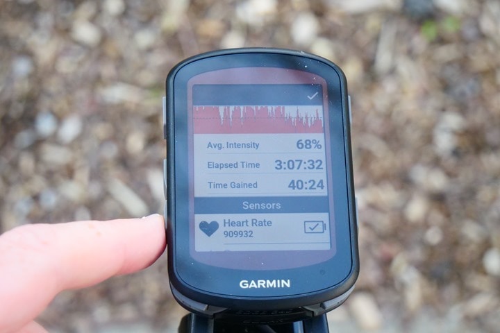
![clip_image001[10] clip_image001[10]](https://media.dcrainmaker.com/images/2023/04/clip_image00110_thumb.jpg)
![clip_image001[12] clip_image001[12]](https://media.dcrainmaker.com/images/2023/04/clip_image00112_thumb.jpg)
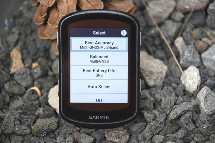
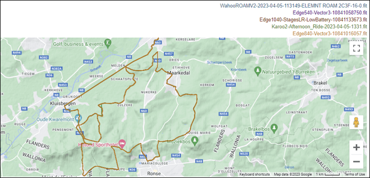
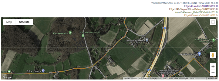
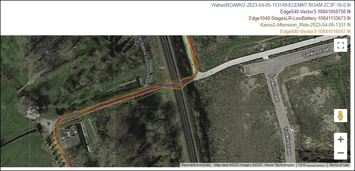
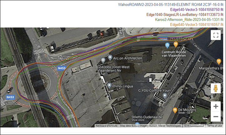

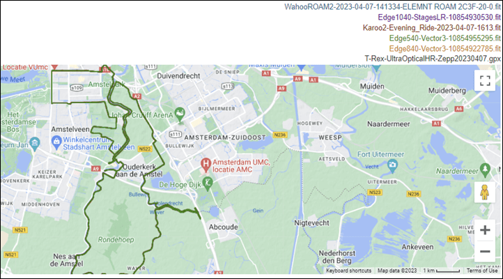
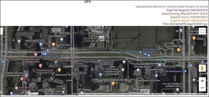
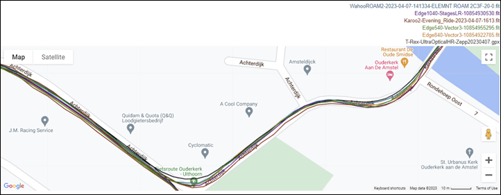
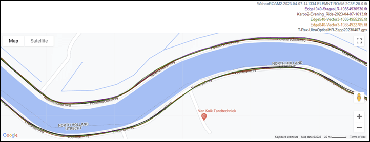
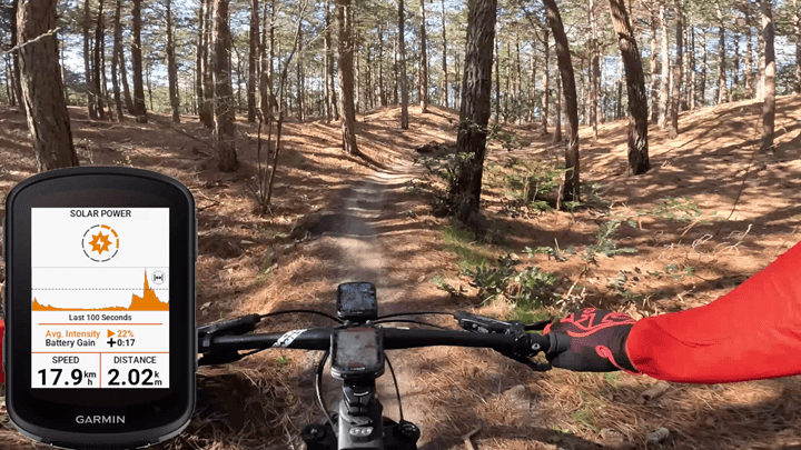
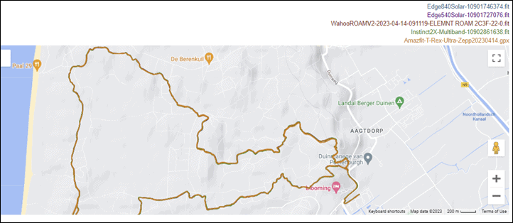
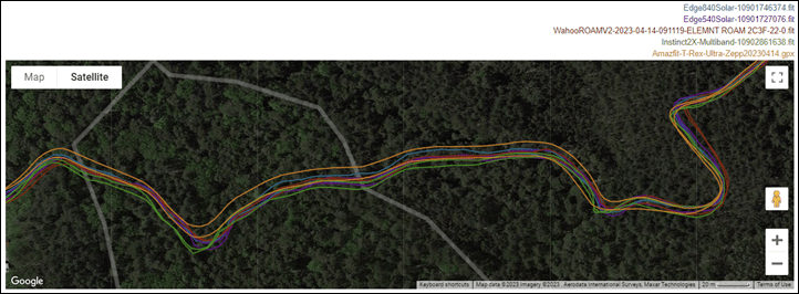
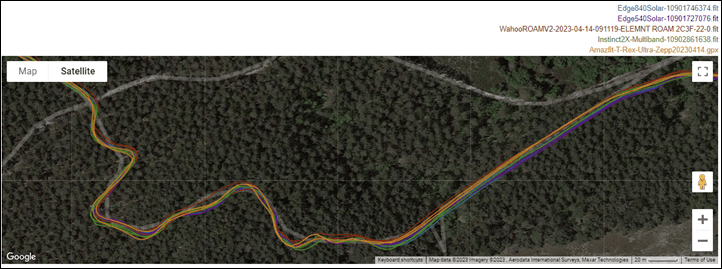
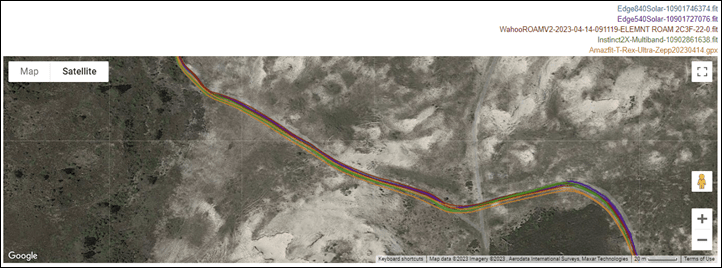
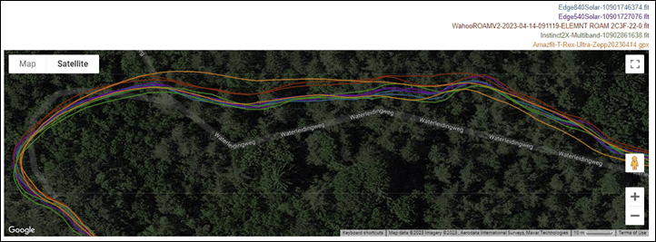

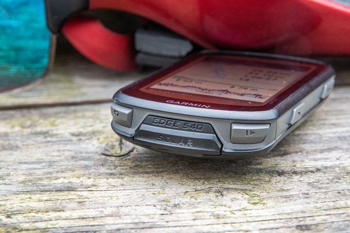
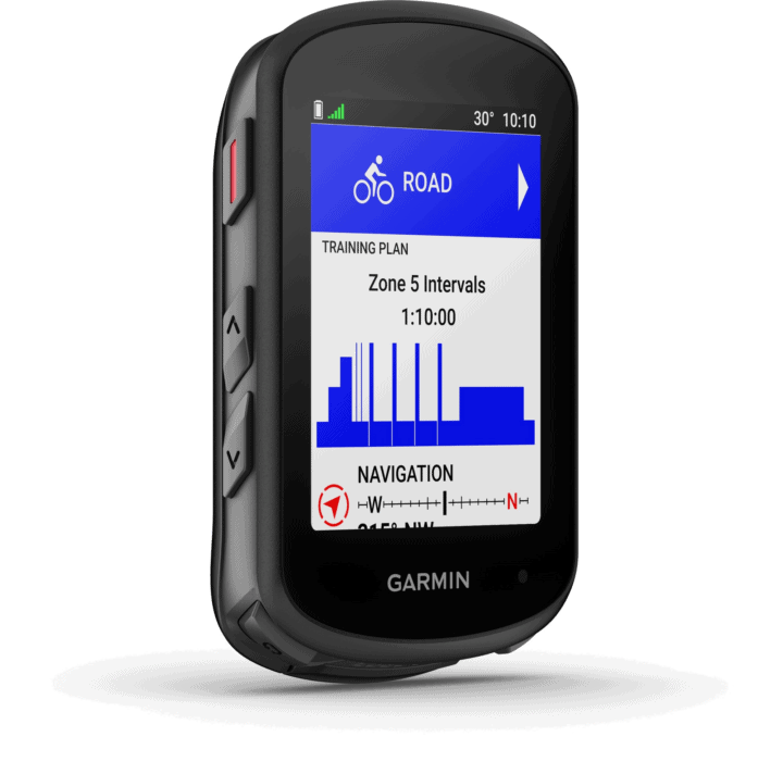
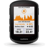
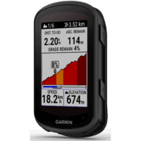
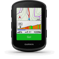


I think the most striking difference when I bought the 1040 for road vs my 530 for xc, is the screen brightness/readability/contrast.
how is this one?
Garmin says the clarity is sharper/better/etc on the Edge 840, partially with new UI design and partially with some changes to a display filter.
That said, I don’t really see it – in fact, a tiny bit the opposite if I compare the Edge 540 Solar to the Edge 530 (non-solar, case solar didn’t exist then). Sure, the phones and such are easier to read on the Edge 540, but the Edge 530 is clearly brighter – even on the highest backlight settings on both units.
Edge 530 at left, Edge 540 Solar at right, same data page, both full brightness level (override).
530 has better nad larger fonts
Does 540’s being less brighter not come from the solar panel?
As you wrote: “ This is due to the solar panel being laid atop the screen (which is over the entire screen at a 15% photovoltaic level). You can’t see the solar screen over the display portion, but you notice that it’s a slight bit darker. “
yeah I think it was the same with the 1040, the solar version was dimmer. I bought the normal one and its superb. I was hoping to replace my 530 but I’ll wait for further feedback.
Sounds like the multiple 530’s I went through when initially released. Just had so many issues.
How loud are audible alerts on the 540 and 840? I often don’t hear alerts on my 530 if there is wind/traffic noise. I have a riding buddy who uses a Karoo 2 and his alerts are loud enough that I hear them. Thanks.
Definitely louder. A comment my wife made a few weeks ago when she was riding with her Edge 830, and then another reader noticed it last week too with their new 540 or 840.
Either way, very short video/recording of it here for ya: link to youtube.com
This is exactly why I wish Garmin would extend the remote display functionality to include notifications from the 530 to a Garmin watch. I live in Texas, there’s a ton of wind and I ride near a lake where there’s more wind. I would love to have my Varia audibly alert on my 530 and vibrate my Fenix when someone is coming.
Great review as ever, shame given that we’re basically at the start of the season, it’s not a clear buy.
“but frankly it’s gonna be touch to charge purely via solar..” -> “…tough…”
Thanks!
“However, each unit has a different amount of storage:
– Edge 540: 16GB
– Edge 840: 32GB
– Edge 1040: 64GB”
Only the Edge 1040 Solar has 64gb, the 1040 (non solar) has “only” 32 gb, correct?
Good catch – forgot that they were two storage sizes on the 1040, just added that in.
Thanks for another fantastic review – super useful! With regards to following routes/re-routing, this is something that has been problematic for me on the 530. I typically downloads rides from “ridewithgps”.
On several occasions, the course has lost the gps signal and no matter which direction I try to go, the 530 is unable to locate the course and does not even provide the option to return to the start (this was a disaster in Girona where I ended up with a dog bite and finally riding along the hiway at dusk). Wondering if this is improved with gpss on the X40 series? As an alternative in these situations, would it work to find a POI that it known to be on the course and redirect to this and then restart the course from there?
Also, is it possible to re-route within the current course or does one need to stop the current course and then start a new course to go to the POI?
Thanks again.
How are the notifications on the 540 with an iPhone? On my 520 it only notifies for incoming phone calls and text messages, but there are no app notifications at all (whatsapp, teams, slack, …). Does this work on the 540? I’d love not to have to look at my watch when a notification comes in.
The 530 already shows the notifications from apps like Signal or Matrix, these notifications belong to the category “Other Notifications”. Depending on your smartphone operating-system you can control which notifications are passed through with iOS (Settings -> Notifications) or Garmin Connect itself (Android). On my wishlist is already inclusion of GNU Freefont or Noto Emoji Monochrom for rendering of emojis.
Why?
When people react on Signal with an emoji (e.g. thumbs up) the device shows only a symbol for “missing character”. With an available emoji font you can see the actual symbol. If that isn’t possible I woulde appreciate the behavior of Linux, it falls back gracefully to render the actual numeric codepoint i.e. “U+1F44D”. Which enough “thumbsup” received you will memorise that this is “thumbsup” :)
Monochrome Emoji example:
link to blog.jolla.com
Linux is doing this as fallback, after the fifth time “U+1F44D” you learn the maybe that it is “thumbsup”.
Thanks, Ray!
I’m trying to decide between the 540 vs 840 and one of the considerations is memory: for those of us in North America, can the 540 store all of NA + Trailforks?
Also, does ClimbPro work on mountain bike rides?
Apologies, now seeing MTB ClimbPro pictured above (assumed that section in your review would be the same as 840, which didn’t show MTB).
Any updates to battery life estimates for the recently-added SatIQ mode?
Wondering how much of this could trickle down to a hypothetical 140? Maybe they won’t even bother with one since solar wouldn’t work for that form factor.
With the Karoo 2 sitting at $399 the 840 at $449 and the Edge 1040 at $600, has Garmin shot themselves in the foot with the 540? Maybe they meant to? I can see the appeal of the 840 for a smaller unit and buttons but it’s kinda like Garmin killed their best selling line. Ray, a writeup of the difference between the Karoo 2 and 840 would be great. It would be interesting to see how these two now compare.
Excellent review like always. Do you know how the accuracy compared to a wearable like the Epix 2?
Hi Ray,thanks for your review, as always.
Just a questione about interaction between edge and forerunner (955 in my case). Activity load, FTP, training status, training readiness…I run and swim with fr, and ride only with edge: my watts and my hr will arrive to my forerunner?
thx!
Is there a way to get the ClimbPro freeride screen (i.e. the one with both map + elevation) when following a course?
I’ve also tried enabling the elevation profile on the map screen but that doesn’t seem to work as I’d expect, the line is flat and doesn’t show the actual elevation profile (though it does have colors indicating gradient). Maybe that’s a bug.
Not yet. It’s something Garmin is looking at though (making that available all the time).
In the list of ANT+ sensors you list the Tempe and then say that the list hasn’t changed. Tempe support was added to the 1040 device and now the 540 but it wasn’t supported on the previous generations.
This is one reason I upgraded my 530 to 540 (and 1030 to 1040).
Another nice addition is that the 1040/540 (presumably 840) now count intensity minutes without needing the HRM-Pro as you can use other heart rate monitors.
And a final small change I like is that you can now on the 540 add the Load data field to track load as you are working out.
Small changes but things I like.
“ This is one reason I upgraded my 530 to 540 (and 1030 to 1040).”
This reason could have been annulled by ciq datafields. I use this one link to apps.garmin.com with my 530, and it is better than the “native Temperature” solution of Garmin (on Fenixes eg.), because you can use an offset with CIQ Tempe field.
Nice catch!
Maybe I am wrong, because I just compared the manuals of 540 and 530, but it seems that although you still cannot navigate to adresses, but apart from the “only saved locations” navigation of 530, with 540 you can search for cities at least. So I guess you can navigate to cities, even if you cannot specify any addresses or intersections.
Is my understanding correct?
Correct, you can. I actually show this a bit in the video about 2/3rds the way through.
Looks like the 840 Non Solar is the way to go this round.
(Maybe even the 1040)
@ray Buttons and Price aside what would your preference be between the 840 and 1040?
If you do road 1040 for sure. For XC/Gravel 1040 is too big. I kept the 530 for offroading but for road the 1040 is really nice.
> The *curser* just skips over it. Likewise, the buttons don’t save any changes to certain data pages (like ClimbPro & Power Guide pages). And then there’s countless times I literally can’t get back to the ride itself from the menus/controls pages. The selection *curser* […]
I think you mean “cursor”, unless you are actually referring to someone who is cursing (possibly yourself, given the frustrations with the absence of touchscreen).
Switched to bolt some 6-7 years ago i think – haven’t desired a new unit nor thought I’d go back to garmin. Now that they finally added app set up and the training feature to suggest workouts – I’m certainly intrigued. Have you heard any rumblings of a new offer from wahoo with similar features to the training suggestions?
Im in a similar place. I would bet if they do it will require a Systm subscription to work.
Hi Ray, I’m looking to upgrade from an Edge 520. Currently got the choice of a 530 at around £200, or 540 at £350. Any thoughts on whether getting the latest model is worth the extra cost?
Curious – for those with the 530 is it worth the upgrade? (assuming they work out the bugs and other kinks)
Yes, what to buy? The 530 is 210EUR; the 540 is 400EUR. That’s a huge difference. My 530 works fine and not sure what to get my partner. The only feature I wish for on the 530 is the always-on climbpro … meaning the profile for the road ahead can be always on (not triggered by climbs and also shows descents, etc and is zoomable and indicates the distance in view). I have a fear that if/when they implement climbpro ‘always on’ option, it would only be for the 540 and above.
Always on ClimbPro does not mean that the unit is suddenly telepathic and can see which way you intend to go. The only way to get what you want (seeing profile ahead) is to navigate a course, and the 530 can already do that. Always on ClimbPro is a little weird (I have a 1040), but it definitely can’t show you a profile ahead unless you’re already on a climb, and it may be the wrong profile. If you intend to turn off a climb to continue up a different one, it can’t know that in advance. There are also errors in the database. A climb I routinely do (and never finish the way it wants me to; I always turn off just before the top) shows the wrong profile all of the time.
Ray, will you be adding the 540, 840, 1040 to the product comparison database?
I know it’s not something your link has any control over, but for some reason it’s not actually available on Amazon. There was some sketchy bundle, but that seems to have disappeared too.
Good catch, looks like the initial link died. That said, I see them here direct from Amazon:
Edge 540: link to amzn.to
Edge 540 Solar: link to amzn.to
Solar is in-stock for immediate shipment, base unit ships on Thursday.
What happened to ‘Always Display’ course colors? Colour options changed with 540 release, they are nearly invisible compared to 530 colours.
link to reddit.com
One thing that I noticed (and was annoying) on the 530 is that when you are riding, and change plans, you cannot sync a new route/course from your phone (using Garmin Connect) on the GPS unless you stop. there is a workaround to use a widget.
Do you know if that is the same with the 540/840, or have they fixed it where you can load a road from Connect while riding?
All x40 units now support mid-ride sync of new routes. Cheers!
Routes and workouts !
Sad that Garmin decided that for midride sync you have to buy x40 unit. In that case why not buy Karoo, or Wahoo. Not ready to pay 200€ (sell my 830 and buy 840) just for midride sync
It’s likely because the x40 has an entirely different codebase with it. Notably, the old Garmin units (every other one till now) had dual Bluetooth connections (concurrently). One legacy Bluetooth, and one Bluetooth Smart one. It as mostly a mess, but a legacy mess from the very beginning days of Bluetooth.
I suspect there’s a significant re-architecting that would have been required to add this feature in for the x30 units. In the same way Hammerhead drew the line on certain features going forward from V1 to V2, and Wahoo also did for free-ride from V1 to V2 – Garmin chose the line here.
Probably a personal preference but do you think a silicon cover or screen protector is needed for the edge devices?
Hi Ray!
Been a long term reader and watcher. I have a Fenix 7 and a garmin edge. (1040 soon to be possibly 840). but one thing that has really been challenging is the multiple device syncing. For example, I did an outdoor ride with my 1040 and had 615 ACTIVE calories burned, (not total calories which was more) and then when I sycned it with my garmin connect app, my fenix 7 still says only 456 active calories burned for the day on my Fenix 7. I spent 30 mins on the phone with Garmin, and upload all the files, images etc.
I really hope they get to it as a bug fix, but in the meantime is this what you see? I really want the active calories to be right on my Fenix as I eat and do activity based of it.
Have you seen this before? or have experienced it? I have the Fenix 7 as my primary device, but the Edge as my primary training device. Anything I am doing wrong?
Hi Eric! For your Edge 1040 – are either or both paired to a power meter?
Hi Dc,
It’s actually a pretty big bug! garmin has been admitted to it. Here is link i found on their forums
link to forums.garmin.com
On my last trips in other towns I used Osmand to create GPX files based on its routing, that I shared with the Garmin Explore app to get the route synced with my watch and head unit. This was the only way to get routing to work for me, because I didn’t had any internet, and both units (Instinct 2 / Edge 530) don’t allow for routing calculation on the device itself. Also finally USB-C! Both features make me currently think I should sell of my 530 and get a 840 instead.
About the solar: For travel I see it as more as a nice safety, that it can charge itself from zero, if I don’t get anything else to charge it with.
Would be interesting to know if any of the features will – over time – be implemented on the x30 series. As Ray mentioned, over time some functions were added since the launch. I guess however that the really interesting features (power guide, during activity sync, proposed training, etc) will not be implemented on the older units.
I wouldn’t expect any x30 units to get any of the new features. With the UI being a totally new revamp, Garmin has kinda drawn the line there.
Page with Edge 840 review dosn’t work now
link to dcrainmaker.com
Hmm, that seems to enumerate for me. Is it still broken for you?
everything is fine now.
Would be nice if these bike computers could store music and garmin pay like the watches do…..
I know right, this would be ideal!
Hi,
Are the new units more stable?
I got plenty problems with my 530 like the altimeter acting up or breaking completely (mainly when exposed to moisture). I don’t want to send in my head unit every time i gets wet just to get a new one that works… until i gets wet. Then it tends to crash constantly (mainly after going to sleep mode) and with that it looses all the activity data, again with no fix in sight. Its weirdly often losing satellites when around other devices.
The syncing to my phone is always a struggle. Sometimes it just syncs but often it takes 15-20 minutes and app/device restarts.
The computer is ok for recording activities, but most “features” never really worked or are just straight up sh..t like the navigation, so after trying them out a couple times i didn’t bothered using them again.
Sorry if it sounds a bit cynical, but using it every day those bugs get really annoying. For some bugs i found a way around, but those are no fixes. Some little ones i didn’t list here.
I was waiting for a new line to come along. Im hoping they are a bit more refined and do what they are supposed to do reliably since i have a Garmin watch that i really like and therefore switching to wahoo is not really an option.
From a phone syncing stability standpoint, that’s unquestionability one of the biggest under-the-hood pluses of the x40 series. All previous Garmin Edge devices used a dual-pronged Bluetooth arrangement (one Bluetooth legacy connection concurrently with one Bluetooth Smart connection), which had long been a dumpster fire of stability issues.
However, the new x40 series adopts the same as the watches, which just uses a singe Bluetooth Smart connection. I haven’t had any issues there at all.
As for stability/crashing, I haven’t had any issues there. Virtually all of my Edge 540 issues were more around features not designed for button-only. Everything else was fine.
Since i broke my 530 on a Swiss Cobblestone Decend i bougt a 540. The main Features are a lot better and so far everything works. On one very wet and Muddy MTB ride i seemed like the Altimeter was acting up a bit, but im not sure since the Elevation profile looks right.
The Button Usability is pretty much like the old one. To be honest, mostly its set it and forget it. And since you can dial the settings via your phone its no problem whatsoever.
The fancy addition of the new Climb Pro i was looking ahead to is more annoying after a while, since it counts every little hill as a new climb and you have the constant beeping on rolling hills or when changing direction on a climb.
One weird thing The training load and training Status are completely different to my FR745 so my Connect data is completely messed up now.
But all in all very happy with it so far. And love the replaceable connector plate on the back. Just wish they would sell them without contacting Support.
Hey Tom.
did you find a solution for the sync issue by chance?
I am in the same situation as you and this drives me nuts. Already resetted all my devices but to no avail.
Any info on why it’s not yet available on European Amazon? And when can we expect that?
Not sure there. Garmin has been doing some odd stuff lately with respect to listings on Amazon. Some products have it instantly at the announcement, and some are skipping it for months.
My assumption is they are trying to appease local retailers. It is available on Wiggle though (link above), which does help support the site.
As for this new POI db – there is a subcategory for airports, but not for railway stations… How is this bike specific? I have no idea. It’s not really fiendly for commuters or bikepackers IMO.
One can always find stations in the main category, right? Maybe I wasn’t lucky, because the list showed me so many parking spots within 1km radius, that the train station didn’t make to the list.
Hey Ray,
Long time reader. I even based on your recommendations went from Fenix to a Wahoo Elemnt Bolt v1. Unfortunately the later decided to die with the latest software update (sadly interesting). So here I am trying to figure out if going back to Garmin with the 540 and paying almost $100 more than staying with Wahoo and acquiring the new Bolt V2.
Could you give your recommendation?. The buyer guide is not updated if not I will probably not be asking. Hope you can chime and help.
I have exactly the same doubt and considering to jump from Wahoo to Garmin.
Thanks for the review.
Great review. Thanks for putting it together!
Have firmware updates improved the usability at all? I’ve always been a 5×0 series guy and would just as soon save a few bucks over the 840 all other things being equal.
Would be great to know if the button only navigation has been fixed by now.
Do you know if the 40 series has improved water resistance of the altimeter?
Hi Ray,
Is the free mode ClimbPro expected to migrate to the latest watches such as Fenix 7 Pro or Forerunner 965 at future updates? Or would that be a feature available only on the Edges?
Thanks!
Hoping to get my partner a dedicated bike computer since her Fitbit is hasn’t been great & is gonna go out of support eoy. Any chance 5 months on there’s an update on how the 540’s software has(n’t) been addressed? My plan is to get them one, then when proven solid get the same for myself to have a bigger screen over my FR935 & be ready for whenever the watch kicks the bucket. If the 530 is still more solid, would get that instead & save the ~$50 for ease of use.
Hey-yo, can you plz add the new(-ish) Edge 540 to the product comparison tool? Also the new Forerunner 965…
Thanks!
-tim
I noticed that 540 has not 1 second recording as 530 so it’s is less accurate??
If I remember right it always records at 1s. So there’s no need for a selection for it.
Hi Ray
Do you have any update on whether/how satifactorily garmin have addressed the issues with the 540? is the 840 still the way to go is or the 540 now a valid way of getting all the same functionality but saving money by losing the touchscreen.
Seems like my 520+ battery died so I care here to ask the same question…
Is there any feature you want from the 540? If you contact Garmin they’ll offer you to refurb the battery for like a hundred bucks, or find a used Garmin, you’ll save a lot of cash if none of the features of the 540 would be useful for you.
Any chance you are doing a Sigma Rox 12.1 Evo review? Or at least a quick hands on?
I am currently not in the market for a new head unit, but wondering whether they can really make something competitive…
On the climbpro page, what is the horizontal bar (and the hash mark on it) below the profile (4th pic in the climbpro section)? It doesnt seem to corelate to the location dot on the profile. I think theres one on course nav page too but Im at work and dont have my Garmin at the moment.
I think there’s a second hash mark at the right end of the horizontal line. The hash marks show the section of the total climb for which elevation and grade info is shown above it. So in the photo, the graph shows only the last 55-60% of the climb. I hadn’t noticed it before, but part of the horizontal line is colored. I wonder if that’s the portion of the climb that’s been completed,
I agree. There’s an example a little further down of a longer climb. Matches what you said
When navigating a course, if I go off course I get the option to ‘pause navigation’ or ‘reroute’ If I select pause navigation and then press enter (top right button) the ride is stopped and the ride saved. What am I doing wrong or is my unit faulty?
Look forward to your comments
Gostaria de saber sobre a stamina. Tem que ter somente sensor de frequencia cardiaca ou precisa tambem do sensor de potencia?
As we are almost a year later, how is the usability of the unit without the touchscreen? Is it still problematic as mentioned in the review, of had this been fixed completely?
Wondering about this as well. The 130 Plus is too small for me.
Hi Ray,
When the the 540 came out you mentioned that the software and lack of touchscreen capabilities pushed you away from recommending the 5xx over the 8xx models.
I was wondering if over the last year there have been updates to the software that have pushed you back to recommending the 5xx over the 8xx? Additionally I was curious if you recommend a 530 over 840? (Can you use a 530 on the older operating model or do they push you up to the latest system?)
Trying to decide which model to upgrade from my current 520 with a depleted battery.
Thanks! Big fan.
Just upgraded from a 520 to the 540 but not liking it so far.
My biggest pain point (besides the hard to press buttons and non-intuitive interface) is that the 540 does not automatically power down after disconnecting from the charging cable.
With my 520, once I removed it from charging it gave me a 15-second auto power off countdown and then turned itself off.
With the 540 lacking this Auto Power Down feature requires me to perform an additional 3-clicks of hard to press buttons to power it down. WHY?
This is so annoying. From what I’ve discovered online, this feature was removed starting with the 530 and users were pissed off then. Now it’s carried forward to the 540.
Why would Garmin not include an auto power down feature after charging? If I take a turned OFF device and plug it to charge (which it then turns on) and then its completely charged and removed from the charger, it should return to its OFF state. That is only LOGICAL.
I can see how lacking this feature its possible to forget to power it down manually and then wake up the next day with a dead device that remained on all night.
My 530 does power down itself when fully charged. I normally do not take it off the charging cable before it is fully charged though, no idea whether it will power down then.
> And I’m sure in a few weeks/months it’ll largely be fine button-bug-wise, but how long it’ll take to turn the ship to make this Edge 840/1040 touch-driven interface really sing in a button-only Edge 540 configuration, is another question.
Hi Ray,
Could you give an update on the 840 in button-only mode now? After a year has it started singing well or could it still do with some work?
Cheers
Obviously I meant 540 here…
Hi Ray
Now more than a year down the road. How has it been update wise with the button usability? Still not so much or is it already a serious alternative for the 840?
Hi DC, I am having issues installing EU Maps on my 540 (from Austrialian / Asia Maps). I have removed all other region Maps from the 540 and still do not have space for the EU Maps. Would you have any other advice on how to make more storage? Or any articles which goes through these steps?
did you get any reports about failing barometric sensors in Edge 530/540? I had 3 530s where the sensors died or went crazy – Garmin replaced them eventually switching it to a 540 – but just had 540 start showing erratic profiles (and it’s not a calibration issue when it essentially shows you’re cycling up while descending)
Is there any hack for that, or is it just acknowledged issue? Had a 520 for 4 years and never saw problems with that one
Do not buy an Edge 540, if you are planning a trip that crosses from western Europe to central Europe, as the device does not have the memory capacity to accommodate both regions.
After communication with Garmin, informing them of my and others frustration at this issue, Garmin informed me, three months later, that this problem has been resolved and updating my Express and re-installing both regions will solve this issue – well, it hasn’t.
I am now in the situation that having spent a lot of money in the hope of an better bike packing experience, travelling from the UK to Czechia, my Egde 540 still will not allow me to upload both areas, so it seems I and others, have wasted our money, on a product not fit for purpose.
So far, Garmin’s customer service has been abysmal and unless something changes very quickly, this will be the last Garmin product I ever purchase.
I would welcome any input from other purchasers, regarding this problem and if they’ve had better luck than me.
I have the same issue. I purchased the device in Australia and am now cycling in Europe and the device doesn’t have capacity for Europe maps when all other regions are deleted. Does anyone know of other device software which could be deleted to make space for the Europe Map?
When will Garmin finally bring out a small/light dual frequency/multi-band GPS, for example in an Edge 140? Preferably without solar and navigation gimmicks
Hello Ray,
I’m looking for my old Edge 520. Do you think buy the Edge 540 it’s good idea or we can wait for a new 550, more user-friendy to use, next April 2025 ? (Idea of the price of 550/850 ?)
Thanks, Adrien