
Starting today, users in certain countries will be able to use their iPhone 14 units to trigger an emergency SOS, even in areas without cellular coverage. It does this using a network of 24 low-earth orbit satellites that the iPhone can connect to. This allows you to send very short low-bandwidth emergency text messages to earth-based ground stations, which in turn get routed directly to either emergency responders or to Apple relay centers, which coordinate with emergency responders. While today’s launch is limited to the US & Canada, starting next month it’ll open up to certain countries in Europe (Update: March 2023, this has now rolled out to a number of European countries, see below, and as of May 2023 – also in Australia & New Zealand).
At present, this feature is all about emergencies – and sending a selfie text message, or even a short ‘goodnight’ message doesn’t qualify. Instead, this is focused on routing you directly to first responders that can get you out of whatever pickle you’ve gotten yourself into. It’s roughly akin to other platforms that already exist today, such as Garmin’s inReach devices, or SPOT’s devices – both of which use satellites.
However, unlike those devices, this isn’t an extra thing you have to carry. Instead, it’s built into your phone. But, as you’ll see, that has both pros and cons. Even Apple themselves noted that if you’re planning on going deep off the grid in challenging terrain, this should be seen as one tool in your toolbox, but probably not the only satellite tool. Instead, the iPhone-based solution is mostly focused on casual out-of-coverage scenarios.
In my case, I was able to try the emergency platform for real, dialing 911 on a real phone to see how the system works – with real emergency responders replying, and real satellite systems sending the message.
(Note: While I use 911 as the example here, that’s simply because I was in the US at the time. Once it rolls out to other countries, then you’ll use the local equivalent in that country.)
Current Requirements:
There are two basic things you need for this system to work, the first is the phone, and the second is your location. Specifically, you need an iPhone 14 series device (any iPhone 14 variant). It does *NOT* need to be purchased in the US and Canada. The availability of the service is specifically tied to your current location, not where you bought your phone.
So if you buy an iPhone 14 in the Netherlands (where I live and buy my iPhones), and then travel to the US – your phone will work with this system upon landing in the US or Canada, today. The singular exception to this is iPhone 14 units purchased in China, Hong Kong, and Macau, which do not support the SOS system – because…China.
Next, there’s the coverage area. At launch, that initial coverage area was (however, see the updated country list just below the map):
– United States (inclusive of Hawaii, Puerto Rico, and the U.S. Virgin Islands – but not Guam or American Samoa)
– Canada
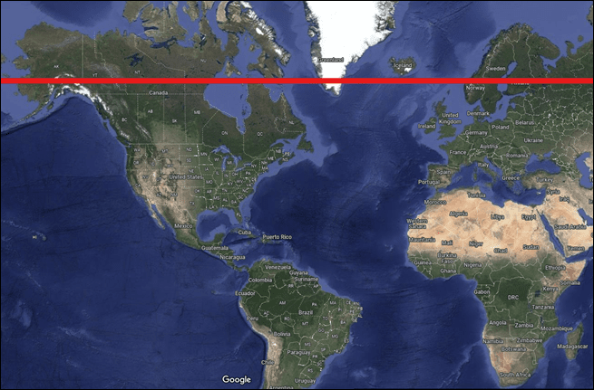
However, within that there’s also another restriction, which is that it doesn’t work well above 62° latitude. For reference, here’s that line:
Additionally, Apple says coverage on the water part is until it reaches international waters, then it’ll stop working. That part seems a bit perplexing to me since the coverage area doesn’t magically end there, but hey, them’s the rules. I suppose they’re trying to avoid an issue where they don’t have emergency response in place for the ‘right’ country.
Now, Apple says starting next month (December 2022), they’ll additionally roll it out to the following countries (Update: This was completed):
- France
- United Kingdom
- Ireland
- Germany
Update March 2023, they’ve additionally announced support for the following countries by the end of the month:
- Austria
- Belgium
- Italy
- Luxembourg
- The Netherlands
- Portugal
Update May 15th 20123, they’ve now added support for:
- Australia
- New Zealand
You may ask why not all countries in Europe? Well, merely having satellite coverage is only one part (these 24 satellites already cover much of the globe within the latitudes noted). But in addition to satellite coverage, they need to ensure the Apple relay centers that funnel the traffic to the local emergency responder system is set up as well. That includes everything from having people actually speak French, German, and any other language they’re supporting. And even the differences between Canadian French and France French (Canadian French is supported at launch for Canada, and then France French upon launch there).
In addition, that’s rolling out training for the thousands of PSAPs (Public Safety Answering Point) that receive emergency calls/texts in these countries. In the US/Canada alone there are 3,000 centers that handle emergency calls. Apple has already trained some 300 of those centers in the US/Canada with specialized training on how to handle routed text messages. While there are international standards in place for how this all works behind the scenes, Apple says they still want to have training be as widely available as possible to ensure smooth operation of everything. Of course, that’s basically going to happen via trial-by-fire starting today.
Triggering An Emergency:
First – note that this test was coordinated with Apple, specifically, they knew not to send rescuers to my location. But everything else is as-is, leveraging the real satellite systems for all communications, and I show where it works well, and where it struggles a bit. It goes without saying though that if you go through and dial/text 911 for realz, real people will show up to try and rescue you. So don’t do that unless it’s an actual emergency – instead, Apple specifically has a demo mode you can try that also uses the satellites for real, but doesn’t send the emergency responders, which I’ll also show later on in this post.
Got it? Good. Let’s cause some trouble.
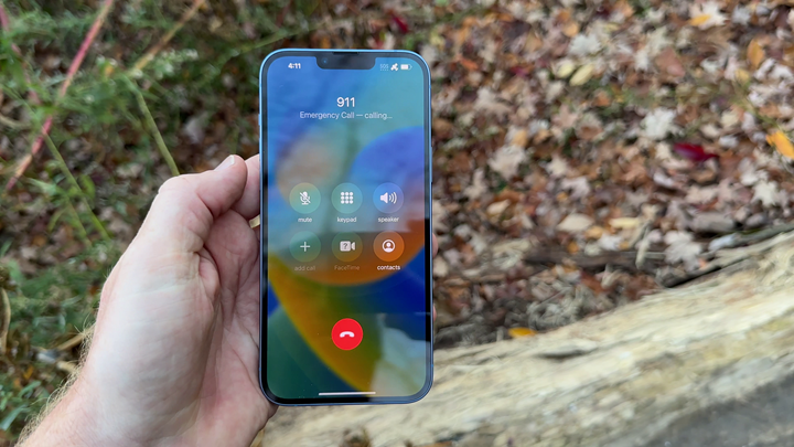
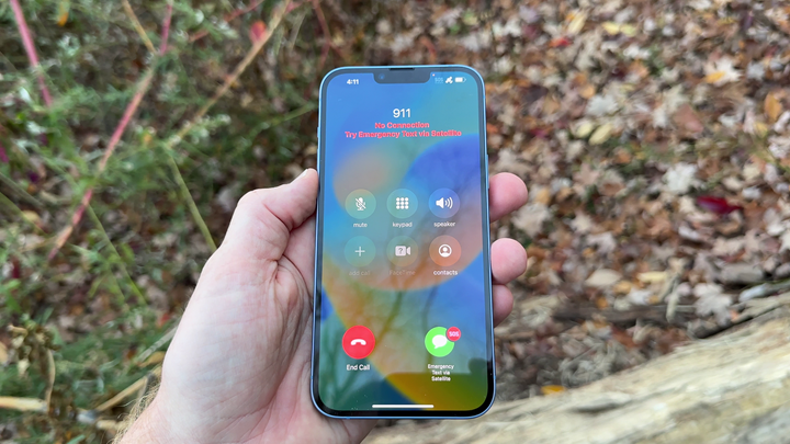
To begin, I dialed 911 (because I was in the US, if in a different supported country it’ll use your equivalent). That’s it though, dialing and texting 911 are the only entry-point into the Apple SOS system. The reason is because dialing/texting 911 on an iPhone actually does some interesting stuff in the background. Unlike a normal call to your friends, dialing/texting 911 elevates the iPhone to go beyond your carrier’s cell towers. So, even if your phone says it doesn’t have signal – that means it doesn’t have signal from your specific carrier. But when you dial/text 911 (even today on an iPhone), it forces it to any carrier tower that might be nearby, regardless of your carrier plan.
Assuming that fails, and you’re legit in the middle of nowhere, you’ll see an option to escalate to the SOS via satellite option:
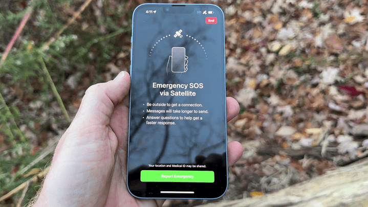
Once you’ve done that you’ll see a new screen that confirms you want to trigger a satellite emergency:
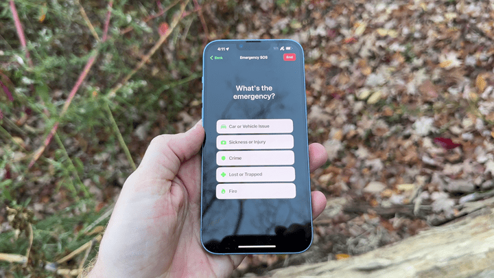
Next, you’ll get the first question, detailing what type of emergency it is. As you might expect, all of these questions were created in coordination with emergency services. During this first pass, I specified ‘Sickness or Injury’:
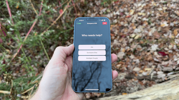
Then I specified for ‘Me’:
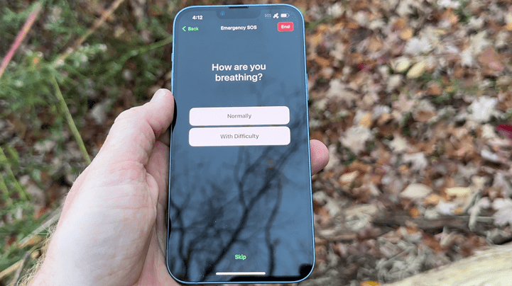
Then I said I was breathing normally:
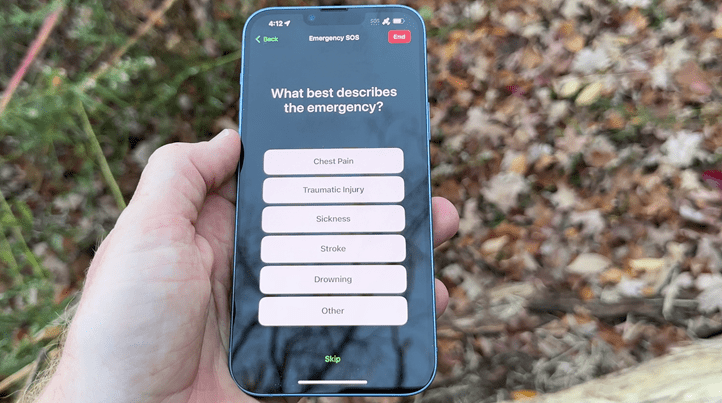
Next, it asked what type of emergency, for which I said “Traumatic Injury”:
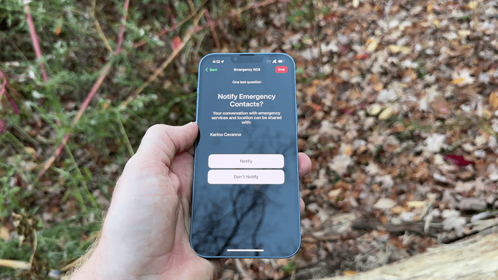
Finally, it’ll ask you if you want to notify emergency contacts (more on that in a second, it’s super interesting). In my case, they had set up a secondary phone that was predefined as my emergency contact. Note, you do need to set this up ahead of time. So, if you wait till you’re in the middle of nowhere without coverage it won’t work (trust me, I tried, I changed it…much to their initial chagrin). You’ll still contact emergency services, but your BFF’s won’t be notified.
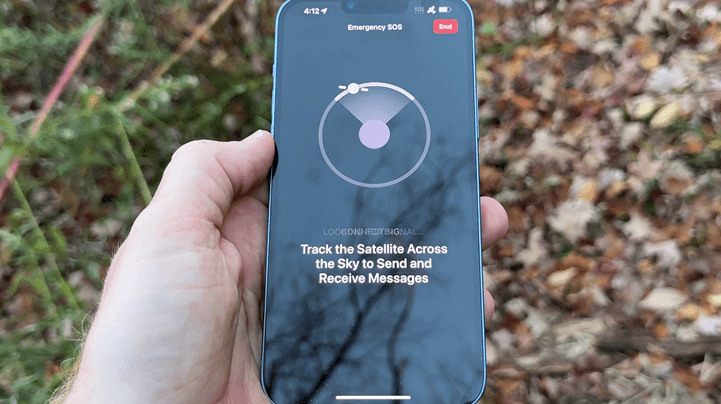
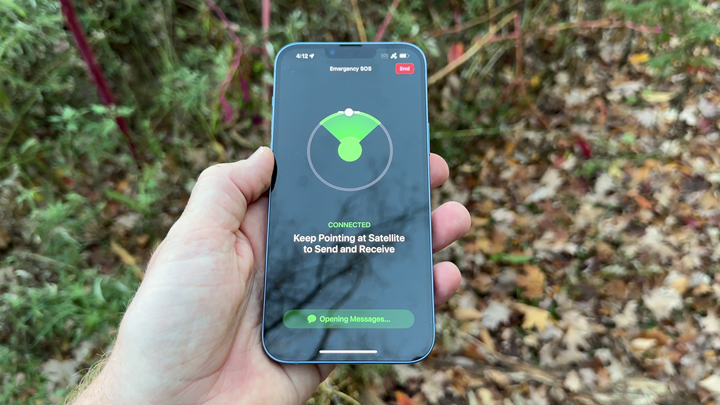
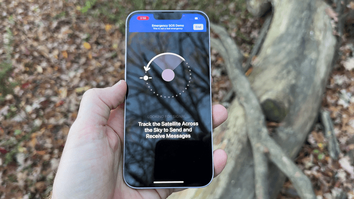
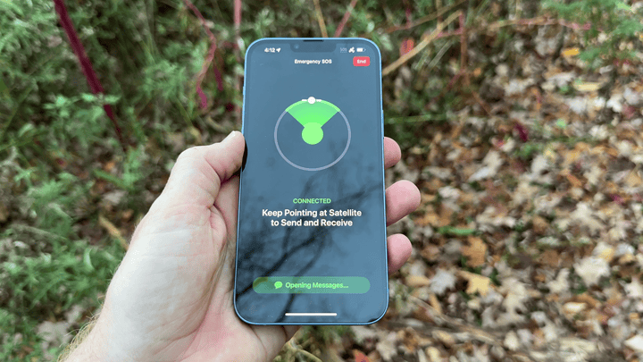
After pressing confirm, you’ll get to this satellite pointer screen. As noted, there are some 24 satellites as part of the constellation, and they are constantly criss-crossing overhead. So you need to point your phone towards them in order to get the best connection (more on what happens if you don’t, in a moment). As you move your phone, it’ll keep it within the green area:
You don’t need to wave your phone above your head, or anything else. Just keep your phone flat like you’d be scrolling Instagram, and instead rotate your body/phone till it shows green. It’s really simple. It showed up in under 20 seconds in my case:
What you’ll find while hanging out having an emergency, is that the 24 satellites slowly move over the course of a couple of minutes. So you may be facing one direction when you start, and then facing another a few minutes later. And then a satellite will disappear entirely and a new one will show up, and it’ll tell you to turn a different direction. Apple says it’ll even tell you how many minutes you might need to wait till the next one. They say that at continental US latitudes, it should be near-constant coverage, whereas far further north, it might be a few minutes between satellites.
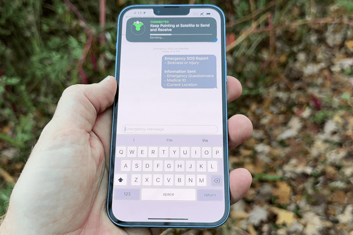
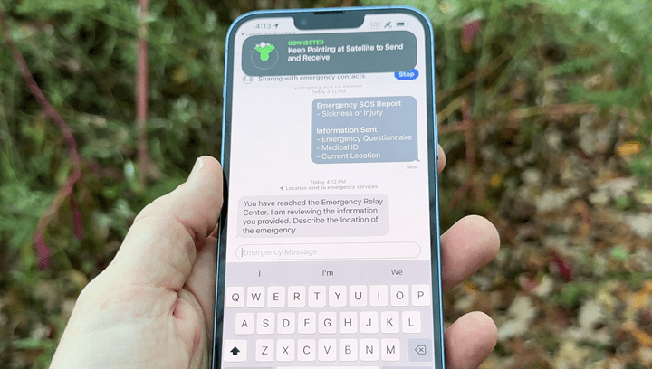
Once all that was set, it started sending the message. That message includes:
– Your contact details
– Your current location
– Your current altitude
– Any Medical ID information listed on your phone
You’ll see the status of a message being sent at the top, as well as the current satellite connectivity status too. You can either hide this or make it bigger by tapping on it.
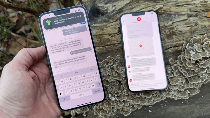
The emergency relay center responded within a few seconds of the message sending (which at first only took maybe 30 seconds), asking for more information about my location/situation:
This text message is with a real human. It’s a real Apple relay center operator, or, if your specific region supports it, then it’d be directly with the PSAP (public safety answering point) in your area. Basically, the 911 operators in your area.
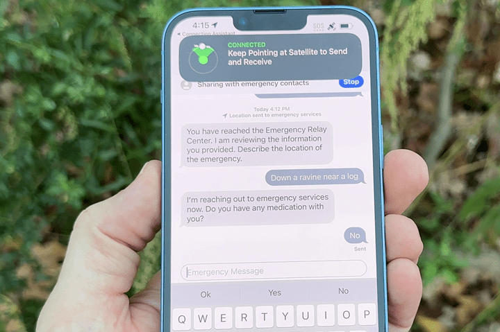
I then gave more information, and they volleyed back as well.
In an earlier test of this, prior to saying I was stuck in a ravine, I specified a stroke had occurred. This caused a different set of responses from the person on the other end, asking if the person having the stroke had a history of strokes, as well as other relevant questions.
Now, around now, the satellite disappeared on me, and thus I had to rotate again. This second set of messages took perhaps 2 minutes to send under relatively light tree cover. Other times it was near-instant. Again, really depends on what’s in the way.
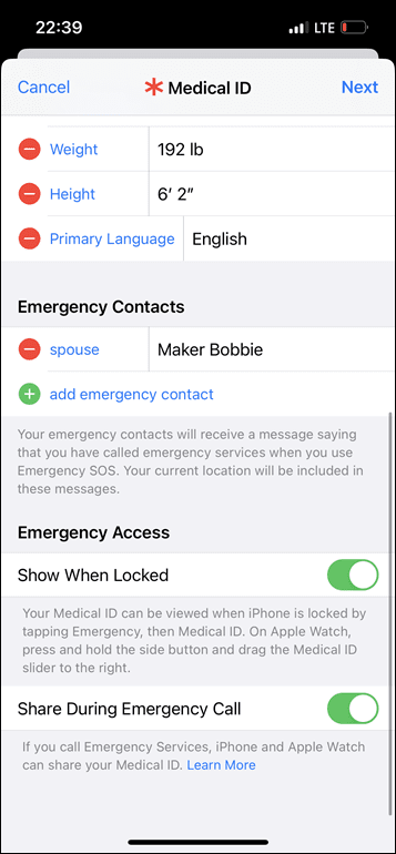
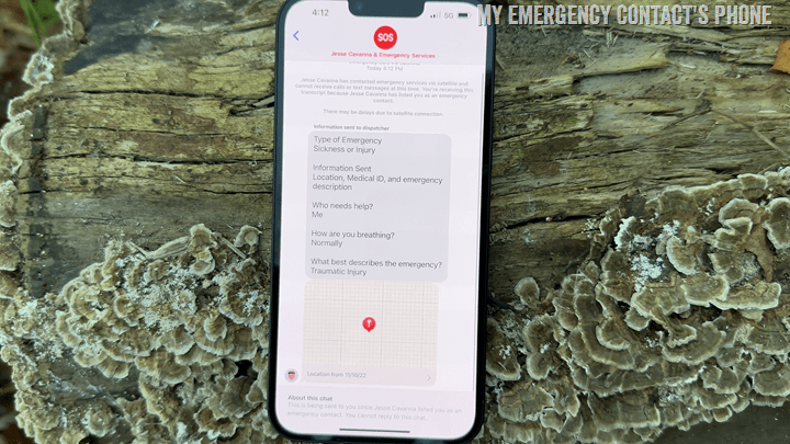
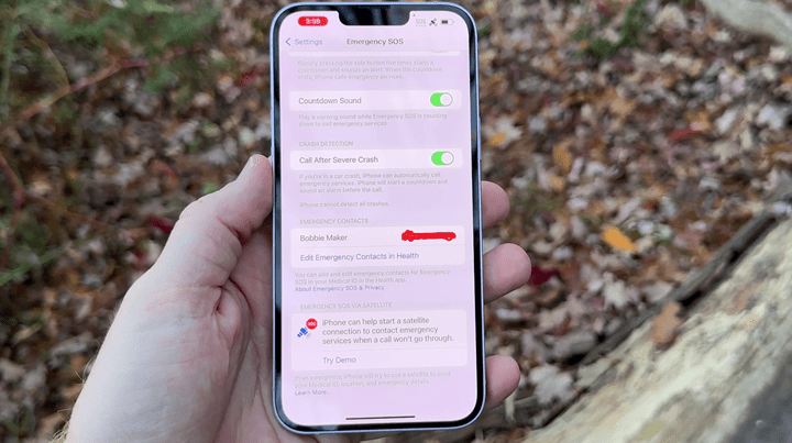
Now, while all this is happening, it’s also notified your predefined emergency contact on your phone. This would be a good time to (right now), double check you’ve actually filled this out. It’s located at Settings > Emergency SOS > Set Up Emergency Contacts in Health > Create Medical ID, then simply follow the steps. I promise, it takes under 60 seconds, and is useful beyond satellite SOS. Be sure to check the very last box for “Share During Emergency Call”
However, what’s super cool here is that from this point forward, *EVERY TEXT* you send to the emergency responders, as well as every message they send you, is mirrored to your emergency contact. They basically get to watch a livestream of this event. They also receive your exact GPS coordinates too.
In fact, the emergency relay center responses actually showed up slightly faster on my emergency contacts phone, which is logical given that was on cellular. Note that this is all ‘read-only’, your emergency contact cannot be active in the conversation.
Now – Apple says that the main limitation here is that the antenna to satellite connection simply isn’t as strong as dedicated satellite devices, for example a Garmin inReach or SPOT tracker. As such, things like trees will impact it more and slow it down. The heavier the foliage, the slower the service. Same goes for mountains, or even hills – all of which could block access to a specific portion of the sky, where you’ll have to wait for a satellite to swing past the visible portion of the sky.
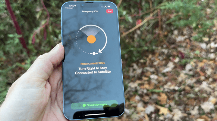
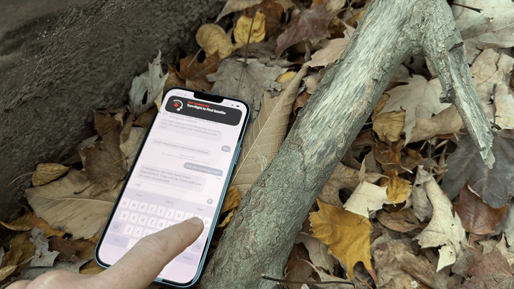
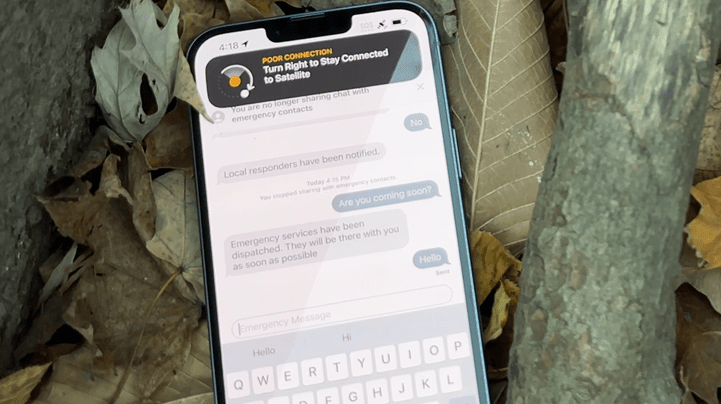
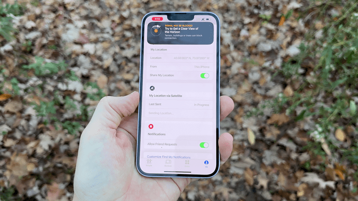
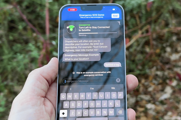
To test this, I stuck the phone down under the edge of a log. And then faced it the wrong way from the satellite it was chatting with. As expected, it got unhappy:
However, it kept trying to send the message. And within about 3 minutes it managed to send the message. So while there is a ‘best’ way to position the phone for optimal performance, the reality is it’s going to keep trying. Apple themselves even notes that if the situation requires, you can simply place it on a surface and let it do its thing. What’s fascinating here is that I never moved the phone from the above position. Instead, the satellites moved around me, and thus, into poor, but workable satellite connectivity – and the message sent as you see below:
Finally, it’s worth knowing that there are actually four ways a satellite SOS message gets triggered. The last three outlined below are all existing ways to notify 911 on your phone, and they’ve now been integrated into this system as well.
A) The manual process I just describe above
B) Manually holding the top two buttons until it triggers an emergency
C) Automatic Vehicle accident detection
D) Fall Detection
In the case of B/C/D above, since the type of emergency is already pre-defined by nature of it being automated, it’ll go through the same process as above, but immediately start connectivity, and continue trying to reach satellites ‘forever’ unless canceled. Basically, even if the phone is in your pocket or on a car mount while you’re unconscious, there’s a chance that it’ll eventually get coverage by a passing satellite, and keeps trying. There’s currently no low-battery cutoff for that, it’ll keep doing it in the foreground. Remember of course, if you’re within cellular range, it’ll simply use that as normal.
FindMy Tracking:
Next, this one will be a quick section – cause, it’s pretty straightforward. In addition to all the emergency bits, there’s actually one non-emergency piece, which is the ability to manually update your FindMy location. For those with Apple devices, FindMy normally uses cellular/WiFi to constantly show the location of the person and their devices (be it phone/watch/computer/AirTag/etc…). FindMy locations can be shared with family members, so they can see your location.
With satellite connectivity, you can manually update your FindMy location, which lets your family members see your current spot. This is great for camping or other out of cell scenarios where it’s not at all an emergency, but you basically want to show/share your location – perhaps as you arrive for the night at your campsite. Or, just simply checking along the way.
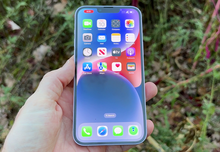
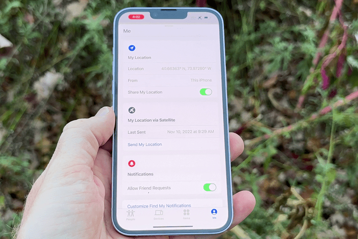
To do this, you’ll crack open the FindMy app (lower right hand corner here):
And then you can choose to manually update by selecting “Send My Location”, within the satellite section:
You’ll get the same manual satellite positioning bit as with the emergency pieces, and then it’ll show you that the message is sent. In my case, I seemed to be between two different satellite passes, so had to do a bit of the satellite movement dance, and all-in it took about 3 minutes. A previous time it took mere seconds. Again, just depends on the satellite situation above you.
Once that’s done, you can put down your phone as normal. Note that if you then travel through a cellular area, it’ll re-update that with the latest location via cellular. For example, I’ve done some hikes in the last couple of months that had spotty cell-phone coverage. So it’ll leverage cellular as normal, but then I can manually update via satellite as needed.
There is no automatic update via satellite, it’s only when manually triggered. Further, there’s no option to add any informational context here, which would be a huge update if Apple simply had a list of predefined messages to include, such as “At Campsite for Night”, “Still on Trail”, “A bit behind, but all’s good”, or such. This is what other platforms have, which makes it easy to choose from a list of predefined messages, minimizing bandwidth while significantly expanding use. Because these messages are predefined beforehand, the bandwidth to send them can literally be only one or two characters/numerals out of a stream that otherwise includes GPS coordinates and more.
Though given all the other weird FindMy limitations Apple has (such as inability to share AirTag device locations with members of your Apple ‘Family’), I’m not holding my breath. Nonetheless, the FindMy satellite update feature is super useful if you don’t have a satellite device, simply to update friends/family on your location/progress.
Demo Mode:
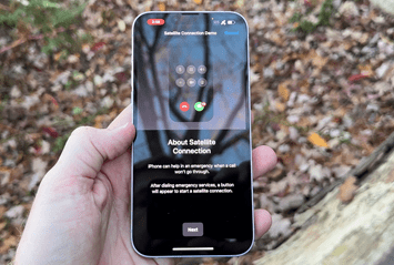
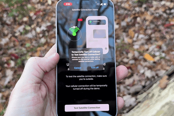
Being that humans are curious creatures, and being that Apple knows people want to try this out, they’ve actually created a demo mode. This demo mode uses the legit satellite to send test messages back and forth, letting you figure out exactly what service availability looks like in varying conditions. You can go through the emergency questionnaire, try out pointing at satellites, and even see response times via satellite from the relay center (the replies are automated from the relay center, but traverse via satellite).
To open the demo up, you’ll go into Settings > Emergency SOS > Try Demo (at the bottom):
It’ll warn you that it’s going to shut off cellular and WiFi. So obviously, if you’re expecting an important call or text message, this isn’t the time to do this.
However, unlike before, it doesn’t let you answer the questions. Perhaps that’s to avoid confusion in the event of a real emergency. Instead, you funnel directly into moving your phone around to find satellites:
At the end of which, it’ll send all this information to the relay center, and you’ll see the satellite positioning bits as well as response times. If you stick the phone in a hole in the ground, these messages won’t come through. If you’ve got poor coverage, you’ll see poor response times. All of this is, again, happening via the real satellite system. This isn’t faked. The only thing faked here is the responses from the relay center are automated, but are indeed coming from that relay center system.
This is super cool for Apple to do this. Though, we’ve seen other platforms have similar concepts. For example, with Garmin inReach, you can send test messages to the relay center, which lets you validate things are working correctly. Still, given the massive scale Apple is looking at here (eventually hundreds of millions of users), being able to have a demo mode is key to letting people understand how the system works.
Also, secondary reminder to update your medical/emergency contact information if you haven’t done so already.
Wrap-Up:
I suspect in 5-10 years, or even 20 years, this will become one of the most pivotal points in the history of not just the iPhone, but Apple. It can’t be overstated how big a deal this is. Over time this will basically put satellite emergency response in the pocket of every person with an iPhone. And while there are other services being planned (such as one from T-Mobile), that’s got both highly fuzzy timelines and is also just one carrier. Undoubtedly it’ll eventually become available, and probably from plenty of other carriers too. But the Apple solution is real, and it’s here today, with the first international expansion plans already set for next month.
Of course, as noted, this isn’t a direct replacement for a satellite communicator device if you’re headed deep into no-cell zones and need or want constant tracking. When I go hiking in no-cell areas, I’m still absolutely going to take my Garmin inReach device. That provides constant non-emergency tracking at specified intervals (down to every 2 minutes), and it works everywhere on the planet. I can send messages back and forth, just like texting, to friends/family, and with a variety of updates. It’s not limited by my location, nor is it limited in what I send. But, it does cost money for the secondary device, and also costs money for a subscription plan.
For now, the Apple solution is free. Apple says it’ll be free for the first 2 years, but hasn’t defined costs after that. Speaking of which, the exact definition of the two years is a combination of the date of activation of your iPhone 14 combined with the date of availability in your home country. So for a US-activated phone, that’d be starting today, November 15th, 2022, until November 15, 2024. For someone in France, that’d be December 2022 until December 2024. For me in the Netherlands, since it’s not yet activated there, I’ll get a free pass for my start date till it’s activated there. So if that were March 2023, then I’d get till March 2025 for free. But I could use it in USA/France/Canada/etc for free before then. And to be clear, that ‘March’ date is purely an example. I have no idea when it’ll be available in the Netherlands.
Thus it’ll be interesting what this ends up costing down the road, though, I suspect it’ll be bundled as part of one of Apple’s subscription services, or be a relatively trivial cost. Apple hasn’t said either way. However, what will be fascinating to watch is just how fast Apple can roll this out, how well that roll-out goes (invariably there will be bumps, but the tolerance for bumps is low in life or death situations), and how well they can scale it beyond North America and Europe.
With that – thanks for reading!
FOUND THIS POST USEFUL? SUPPORT THE SITE!
Hopefully, you found this post useful. The website is really a labor of love, so please consider becoming a DC RAINMAKER Supporter. This gets you an ad-free experience, and access to our (mostly) bi-monthly behind-the-scenes video series of “Shed Talkin’”.
Support DCRainMaker - Shop on Amazon
Otherwise, perhaps consider using the below link if shopping on Amazon. As an Amazon Associate, I earn from qualifying purchases. It doesn’t cost you anything extra, but your purchases help support this website a lot. It could simply be buying toilet paper, or this pizza oven we use and love.



Will it work on an iPhone with no service at all that is just used at home with wifi?
It should, as long as you have set up the phone. The phone itself isn’t using and carrier towers to relay the information.
On an iPhone which has the right satellite radio, which is currently the iPhone 14. I can’t imagine anyone is using an iPhone 14 as an iPod touch right now.
I don’t see demo mode on my iPhone 14 Pro. Does it require an upcoming iOS update? I’m running 16.1.1 currently.
Oh, and did Apple say anything about this showing up on an Apple Watch in the future?
It should be pushed effectively server side. They said it could be a few hours till it shows up for everyone (physically in US/Canada, plus iPhone 14 on latest OS).
No comment from them on the watch side though.
What a great feature – dynamite for the backcountry weekend warrior. Really feels like v0.1 of the future.
I believe that when you have the Garmin subscription the service includes insurance coverage for the rescue. Has anyone seen any information on the Apple side of things. If you were say to get rescued by helicopter in the backcountry who covers the cost?
In the US, I’m not aware that any sheriffs or search and rescue services charge for rescues. There are some states where if you did something stupid/negligent they have a system set up to fine people who do this, but charging people to be rescued can cause people to hesitate to call 911 and that’s generally a bad thing.
The inReach does not include rescue insurance in the base plan. You can pay extra for it. Everything beyond that is a huge “it depends.” There is no simple answer and ultimately, if you’re in a life-or-death situation, aren’t you going to make the call? If you want to be prepared, consider rescue insurance (e.g. through AAC).
If you’re concerned about helicopter specifically, depending on the nature of the situation and where the pickup happens, the helicopter might be considered part of the cost of the SAR operation (see below), or it might be considered air ambulance transport and billed to you, just like if you needed air transport from a car accident.
@Michael, here in NH people may be liable for the cost of their rescue if found negligent–it is not a fine, it is cost recovery. In very rare situations (one that I know of) there may also be a fine for particularly reckless behavior. In no instance do the volunteer teams have their costs covered.
Interesting feature in line with the iPhone’s full time detection of abnormal pulse and heartbeat. This would come in handy for hikers in places like Colorado where phone service is unavailable on many trails.
Indeed, and Colorado (among many US places) is a great example of where it’s relatively easy to drop out of coverage, even just on the major highway somewhere for a very-non-hiker-person. This solves that.
Not a bad tool to have in the toolbox. My wife and I hike offgrid quite a bit in state and national parks (like Grand Canyon), so having this as an additional tool is nice.
If I have a 13 Pro Max, is this worth the upgrade for it alone? Not sure, but DEFINITELY something to keep in mind!
Yeah, I think it’s hard to see as an upgrade from an iPhone 13 Pro Max, but I could see from older phones, very much.
Will it work outside the country your phone ist registered?
German SIM-Card with bike crash in the Austrian Alps.
Yes, Apple doesn’t care about where you bought or registered your phone*, they care about where you are physically at that moment.
So if I took my iPhone 14 Pro activated/bought in the Netherlands, to the US right now, it’d work. And next month, if I took it to France, it’d work. However, my “free 2 year counter” actually doesn’t start until it’s offered in my activated home country (Netherlands). So whenever that is.
*Singular exception to this is phones purchased in China, Hong Kong, and Macau – which prohibit this, and thus it doesn’t work at all, no matter where you go.
Eagerly updated to 16.1.1 this morning before reading the article (thank you for all the research!) – but I can’t find the Satellite settings. My emergency SOS settings screen looks just like it did before the rollout, with no mention of satellites or a demo mode. I’m using Verizon in the US (Oregon). Am I missing a switch somewhere in settings to turn on the satellite function?
Apple says it’ll be a few hours till it shows up everywhere.
The best place to keep looking is in the ‘Find My’ settings or SOS settings for Demo mode. It’s plausible restarting your phone will speed things up, but I’m not sure there. They just said it’d be a phased rollout and it’d probably take a few hours.
What was the impact to battery life when communicating with satellites?
All GPS chips produce latitude longitude and an accuracy value in meters. Does it also send the accuracy value to 911 or the apple person?
Another great DCR technical review.
Goodly number of technical details in Apple’s news release as well.
link to apple.com
Are they expecting people to dial 911 even when not in N America?
Each country has its own emergency services number (eg 999 in UK and Ireland ) The EU has also mandated 112 as a pan European number so people can dial that if they don’t know the local number.
There is an apocryphal story about someone in the UK who noticed a fire in his house while watching the US TV show 911 and the house burned down because he dialled that and couldn’t get through … ;)
This feature and review are from USA.
That’s a bit of a leap. It’s available today only in two countries, both of which use 911. iPhone users don’t dial 911 in other countries, so why would we expect them to have to with this feature enabled?
It actually makes no difference. 911, 999, 112 all work from most countries through international agreement. Don’t try it, but it definitely does work.
There are very good reasons for each of these numbers. 999 was down to pulse dialing for instance, due to the age of the service and allows you to tap the “hook” over and over in an emergency. I think 911 was something to do with rotary dials and certainly made sense at the time, it also wasn’t an in use area code in the states. 112, being more modern was designed for use with touch dialing and used different digits on purpose to ensure dialing was on purpose. Low numbers used so that rotary dials didn’t waste much time.
As above though, all can be dialed from a locked mobile, and all work in most countries.
iPhones (and all mobile phones) are already ‘aware’ of the emergency numbers in whatever country they’re in as they have to support the functionality whereby they will attempt to use any carrier (not just the one you subscribe to) to connect emergency calls. By extension, I’d imagine the same would be the case with this.
This was my thought too! If in trouble, I would dial 999. Maybe 112 if that didn’t work. But I doubt I’d try 911 (unless I was in the States at the time). Having them all work really is an obviously very important thing, I think.
This is brilliant stuff from Apple.
Very useful writeup, but it’s hard for me to understand the view that this is a big deal. Even after more countries get this, it only fits a very specific use-case where there’s no cell coverage to call 911 yet the adventure is not so intense that one would have embarked with a dedicated satellite device. Day hikers and weekend warriors who get in over their heads. It will save lives, for sure, and that’s a very good thing, but it doesn’t seem that momentous?
It is less that the vital core capability is new, and more that Apple has packaged it into a common consumer device. They improved the user experience far beyond what was typical.
An earlier example of their same approach was taking the core capability of MP3 players and improving it far beyond what people generally imagined at the time. If you remember the days of the Rio MP3 player and ripping CD’s it was somewhat difficult to envision our current situation with digital music.
If they are able to sway satellite providers as easily as they have cellular providers, then things could be getting very interesting over the next five years.
“If they are able to sway satellite providers as easily as they have cellular providers, then things could be getting very interesting over the next five years.”
Exactly this. Apple is playing the long game. Expect more from Apple in terms of expansion of Satellite features over time. This is the way…
Thanks, that makes sense. Maybe in 20 years we’ll be satellite-streaming 10K video on top of Mount Everest. Or, more importantly, in our living rooms without fiber or cell towers.
Article arguing that cell phones don’t make people safer in the wilderness — they make them overconfident and less self-reliant. The numbers don’t show a reduction in per-capita wilderness fatalities since cell phones became common.
link to outdoors.org
“…To put it another way: Would deaths spike if cell phones disappeared? “I feel people would self-rescue more, find their way out, crawl out,” said Marunowski of the USFS. “I wouldn’t be more worried.”
Kneeland said he’d never criticized a hiker for not carrying a cell phone. In fact, many times he’d wished hikers hadn’t carried cell phones at all. The device has led to a rash of nuisance calls, particularly during the shortening days of autumn when hikers are “trapped by darkness.” Almost every night in fall is a triage for Kneeland, who often finds himself hunched over a computer, toggling between maps, handling call after call from hikers who carried no map or lamp.
“When something starts going wrong, hikers are quick to call 911 and request assistance,” said Kneeland. “I’m not opposed to giving that assistance, but a lot of times they probably could have worked themselves out of their mess by carrying appropriate equipment such as a map or headlamp or something like that.”
Sometimes Kneeland will tell a benighted hiker to wait for another person to come down the trail with a headlamp, or to enjoy a night in the woods and self-rescue when the sun rises. That rarely goes over well. “They’re going to call me every five minutes,” he said. “Quite often they keep you up half the night, so you might as well go get them and be done with it so you can go back to bed.”
That particular viewpoint has been widely condemned within most search and rescue circles, someone else wrote something similar a couple of years ago that got some traction. It really holds no actual water. So many pieces of it are stupid, such as the idea that just because there’s no coverage, other areas with coverage someone shouldn’t carry a phone. From a SAR standpoint, it’s a eff-ton easier to find an injured someone armed with a phone 1-mile down the trail but a few hundred meters off lost, since they can tell you exactly where they are. Versus, sending tons SAR crews out dozens of miles deep into a trail for hours or days on end, because they have no idea where the missing person is since they didn’t have a phone.
Frankly, it’s mind-boggling how stupid people can be. It’s literally the equivalent of ‘old man shouts in woods’. If helping people as a search and rescuer (including the official the article talked to, is such a challenge, then frankly, he needs a job change. That’s his job – whether he likes it or not.
More than once I’ve hiked up a mountain to bring flashlights to people who were trying to descend by the light of their phone.
A lot of people have no clue how volunteer-based search & rescue actually works. They think that they can call 911 and minutes later a helicopter will lift off and come get them. It ain’t so.
I’m not against carrying a phone. I carry a phone and an InReach. I’m against people thinking their phone is a substitute for preparation and good judgement. I don’t think this is going to help that.
I have no problem with saying people should be prepared. Or that, as a population, people do stupid things. People have long done stupid things, and will keep doing stupid things. The ratio of stupid hasn’t changed.
However, I do classify a government official that’s in charge of search and rescue components to say he wished people didn’t carry a cell phone so they don’t interrupt his evening, is stupid.
As for how satellite helps – I think it’ll help SAR crews even more. Once again, it’s the same paradigm as I noted before. Rather than crews having to spend forever looking for someone out of cell range (even if just a few hundred meters from a trailhead), they’ll know now exactly where they are.
I think we agree that the technology can be a huge help when people get lost. No argument there.
I do think that over-reliance on tech makes it more likely that folks will get lost, and will call for help instead of trying to solve their own problem. In the example cited, the callers are not in danger — they are in the dark. They might be a bit cold, a bit scared, but they could hunker down and wait until morning and they’d be fine.
Those rescuers and the volunteer teams go out in appalling conditions if they think someone is in danger. I think it’s reasonable for them to be annoyed when someone wants rescue because they are slightly uncomfortable.
I think there are two parts to this. Those who call for help when they don’t really need help and those where the cell phone gives people the confidence to do something they are not really prepared for. Before cell phones it was “If something bad happens to me I’m screwed so I should be prepared and do my best to save myself” now with cell phones its “If something bad happens this cell phone will protect me, no need to worry about saving myself”
Sure, having this ability will help who would have been screwed without it, no question. But how many people will be more willing to be in a risky situation that they wouldn’t have done without this?
Plus if you’re talking about areas with no cell reception SAR will be much harder. Not so much because cell signals make SAR easier (though I’m guessing it does) but because you’re much more likely to be remote and hard to reach so the amount of work needed is much higher. I don’t think people realize how much work and time goes into a rescue. Take for example if you trip and break your ankle, painful sure, not life threatening. In a suburb should be under 15 minutes to get an ambulance and a short ride to get medical care. Try this near the top Old Rag in Shenandoah, popular hike in the DC region in the US where there is no cell reception outside the very top and about 1.5 hour drive from DC. That’s more like 12 hours to get to a medical center when you’re on the trail at a known location (get SAR team together, hike up to you,….) Now imagine more unprepared people on less well traveled trails.
Yes, but people say that about all sorts of safety equipment. Bicycle helmets, seat belts, modern American football armor, etc., etc. are all claimed to encourage risky behavior. That doesn’t mean we shouldn’t have them.
I carry my cell phone on every ride, ski, or hike, even when I know I’m going outside of cell service (pretty easy to do in this area). It doesn’t change my behavior. (No longer being young and stupid helps, too. When your my age, you worry about injuries taking longer to heal and don’t take as many risks.)
I wonder how much of this is Apple controlling it. Apple is using Globalstar for the satellite constellation and google has said satellite support is coming to Android with Globalstar already having android apps
GlobalStar has a market cap of 3.6B – Apple has spent ~$450m, but that’s also including a slate of their own costs that aren’t directly going into GlobalStar’s pockets.
Either way, I have no doubt that this is a massive deal for GlobalStar, especially if it’s even loosely exclusive long-term, as you scale this up globally. I haven’t seen specifics that Google is partnering with GlobalStar specifically, but rather, just that their device can support it (as we’ve seen with T-Mobile’s announcement for future stuffs).
Interestingly on the U.K. website Apple talks about having a clear view of the sky and in particular actually says “avoid mountains and heavy foliage” Not great then if you’re in the Scottish mountains or any other forested/mountainous region and as you’re article states not a replacement for an inreach or similar device.
Yeah, it’s interesting. This is largely Apple being incredibly CYA legal cautious, and certainly for good reason.
However, once you understand the technical side of it, it’s not too bad. Essentially, Garmin has an omnidirectional antenna, and so it really doesn’t matter which way it’s facing, it’ll see the satellites. But Apple’s antenna is heavily skewed towards the top, rather than all directions.
Thus, you’re essentially having to wait for the satellite to pass by the ‘front’ of the phone to make contact. Or, in the case of a mountain/etc, you’re having to wait for the satellite to pass by that section of open sky. With Globalstar, they have 24 satellites, whereas Irridium (what inReach uses), has 68 satellites – basically triple the number. Thus, there’s triple the chance that the section of the exposed sky is wide enough to see a satellite, and given it’s a far bigger antenna, it’ll have an easier time of finding it.
In a nutshell, I think mentally you can assume that as long as you have some section of free sky clear, it’ll eventually get that message out (even with some tree cover), but the service degradation of that could be moderate to high.
I would have loved to put this in trickier spots against inReach, and I think I still can, once things open up in December on this side of the pond.
Thanks, that helps. I don’t have either device so it would be really interesting to see your results if there was a way to do side by side testing in challenging environments.
If Apple included this in their marketing and it demonstrated comparable results, even if it was slightly slower, then this really would be a game changer.
Also, will the fall detection mode on Garmin watches activate the SOS via satellite mode or is that limited to the Apple Watch ?
That’s limited to Apple Watches.
Some other differences between Globalstar and Iridium:
– Iridium coverage doesn’t drop off as you approach 62°N or S, because their satellite orbital geometry is different. Iridium satellites are just as visible at the poles as at the equator.
– For a Globalstar message to get through, the same satellite has to be in view of both you and a Globalstar ground station. Sometimes you might be in view of a satellite, but the satellite might not be in view of a ground station, or vice versa. (That’s why Globalstar doesn’t work once you get too far offshore). The Iridium system doesn’t have this limitation. Each Iridium satellite is always in view of at least two others, and if a satellite it isn’t currently in view of a ground station it’ll relay messages to other satellites in the network. Globalstar satellites can’t do this.
I’m a little disappointed that we didn’t get at least one canned messages to avoid involvement of emergency services. I’ve used a SPOT at work many years ago that I believe had just one canned message you could send, for that workplace we decided it meant something non-emergency had you stuck, like say two flat tires. And they would come get you.
I had considered that just sending my location via satellite if I were stuck my be a substitute for this (i.e. if you see my location in a remote place, it means that I took the time to send it, so I may need assistance) but I realize that Find My will continue to update your location as you move in and out of service (if that is happening) so that method isn’t going to work.
So I guess it’ll come down to only being useful for non-ememgency after I’ve exceeded my expected return time. For me I don’t think this is a problem as if I’m just in need of someone picking me up because I’m stuck walking instead of cycling or driving, I hopefully will have prepared myself for walking out of a situation (or prepared to hunker down for the night). If I’m not prepared, I probably ought to be contacting emergency services.
Come to think of it, if Apple added the ability to send a single SOS notification to your emergency contact(s) or a predefined group, that would save a lot of satellite bandwidth and would suffice for many situations, getting the predefined message out to the important people without involving emergency services
I think in a sense, that’s what FindMy is about – minus the ‘I need something’ side of it. It’s more of a check-in option.
But I agree, if they allowed you to create even just a few dozen options, pre-defined, that you could send. Thus, it would literally be the tineist of message behind the scenes (since those pre-defined options would be server-side, and it would only have to send a single character).
Does this is limited to the listed Europe countries or it extend to those countries’ overseas’ territories ?
I actually asked that prior to announcement and was essentially told that more information will be announced in December at that launch.
Obviously, as you know, that gets complex quickly – in terms of physical locations. Be it the Caribbean or off the coast of Africa, middle of the Pacific, etc…
Let’s say me and my friend are both in the mountains outside of cell service but not together. If I use the satellite function to send my location to him in Find My, will he be able to receive it? Or you would only be able to view someone’s location in Find My if you have cellular/wifi connection.
Sometimes I’m in the backcountry with a large group and we’re not all together at all times so it would be really useful to be able to view one another’s locations like this.
No, one can’t view other FindMy object/people locations – only transmit your own. In a nutshell, you’re still looking for something like a satellite communicator in this scenario.
Is this only for iphone 14? That sucks if they wouldn’t release it for all their phones.
iPhone 14 only, due to different internal antenna design.
I see it is strongly rumoured that the new Samsung S23’s, coming Feb 2023 will have texting by satellite and not just for SOS. Apparently they will be using the Iridium network.
So might not be as big an exclusive for Apple as first though. Especially is Samsung are going to support regular texting.
InColorado if you buy a fishing license it covers some of the cost of mountain Rescue. In Pitkin County , Aspen area the Sheriff emphasizes that they do not charge for rescue. One of our local hospitals has a medical evacuation helicopter staffed and ready always. We have the Air National Guard close by also. We have had many casualties over the 45 years that I have lived here due to people not telling someone where they were going and not having the means to communicate.
I thought you might find this article interesting on how the iPhone auto-crash detection is playing out in Colorado, USA ski country…
link to coloradosun.com
Just got this enabled entering Portugal. Dunno if it is also available in Spain and it was a coincidence, or it is only on Portugal