While this might not exactly be the best time to roll out a new feature focused on exploring the outside world around us running or cycling, it’s still a super cool new bit of functionality that will keep you distracted for a while sitting in your living room lockdown. Strava has just launched their new routes feature that automatically creates routes on the fly at variable distances for running or cycling, taking into account the company’s massive data on where people are actually going, as well as preferences for elevation and surface type.
It’s vaguely like Garmin’s Round Trip Routing function that’s been on their units for years, but appears to be a fair bit better and more flexible in most cases. Both in how you define routes (such as road times), but also in how they route. It’s not always a circle. It could, for example, be an out and back, or even a ‘Y’ shaped route. And it’s super fast.
But is it worthwhile, or perhaps even better than a local? Well, I dig into that. Oh – one more thing. This new feature does require a Strava Summit membership (of any sort). As expected, eventually Strava was going to start adding more value for people paying into their platform.
In any case, on with the show, and if you want the total walk-through in a video, simply hit play:

Otherwise, keep reading. Or, do both. Multi-tasking and all that.
Creating Routes:
First things first, ensure you’re on the latest version of the Strava app. For iOS users, you need to be at 143.0.0 or higher, and for Android users should be the same as well. As always, it may take a little bit of time for these to filter their way out to the world through various App Store platforms (but they have begun to be distributed).
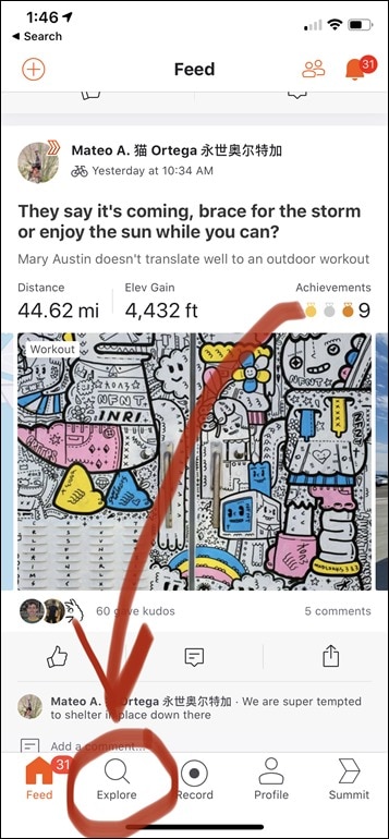
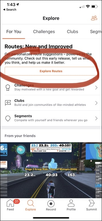
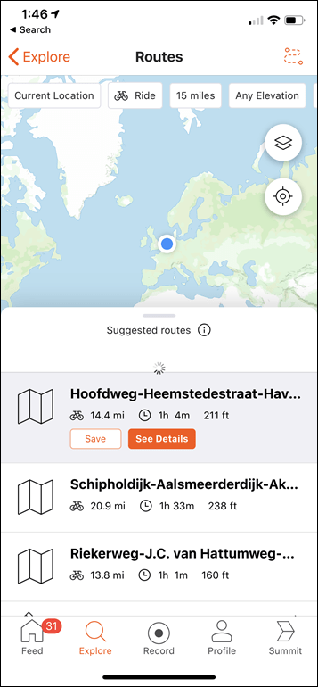
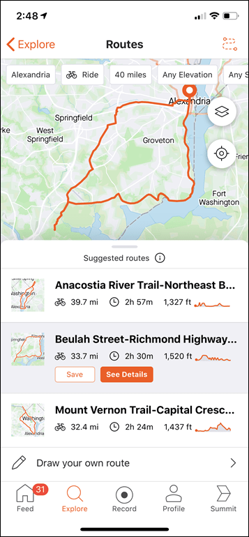
Next, open Strava and tap on the ‘Explore’ button at the bottom, then tap ‘Explore Routes’.
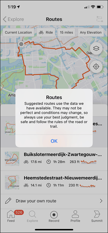
That’ll open up a page that’ll start pondering life for a few seconds, showing you a view of the world. A few seconds later it’ll come back with three routes, based on default parameters at the top of the page. As part of that though, it’ll warn you that it’s based on the data they have, not an actual human inside a hamster wheel giving you these. As such, sometimes data-driven routes might need human judgment applied.
Now, the way it works is that at the top of the page you’ve got five levers to dork with, the are:
Location (to start/end): You can specify current location, or choose any address/place on earth, or just tap a spot.
Ride/Run: This is specifying the sport type. The company is starting with these two for now.
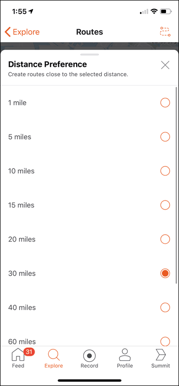
Distance: You can select a distance in either kilometers or miles. There’s a few options here from 1mi to 100mi.
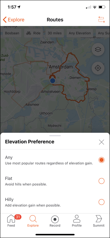
Elevation: Whether you want flat, hilly, or throw your hands in the air like you don’t care
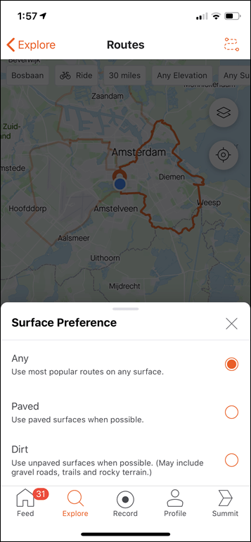
Surface: Paved, dirt, or surprise me.
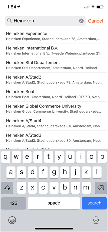
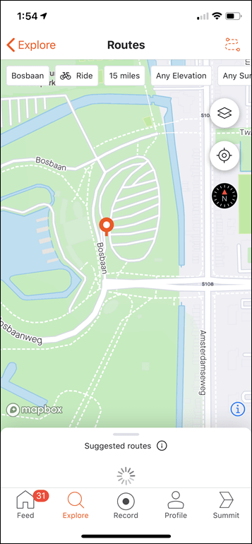
So, let’s start with a 30mi/50km ride from nearby the DCR Studio as a good example. First, in my case I tapped the start of the park nearby. By default it’ll use your exact location this moment, but being able to choose a different starting location is useful. Especially if you’re sitting at the baggage claim of an airport waiting for luggage, but want to plan a route from your hotel a few hours from now. Or, you want to find a route from a mutual starting point. You can also simply type the name of a place in too:
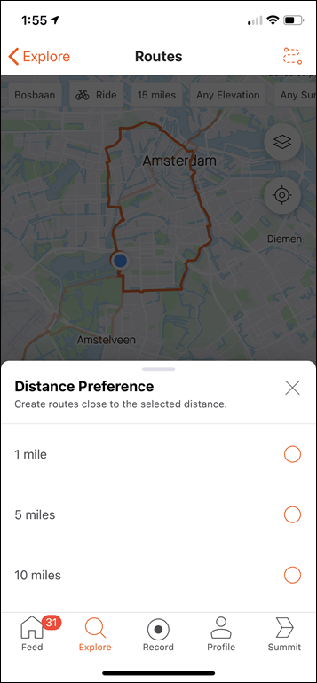
Next, I’ll leave the default at ‘Ride’, and then we’ll select our desired distance. In my case, I’m going to go with a 30mi/50km ride. You can see some of the different pre-defined levels here:
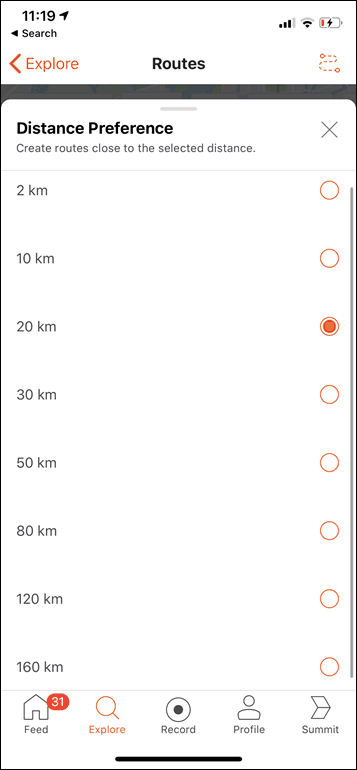
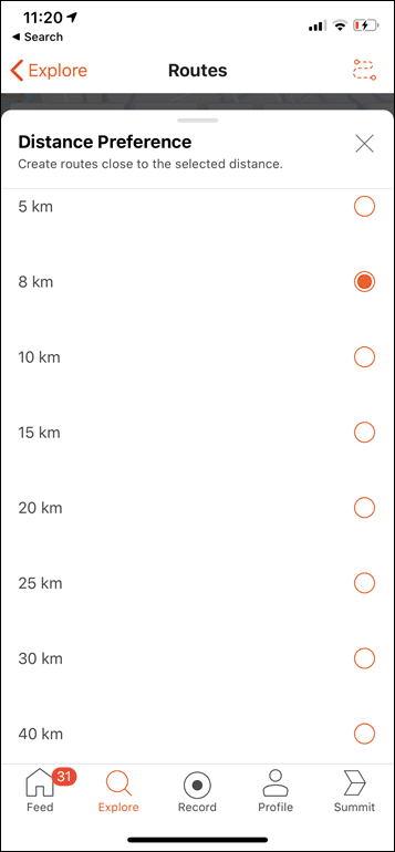
For those in metric, here’s the run/ride screenshots. For running, there’s also 2KM & 50KM option that didn’t fit in the screenshot:
Finally, in my case I’m going to leave the two elevation options at the default. I have no elevation around Amsterdam anyway, and realistically there’s even fewer off-road routes around here.
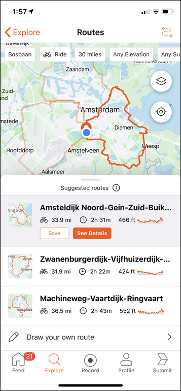
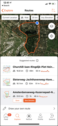
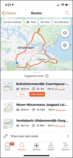
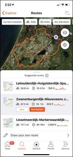
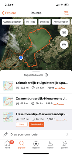
With that, it comes back with three choices. They aren’t precisely 30 miles. One is 33.9mi, one is 31.9mi, and one is 36mi.
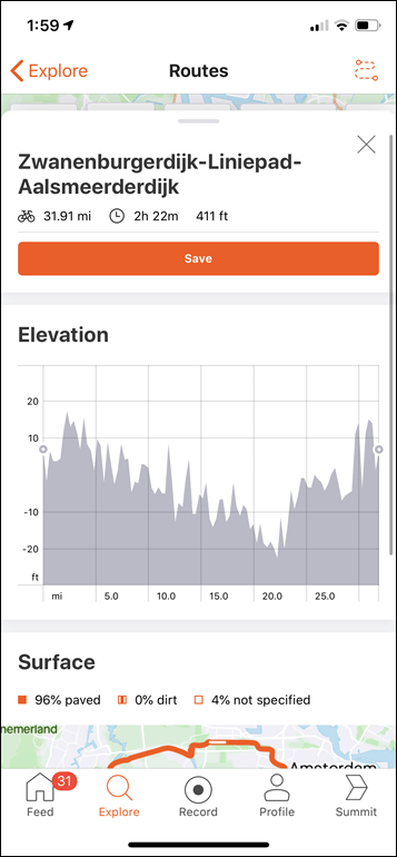
As you can see, they go off in various directions to form giant loops. We’ll discuss whether or not they suck a bit later. I can tap on one, then choose ‘See details’ to get more info about it:
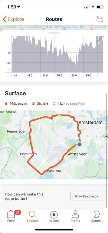
The above includes information like the exact surface type of the route as well as the elevation plot. It also has an estimate for how long it’ll take me (a metric I’d say is definitely not correct).
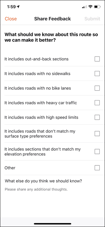
Interestingly, you can give feedback on the route too:
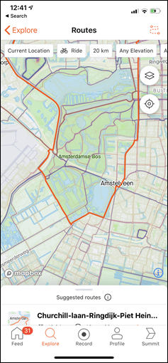
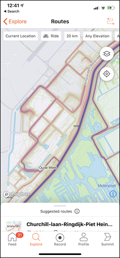
Also, before we go forward, you can toggle various map layers, including satellite and even the Strava heatmap, in case you want to take a closer look at what people are actually doing around you:
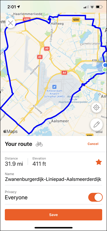
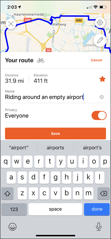
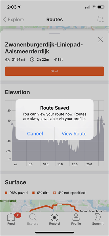
If you tap the Save button, it’ll show your route within the Strava route viewer, where you can give it a new name and save it for realz. Also, by default, it’ll be favorited. This means it’ll automatically sync to some 3rd party devices and platforms. For example, a Wahoo bike computer will automatically sync in new favorited routes.
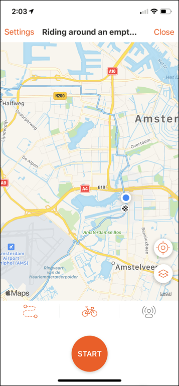
Finally, you can go ahead and execute the route from the Strava App if you want to:
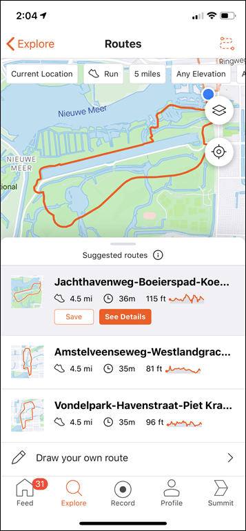
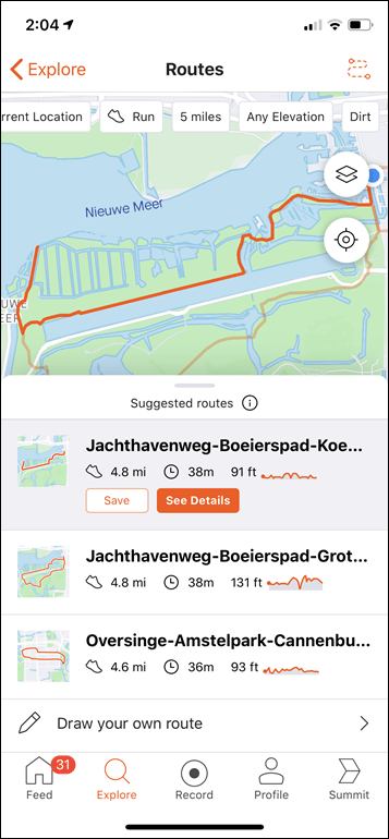
All of this is the same on running as well, for example, here I asked it for a 5-mile route, first of any type (left, below), and then unpaved (right, below):
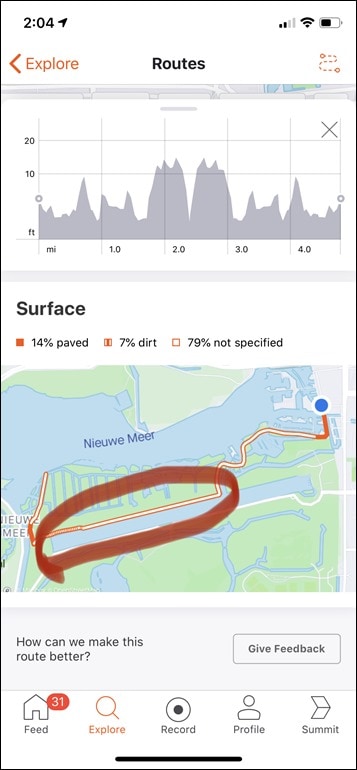
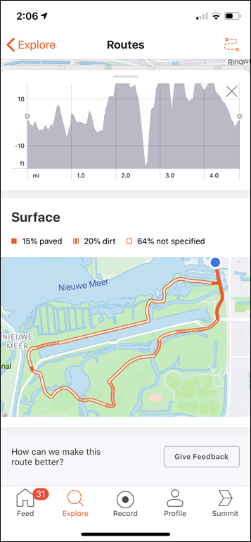
In the case of the unpaved route, it didn’t really know, but kinda lucked out. You can see if I open the route profile, it shows the white section as unspecified. The part I circled below is actually unpaved, whereas the remainder is paved. Still, it’s not a bad swag at things. And in fact, looking at another one of the options isn’t horrible either. Most of the route it gives me here is unpaved, even if it didn’t know that for certain.
Ok, so good stuff – silly easy to use. And, you’ll find you’ll get both slightly and significantly different routes if you adjust the starting points slightly. So it’s not always exactly the same.
Strava says that the routes are generated based on looking at everything from the routes where people ride, where they tend to start/end, elements they tend to include or divert towards, plus bits like road type and average speed on those sections. They say it’s not perfect, but they think it’s largely at the point of being valuable for folks today, even if some people aren’t allowed outdoors.
How it works:
Before we dive into whether or not I think the routing engine is worth it, I figured I’d talk about how it all works under the covers.
The first piece of this is actually figuring out what’s a road or path. This may sound like a silly or obvious thing, but it’s probably the biggest challenge. See, when people upload data to Strava, it doesn’t upload in a file that says “User rode bike down Main street, turned left onto Clanker Bike Path”. Rather, it just uploads a slew of data points, usually one GPS coordinate for each second. That’s it. No street names, no ‘turn left or right’ intentions, etc… Just GPS plots.
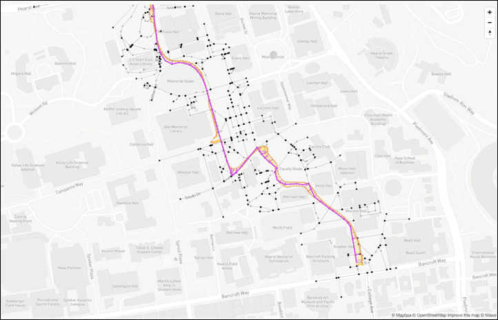
So Strava first has to figure out if the user was actually on a road, and to do that, they have to map all these data points to real-world maps. This is called ‘map matching’. Strava has roughly 3 billion activities (billion with a B) in its database from roughly 50 million people. They believe that covers about half of the world’s trails and roads. But all of that data has to be normalized to figuring out what’s real or not. What’s a GPS error versus someone on a different path. To do that they break it down to one block at a time. Where there isn’t a block marker, they then look at the next point two roads or trails intersect. Below shows that snapping process for a single section of road and how people move up/down that road, as well as onto other nearby roads.
The points you see above are what Strava calls ‘intersections’, and are basically where a block ends/begins, or a trail ends/begins. Between those intersections are what Strava calls ‘edges’, and this is what it allows you to route between. This is, of course, transparent to you, but under the covers what Strava is doing is setting up a constellation of these intersections and edge points, or effectively waypoints, that it routes you through. By snapping you to these edges, Strava can increase the confidence they aren’t routing you off on some random track that doesn’t exist in real-life.
The next piece of the puzzle is when you tell Strava where you want to start. When you do that, Strava goes off and looks for the nearest edge to begin you from. It’s like getting on a bus or a train – it needs you to get on at a station. Mind you, that doesn’t mean you need to start at a street corner. You can start anywhere on a known road/path (try it, you’ll see).
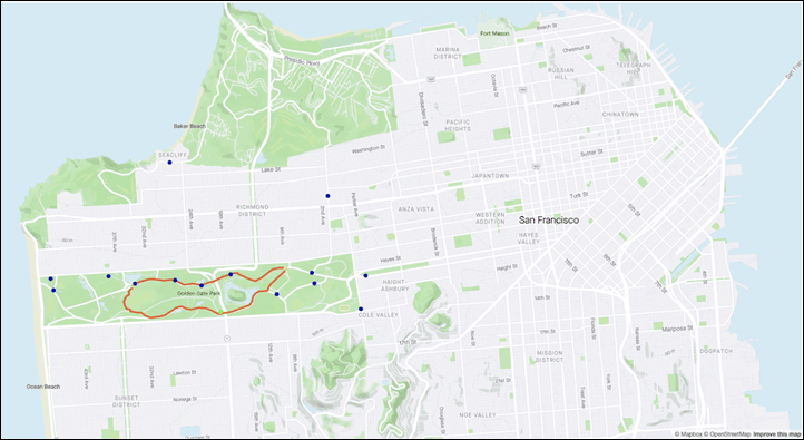
You can see below when someone zoomed in to try and create a route around Golden Gate Park, it is showing some of the waypoints that are common starting points within that realm. Strava is taking this a step further than just looking at roads, and saying ‘Where do people often start/end in this area?” – and then once they know that, they start to look at where those people go from that point (again, over thousands or hundreds of thousands of data sets).
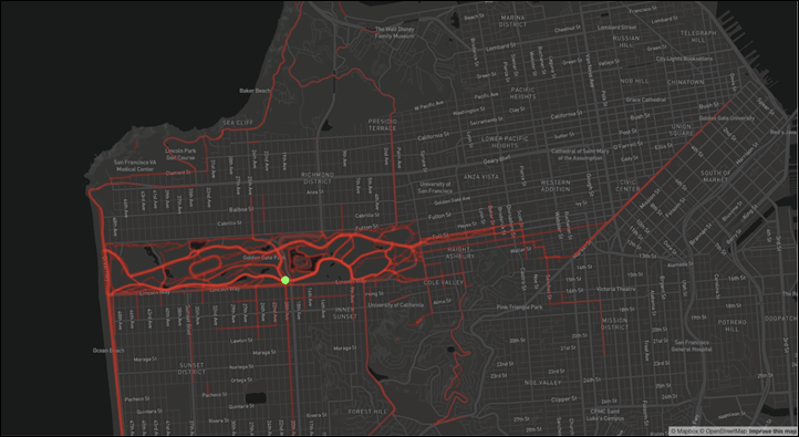
Next, they look at the heatmap. But not the entire Strava heatmap. Rather, the heatmap for that starting point. And that’s a super-specific thing. So what you see below is the green dot of the defined starting point (same as above actually). From that starting point, Strava then looks at the heatmap of where people tend to go. As you can see, logically, most people that start close to that waypoint tend to stay within the park. A few then wander out towards the coast and connect to other parks. But most stay within.
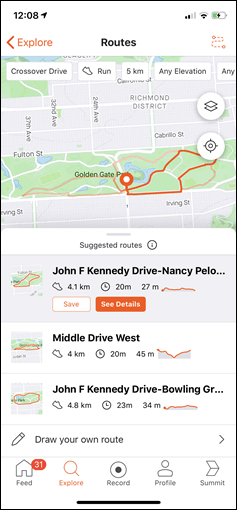
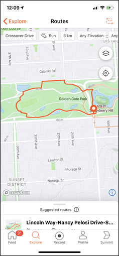
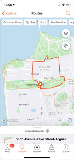
As such, that’s one of the factors that drives route creation. The above three screenshots were from Strava. But to demonstrate this, I then cracked open the app and selected the same starting point and told it to create 5KM & 10KM routes. As you can see, it seems to drive users onto some of those heatmaps. But not exclusively. But certainly, it’s a part of it:
Finally, remember that it’s not just popularity. Strava still has to then account for hills vs not, and surface type as well. So those selections would naturally override (to a degree) straight popularity routing.
Is it any good?
As one who, till recently, travelled quite a bit – I figured I’d put a handful of cities to the test that I know well from a riding/running standpoint. I figure I’d see whether Strava’s algorithm was worthwhile. The key thing I’d be looking at was whether or not these routes were something I’d want to actually ride or run, or whether my local knowledge would best it.
In the case of cycling specifically, I’d be looking heavily at whether or not Strava minimized the use of lower-speed but higher volume commuter paths. These could easily trick the algorithm into thinking they were good for workouts due to the high volume of people using them implying they were good bike routes, when in reality, they were less ideal for trying to get a good workout. How often would this actually occur? Let’s dig in.
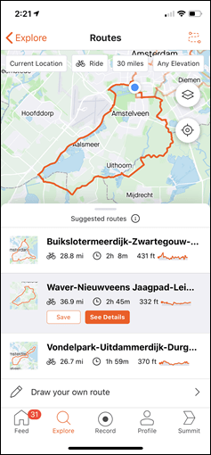
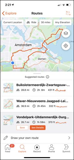
Let’s look at three 30-mile routes it’s giving me right now for cycling.
Route 1: First, looking at the 36.9mi Waver-Nieuwveens route. That’s a solid route. I’ve ridden elements of this frequently, though never exactly what this is proposing. Still, it’s a perfect route. In fact, I’d argue of all the routes that I’ve seen the app generate over the last week, this is as good as any local would give you:
Route 2: Next, is the Vondelpark route. This is one route that I too have also done some variations on. It’s not a bad route, and it definitely mixes it up. It properly uses Vondelpark as the bike superhighway it is, and then sorta takes you into the city (less ideal, but unavoidable once you exit Vondelpark) before edging out off the side towards the bay. Once you cross the bridge, it’s really nice. And the return is pretty nice too – super efficient. I’ve actually saved this ride, this is a keeper.
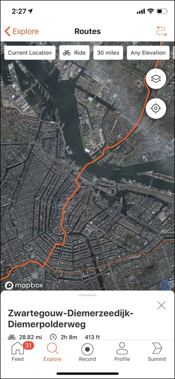
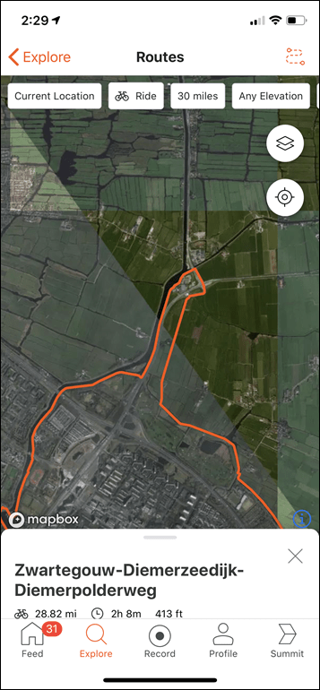
Route 3: Last is the Buikslotermeerdijk route. Err…nope. It’s not that it’s a bad route in terms of structuring. It’s just a pointless route. The initial part across the city sucks. It’s slow, normally packed with tourists blocking in bike lanes, and lots of stop and go. That said, I have used that exact route to exit the city across the water, via the ferry many times, just like this route does. However, anyone that does that is doing so to ride much further into the beautiful farmlands and bay routes that direction. Instead, this basically crosses the mess of a city, merely to draw a dick-pic and then turn-around again:
And the return, while well-meaning on some sections, is still mostly a mess for anyone training to maintain speed. Now, I’ll say it’s not a ‘bad route’ overall. If you’d never ridden a ride from Amsterdam before, you’d probably think it was pleasant (as some parts are). Maybe even fun in the city. But the time to cross the city (25-30 mins), only to then re-cross it (another 25-30 mins) means only a portion of your riding is good. Whereas the entire southern region from where I’m located is fantastic. Now again, if I had asked to do a 60-mile ride, and it came back with those same intro/outro areas – awesome, totally acceptable.
And in fact, I just tried that, and on the last one, it uses those same in/out routes. And it creates a route that’s highly rated by any local (as are the other two routes it created). I’ve ridden those roads as part of various routes, they’re great.
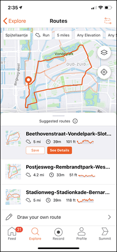
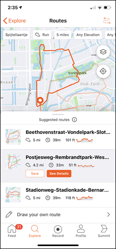
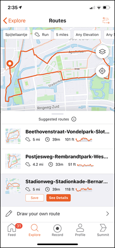
So, what about running? Sure, I just placed a different dot closer to home, and tried to give that a whirl for a 5-mile route:
The short version of this recap is that 2 of 3 are great routes that I and any local would give you the same variant of. Well done. The 3rd route (Stadionweg one) is a bit of a cumbersome mess that would be hard to follow if you didn’t know the area, and isn’t anything special. Nothing wrong with it in terms of a route per se, but not one I’d try and recommend to someone travelling to the area.
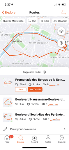
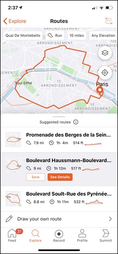
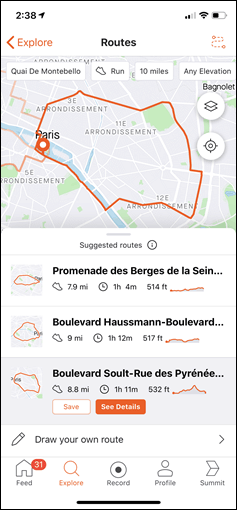
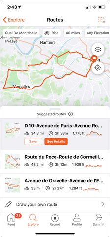
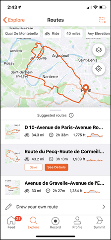
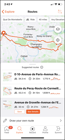
Let’s change it up again: How ‘bout a quick look at a route in Paris? I put in my old address there to see what it would come up with for a 10-mile run:
Ick.
There are elements of those routes that I’d run, but nobody would willingly say that was ‘an awesome route’. I’d never take any out of towner on those routes. Again, a small fraction of those routes are great pieces, but even a local wouldn’t set out to run those routes unless times were really desperate. It’s just waaaay to much stop and go. Especially given I started it across the street from Notre Dame, which puts you virtually atop the biggest running highways of Paris along the Seine in both directions for dozens of kilometers.
And in case you’re wondering, cycling is mixed. When I tried 60-mile routes, I got good stuff. But bringing it down to 40-mile routes and it’s messy. I’ve done variants of all these routes, and what it came up with is so-so. For example, the D-10 route is mostly OK. And the Avenue de Gravelle route is perhaps 75% OK (some parts are just slow through neighborhoods that I’d skip). And the Route de Pecq is just excessively in the city on main non-ideal routes.
I could literally do this all day long, judging routes around the world from the countless cities I’ve run or rode in. But, I think you get the idea.
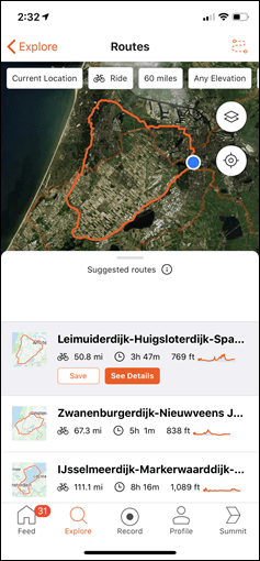
It’d say on the whole, the majority of the routes are good – especially longer routes. The more rope you give it, the better the routes get. It’s the shorter routes from city starting points that seem to struggle a bit in spreading their wings. It’s almost like sometimes it really wants to show you a creative route, rather than just giving you a beautiful out and back.
Oh, it does however sometimes give you out and backs, or Y’s, or others. See below.
One of those routes is good, the other is a hot mess.
Wrap-Up:
I’m actually impressed. I had relatively low expectations for such a feature, mostly because it feels like every time we see companies try and do automated route generation, it either ends up being too stiff or too focused on data driven by commuters – which aren’t really ideal for workouts (where sustained speed and non-stops are of higher importance). In the vast majority of scenarios I throw at the new routing function, it handles that balance fairly well.
It’s not perfect though, especially for shorter routes, and especially closer to cities for cycling where it has to ‘get out first’. In those cases it seems to try to err on the side of giving you creativity over optimal functionality. It’s sorta like when I would do a creative new route in a city, and my coach would come back with a comment post-workout of ‘That looked like a nice scenic run, but missed the point of the target zones due to the stop and go nature’. Of course, sometimes a scenic run is the goal – and so the flip side of this is that Strava may nail those aspects.
Still, the more distance you give the feature, the better it gets. Virtually all of the longer cycling routes I give the app are superb for the areas I’ve tried, and many of the running ones too. I’ve been favoriting all sorts of great routes the last few days that I hope to get to try sometime this spring or summer. Routes that I wouldn’t have thought to do, but clearly look awesome. And the same is even true of some of the running routes it’s spit out, for areas that I’ve poked at a bit, but never really stitched together into some sweet looking trail or otherwise quiet runs.
With that – thanks for reading.
FOUND THIS POST USEFUL? SUPPORT THE SITE!
Hopefully, you found this post useful. The website is really a labor of love, so please consider becoming a DC RAINMAKER Supporter. This gets you an ad-free experience, and access to our (mostly) bi-monthly behind-the-scenes video series of “Shed Talkin’”.
Support DCRainMaker - Shop on Amazon
Otherwise, perhaps consider using the below link if shopping on Amazon. As an Amazon Associate, I earn from qualifying purchases. It doesn’t cost you anything extra, but your purchases help support this website a lot. It could simply be buying toilet paper, or this pizza oven we use and love.



Cool – good to see some more features coming out of Strava. I guess the next question, how does this compare against similar functionality provided by the likes of Garmin?
What I would like to see both companies do is to allow you to run/ride point to point but be able to choose the distance to be covered? ie it’s about 4k to my work from my house, while I’m in lockdown at present, being able to do autoroute a cool 8k run to work, for example, via the app would be great.
It depends a little bit on whether you’re talking on Garmin’s Smartphone app, or on their Edge or wearable devices. For either, there’s a couple of key differences:
A) In Garmin’s case, you have to specify a direction of travel (West/East/South/North).
B) On Garmin’s devices (not apps), you get three results back – but, it takes approximately forever (like, minutes usually)
C) On Garmin Connect Mobile (app), you get a single result back after entering in your parameters. So not three results back like on device or Strava (which is too bad, because the app is so much faster).
D) You can’t specify elevation on Garmin’s app
In general, I did some testing of the two side by side from the same points. For mid-range running routes (like 10KM routes), the two were relatively similiar in what they picked out. For longer cycling routes, the two were much more varied. I found Garmin ran me into odd dead-end short out and backs a few times, though, so does Strava.
For longer cycling routes around here (Amsterdam), Garmin is very clearly locking onto commuter routes moreso than road-cyclist type routes. So that’s great for touring, but less ideal for sport. As such, I wouldn’t likely use the round-trip routing feature on GCM as much.
But, still might be a fun bake-off type post, especially if things change and I’m required to stay put within the home for a while…
So Strava used to have “explore activities” but removed it because of secret government facilities and now there bringing it back and charging for it. Fortunately when they tolk it away I learned to find routes without it so now I really dont need it.
I hope this is “smart” enough to recognize aberrations, vs. just counting segments from their heatmap.
For example, RAGBRAI crawls across the state of Iowa over seven days every July (well, not this year) mostly across rural paved farm-to-table roads, but sometimes they need to get an entire lane of a highway closed to car/truck traffic, which might not be part of an appropriate route any other day. (If you look at the heatmap for the state, the routes for the two past years are obvious.)
Strava response to a similar concern via Twitter:
“We actually omit activity counts that come from large single-day events, like marathons or Gran Fondos, to avoid this problem. It’s not perfect though! We released Routes early, for anyone who’s able to enjoy it, so we can learn from people’s feedback and make it better.”
?
“kilometers our metric”! Don’t forget us Yanks, imperial as in army.
Was interested to try but stopped at $59.99 per year for Routes feature( yes, there is 1 month trial ) . Doesn’t look reasonable especially since this feature is based on our routes and segments we logged into Strava.
Free and easy alternative ( almost like ask local :) )
– explore -> find interested segment
– check this year top for this segment and see how people are getting there
– use Google Maps to find how to get to the route from your current location
Hello,
Did they improve the navigation after that ? Because it wasn’t a turn-by-turn like it is on Garmin, for example. If Strava continue to show the map, and let’s us decide whether or not we have to turn left “right now”, it’s not very useful.
Depends what device you’re using. If you have a Wahoo Elemnt Roam (not Bolt or original Elemnt), then you get TBT navigation, if you have a Garmin Edge or recent Forerunner/Fenix (there’s a ConnectIQ app called Strava Routes, but it will depend which Garmin you have what it would look like, with mapping and/or with TBT navigation).
If you’re just using Strava on a smartphone to track your run/ride, that’s just going to show a breadcrumb trail on a map. But let’s assume that most visitors of this website have a head unit or running watch.
I bought a new Wahoo Elemnt Roam so i could use this feature but it only gave me a breadcrumb path, it didn’t tell me turn by turn. How do I activate it?
I am having exactly the same issue – bought an Elemnt Roam for TBT but I just get breadcrumb path.
It might just be me (or others may have posted this before, sorry in that case, please feel free to delete the comment) but I am experiencing issues in viewing pictures on the site for a couple of days in Chrome. In IE and firefox, the site even looks like from 1993, just text and blue underlined links. It does not happen with other websites and the browsers are up to date, e.g. build 80.0.3987.149 for Chrome, so that I do not see an obvious reason on my side.
Try resetting Chrome:
Put this in your browser
chrome://settings/reset
there is then an option to reset your chrome browser
Is this all available on the Strava Website and when will we see Strava for iPad?
The Online Route Builder is still Beta. link to strava.com And i dont’t find the new Feature online.
Is this on the app only? I’m sure many Strava users who create routes there won’t use the app and will just export the route created on the website to their Garmin/Wahoo unit.
What’s stopping you syncing it to your Garmin/wahoo?
I would have to actually go and install the app. If you have no use for the app otherwise it seems like an unnecessary step to create the route on the app, go to the website to download the route when you just ideally would do it all in one place.
Great article as always. Chuffed to see this feature and it could well persuade me to take summit again.
Oh and how long have you been waiting to get the phrase “dick pic” into an article…made me chuckle
Interesting.
Played around with it a little bit here in Stockholm, Sweden and for some reason 75% of the routes it returns ends up going north of the city regardless of distance or surface parameters. This with a starting point south of the city center, meaning that you always end up going through the city even though there are plenty of open roads to the south with just as much (if not more) heatmap activity.
I wonder if somehow Strava haven’t managed to filter out commutes from their data despite all the recent commute related Challenges?
Is there turn by turn directions when using apple watch app?
$59.99 yeahhh no thx
Just had quick look on my local roads. I’d say it does a good job.
Though the choice of route lengths is odd. Why can’t I choose a 100km route? 80km I can choose, the next one is 120km – takes me from a “too-short” Sunday morning ride to one that is too-long.
Although, if I were imperial, I could choose 60miles (as Ray shows above). Odd.
Still – after a quick look I am impressed. Good job Strava!
(Hopefully once you save a route, it will sync to my Wahoo – haven’t checked that yet)
Hey Ray, thanks for your work. I really miss anything about segments on that routes. Neither to see which segments you will come along nor you can select segments to be connected on that route. Maybe you can give Strava feedback on that. Cheers, Tom
“You can select a distance in either kilometers or metric. There’s a few options here from 1mi to 100mi” — I think you meant to say “kilometres or miles”
In a word – Meh. I’m located in Rural New Jersey. Awesome riding on hundreds of miles of quiet back roads right out my door. Tried several distance options. Routes presented used long sections of busy (for around here) roads when there are much better routes that get you to the same place. The local cyclists tend to avoid these stretches, though I see many runners on these roads. I wonder if Strava is in distinguishing cycling vs running in its data set when planning a route?
That said, I have used Garmins route planner for unfamiliar areas and have found it acceptable while understanding it might not be the best route but it does serve useful purpose. I’ll try Strava’s next opportunity (whenever that will happen again).
Had a quick play and the annoying thing for me it that even the paved surface option includes footpaths / cycle paths. Around where I live these aren’t something you want to be riding on with a nice road bike unless you like repair bills. They are also not the most sensible routes to use in most cases either.
Would be nice if you could select a specific road section. When plotting routes on ridewithgps I tend to have to use “driving” option to get it to ignore the cycle paths.
So is the finger dragging route builder they (allegedly) borrowed from FootPath (link to dcrainmaker.com) still around?
Sounds like this could be something that could work together nicely, you give a vague indication which area you want to ride/run in and Strava can create a route in those boundaries.
My Summit ended 1 month ago, so can’t try it :). This sounds worthwhile, not on its own but it’s a step in the right direction.
What would also need to change is the feature differences between website and app. As a free user i can build apps on the website, not on the app. On the other hand, as a Summit user you can only build manual routes on the website as well, so no value over the free tier (this is of course still a work in progress but some other features have taken years to move from web to app or the other way around). However, as I use a Wahoo Elemnt Bolt, I’d be required to export a GPX file, import it in a service that includes TBT in the route (like Komoot) and use that route on my Bolt. If the app can export GPX files (mainly talking Android here), I can upload it to Komoot from my Android phone. It would be really cumbersome to have to create the route on the Strava mobile app, download it from the Strava website on my pc, upload it to Komoot (on pc or phone) and then wait for a bit for my Wahoo to fetch it. I know my Bolt’s implementation of TBT is the cause of this, but I’m not getting a new bike computer for just that.
It needs a “public roads only” switch. There’s a back way into my neighborhood that’s basically a farmer’s gravel driveway with an extension he uses to get to his fields which reaches one of the paved streets. I’ve never actually done the entire thing, although I walk the dog on parts of it frequently. The route builder shows an inordinate fondness for it. I’m not sure how the farmer would feel about it.
Would be interesting if you toggled the heatmaps option for it, how it looks…
Nothing on that particular “road” at all, although the < 1 year old new streets missing from the base map show up nicely, and the "ride the grass across the park to the other back way (the one with the "No Trespassing" sign)" also shows up.
It sounds like that road is not correctly registered in Strava’s map data. Fixing it in OpenStreetMap should (eventually) make it into Strava’s system. I don’t know how often they update their map/routing data though.
Yes, I should take a look at OSM. The point is it’s not a road, so Strava shouldn’t be using it to route, but it’s useful to know it’s there just in case anyone in the neighborhood needs a (much) shorter way back home. Maybe it can be marked “private” or something. (Ideally the township would just acquire the right-of-way and make it public, but that hasn’t happened yet.)
> I don’t know how often they update their map/routing data though.
They completely stopped handling map updates about two years ago. At least, that’s the case for the website maps. The app maps suddenly started to use updated data last fall. I don’t know what data they use for routing.
Quite some routes pass by my house as I live in Amsterdam IJburg. They look really good and I picked up on some ideas for new routes!
I only don’t like the ones that go through Amsterdam downtown.
Building Routes for Cyclist will never be easy or so good as for cars. Because to less Information about the quality of the way in Openstreetmap. Also no/less Information about Way-Quality in the GPS-Files (headmap).
For Example, here is a way much people go with the Road Bike where you have 100m Gravel. In the Headmap the way looks good and much used. But in reality you will go this way only if you had no rain in the last days.
Thats a Problem all Cycle-Way Builder (Strava, Garmin, Komoot, …) have.
I just gave it a quick test to see if it would also come up with rides I actually do around here and found a pretty significant limitation (at least until they get some feedback to address it). I live somewhere with lots of mountain biking and lots of road riding – and it has no way of telling the difference so it combines them in bizarre ways. For instance – for a 40 mile “any” surface loop it routes out to a mountain bike trail everybody rides all the time via the roads they would take to get there, but after 10 miles it pops out onto a paved road for the next 25 miles on a route lots of people ride as well on a road bike, but nobody would ever ride those two portions together. The singletrack is just too technical to be any fun (or even rideable for average riders) on a gravel bike, and then you would be abandoning lots of trail options to ride your MTB on the road. I’d imagine they will try to get around this with clever big data/feedback techniques as usual – but sometimes old tricks are the best tricks and I wish Strava would just add a way to designate “MTB” vs “Road” on activities. That would also make it a hell of a lot easier to look for places to ride mountain bikes in unfamiliar places while traveling.
Took a look at my local home neighborhood – it definitely needs an ‘avoid cars’ metric – i.e. some of the routes are good, and similar to ones I’d take (in fact, maybe my data is driving the routes), on other routes – it takes me into heavy sidewalk/car traffic areas. While this might work for some people, it doesn’t work for me – i’d prefer to avoid other people and cars (even not in the covid era).
Like another person suggested, it needs to have some other local knowledge. As an example, my local high school track has a lot of runners on the weekend and on weeknights, but strava probably doesn’t know it’s closed to non-students from 8-4:30 on weekdays.
Finally, what would also be nice – a route extender. Instead of me selecting a pre-arranged route. How about letting me choose a route I’ve run and allow me to extend it by a mile or two (i.e. take my most common 3-mile run and make it a five-miler)
It’s very good in my view, got it to plot about 15 different routes of varying lengths, getting out of town isn’t so good which I get, but once I hit the outskirts it is excellent, I like the fact it mixes the roads up and takes turns/directions I wouldn’t normally do, Strava gets top marks from me.
You know that you can run/bike ride/go outside during this “lockdown” correct? I think it’s imperative to communicate that no, you don’t have to stay inside your house. Run and bike ride so long as you keep your social distance.
Except this isn’t true. Recreational cycling has been banned in quite a few places.
Yeah, in the US with multiple levels of government it depends greatly on where you are. (Here in central PA we don’t have a lockdown, while I believe the City of Philadelphia has one). The BS reason I’ve seen to rationalize banning cycling is that “if you get in an accident you’re taking a hospital bed away from a Wuhan virus patient”. What they don’t seem to realize is that that applies with much greater force to motorists, who maim, kill, and get injured in far greater numbers than cyclists do.
Ray, are you aware of any plans to overhaul the desktop route builder with a paved vs dirt view? Now that they have a strategy for differentiating between the two it seems like a relatively easy feature add.
Garbage. The first run suggestion took me up a slip road and down a main trunk rd with two lanes of 70mph traffic and no footpath. There aren’t even any Strava segments down there!
Hi Ray. I live in the Madison Wisconsin area, on the far west side. There are some awesome, hilly and winding country roads that I ride on here. I played around with this for a while, trying all the various distance options. I also selected Paved, and hilly, because it nearly impossible to find routes with flat roads.
However, most (probably 70%) of the routes it mapped went to the East through the city. There are some nice bike paths in the city. However, the road riding to the west is so good, I’d never go East.
I agree with some of the others that an option to stay on roads would be good.
I tested last night and discovered a new run loop. The options are a little clumsy yet and determining which way to navigate (clockwise/counterclockwise) was not intuitive, but the end result of a new run course was completely worth the effort to experiment. I needed to evaluate three courses before finding one that had safe areas to run and sidewalks throughout the run. Strava also asks for feedback on courses that do not work, so I hope they are able to incorporate those data points into fresh versions. In my case, for courses rejected, I noted no sidewalks, heavy traffic, and no bike lanes.
Overall, I really like the new feature and will be looking forward to experimenting with new courses!
Doesn’t work for me. Keeps telling me I need a Summit membership, which
I have…
Good old Strava.
Same for me on Android.
I suspect it is because I’m only paying for the analysis pack but have the free 3 month Summit upgrade?
Same here. I just activated the summit-routes trial (30 days) and am unsuccesfull to access the new feature.
I found the easy fix: simply log out and log back in to the app.
Got it to work by selecting “Restore Purchases” under the profile settings.
I discovered some new running routes to try in my neighborhood, but when I run the Strava Routes IQ app on my Garmin 935, I continually get “Trouble Connecting to the Server, Error Code 2050.” Anyone else seeing this?
I’ve had all sorts of errors. Happens every tenth time or something. Right now I’m in my living room, with the same problem – the 2050 error. I should’ve been on my ride an hour ago.
Is the app only? I can’t find it on the web version. I am a summit member
Seems to be app only right now. Once you save a route on the app, though (and you have to tell it to save twice), then it shows up in your Routes on the web and you can edit it there.
The web route planner isn’t exactly the same, but it’s pretty nice. Allows for a lot more customized route planning. link to strava.com
I still get the old “BETA” route builder through that link. Annoying! Guess they’re doing a gradual rollout.
I absolutely love this feature. It’s fantastic and, moreover, it’s arguably the perfect killer app for Strava. Through their years of data, they “know” which roads are good for riding bikes, full stop.
However, in playing with it, there is one aspect that I don’t totally love:
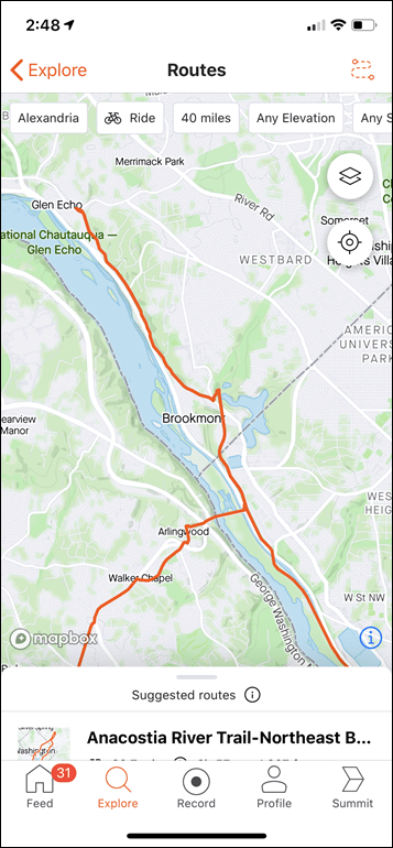
There are a few pretty prominent trails around where I live (MD suburbs of DC) including Rock Creek Trail, Capital Crescent Trail, and the W+OD rail trail. I find that very often the Strava routeplanning app tends to “snap” onto these.
This is, unfortunately, less than ideal because (1) some of these are not great for road bike tires due to cracks/roots, (2) they’re crowded with ladies walking 2 or 3 abreast, pushing strollers, and totally oblivious to “on your left”
This Strava feature would be perfect – PERFECT – if they could somehow exclude trails completely (not just gravel surface) and only follow car-legal roads.
I wonder if that’s something they can bring into their dataset. Otherwise they could potentially just filter out anything with “trail” but that feels like a blunt instrument.
Amazing, needed, potentially killer tool but with that one extra feature it would be utopian.
Yeah, it really needs a personalized way of permanently marking roads/trails “I definitely won’t ride here, don’t use it, I don’t care what the heat map says”.
Hi Ray,
After reading the article I took a look at this feature of Summit and can’t help but thinking they’ve missed a trick. It’d be good to be able to sit the route they’ve created if there’s a particular bit you’d like to avoid.
The other thing that I find frustrating about their routes is that if you’re using the self-draw routes it uses Apple maps by default instead of Mapbox. Where I live in the North of Scotland the detail of Apple’s maps for paths and trails is a good bit short of Mapbox, so route creation is way more limited.
Nice one, but developers shall add the option to remove some of the roads. Just tried to get some ideas and it always uses on the end the major road next to my block where heavy trucks are driving so you don’t see anyone running there, maybe some idiot with bike :)
For me, I would really like to see a “shoulder width” filter. This would make the tool so much more useful.
I don’t think that data exists in any database.
Here in Colorado we have this data in a statewide map (link to dtdapps.coloradodot.info), but I checked OSM and you’re correct, most roads there don’t have shoulder tags or widths. Bummer. Seems like the number 1 most important way to plan a safe and fun ride.
I tested this out earlier and it looked…. promising.
While some of the routes it showed looked to be great and I haven’t usually gone it keeps telling me to go through one specific road which is actually a tunnel with minimal walking space on the sides. If there was a feature that would allow you to reroute/ignore a specific road i think it’d be better.
While I really like this feature (still need to test it), I don’t get the pavement thing… I select “Paved” as I want to ride on my normal road bike and Strava sends me on a downhill track… at least it says “Unpaved”…
Hi Ray,
great to see all is ok with you in the Netherlands.
I’ve tried this in Brussels, I live next to a park with a 2.2km perimeter, which is full of runners (Parc of 50aire in case you’ve been to Brussels). If I choose the 2km distance, it takes does some weird internal track in the park. I guess 2km means max 2km, but expanding to 2.2 probably it wouldn’t be so bad.
I also tried the bike routes, and many of them go through the city. Normally people starting on the east side of the city, do not cross the city centre to ride on the other side. I understand they probably use the heatmap to plot the most used routes, but maybe they should filter out the segments used in commuting trips. In Brussels probably many people go through the city to go to work by bike, but it doesn’t mean that those segments are appropriate for leisure bike rides.
Also, I noticed that every time I open the route planner, I get different routes. So maybe it would be nice to have a “refresh” button or “more” button, to generate an additional 3 routes every time, without opening and closing the app again.
Just played around with this. Neat feature. However I immediately noticed one of the routes in my area is one that’s known by locals to be an unsafe route due to lack of shoulder and fast drivers and also no bike lane. It would be cool if the map had a bike lane overlay or something. Or if route selection had a feature to prioritize routes with bike lanes. Otherwise, it’s cool
buying a garmin head unit like 530/830/1030 or not is the question ? or wahoo…..? or iphone bike mount ?
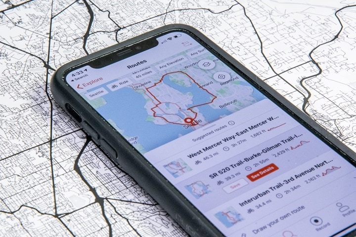
I am more interested in the heatmap style art in the background in black and white. Does anyone know how this was generated? I’d love to have some wall art like this from my own data.
Used today. Looked like great routes but when transferred to Garmin watch, there were no turn by turn directions and no climbs identified for climb pro. Is this a known deficiency for all Strava routes?
Used Fenix 6. No issues like this when using Garmin connect to build routes.
I’ve constructed a route using it on my iPhone, slightly edited it on Strava’s web site, and then moved it to my Edge 830 using the Strava Routes IQ app. I haven’t ridden it yet, but the preview and the summary all look correct, and three climbs are listed by ClimbPro. I’ve constructed many routes entirely on the web with Strava, and they all work properly with ClimbPro on the 830.
So far, even during the Event, Ive managed to use the route planner in Chamonix and Peak District, England. Attached is a very closed section in the Peak District that I dont think a bike of any form has been down recently.
The route in Chamonix for an 80km ride went up the Vertical Km route under the Plan Praz lift. Wager a bike has never made it up that. The remaining 80% of the route suggested would challenge a good Enduro mtb rider.
While the Strava route planner had some good ideas, by no means can you plug a 100km route into your Garmin and go.
Love the idea and hope it develops into a good feature, but it’s dangerously bad in its current form, at least in my location.
I requested a 10 mile run on paved surfaces and was routed onto a notoriously unsafe (for cyclists) 60mph road with heavy traffic, numerous blind crests and no footpath or lighting. Every local runner and cyclist I know avoids this road wherever possible, so I’m baffled that their popularity routing would suggest it.
Teething problems might be inevitable, but it feels a bit HAL 9000 right now.
I found the fix: simply log out and log back in to the app.
This is very similar to https://trailrouter.com, which I developed and released late last year for runners. I have a suspiciously large number of hits from Strava IP addresses in my web server logs in the past couple of months (hello 12.131.20.242 !).
Anyway congrats to the Strava team on getting this feature out there, the UI is very nice! The routing algorithm could definitely use some work though. For example, here in London it suggests running routes that go through the Blackwall Tunnel, which is illegal for pedestrians or cyclists to use. It also seems to stick to the main roads, which I guess makes sense if they’re using the heatmap data as they’ll be biased by commuters.
Interesting!
Gives some interesting results and it isn’t afraid to give you “out and back” sections that traverse the same path in opposite directions. Strava seems to strongly prefer “loopy” routes, which can reduce it’s options.
Ray, or someone out there – can you tell me how i save a strava route and then upload to my wahoo elemnt ? thanks!
You just save it to my routes or on the app itself their route finder and it automatically uploads to your computer
I’m having the same problem. When I create a route on the App it doesn’t show on the desktop version and wahoo can’t find any of the auto generated routes. I can only see that route in the App. Also I noticed that whenever I save a Auto bike route, there is a running icon that depictis it as a running route instead of a bike route. No matter what it always saves as a running route.
Is it just me or have these changes also removed the ability to look at a segment time and see how you compare with those following you? This is one of my main reasons to check progress with friends and followers on local segments and Zwift etc!
Indeed, it’s a bug in that release. It’ll be back for the next update (Strava posted somewhere on Twitter about it).
Cool, thanks for the response. I was suspicious it had become a premium feature!
Hello. Good review.
Has matched runs become a subs only feature now? Also, is matched rides now a thing?
Thanks
I’m in Southwestern Ontario Canada. I found this feature to be useful, but it was kinda like playing a slot machine. It would come up with one ok route, but the other two would venture through a busy areas or on a major highway or where a local person would not normally ride a bike. After trying a few times, one out of the 3 routes would come out decent. I played with it for about 10 minutes and save maybe 3 routes to try. My suggestion is if Strava could incorporate a dedicated icon to the page that you could click to find more routes. That way you wouldn’t have to back out and go back into the section in order to refresh the routes.
Hi there,
Looking forward to start testing this new feature.
Any idea where I can find a Map Key for the Strava Maps?
Rgds,
Harre
I really wish there was a way to pick a starting point and ending point and have it give you several different length / elevation options for rides. I’ve started commuting a lot and on the way home sometime I have another 15-30 minutes I could spend riding, would be nice to have a couple of saved routes ready to go that I didn’t have to make myself…
Luke – Shameless self-plug, but this is something link to trailrouter.com does. You can pick a start and end point and then give it a distance, and it will extend the route to that distance. It is designed for runners, but the routes should be largely suitable for bikes too. Worst case, just turn off “Prefer green areas” in the settings and it will stick to roads.
I know it’s been mentioned briefly in other comments, but for me the main thing that’s lacking is TBT navigation. I want to be able to sit on my laptop or tablet, plan a route and then upload it to my phone to assist with navigation.
Like others, most of the routes I cycle are in areas I know, but I’m also planning a cycle tour of the U.S. and want to plan my route each day. I won’t know any of the roads and a TBT function will be invaluable in getting around. I love Strava for everything else, but this feature is sadly lacking and I’m really surprised by that.
Nice Video’s!!
I have een Elemnt Roam and i would like to import Strava Routes including the Cue sheets (zeg maar routeaanwijzingen voor onderweg). I can import shem, but it wont include the Cua sheets, is there enyone who can help me?
Good option, if you’re looking to commit suicide :D
almost all proposed routes take me straight through some busy city centre, or follow busy primary roads that are most often used by commuters.
The new(ish) map overlay, combined with the blue heatmap, makes it very hard to distinguish between busy roads and quiet roads. Definitely not an improvement (and I gave it a (long) shot before complaining ;) ).
Anyone that can propose a proper alternative? I like the have the original OSM layout, as well as the option to use street view (for which popularity routing, despite Strava’s claim, is absolutely no alternative).
Nice feature in the mobile app, would be great if it also was available in the web version of the app.
Instead of generating routes, you could also try to use route created by other Strava users on Strava. If Strava would let you search for routes created by others…. Which is does not. That’s why I created https://find-routes.com, a place where Strava users can easily share their routes and others can search them and discover new beautiful and/or challenging routes. The service just launched and the collection of routes is growing (share yours via link to find-routes.com) and I’m adding new features every few days. Goal is to make this a service for the Strava community to share and find new routes.
I do now there is Strava local, but that only lists a routes around a limited number of cities. With Find-routes we aim to cover all areas of the world, also in rural areas.
does anyone know if you can disable synching of starred routes & segments to a device but allow it on another? I use an Edge 530 for cycling and all the new route / segments stuff is great.
However my forerunner 935 is not happy. Constant freezes, bluetooth timeouts. I’ve just reset it for the 34rd time and leaving bluetooth disabled. But even using Wifi caused a 10 minute freeze after the sync.
Any advice appreciated.
I created a route, hit start and started my run…I was hoping Strava would give me turn by turn directions in my ear, or at least tell me when I hit my first mile (it does this when I do not create a route and just run). Am I missing something? Are turn by turn directions an option?
This is only by subscription now right?
That’s a good question. As I have a subscription,I had to look for myself to find out.
This is what I found:
Strava subscribers can get personalized route suggestions in the app, or use the web to plan rides and runs with a whole new suite of easy-to-use features.
I hope that helps you out.
?
yes thank you. the answer helps, unfortunately strava doesn’t.
Routes is pronounced ‘roots’ but spelt routes. Americans are so thick. But they do shoot guns real good, ;)
Is this still only available on the mobile app? I cannot find it on the website. You can create a manual route on the website, but I’d love to check out some suggested routes.
So Strava discontinued the “load 3 more” routes in one of its recent releases. Feature I loved to use. Bummer.