For those that have been around the DCR block long enough, you’ll know that I’m always looking for tracking solutions for my worldly activities. Especially ones that don’t depend on having a mobile phone nearby, and even more so for ones that don’t depend on cellular service at all. I’ve long since played with various satellite trackers, be it on remote islands in the Pacific Ocean, or in random spots in Africa or beyond. And about a decade ago I even wrote a review of one of the original Spot Tracker’s. Talk about a blast from the past!
And today’s In-Depth review is exactly in line with all that past goodness. The inReach Mini was just announced today and is one of the smallest satellite trackers out there. The key thing that a satellite tracker has over other trackers is that it doesn’t have any dependency on cellular service. This can function just fine in the middle of the ocean. As long as you can see the sky, it’ll work.
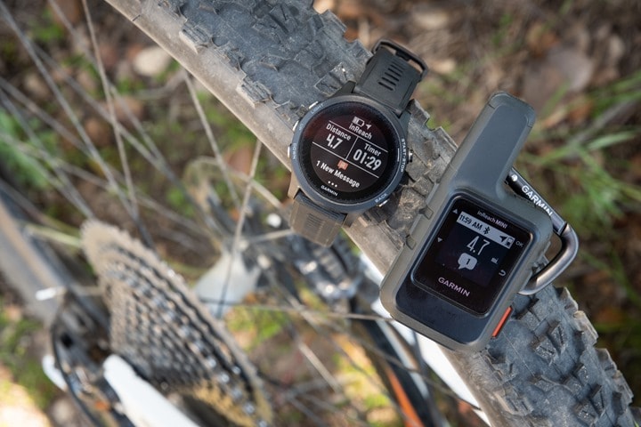
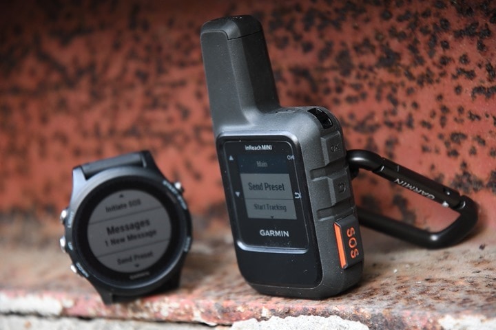
In the case of today’s announcement, the inReach Mini also gains connectivity to the Fenix 5 and Forerunner 935 watches, hopefully paving the way for other devices. While the unit was announced today, I’ve been using it now for a few weeks across two continents.
Before we dive into things though, note that I’ve got a media loaner of the inReach Mini to try out, after which I’ll send it back like normal. And in this case, it’s pretty likely I’ll go out and buy my own. If you found this review useful, feel free to hit up the links at the end of the post to help support the site.
The inReach Mini Review Overview:
Don’t have time to read the full in-depth review? No problem, I’ve got you covered in this bite-sized section. Pros, cons, and everything in between.
The last time I touched on inReach devices was some 17 months ago, with the original inReach unit – Garmin’s first rebranded DeLorme product line. The core appeal to the inReach series is satellite communications. Not just satellite GPS, but full on text messaging via satellites. Thus no dependency on cellular service. If your openwater swim goes horribly wrong and you find yourself 1,000 miles from land, it’ll work just fine.
But the appeal here isn’t misguided openwater swimmers, but rather folks heading well beyond dependable cellular service. Hiking, mountain biking, trail running, etc… The challenge is that for some of those people, the existing inReach devices were bulky and simply cumbersome. The inReach Mini aims to solve that problem. And even more interestingly, it now integrates with some Garmin wearables. So basically you can toss the inReach out of reach (backpack, rear cage on bike, etc…), and then get satellite notifications straight to the wrist.
But for simplicity’s sake in this brief overview section, here’s the core things it’ll do:
– Satellite messaging to friends/family/pizza delivery folks, even if not on service
– Sends GPS track/map of where you’ve been/are every 2 minutes
– Can overlay planned route as well for GPS tracking web link
– Has quick preset messages, as well as longer custom presets
– Can type out long satellite messages (very slowly) just like real text messages
– Has SOS button, which will ultimately result in government rescue services
– Has 50-hour battery life with sending updates via satellite every 10 minutes
– Has 20-day battery life with updates every 30 minutes
– Can be paired to Fenix 5 series and Forerunner 935 watches
– Basic waypoint navigation/saving using compass-style display
– Can use paired phone app (without cellular service) to send complex messages/details
Now the inReach technology actually came from DeLorme, which Garmin acquired a couple of years ago. That got them a few things. Primarily, it got Garmin access to the Iridium satellite network for communications. But it also got Garmin a billing and subscription platform. See, this device does require a subscription. I dive into the details a bit later on in the post, but it can be fairly reasonable, especially if you just use preset messages (and create a crapton of them). The cheapest plan is $12/month, and the most expensive is $100/month.
I’ve put together this overview video showing how it all works out in the real world, while mountain biking in California a few weeks ago. I also dive into the integration with the Garmin watches too.


However, the inReach Mini is twice the price of the Spot device ($349 vs $169), not to mention the battery life is substantially less than Spot’s Gen3 units, which are looking at weeks of battery life depending on the tracking rate you utilize. Also, the Spot unit can be configured with accelerometer based tracking, so basically if you’re moving it updates more frequently and if not moving it saves battery (such as at night while camping). Garmin has something similar, though different in implementation. In Garmin’s case it can retreat to a 4hr interval, though it checks every 10 minutes to see if the device has moved, and then will adjust accordingly if it has moved.
Now in the review I dig into some of the more nuanced items of the inReach, and in some way – the ‘biggest’ issue I have with it is just the split between the inReach world and the rest of the Garmin world. Being an acquired company, you can clearly see the split in web and app platforms. If you didn’t have another Garmin device, you’d probably never notice it. But if you come from the Fenix/Forerunner world, you’d notice different aspects like the fact that your ‘Routes’ aren’t kept in the same database/platform behind the scenes (two silos), or that if you load a route on your Fenix, it doesn’t translate into a route on the inReach Mini. You have to duplicate and do that separately. Minor hassles for big trips, but moderate annoyances for day to day training/usage. Again, Garmin’s their own enemy here in having too much stuff.
As you can see, there are definitely pros and cons to both devices. It depends mostly on how ‘interactive’ you want to be with your device. With Spot, its more ‘fire and forget’ (but longer battery life), whereas with Garmin, you’ve effectively got real-time messaging with friends/family/rescuers.
Ultimately though, it’s a super cool little device if you routinely go out of cellular range, or, if you just find that cellular phone based Live Track isn’t normally dependable enough to use day to day. I’d love to see inReach integration become ‘baseline’ across all of Garmin’s mid to high-end fitness/cycling devices, just like you see Varia Vision integration or their cycling lights. Further, with a unit like this, it’s almost perfect to split between friends. Sorta a pooled device that whichever buddy/person is headed out of range can use for the trip/weekend/etc. All of which is easily supported within the platform.
Overall, I’m looking forward to buying one here shortly to keep on hand for when I head into the backcountry, be it skiing or cycling, running or hiking. If nothing else, it’ll make The Girl happy. Happy wife, happy life.
Unboxing:
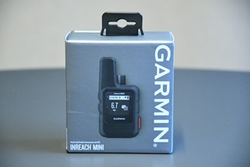
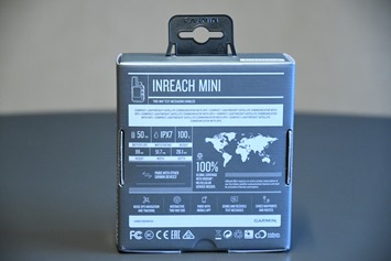
The inReach Mini comes in a small box about the size of a piece of corn broken in half and placed side by side. On the back of it you’ll find stats about the unit, and most notably the coverage area being 100% of the earth.
This 100% tidbit is notable because their primary competitor – Spot – doesn’t actually have full earth coverage. That’s because in Spot’s case they use land-based systems to increase coverage, which doesn’t work well in the oceans, or towards the polar caps. All of which is detailed on Spot’s coverage page. This is part of the reason why inReach has done so well with past (larger) devices.
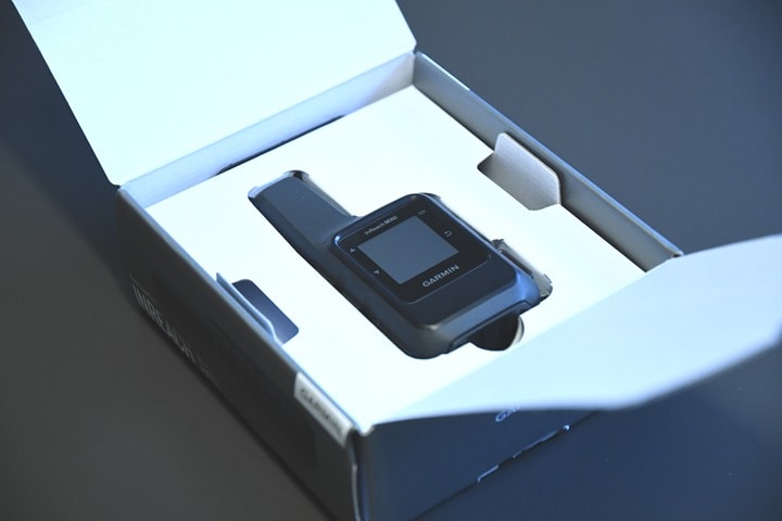
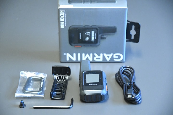
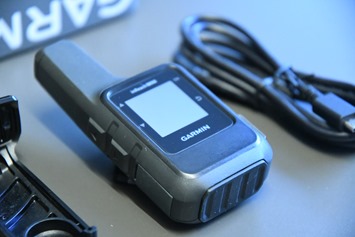
Inside you’ll find the unit staring up at you, and if you remove it and the remainder of the stuff from the box, this is what you’ve got:
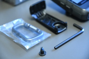
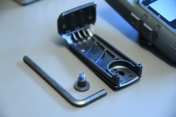
Starting with the accessory bits, this is a small clip that you can screw on, using the hex wrench and screw.
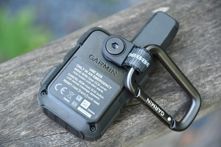
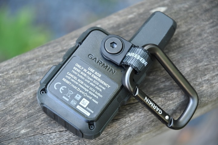
Alternatively, you can do as I’ve done and use the included carabineer and simply attach it to the small bit of rotatable strap on the back.
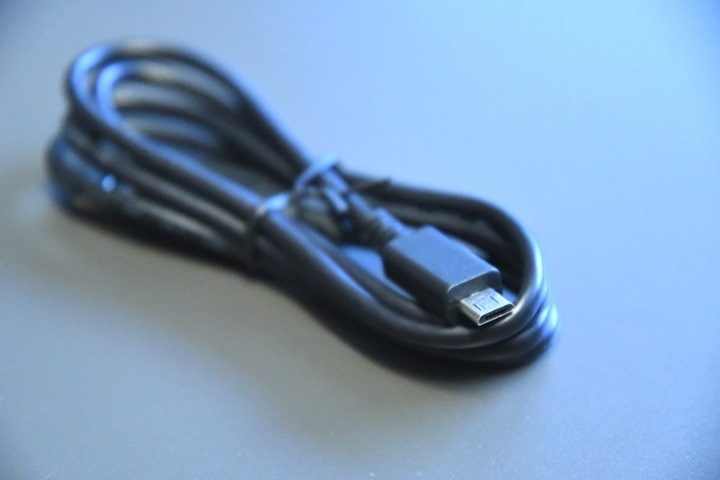
Meanwhile, the unit is chargeable via Micro-USB cable. Someday we’ll see Garmin adopt USB-C…but today is not that day.
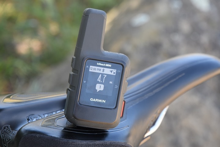
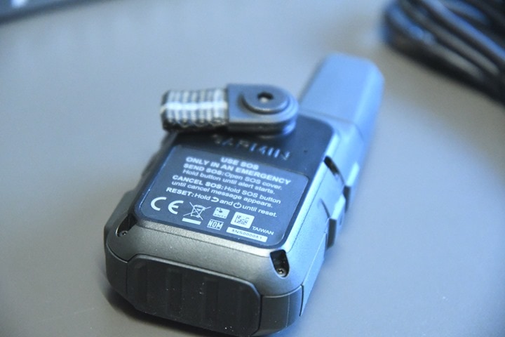
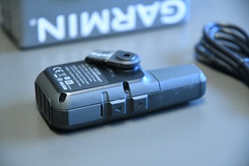
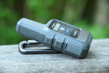
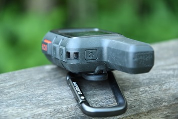
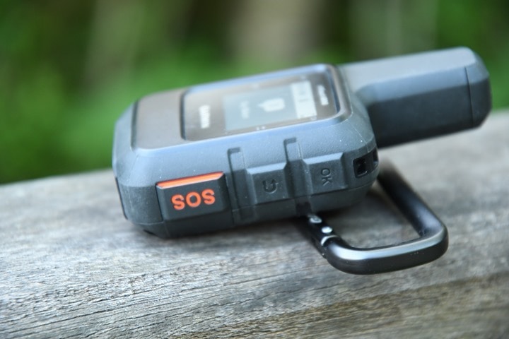
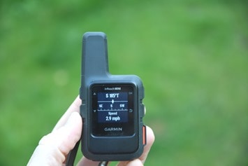
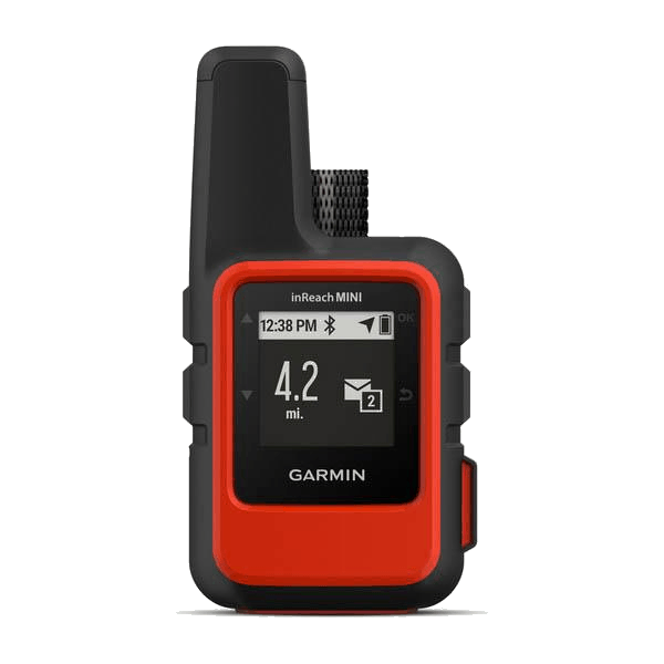
And then finally, we’ve got the unit itself. Here’s a few pics of that, though honestly by the end of this review you’ll have seen it from all the angles:
So with that quick unboxing out of the weight, let’s dig into the specifics of how to use the unit, and what it’s good for…since sitting atop a table inside isn’t really all that exciting.
Satellite Messaging:
In many ways the inReach Mini is pretty straightforward, but I found that the more I dug into it, the more layers of the onion peeled back in terms of functionality within it. So, I’m going to start with the basics, and then dive deeper and deeper.
It’s probably logical to start with the buttons. The unit has six of them. On the left side are up and down buttons, and atop the unit is a power button.
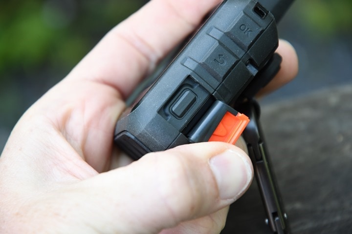
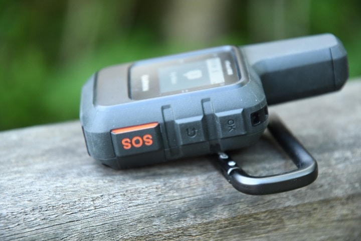
On the right side are three more buttons. You’ve got OK and back buttons, followed by the protected SOS button.
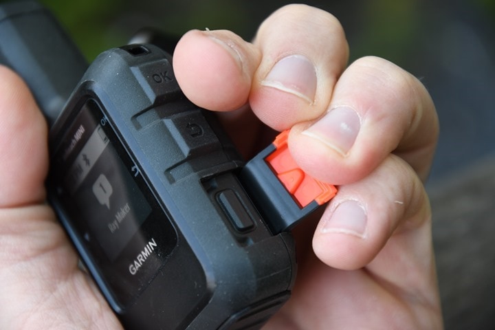
The SOS button sits below a hard protective bit of plastic that you have to open up to access the actual SOS button. This ensures that the unit doesn’t trigger a military response after being pressed up against a squished peanut butter and jelly sandwich.
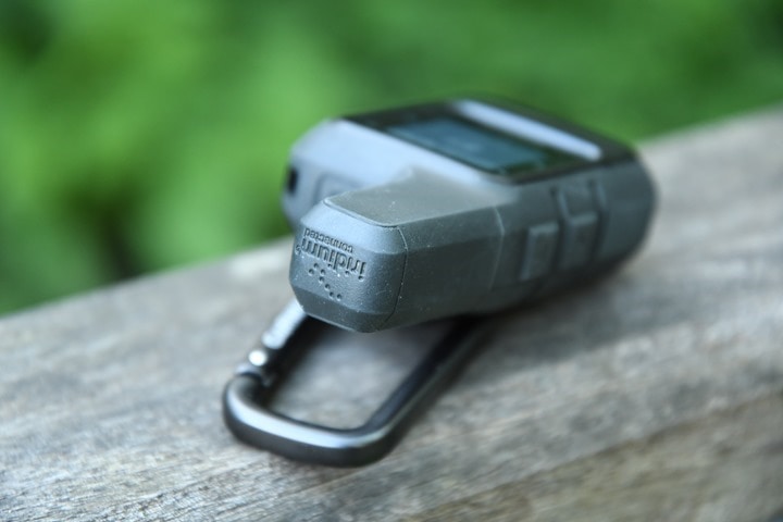
Atop the unit is the thick satellite communications antenna that talks with the Iridium satellite network. It’s this dorky looking top that contains the magic to message two-ways without being near cellular service.
On the back of the unit you’ve got the ability to hook in the carabineer clip, or you can attach any number of accessory clips they have for it as well.
Once powered on, the unit will acquire an initial GPS fix, in addition it starts checking in with satellites for the communications side of the house as well. You have to think of these two as fairly independent. We’ll start with the communications side first. When it comes to sending messages outbound, everything falls into one of three and a half categories:
– Presets: There are three of these that can be customized, including precisely who they go to
– Quick Messages: These can also be customized, but aren’t assigned to a given person, you can create endless quick messages
– Free-form messages: Type as you wish, using the unit, your watch, or your phone
– SOS Message: Crap went horribly wrong, use this as a last resort
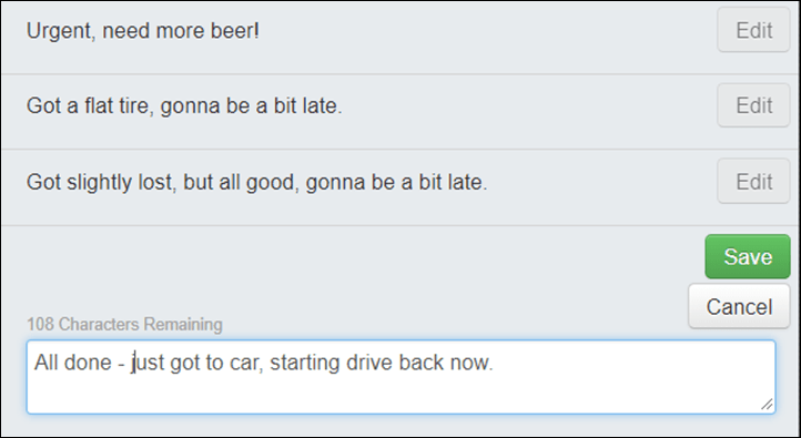
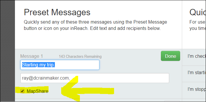
Looking at the first two categories, these can be customized on the web portal. It’s easiest from a computer, and they are designed to be done ahead of time. On the left side you see my ‘Preset Messages’. These are the three messages I can quickly access from the unit that go to specific people. Many inReach users would have these configured to a larger group of friends, but I lack such a group. Also, companies might link these to numerous people in a company too. You can see I’ve configured it to include a map of my location/track.
Whereas on the right side are ‘Quick Text Messages’, which are more like text templates. You can add more and more of these, and customize them however you want. But they aren’t preset to send to a specific person, rather, you can send them to whomever you want on the fly.
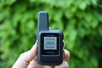
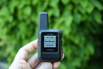
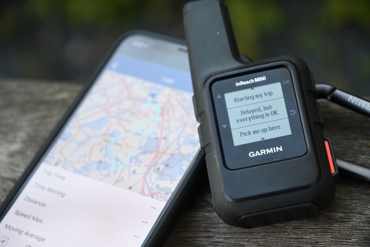
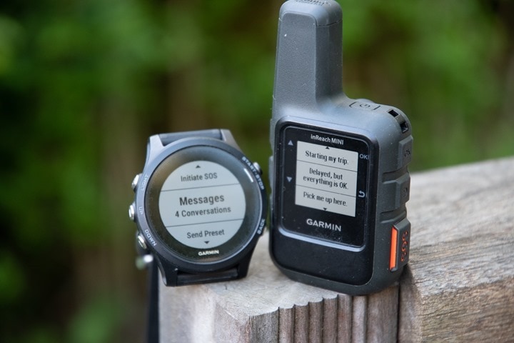
On your device, you’ll see these first two options displayed – ‘Send Preset’ and ‘New Message’. Here’s the preset message menu, first the option to choose it, and then the three options to send:
Remember, with presets, they go to the specific contacts you’ve pre-configured for presets, along with the specific message.
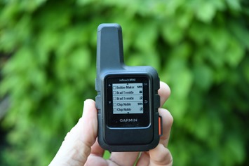
Meanwhile, if you start to go into the larger ‘Messages’ menu, you’ve got a boatload more options. The first thing you’ll do there is decide who to send it to, so you’ll select contacts to send the message to:
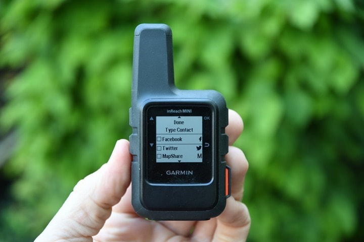
This also includes sending to Twitter or Facebook as well, if you’ve configured those:
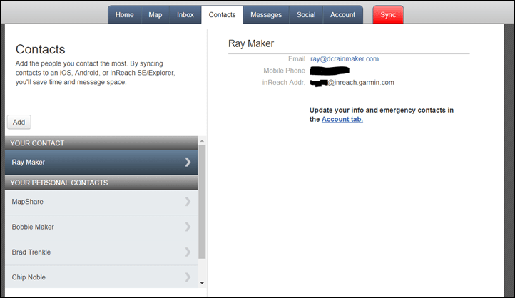
Contacts can be pre-defined online using the web portal or via the phone. These include an e-mail address, a phone number, and an ‘inReach’ address, in the event they have an inReach device. The inReach addresses are all based on the format of somename@inreach.garmin.com. The benefit there is if you had multiple people with inReach devices on a mountain, it makes it a bit cleaner than trying to send to e-mail/phone numbers.
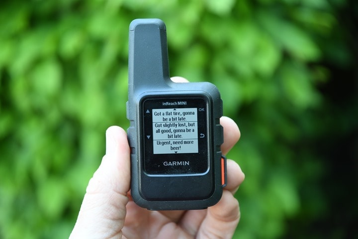
Once you’ve selected the contacts you can then decide to write a fully custom message, or, to select one of your ‘Quick Text’ options. If you select a Quick Text, you’ll see a list of those:
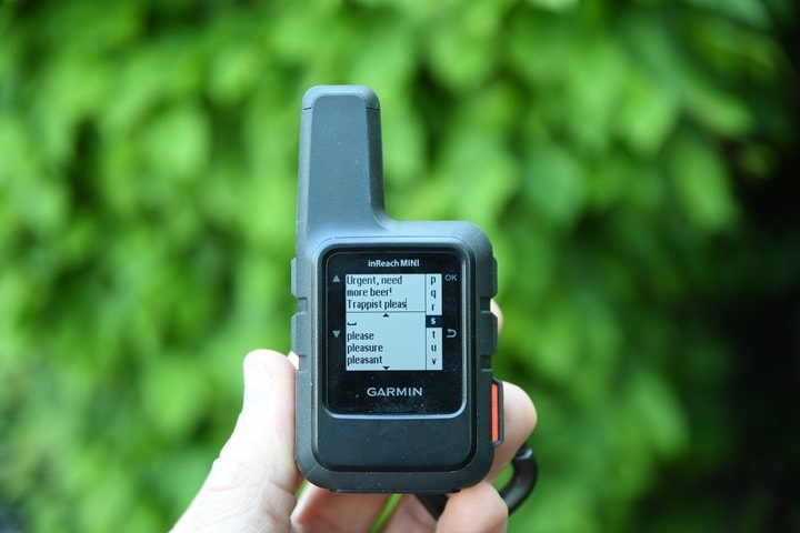
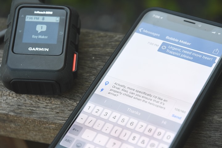
Else, if you want to type out a message, you can do that via the messages UI. You can actually combine the methods too. For example, I can combine a Quick Text message with custom information at the end of it. That’s a good way to perhaps add an ETA or similar extra important information. It also has an auto-complete function, which does help finish words for you.
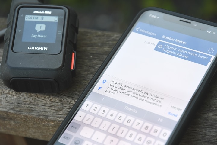
Obviously, typing out messages one character at a time is painstakingly slow. But that’s kinda the point, it’s not really supposed to be a full on sexting type of situation. It’s supposed to be for more urgent information…like beer selection.
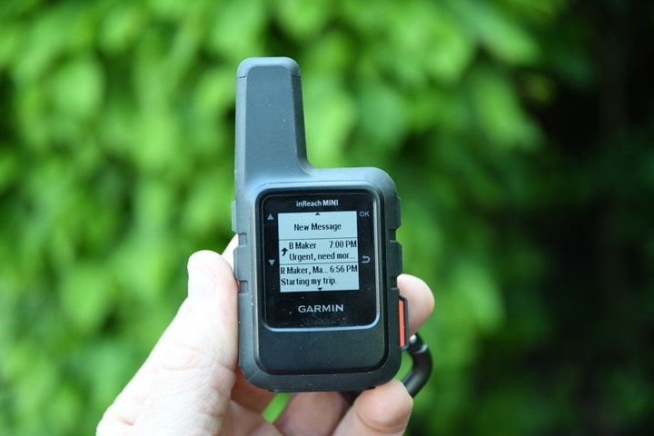
Once you’ve done all this you’ll hit send, and away it goes. The little ‘upwards arrow’ icon below means the message is still sending. When you send/receive messages, it’ll give a little chirping tone upon completion.
In addition to all that, you can use your phone paired up to it, to type out longer messages, which are then still sent via satellite. This is useful if the contents of your message are more complex than you want to type using just the up/down arrows of the inReach Mini. You’re limited to 160 characters per message.
As far as checking in for messages, the unit does so at predefined ten-minute intervals, though you can force a sync anytime, which will also update your mailbox. It’s kinda like going back to AOL when you hit to refresh your mailbox manually to check it faster. The interval time is also customizable, but as you might expect, the more often you update, the less battery life you get. And more importantly, the higher rate option (2-minute intervals) is only available on the most expensive subscription plan. Obviously, if you’re leading expeditions in the mountains of the Himalayas, the extra cost is trivial. But for the weekend hiker in fringe cellular service ear the Appalachian trail, the highest priced plan is a bit much. But more on pricing later.
As an interesting aside here – if someone (perhaps a family member or someone else on the team) has the full admin login for your device, they can actually change the tracking rate on the fly. The next time the device checks in (which at worst would be 20-30 minutes), it’ll update the tracking rates. Obviously this would have a downstream impact on battery life, but certainly there are scenarios this could make sense.
Finally, I didn’t dive into the SOS feature much here – for the very simple reason I didn’t use it. Doing so requires triggering a very real chain of events that ultimately would result in a helicopter coming to get me. I didn’t think they’d be pleased with arriving to me shooting photographs of their arrival for this review.
That said, the way it works is that once you press that SOS button the alert is routed to an inReach command center that’s staffed 24×7. Real-life humans would then actually message you via inReach satellite first, to find out more about the issue. Is it a real problem? An accident by a kid, etc… And if it’s an issue – what type of assistance can they send. As part of that, they’ll also reach out to your defined emergency contacts. These could be family members, or part of a company if you’re using the device in a business capacity. They could also be teams nearby you that may be able to assist. And ultimately, if required they’ll coordinate with governmental agencies in virtually any country to save your bacon. They’ve done this more than 2,000 times according to a post I found from last fall. In talking with Garmin, during peak season on Mt. Everest, they often have more than 500 inReach devices active at a time.
Now here’s the thing: Sure, the SOS feature is without question invaluable if you find yourself in that situation. But I think for everyone else, it’s actually the constant communication and tracking features that are most valuable. The ability to specify the route you should be on, versus the route you’re actually on. Or to have a real-time conversation with friends/family/teams about your current situation. You’re two hours behind schedule…but it’s OK because you just had some mechanical issues. Versus them wondering if something worse happened. To me, that’s the real value here.
Oh, and lastly, there have been reported issues with SOS buttons being accidentally pressed upon previous inReach devices (two generations ago, not the most recent generation), and actually triggering. I’ve largely kept the unit on actually while in my bag, just for the fun of it, and haven’t triggered it accidentally that way. But what if I put all my force on it, and pushed it up against a hard surface and held it for 10 seconds, would it trigger then?
Nope, simply nope. The button cover on the Mini is unbendable, and they’ve appeared to have added a ‘cross-beam’ on the underside of the button as well, my guess is to provide further structural support.
The reasons for not accidentally triggering an accidental SOS event are many. First, embarrassment of it all is less than ideal. Then there would be the wasted resources of emergency folks. But more importantly may be the cost: It can run many thousands of dollars to rescue services if it’s not cancelled in time. Nobody wants that.
Tracks and Maps:
Now that I’ve covered messages, let’s talk maps and tracks. This is where the unit shines, but also where things get a bit confusing if you’re already within the Garmin sphere. First, let’s talk shared maps of where you are currently. When you send a message you get the option to include a map with it. This is largely defined on the preset message page, where you can choose to enable ‘Mapshare’:
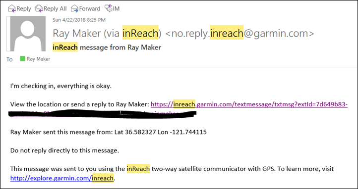
When you send that preset message to the preset contacts, they’ll get an e-mail, just like this:
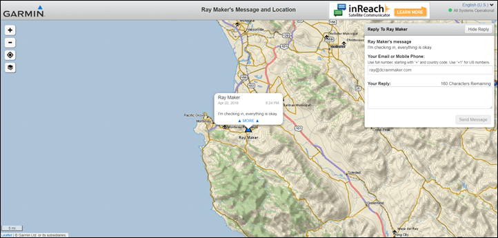
Once they click that link, they’ll get brought to this page here, which shows your current location. It also has the ability for that person to then send back a message to you, directly from that page. So if your friends/family want to send you a message, they can do that. Just remember to read the ‘Subscription’ part of this review for some caveats on how many custom messages you send. Note, if you want to also show your track, you need to send that as part of a MapShare link. It’s a minor difference in how you do it, but it makes a difference as to whether or not they just get current location, or the entire track.
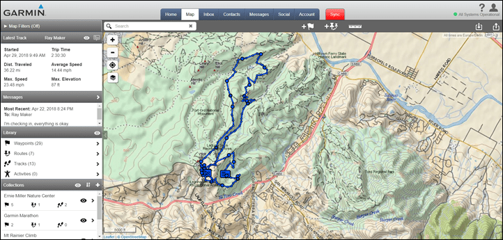
As part of that, you’d see the tracks for a given trip/route/activity. And as the owner of the devices, you can look these up as well afterwards on the portal. For example, some mountain biking. On the left you can see totals for that activity, as well as the track on the right:
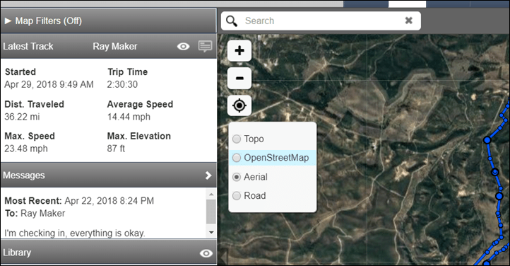
I can also change the map types here too:
But all of that is focused on looking at where I’ve been or where I am. What about where I’m going?
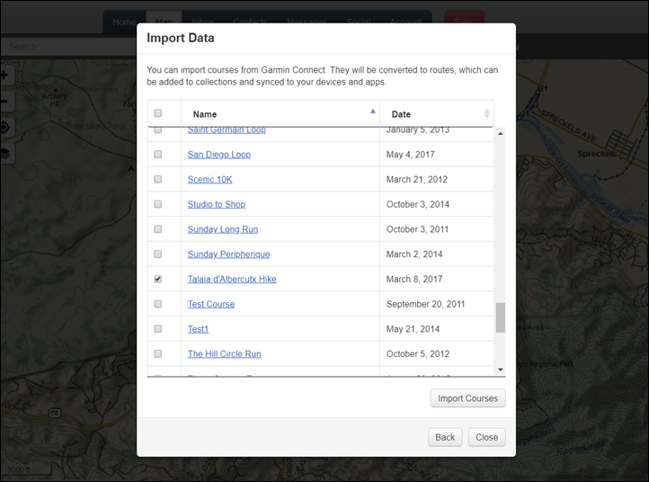
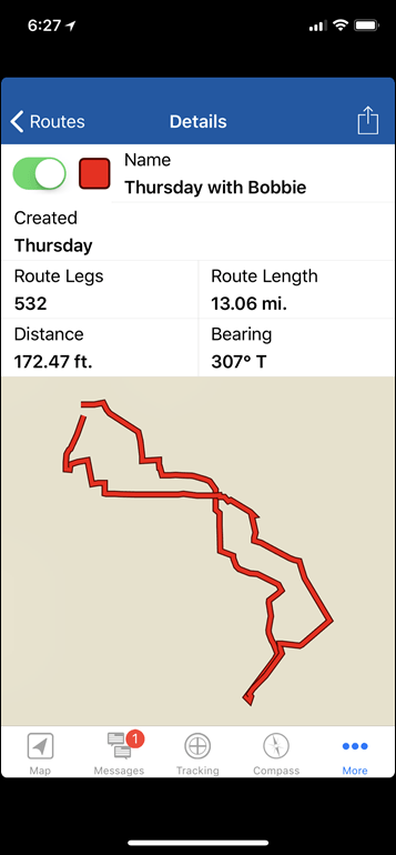
Well, that takes a bit more planning. The first step is creating a pre-planned course or route. You can draw the route on the map, or import a GPX, KML, or KMZ file (variants of GPS file standards). Alternatively, you can import courses from your Garmin Connect stash.
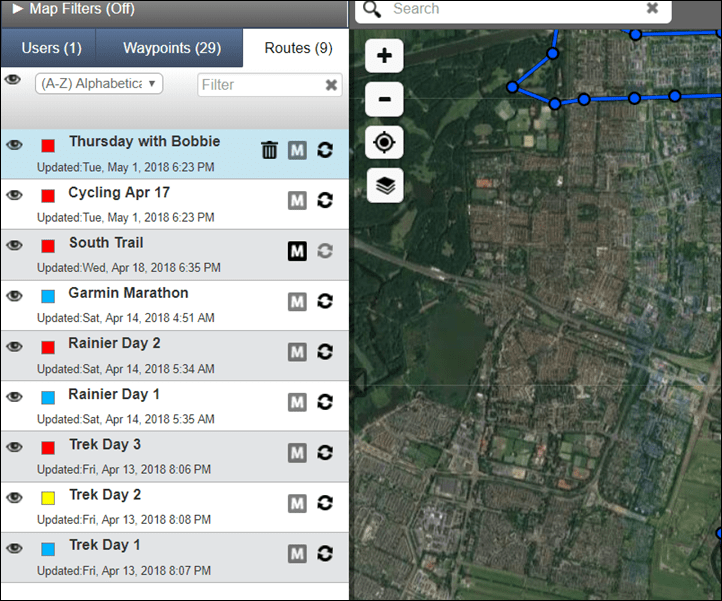
The main reason you’d do this from Garmin Connect is if you had another Garmin devices with routes there. Plus, this is really the easiest way to ensure the route on your watch matches the route on the inReach device. Once these are imported in, they appear within your routes section.
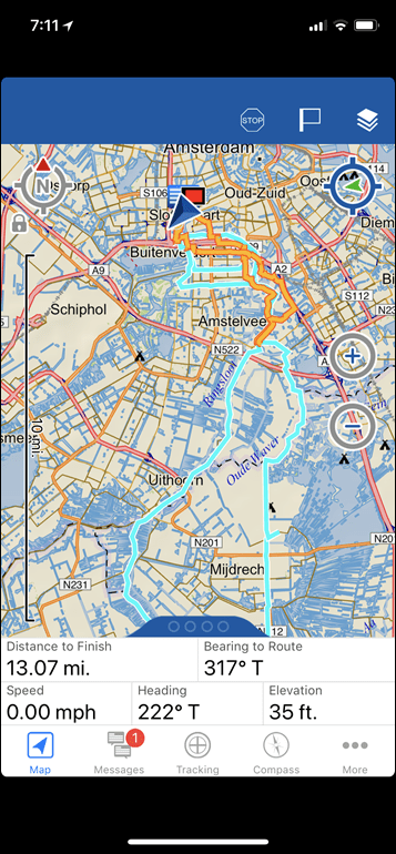
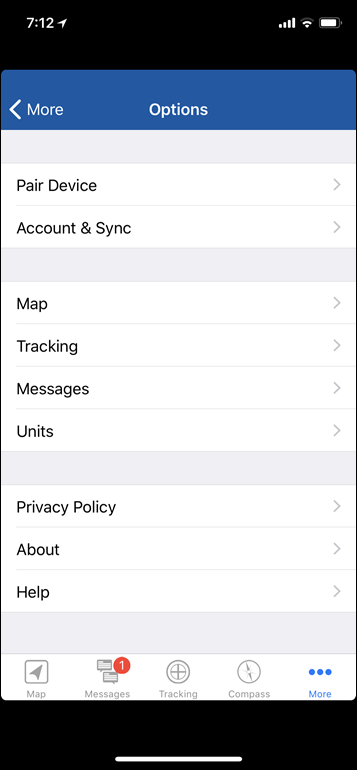
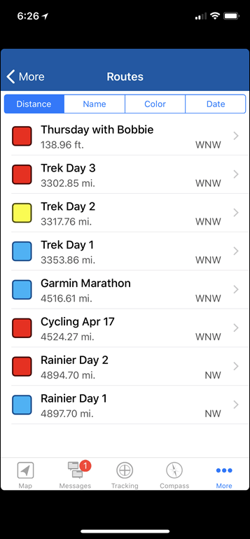
This is then mirrored on the inReach mobile app, called EarthMate. That app acts as a gateway to both the Garmin inReach platform online, as well as your device via Bluetooth Smart. It needn’t be connected to either though. So it can operate without online access (including offline maps), as well as operate without access to your device.
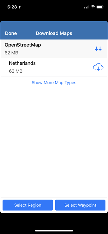
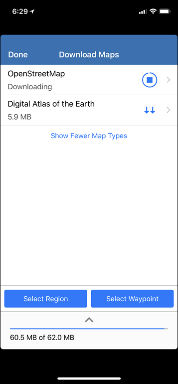
You can even download other map regions for free, quickly and efficiently. Perhaps the remainder of Garmin could steal this capability…cough, Cycling and Outdoor wearables teams.
It’s from the mobile app that you can also send messages. This is handy if you have a phone charged nearby, because you’ll be able to type messages far quicker on your phone than on the inReach or watch devices.
Same goes for sending previous tracks or current tracks to other previously unspecified people. You can basically go totally free-form here, and it’ll use the inReach satellite system. Thus, in effect, you can operate totally without cellular or WiFi service from within the app. Obviously, you can’t access Instagram or Snapchat, but you can at least send plain-text messages and such via e-mail, text, and to other inReach folks.
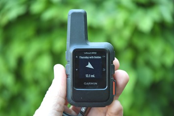
Finally, it should be noted that the unit can do basic navigation. In this mode you can load up any of the courses that you’ve synced to the device, which you can access via the navigate menu.
From there you’ll be able to follow the track using a combination of a directional arrow and a compass. Obviously, you’re unlikely to use this method for complex routing, but for last resort routing it’ll do the trick.
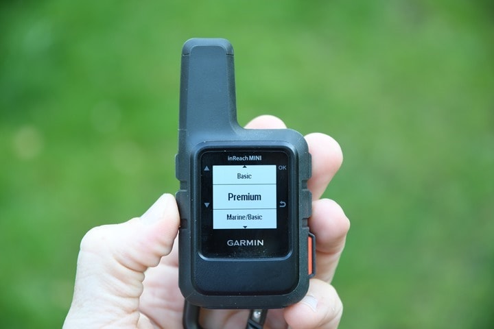
Oh, and for lack of anywhere else to stick it – the device can receive weather updates for your position. This is pretty similar to what you’d get on a Garmin wearable/cycling device. You do have four options though: Basic, Premium, Marine Basic, Marine Premium. The premium ones cost extra in certain plans, and give you more detailed information.
It’d definitely be handy out in the backcountry/wilderness areas for a week or longer where you wanted to know whether that never-ending rain would…well…end.
Watch Integration:
Probably of most interest to many readers here is the new integration with Garmin’s Fenix 5 series (5/5S/5X) and Forerunner 935 watches. Those watches were selected primarily because of the outdoor/hiking slant of the Fenix series, and because the FR935 shared the same codebase with it, thus coming along for the ride.
The integration occurs via a widget, but not a Connect IQ one. Instead, it’s built into the firmware of those watches, which means that you’ll have to wait slightly for the firmware to be updated. Given I’ve been using a beta FR935 firmware that contains it, it shouldn’t be terribly long before it’s released.
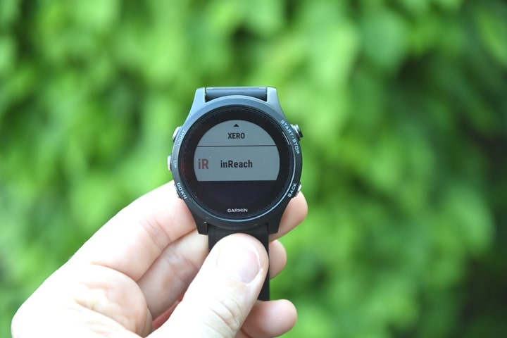
To get started you’ll simply enable the inReach widget on your watch (again, once the firmware is out).
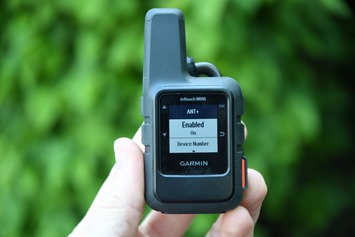
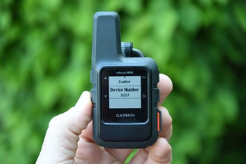
Then from there you’ll have it pair to the inReach device, which is done via ANT+. This pairing also needs to be enabled on the side of the inReach unit:
And…that’s it, it’s done.
To use it on your watch, you’ll scroll down the left side to the inReach widget. Note that this widget can be accessed both within an activity and outside an activity.
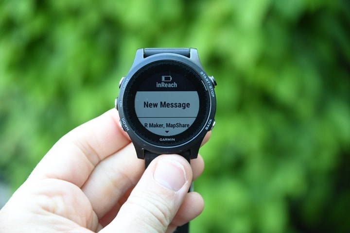
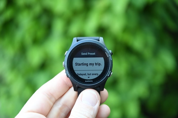
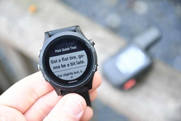
Then from there, you’ve got the watch acting as a mini display for your inReach Mini. You can do almost everything message-wise from the watch. Be it selecting presets to send, or quick text messages, it’s here:
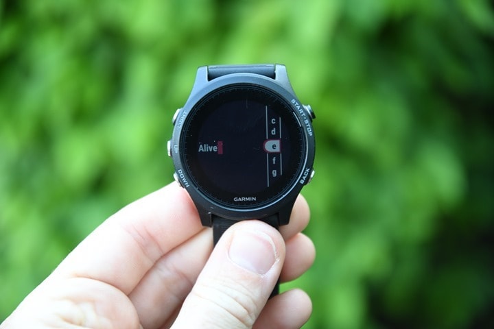
Even the ability to painstakingly type out a message response:
I find it somewhat ironic that they’ve developed a very capable widget for this, but that I can’t do this for regular text messages yet on my watch (or have pre-canned presets like the Apple Watch). Someday…
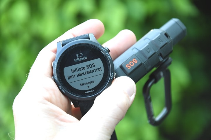
And lastly, you can trigger an SOS message from the watch too. I could see this being useful in cases where you had an inReach on a backpack or something and during a fall it got separated from you physically, but still within range of ANT+ (which can easily be tens of meters or longer if line of sight). In my case, that bit of the firmware isn’t enabled.
Now, as I argued to Garmin when I visited them a few weeks ago, they’re missing an opportunity by not having this available on their Edge devices, especially the Edge 520/820/1030 – which are key devices that cross-over into the mountain biking realm. The ability to have this information directly on my handlebars would be awesome, and hugely appreciated in quite a bit of mountain biking terrain where cellular service is spotty (including where I was testing this not far from Sea Otter last week).
The next thing I’d like to see Garmin do here is merge the backends of the tracking platforms. Right now Garmin’s ‘Live Track’ service, which is used for just about every fitness/cycling/etc device in the last decade hasn’t been updated since it was first rolled out nearly a decade ago. It doesn’t show your planned route for example, whereas inReach does.
But more so, I want to see these two service mesh together. You should be able to go out for a ride with your Edge 1030 and have it use cellular live tracking when available for near real-time tracking, but then at the same time with a paired inReach Mini it should be able to seamlessly merge the tracking data on the backend web platform. To friends and family watching via web link, they wouldn’t care what the medium was (satellite or cellular), it’d just appear as your current live track, along with the planned route. This reduces the expensive satellite network tracking burden when not needed, while getting more information on the cellular side. inReach messages would then arrive to your Edge device or watch seamlessly, be it from cellular or satellite (again, reducing costly Iridium services).
The benefit for Garmin there is that once they make this totally seamless, the solution pretty much sells itself. To be able to give my wife a single tracking link with my planned ride or Alps hike for the day, and know that it’ll work no matter where I go – is huge. And from my side, to only have to ‘deal’ with a single device (my watch or bike computer), and to treat the inReach just like any other sensor – reduces my complexity later.
For its part, in my discussions with Garmin about this – they get it. They completely agree the use case for getting this in Edge devices is huge, especially in the mountain biking community. And I don’t think they see it as a big barrier either. I’ve gotta believe they’d generate more inReach revenue (devices + subscription fees) than they would Varia heads-up display units. After all, they added that capability to a flotilla of devices.
Subscription Model:
All inReach devices require a subscription plan – not much different than one you might pay for Apple Music or Spotify (or, just the Spot platform). However, unlike common music subscription services, there’s actually a slew of options available on inReach. They roughly can be divided up into two camps: How much data/tracking you want, and how often you plan to use the device.
If you are one that uses the device every month of the year, then you’ll basically want an annual plan, as it saves cash. Whereas if you hibernate in the winter like Yogi, then you’ll probably be better served by a month to month plan that you can turn on for the warmer months.
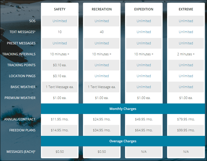
I’m gonna paste a copy of the pricing model as of today, but of course, if you visit this review two years from now, double check their page for current pricing. The top line-item is the name of the plan. ‘Freedom plans’ means a 30 day period that you buy as a one-off (for example, June 15th to July 15th 2018 for a trip, but not August or September).
The most notable areas to focus on are:
A) Presets are unlimited (these are the three messages you can customize)
B) Quick Text options though fall under ‘Text Messages’, even if you don’t customize them.
C) Tracking/location message costs
D) The cost, duh.
Now, the biggest difference between the two cheapest plans is that one includes unlimited tracking points, and 40 messages. It’s the first part that’s most notable though, one being 10 cents a message, the other unlimited. Tracking points over just a single day can add up very quickly. By default Garmin will actually turn off the tracking feature so you don’t accidentally run up a bill, though you can override that as needed.
Using the defaults, this works out to 60 cents an hour while tracking, or $14 a day if you left tracking on 24/7 at 10-minute intervals. You can reduce the interval though, which would save you costs. But the message, no pun intended, is clear: Just pay up for the $25/month plan. After all, at that rate, you’ve got unlimited tracking points and 4 times as many messages.
And while you might think you use a ton of messages, if you’re primarily using the device for tracking and SOS, as I have been, then I rarely used custom messages. The three presets are fully inclusive no matter which plan, and if you tweak those just enough you can kinda cover all the basics. Thus I think for the vast majority of people, the ‘Recreation’ plan is probably the way to go. You’d have to go through over 90 messages to cover the cost difference to the next highest tier.
As for the tracking interval of 10 minutes vs 2 minutes, I don’t think that matters much for most scenarios. After all, the main point here isn’t Strava-accurate tracks to compete on segments. Rather, it’s to give someone a location to come and find you. So you needn’t really be up to the second accurate, since more than likely if you got yourself in a pickle, you’ll be in that pickle-spot for 10 minutes anyway.
Just for context, the main competitor – Spot – the tracking costs $16.67/month (annualized) for the base level (which is tracking points at every 5 minutes). You can pay ~$9 more and get it to every 2.5 minutes (so total $24.99/month). In that case, you don’t get back and forth messaging, but you do of course get SOS services. Obviously, there are the device-specific differences I outlined earlier, the major one being that the inReach Mini has back and forth text messaging while Spot doesn’t, whereas Spot has vastly longer battery life.
Summary:
Garmin seems to have largely nailed this device from a features and functionality standpoint. It does precisely what it says it does, and does it in a super small form factor that has fairly versatile battery life. The fact that it can go from 50 hours of battery life up to 20 days is astounding, especially for longer range treks that may be moving slower where a 30-minute interval is perfectly functional. And the integration with Garmin’s higher end watches is a pretty natural fit, which works great in allowing you to keep your unit clipped to the back of your backpack.
The downsides here are relatively few, but the main one is cost. At over twice the price of the Spot device, and with more expensive tracking required, it’ll minimize the number of weekend warriors who might pickup the device based on the Garmin watch integration. Had it been priced at $249 or $299, it’d probably do significantly better. I suspect though that Garmin is catering this device towards people dropping thousands (or tens of thousands) on other gear and trip fees, whereby the cost of this is relatively trivial. But ultimately a unit like this is low-volume (today), but I actually don’t think it needs to be. At $249 it could easily be sold in bike shops that are mountain-bike heavy, especially if Garmin were to add Edge computer integration.
Still, for many people, the device’s features and more importantly – size – will win them over at the current price point. I could see myself picking one up to use in my more remote travels, especially in the 30-minute interval mode and just leaving it on for weeks at a time, allowing friends or family to quickly check in. One more gadget won’t hurt, right?
With that, thanks for reading!
Found This Post Useful? Support The Site!
Hopefully you found this review/post useful. At the end of the day, I’m an athlete just like you looking for the most detail possible on a new purchase – so my review is written from the standpoint of how I used the device. The reviews generally take a lot of hours to put together, so it’s a fair bit of work (and labor of love). As you probably noticed by looking below, I also take time to answer all the questions posted in the comments – and there’s quite a bit of detail in there as well.
If you're shopping for the Garmin inReach Mini Satellite Communicator (2-way) or any other accessory items, please consider using the affiliate links below! As an Amazon Associate I earn from qualifying purchases. It doesn’t cost you anything extra, but your purchases help support this website a lot.
And of course – you can always sign-up to be a DCR Supporter! That gets you an ad-free DCR, access to the DCR Quarantine Corner video series packed with behind the scenes tidbits...and it also makes you awesome. And being awesome is what it’s all about!
Thanks for reading! And as always, feel free to post comments or questions in the comments section below, I’ll be happy to try and answer them as quickly as possible. And lastly, if you felt this review was useful – I always appreciate feedback in the comments below. Thanks!





I suggested this to Garmin when the Fenix 5 first arrived because I use both hiking frequently. I have an original Delorme unit before Garmin aquired them. I didn’t see a point to upgrade to the new Garminubit as it did the exact same thing. The mini is a decent upgrade but I can’t see myself paying $350 for basically watch connectivity. My unit does all the functions this does.
It’s unfortunate that MH370 didn’t have one of these…
MH370 had multiple types of trackers on it. But, this is not the forum to discuss it.
I so want one of these, but I don’t know why!!
Right, this is the kind of cool sh*t Ray talked about where you didn’t real know you needed it. Based on the review I can think of all kinds of use cases where this could come in handy.
Bit off topic but I think the important one: Garmin should already implement on-watch (F5/5S/5X) replying to messages with predefined texts! Hey people, this already exists on Vivoactive/TactixCharlie watches!
I’m tired of constantly checking my pocket/bag/whatever for smartphone to answer with simple “yes/no/maybe”. :-(
Garmin, please do it already!
Android only too…
If the helicopters are failing you, the second best way of getting that emergency Orval is going up to the Hospice du Grand-Saint-Bernard, home of the world famous SAR dogs. They (the bar, not the dogs) have a very fine collection of trappist beers.
Great review, thanks! Just one small query – did you actually check out the longer time battery life? 20 days seem awesome, and I wonder if that’s 20 days normal usage or a ‘maximum’ figure that in reality would hardly ever be attained, like those unbelievable mileage figures the car manufacturers proudly cite! On the face of it (and there must be more to it, I know) if the updates via satellite every 10 minutes give a 50-hour battery life, wouldn’t reducing them to every 30 minutes (i.e. 3 times less) normally give 3 times more (i.e. 150-hour) battery life? Jumping up to 20 days is a leap 480 hours. Maybe they calculated it on the basis that it’s hibernating for more than 12 hours a day during the 20 days? But in that case, why not calculate the 50-hour battery life also assuming nightly hibernation? Puzzling. Anyway, love the idea of a 20-day battery life if it’s true and reliable (e.g. includes using some battery for sending the occasional message, or for using the backlight). So my question is – did you test that and was it reliable? Thank you!
“not really supposed to be a full on sexting type of situation.”
That’s dedication
As far as cost goes, I don’t think it’s fair to say that it is so much more expensive than a Spot. Spot has no monthly subscription options, and requires a hefty annual fee. If you only have 1 or 2 major trips a year, and only pay for a few months of InReach service a year, you come out even with a Spot in only 2 years, and then you’re saving money from then on out with all the added bonus’ of GPS and texting.
Sorry if I missed this – but when is the unit available? I see that Clever Training has it listed as pre-order. Thanks!
Pretty much immediately, within a few days. Units are enroute now to distribution centers.
Interesting, will it work with trackleaders for tour divide type races?
Yes Trackleaders has supported Delorme/Garmin for a while. I used an inReach Explorer with trackleaders last year on the Arizona Trail.
I’ll definitely keep my PLB for actual SOS rescue scenarios but this looks like a great device for all the other scenarios. I’ve wanted something like this for a while, but yet another gadget in the bag has always put me off given the size of them. This looks small and unobtrusive though so looks like a winner. I’d almost go so far as to say these are cheap too, US pricing at least. Can’t currently see UK pricing but I’m sure that as usual the exchange rate will be ignored in favour of keeping the numbers the same :)
Too true Mr Lusty, however I’m sure our cousins across the pond will remind us the price on American sites do not include tax. Also, if you were to order one from USA, the import taxes are horrendous. I’ve looked at the “favoured” price plan, and the 12 month cost is the expected £24.95 per month.
Well this is a first. The UK price is actually bigger numbers than the US price, despite the stronger currency. £37.99/month ($51.29!!) for the freedom recreation plan. That’s utterly insane and kills this for me dead in the water. The US price looks cheap and I’d have happily paid.
Ray, I know the technology isnt there yet with battery life and size but when do you guess we’ll see this built directly into the watch? 5 years maybe?
Worst part about this product launch is it suggests there will not be any imminent update to the existing inReach devices.
Different devices for different folks and uses i guess but I do not find the mini feature set at all compelling.
I have no use or desire for watch connectivity, do want the greater standalone capability of satellite messaging from the larger device but they need to improving the dated delorme navigation software and capability and properly integrate with garmin desktop/web software.
Pretty lame IMHO that over 2+ years after acquisition the underlying software platform hasn’t been updated.
Does both sending and receiving messages count toward the limit or do you only pay to send messages?
Both count towards limit.
Wow, this thing is tiny. Very very impressive.
I do, however, have some doubts about the claimed battery life.
Back in the day I used to develop devices based on older Iridium SBD modules (9601/9602) and getting power draw down to claimed values was only possible in ideal ie. unrealistic conditions.
Anyway, my point is that 20 days with 30 min reporting seems rather optimistic. Especially in cold weather and obstructed sky. Also, I’m pretty sure that this device will not receive messages in real time, but only every 30 minutes when it logs to the network to send the position report. But considering the intended use, this is not much of a drawback.
I would really like to see some real life tests and measurements in various environments (at sea, in urban canyons, open land and in the mountains).
And did I mention that I am bloody impressed by the size of this thing!
Can you switch subscription on and off, or are you tied in for a year? I’m interested in this, but wouldn’t use it that often. Pay as you go would suit much better
The freedom plans let you sign up for a month at a time (technically, let you ‘suspend’ one month at a time according to the website), so you could sign up for only a month or only a couple months (say if you’re using it just for the summer/fall). There is however also a $24.95/year fee to use those freedom plans (so using it for just 1 month a year on the cheapest plan is really ~$40, not $15).
Thanks for this comment, I totally missed the annual fees buried in the fine print, and I didn’t see them included in Ray’s write up. There’s a $19.95 activation fee for annual plans.
It looks like the break-even point is around 9 months for the Safety Plan and 8 Months for the Recreation plan – meaning you can use the Freedom plan for that many months before it becomes more cost effective to use the Annual Plan.
I am trying to get my head around the service plan / costs
just doing the maths on the cost of running the inReach Mini for 4 months of the year UK plan/prices.
£299.00 for the Unit
Approx £38per month x 4 = £160 on the monthly Recreation Freedom Plan
+$25USD for the Annual Freedom Programme Fee
is there also a suspension fee eg for the months I am not using the unit is there also a fee for that?
I would only use the unit for 4 consecutive months of the year.
Hi,
I have an Explorer+ and live in the UK
There is an annual fee of £25 (I believe that’s what I paid)
Then the monthly subscription
The subscription lasts an entire month.
That is, reactivate on, say 18th May and payment will be due again on 18th June.
A movement up a level is instant
A movement down or a suspension will occur at the re billing date.
It works fairly well; however, the inReach is damn expensive
The new SPOT X subscription seems much better value for money.
Tracking does not work when suspended, either on device, or app. Cannot record a GPX when suspended
Can view map, but the map is pretty much useless in the UK, no OS maps.
Thanks for the reply David
Yes I am tossing up between the Spot and inReach Mini.
Although based in the UK I will primarily be using it in the Australian Outback with a retrieve driver following my track.
So do I understand this correctly? Every year on the Freedom plan you have to pay the £25 regardless of being in use or not and there is No charge to reactivate for another month other than the monthly fee.
I must admit the Spot subscription and tracking is far less complicated but the coverage and text messaging is a plus for the Garmin.
That is correct
£25 a year even if no use; essentially keeps one’s account active.
One cannot use the Earthmate app without an account.
Yes, no other charges other than monthly fee.
Regarding Spot, coverage in Australia might be an issue, so do look into it.
My hope is that Garmin will release a high end inReach and review their pricing policy. Oh, and make better maps available.
Haven’t seen the flying pigs yet. :p
There are more flexible plans available from ProteGear for inReach
Did you get a chance to weigh it yourself?
There are 2 weights on the Garmin page – I’m not clear which is correct…
4.23 oz (product description) or 3.5 oz (product specification)
On the scale I get precisely 4.00oz when configured with the carabiner.
Thanks!
Battery life of 50 hours (~2 days) at every 10 minute update and 20 days (480 hours) if every 30 minutes for updates. This scaling seems off.
Also with all the pics you have, none of the USB port :-p But more importantly dealing with the USB port is, is the port water proof and can the unit be charged when in use? Say you do a weekend trip (so 10 min update interval seems good) that goes a bit long so when you really need the device you’d want to be able to charge it off something else and still have it working. Being a waterproof port in case when you notice you need to charge the device its raining or something.
The metrics are weird because at 30 minute updates, that’s for satellite + GPS both at 30 minutes, whereas the default 10min update is at GPS at 2-minutes.
My understanding is the micro-USB is still internally waterproofed IPX7. It’s just a little rubber flap below the up/down buttons.
You are charged both ways for messages
Downunder we offer Spot & inReach plans and tracking on the same platform with monthly freedom plans. Are we leading the world in that option? We have only just been allowed to add the Garmin inReach devices to our service, nearly 2 yers after they first came out. Wonder how long this unit will take?
I am repeating myself, but…. I have no interest in a device like to to day, but loved reading about it. I really like that you expand your focus to things broader than just biking or running.
Great review
Glad you found it interesting! These sorts of devices are interesting for me to do as well, as I get to explore new gadgets that aren’t just more of the same.
Will the InReach app as well as the extended display for edge devices appear on the Garmin Descent as well? Just curious as I may upgrade my 3hr in the future.
Will these work while on a commercial airplane?
Having an unobstructed view of the sky from a commercial airplane would be a bit of a worry. And in that situation one would hope that the pilot or the plane’s automation had already triggered an SOS.
Great article, thank you!
This is not expected to become available in Australia until later this year, so I’m now wondering if there would be any issues in registering and using it here before then if I purchase from overseas. I don’t see why but figured somebody here might have a clue. :)
Yes iridium devices are worldwide coverage. You just may need a US plan initially to use it
Note that from a safety point of view this has a gap in that it can’t call everyone around you like a VHF radio can. And when that helicopter shows up, you need a VHF to talk to it as well. This is probably more of a marine usage case, but regular radio still does things that point to point communication devices (cell phones and this) don’t. In case you don’t know, modern digital VHF radios can also transmit your position (to rescuers and nearby boats, not your wife), but Garmin does not seem to make a handheld one like others do. As with all safety items, you should never rely on just one, and this looks like a useful addition to a VHF. And for that swim gone horribly wrong, you’d need a VHF to talk to the freighter they divert to pick you up.
Ray, three quick questions: what number or address do others use to text the device? Do both receiving and sending text count towards the number included in the plan? How did you find the reception? Do you have to have a clear blue sky above you or on the top of a mountain? Will it transmit through some tree cover? Thanks! As always awesome review.
Timothy, the inreach devices are some of the best in terms of connectivity. They use SBD or short burst data so they dont connect for long periods. Clear sky is not required, we have them transmitting out of an aircraft hangar overnight if left on. Yes they work through light foliage cover, but the great thing about them is the audible whistle when the message has successfully sent.
On our system the return message is handled by a permanent link online, GARMIN, and shortly we will also have, have direct to device reply texting and online email return link like ours.
To instigate a message you need to provide a link they can go to to send you a message, there is not “number” you can text to deliver this. Yes on all services a request (send) or reply is all charged to the holder of the account. I agree it was a great review.
Tony
Does anyone know how the SOS function compares to a PLB? In particular, how different are the antennae & signal strengths?
I would love to use this rather than a PLB (given the ability to send msgs). But I don’t want to compromise the likelihood of my SOS being received by emergency services.
The signal from this device is superior to the PLB as the Helix aerial is not worried about the angle you have it on. Also the message has an audible tone to let you know it has been received.
The advantage of the PLB and EPIRB is the homing ability by the rescue service able to lock on and triangulate when close by. The accuracy the GPS on the nReach means unless you are drifting or having to move for safety reasons, then the position you set it off from is very accurate. It also can update on the go and most rescue helicopters have Satellite comms to get updates in flight.
Tony
Thanks, very helpful.
Do you know how the strength of the signals compares between the Garmin and a PLB/EPIRB?
I think PLBs send signals of around 5 watts. So a PLB SOS is likely to be received by high orbiting satellites, even if the PLB can’t get a GPS lock (in difficult terrain such as a canyon). My concern is that a SOS from the Garmin would be less likely to be received due to a weaker signal. Or am I missing something?
@Tony the signal may well be superior to SOME PLB devices, but this is not in any way comparable to a PLB and should not be considered a true safety device. That’s a dangerous suggestion to make and could put people’s lives at risk.
A PLB connects directly to the MRCC rescue centre in Falmouth, UK. From here, a global rescue will immediately be initiated. The InReach sends a text message to a third party call centre who may at some point call emergency services and ASK for a rescue to be initiated. They will then need to provide sufficient information to the MRCC or other agency to begin a rescue attempt. All of this burns time, and assumes that a rescue is even started, something guaranteed with a PLB/EPIRB.
A PLB has a dedicated, long term battery to ensure that the message will be sent when SOS is initiated. These are designed and tested for a life measured in years such that you never have an emergency and a flat battery if you follow the instructions. The InReach, by contrast, has a rechargeable battery which can lose charge due to cold conditions (just like your camera is always dead in the snow!), could have not been fully charged, or could have been discharged with messaging – the primary use of the device.
A PLB/EPIRB will meet the safety requirements of various agencies for sailing and flying. The InReach will not, so you’d still need to buy an EPIRB or PLB to meet regulations.
A PLB/EPIRB is fully waterproof, not just IPX rated. This means that one definitely won’t fail due to water ingress and the other might.
As you mention, the InReach doesn’t have the homing beacon function. GPS is marvelous, but being within 10-20m of someone doesn’t make them easy to find in most of the situations where rescue is required. Certainly at sea a GPS fix from an hour ago will be useless, but on a mountain in snow you’d also have issues and again in deep woodland.
The frequency they transmit on is very different. PLB uses a frequency which is much better at penetrating obstacles and weather, albeit much lower bandwidth. It doesn’t need bandwidth, it needs guaranteed delivery.
It’s not all one sided though. PLB and EPIRB are presently one way comms. I’d imagine the InReach is quite comforting in so much as you’d potentially get a reply saying help is on the way. PLB you’re left waiting, although almost certainly for less time and with more reliability.
As Ray noted, the InReach is a great device for messaging and I want one to comlement my PLB. In some scenarios the SOS function is also a great feature – these are the same scenarios where you’d call 999/911/112. It just doesn’t compare to PLB/EPIRB though as it was designed for a very different purpose. If you’re doing something dangerous and remote where you may have a serious life threatening situation needing rescue, take a PLB. If you also need tracking and messaging, take both.
Forgot the most important one! PLB doesn’t require a subscription (EVER), so you’ll still be rescued if you don’t pay the bill for that 3rd party call centre and subscription service :)
Hi Dave, our inReach connections are delivered directly to the Rescue centre, not through a third party. All the information is available and updated regularly as we identified this weakness in using call centres. We now rely on Ai and our delivery from device to Rescue co-ordination cente is under 60 seconds. I agree with the built for purpose and extreme conditions or harsh environment has determental effects on electronics and the PLB is built for these very conditions. The perfect ideal would be having both. The original DELORME and new GARMIN inReach are much more rugged than this one looks. In most situations that a PLB was setoff immediate rescue was not warranted and had one of these devices been used a more measured approach would have meant less expense and tieing up of resources needed for the real rescues. A recent study found that over 40% of SOS activations were false alarms or they were people who didnt need the immediate response.
The perfect answer is not there yet but with further development it is getting close.
Tony
To put this in its place.
InReach devices are primarily designed as a 2 way satellite communicators with optional tracking and an enhanced GPS receiver. It’s secondary purpose is as a Safety device for calling the Emergency Response Services.
A PLB has one job, have long storage life and when used to last as long as possible, transmit in harsh conditions, and guide rescue services to a stricken vessel or human, hopefully in time to save them.
Chose your device for prupose
Stay Safe
Tony
Hi Tony, I think you misunderstood me. In this scenario you are the third party. PLB goes directly to the actual emergency services. InReach goes to GEOS, a company who offer membership plans which monetise safety. I’m sure they are a great organisation, and as I said in scenarios where I’d have called 999/911/112 it’s a perfect solution. In safety of life scenarios such as when I was in the Irish Sea in a F10 gale not so much. Any time safety is being monetised, safety is not the number one item on the agenda; money is top of the list. Your example proves this, anyone involved in true rescue operations would never be so concerned by the cost of the operation. It’s better to launch NOW and wait for a cancellation call than to waste vital minutes deciding whether the call is real or not, and then handing over to the actual emergency services.
As I said, InReach is a great solution and I plan to buy one for the tracking and messaging, and possible SOS in non safety critical scenarios. Comparing this in any way to EPIRB, PLB etc. is simply dangerous and puts lives at risk.
I think one thing to keep in mind with the PLB’s is that in some ways it ends up being a case of ‘if all you have is a hammer, than everything looks like a nail’.
PLB’s are great in certain scenarios, primarily ones that time is of the utmost importance and you just need any help you can get fast, without concern for what kind of help you can get. I suspect there’s more benefits in marine scenarios here than land-based ones.
But the lack of communication options is also a hindrance. What kind of help do you need is often just as important as getting help. Also, in some cases you may be asking more for assistance than rescue, so a PLB doesn’t really solve that – but instead potentially puts crews at risk elsewhere.
Don’t get me wrong, I think PLB’s definitely have a purpose, but I’m not sure for the average weekend hiker or mountain biker if that’s really a device they need in addition to an inReach. I think inReach would likely fit almost every scenario.
Your understanding of the delivery of those emergency messages has gaps. GEOS is only used by paying customers. You also pay for PLBs for a one time activation when you buy it. All organisations rely on satellites, groundstations, servers, hosts, message centres and delivery mechanisms. Our delivery to emergency services is not dependent on us notifying them, it happens on a parallel path and has been proven to be quicker and more complete in information in front of the rescue coordination centre than a PLB. Not all systems are created equal, and not all inReach devices go to GEOS, or GARMIN.
Personally if I am going to put myself in an environment where I may need a PLB or EPIRB I would want to cover all bases and have both that and another option for communication like the inReach or Iridium Satellite Phone.
But back to the review, this is a useful piece of kit for people wanting better coverage than cell phone or the current spot devices. By its interface and use of the Iridium network it provides most needs for people tripping beyond the borders of our cities.
Ray I completely agree, that was kind of my point. Comparing the two doesn’t make sense and is a dangerous game to play. If you need a PLB because you’re doing something like offshore sailing or will be doing extreme mountaineering then a PLB is what you definitely need. The question in that scenario is whether you also want to take one of these, not if one of these would replace the PLB. For normal people doing normal things, a PLB is unnecessary, but the OP specifically asked how this compared to a PLB, and Tony gave what I felt was a misleading answer that may lead to people thinking the InReach is a comparable safety device, which it isn’t.
For the La Manche and other open water swimmers… Is it floating or sinking in a water?
…and I hope the update/synchronization will reach the Forerunner 920XT series also….
Sinking without help
I wish it was fully integrated into the watch itself.
Send and receive count toward message count
Any knowledge whether the Fenix 5 widget will work with the Explorer+?
Hi Ray,
thanks for the review. Does link to your position at the end of preset messages counts as tracking point in the cheapest “Safety” plan?
Yes, any tracking points do. But the link is embedded within a tracking point, so that by itself isn’t considered an extra point. (If I’m understanding your question correctly).
Still not clear…. So do I have to pay for one tracking point with each message I send while on the “Safety” plan.
I have used the tracking plan in the past with my inReach Explorer +
A message will show on the mapshare page as a tracking point.
Do consider a message costs more than a tracking point, neither of which are included on the safety plan.
I am not sure, and am looking for the same information. I did find this, though:
Preset messages can be sent to phone numbers, email addresses and other inReach devices. Yes, you can send to Facebook, Twitter and MapShare using Preset Messages at no additional cost.
[https://support.garmin.com/en-US/?faq=Dlq83lU2Ru5SHas9vohbbA]
Did you figure it out?
I hear what you’re saying, but today’s GPS accuracy means rescuers should be able to move to within single metres of your location. Obviates the need to talk them in via radio (which is far far harder than it sounds).
Dan, you’re assuming you’d be in the same position when your rescuer arrives and that you’re visible. In many rescue scenarios you won’t be. Anything in water will mean you’ve moved, anything in snow/mud/forest makes you very hard to spot. If you’re incapacitated or it’s loud then making noise may also not be an option. This is why many safety devices have DF signals in them in the first place – they were found to be necessary during rescues!
Ray,
In terms of sizing a powerbank for recharging on a very long trip, do you know the battery capacity in mAh?
InReach devices use a 2450mAh Lithium Polymer battery. So a 10,000 mAh battery pack should charge 2-3 times allowing for loss
They all use the same size battery?
This particular device uses half of the standard battery as shown by its battery life projections so it will be about 1200mAh
I’ve had an inreach device for years at my off grid cabin (no cell service). This thing has been great. A satellite phone is cost prohibitive for recreational use. I like the idea of the sos feature in case of emergency. One thing to be aware of is that it is very slow to acquire sats and send messages in heavy forest areas like my cabin. I have to wait a long time for the satellites to be in the right position sometimes. If I go to an open field, it is much faster. My biggest complaint is that the Bluetooth connection to my cell phone or tablet is wonky and does not reconnects and requires repairing often. VERY annoying.
This is a good product for recreational use, albeit a bit expensive if you send a lot of messages.
Great and very detailed review!!
You might want to add that there is also some more advanced dataplans and services for InReach available with a dedicated real email-address, SmartSafety, automatic deadman switch and more. link to protegear.de
I travel by bike by myself and sometimes find myself in areas with no cell coverage for a day or two. I’ve had one situation that forgot to check-in when had cell signal and family didn’t hear from me for over 48hours. When I got to an area with service and turned on my phone, it buzzed non-stop because of all the text messages and missed phone calls. My wife and mother were minutes away from calling rescue service on me.
I’m only allowed to leave on my next trip with a tracking device now :)
This review helped me decide between what Garmin and Spot have to offer. Great job!
Hello Friend! I’m from Russia, we have such products Garmin not sold because of the lack of certificates for radio frequencies (Garmin apparently does not want to give bribes). Also at us for gps trackers put in prison. And I hope that the day will come when it will stop (it will never happen), so I’ll ask, but how much are the incoming sms cost, they are in the product?
Is the watch integration over a private ANT+ channel or does it utilise somehow a standardized profile?
link to thisisant.com
I would love to be able to connect this to a 645.
Maybe this devices could prevent tragic events like these (link to www1.folha.uol.com.br)
Hello everyone,
even if it is not comparable to the level of monitoring and for the price of the subscription is it better to rent / buy a “real” satellite phone? (Iridium, Globalstar, Inmarsat) subscriptions are two times cheaper, and at least you can call / receive, if it’s just for the function “to be reachable”.
and for those who are in Europe / Middle East zone, there is a solution “almost” free with Thuraya,
I use a Xt Dual which allows to put a sim card of an operator accepting roaming with Thuraya and it is in this case or it is “free”, since one can be outside a zone covered by cell phones and connect to Thuraya permanently “at no charge”, only the sending of calls, reception and sms will be paid and reflected on its monthly bill, and especially no need to change SIM card, since this will be the same as its national operator,
if we have the cellular network, we can be called on its usual number without having to change the SIM card, if there is no more cellular network, the phone switches to the Thuraya network, always without charge, the over billing does not will be that if we make a call AND ALSO if we are called, ditto for sending SMS,
the tracking is not as complete as on a Garmin inReach receiver, but we can also send its coordinates by SMS to any correspondent, and have a simplified follow-up of a route …
the new model XT Pro Dual has two sim card slots, one for the sim of its local operator, and one for a sim Thuraya, I find it less convenient than the Xt Dual, because you have to change your national sim card and put it back in the “sim Thuraya” location, but the same, you can keep your national subscription and be called on the number of its classic operator,
in France, Orange offers dual sim cards with the same line number, I put one in my S9 + and the other in my dual Xt, and I can be reached on both devices at the same time, and if I no longer have a cellular network, only the Xt Dual will sound …
but at least no longer need to subscribe expensive satellite subscription, I keep the subscription of my national operator and it does not cost me anything every month, and the price of “old” Xt Dual are at prices “very” affordable, the coverage is not global, but covers a large part of Europe and the Middle East, which is not bad …
I have a Gen1 SPOT and have been dragging my feet on replacing it with with one of the newer Garmin units because the Explorer/Explorer+ didn’t really hit all the marks for me. This appears to get a lot closer. I don’t own a Garmin watch or cycle computer that would work with this but once they get the integration going that will only add to the appeal (as well as steer people like me toward Garmin from Suunto). The Somewear device that recently launched on Kickstarter is probably the closest competitor, but this being backed by Garmin adds to the long term viability of the product and future enhancements.
It looks like a really solid offering.
I’d rather have the gtu10 back
One point I’m not seeing expressed about these new satellite devices is that the one place where digital communication wasn’t available, is now becoming available. This eleminates the one wall between wilderness and society. Pretty soon, everyone will be able to be contacted, no matter how remote their location is. This is both a blessing and a curse. As these devices become more popular, people in the outside world will soon expect a response from you when you are contacted. Truth be told, I go the wilderness TO ESCAPE MY WIFE. Now she can track my every move and text me at will???? THE FUTURE SOUNDS TERRIBLE.
If you have an inreach explorer+ and a plan already and you wanted one of these for weight weenie days where you don’t need navigation, can you use both devices on the same plan?
No you need a plan for each device, you can connect them both to the same account and freedom plans enable you to turn them off and on at will, but you must take a month at a time.
You can even activate and deactivate them on a weekly basis with protegear.com
What we get on subscriptions plan on progear is not clear (on web), can you explain more detail
Hi
Protegear plans include everything Garmin offers too, plus in addition:
Including Globalmail: true 2-way email address for your InReach, turns it into a global office tool, including automatic forwarding from your usual email address.
Activate by month,by week or by day*
TripShare / TripView: Individual live tracking pages with statistics, AGL (height above ground) and much more.
Short Tracking Intervals * 30 sec / 1 min / 2 min …
LiveTracking and LiveRanking* for competitions with automatic evaluation (e.g, AGL) and Logs by KML/GPX/IGC
SmartSafety*: Calls for help even if you can’t
High-Res Weatherservice by MetGIS.at
REST-API* (* depending on dataplan)
no minimum contract period
includes all inreach.garmin.com Services too!
Ray, I’m really surprised that the Descent MK1 is off the supported list:
1. Diving, from a boat is surely a classic use case of being out of mobile reception with a real advantage of live track to aid in search and rescue
2. The MK1 was marketed as having all of the best features of the Fenix 5. Since February however a massive gulf has opened up in terms of firmware with the MK1 lagging considerably
You can even activate and deactivate them on a weekly basis with protegear.com
Ray you mention weekend warriors being deterred by the Inreach’s price vs SPOT. Working at REI I see a counter effect which is that many of the more casual users are targeting a few months of use per year and so go for the Inreach due to its freedom plans. Do you think SPOT will ever offer a freedom plan in the US?
Hey Ben-
Yeah, it’s tough to know what Spot might do here. My guess is that Spot’s business model is more heavily reliant on the service side to recoup hardware costs (or, their hardware costs don’t leave them with much if any margin), whereas I suspect Garmin makes a profit on the hardware, as well as the service/platform fee.
So in Garmin’s case I bet they probably look at the subscription side as pure gravy, but they’d probably rather sell you the hardware first and then figure out how to get you to love the service enough to keep it running all year round.
I see that Spot has responded to the Garmin Inreach Mini with their new Spot X two-way satellite messenger device. It reminds me of a Blackberry smartphone and is definitely bulkier that the Mini.
Indeed, it’s a fairly impressive looking device at a solid price and reasonable subscription fee.
The only downside compared to inReach would be the coverage pieces, depending on where exactly you wanted to use it. And the size potentially, but it’s honestly hard to tell exactly how it matches up size-wise without a ton of context.
Looks very interesting
And the monthly subscription is very low
Hopefully this will be a kick up the arse for Garmin with its inReach pricing; the cost is somewhat ridiculous.
Yup, Iridium does have better global coverage
However, this device does go to show the overpricing of the Garmin hardware and subscription.
Let’s hope Garmin releases a higher end device, and rethinks its pricing.
Garmin can’t even play on the “eco system” as the inReach isn’t fully integrated; can’t load Garmin maps for example. Still no high quality mapping available for the UK.
Spot just became competitive
But Spot doesn’t have maps (unless I’m missing something), so not really the same there.
You’re quite correct.
That said, the mapping on the inReach is rather basic, the screen too small, and/or relies on a phone app.
Even though I use an Explorer+ for tracking and beyond cellular messaging I still carry a Garmin GPS.
It would be nice if there were a unified device; however, from what you hint at above this convergence is still some way off.
Does inReach service support sending locate to remote server or API to track yourself? Or is online tracking locked to Garmin’s own services?
It’s not well-documented, but if you send trackpoints to MapShare then a third-party app can retrieve your tracking data in KML format by querying link to inreach.garmin.com. You don’t have to be an enterprise customer to use this.
That should be inreach[dot]garmin[dot]com/feed/Share/[UserName]
To get api feed for Garmin you need to have an enterprise account with more than 10 devices connected or be connected to a wholesale provider. Then tracking can be quicker than the Garmin websites. You see better to connect to a wholesaler in your country of residence. On the Spot X, it uses a duplex system that only Globalstar stations in America, Europe and North Africa can utilise the 2 way traffic, so far from the global coverage of Iridium
SPOT user since 2008 and currently use a Gen 3. Last year SPOT billed me $232 – this year the price will be $260. The price increases, non-existant CS, and shady billing practices have pushed me past the tipping point. So unless Garmin is as bad as SPOT, I will convert InReach mini in a month when my SPOT subscription expires. Until the InReach mini, I was going to downgrade to a COSPAS-SARSAT PLB.
The Spot subscription has steadily increased but their device hasn’t. Garmin run a monthly billing cycle where you get charged off a credit card as well. Look for more freedom options, GARMIN are not the only option
How long will this last? The old Iridium satellites are being deorbited. Does this device also work with the next generation of satellites?
The Iridium satellite constellation should last indefinitely. From what I am reading, some of the first generation satellites are only being de-orbited once next generation ones are on orbit. And although the next generation satellites apparently have greater capabilities, I am assuming that the InReach devices are using capabilities that have been around for some time.
Though I realize that you have fully embraced the Garmin ecosystem and would like to see more integration, I have long used an inReach primarily because Earthmate is the best app I have found for maps in the outdoors. This is especially the case when off roading when I will use Earthmate on my iPad. Great app. Downloads so cellular not required. Detail changes as you zoom in out. GPX, etc. files imported via the online map. Waypoints can be saved while on route and all of this synced to your i-device even if the inReach is not connected. In this way the inReach goes in my pack or vehicle and the phone (hiking, biking) or iPad (driving) become my primary device – even for sending/receiving messages. Why do I share all this? Because I would hate to see Garmin screw up Earthmate or iDevice integration in favor of their own watches and devices.
Will it support the Garmin Descent MK1?
Excellent and thorough review. I enjoy reading these. The detail you provide is unparalleled. Nice job!
Hi, I am looking at the inreach mini to replace cumbersome smart phone with spotty service during my bike rides and road trips. I am trying to understand the role SOS button vs dialing 911 on the phone in places that are not remote.
For example, if I observe a felony crime, say armed robbery OR I am involved in a major car accident (that I can walk away from) would a be appropriate to use SOS button to contact police??? Or would sending a text to my emergency contact and having them dial 911 with my location would be a more appropriate way.
I got my unit yesterday, planning to use it at Dirty Kanza this weekend. I’m not climbing Everest, but as a diabetic having access to SOS when cycling unsupported is nice.
First impressions on the hardware are great. The web interface is kludgy.
I have a route imported for the trip, and I have Mapshare ready to show progress, but it isn’t obvious how to overlay my planned route over my track on Mapshare like you would see on trackleaders or spotwalla. Has anyone else seen that functionality?
Try using KML format in stead of GPX, should work
Just curious: I was planning to get one of these but it looks like all the shipping dates are getting pushed back? When I looked about a week before Memorial Day, estimated shipping time was 2-3 weeks. Now the Garmin site says it probably won’t be available for 3-5 weeks. Do you have any idea why? I’d like to get this one and was happy to wait until mid-June. I’m less thrilled about buying a device that I want mostly for trail running that won’t arrive until the summer is half over. (I would have gotten the older model that was on sale at REI during the sale, but thought the wait was worth it.)
Not sure if you have any information, but thought I might ask. This review was super helpful in making my decision.
Protegear starts shipping the InReach Mini on June 6th
Are the chipsets the same in the Mini vs. inReach Explorer +? Does the Mini have any performance advantages in communicating with your other Bluetooth devices and GPS refresh rate speed wise, other than watch support? I totally understand the functionality aspect of both devices, however no mention has been made to the tech and internal side of things alluding to future benefits that the Mini might have vs. the older Explorer + when it comes to the hardware, and in that case the aging hardware of the Explorer +.
I ordered one of these through Amazon right after I read this article.
Yesterday (May 29) I received an email from Amazon saying my order was cancelled “Due to lack of availability”.
Protegear starts shipping the InReach Mini on June 6th
Hi Ray,
Do you know if the InReach MINI will be realised in different colours ?
Yes, it will be available in orange and black
Any chance Garmin will allow connectivity between the inreach devices and other smart watches such as Suunto?
Is the integration with a smartphone (in my case, iPhone) such that any SMS messages coming from the iPhone go through the Mini if they’re paired? Or do you have to use a Garmin app to compose and send a message via the Mini? I ask because I use an iPhone app which senses when a collision or crash has taken place, and sends out an alert. It’d be great if those alerts went over the Mini automagically when I’m off the cell grid.
I just got the inreach mini. I don’t seem to be able to open the inreach widget on my fenix 5. I’ve also tried to pair with my watch. Turned ant+ on and tried to pair with watch. Nothing. I assume that will come with the widget?
What’s your firmware on? It needs to be on at last 8.99 (Fenix 5 series).
Did you also add the widget through the widget menu settings?
Hey there –
There’s a comment in the review saying it’s possible to import courses from Garmin Connect to the device, which is great. However, I’m wondering if the Mini does the opposite – ie. track your course and stores it, then uploads it to Garmin Connect for reference and stats. Obviously, I’m thinking Strava as well.
Reason I ask is because I’m preparing a Bike Packing trip and will need the Mini for navigation when off the grid. I’m wondering if I need to take my Edge 520 as well to record my riding, or if the Mini can take care of that as well. Hopefully the Mini does it all, so I don’t have to carry the 520 and worry about keeping it charged through the week.
Thanks
B.
Hi,
Can’t help with your exact question; however, might be worthwhile taking the 810 as a backup navigation device.
Garmin Connect and Garmin inReach still aren’t very connected, here’s hoping for the day when it is possible to add an inReach to a Garmin Connect account.
Bought a Garmin Oregon 700 for bikepacking, that connects to Garmin Connect, very useful.
Would be great if you could use it as an external GPS sensor for the Fenix 5 the way the hearth rate ones work, turning the integrated sensor off. No need to keep two GPS running all the time considering how much battery they use.
Ray, have you heard anything about Garmin adding automatic incident notification to In-Reach (like Edge units)?
Seems like a no-brainer now, and when off the grid auto notification is even more important than when on-grid, IMO.
Thanks
That might be tricky.
With cycling, it’s relatively easy to detect crashes, since you’re cruising along without any impacts. But with a hiking type scenario, just taking off your backpack and dropping it to the ground could false-positive things. Or jumping from one rock to another.
Good points, but if configured to a cycling only mode that should resolve that issue. I would also like it to work as the Edge notification does now, by contacting my emergency list instead of going directly to emergency responders.
Essentially using the satellite network in place of the cellular network for the current Garmin incident notification protocol.
Limiting incident notifications to the cellular network works for maybe 80% of my solo rides, but I don’t have to wander too far from home to be without coverage. Using In-Reach is a non-starter since if I’m out cold I’m out of luck.
I don’t know that I’ve seen if In-Reach emergency responders first try to communicate with the injured before deploying forces…
Thanks
This auto notification is available for InReach users with a ProteGear data plan
(notification followup)
Ray, do you know if your phone can be in “airplane” mode while using the Earthmate app? Without cell service, a phone’s battery would drain very fast…
Scott, I tried this morning (testing on my walk to work) and the earthmate app continued to talk to the Inreach Mini and update position on my off-line maps with iphone in airplane mode. This is how I intend to use to preserve iphone battery too.
Just make sure you download the maps from the area your using it…
Thanks Kevin!
Ray – Did you do much testing of the pre-set message location links and MapShare webpage on mobile devices? The desktop (Mac & PC) versions of both work well and allow you to zoom in to the precise location.
However opening the same links on mobile device (iphone 7 and 7s for me, trying both safari and chrome) do not work. The pre-set message position link does not allow me to zoom in beyond 1 mile zoom level, and the MapShare page does not show location.
The MapShare page has an “info” button that lets you “switch to desktop” version and you can then see position and zoom in for detail, but as its not mobile optimised its not easy to do.
I have contacted Garmin support in UK, but wondered if this was working properly for you. IMHO the links really need to work well on mobile devices, otherwise whats the point?
DC:
As a member of search and rescue here in the PNW, I can assure you that no helo will automatically be sent if you press the SOS button.
We’ll show up on foot, and then, if the government honchos see fit, they may grant our request to send a helo. Just a dose of SAR reality these days :)
Excellent article…thank you for your awesome reviews!
I can tell you this. Last summer when I was overdue on a 50 mile mountain run, a helicopter came looking for me. And that was without pushing any kind of SOS button! (I think my local SAR only responds on ATV’s and horses. They wouldn’t get very far on foot).
Thanks Cole.
They very much will call a helo if required. It really depends on the country/region and how it’s handled. Each country is handled differently.
And ultimately, if you’re 100 miles off the coast in a sinking boat, it’s not going to be ATV’s or hikers coming from you. ;)
Of course the button doesn’t trigger a helo directly (as fun as that would be), but that is a very likely culmination for scenarios that have tough terrain and could be far away (especially in the case of cyclists).
Cheers.
I am curious if the SOS button pressing cost something in case of a joke, mistake or, even in the case of a real emergency.
Rescue services does cost money and I suppose Garmin pays a lot to the emergency service partner (GEOS Worldwide) to make them answer the calls.
Ray, are you still having issues with the Fenix and the inReach Mini constantly losing connectivity? I paired my inReach Mini to my 5X+ for a ride yesterday and it must have given me the disconnect warning on my 5X+ about 20-30 times. Even with the watch a few inches from the Mini, I got an error.
Garmin support says that there is a 2.20 firmware for the Mini, but neither the phone app nor the computer inReach Sync app will update it past 2.10. Though even with 2.20, the update notes say they changed Bluetooth connectivity, but nothing about ANT+.
Just wanted to clarify, after some testing of my own, that when you select the “MapShare” checkbox next to a preset message, all that does is send a link to a map that shows where that message was sent from. That link DOES NOT give you access to the person’s full MapShare page, so you can’t see their track, their course, or any other message locations… only THAT message. Super annoying.
I ended up adding my MapShare url (you can find this in your inReach account, under the Social tab) to the end of the preset message text itself. That way, my wife has quick access to my MapShare page to see my track and route.
And that’s just fine. I have a preset message “I love you xx” and I only want my wife to see it. There are only a few people that can see the track, and they only need to see the track, not the messages.
How do you differentiate between someone seeing just a track versus your track plus messages? If you use the “MapShare” checkbox next to the preset message, it only send a map link to that message, correct? So if you want to share your track, someone has to have your social MapShare url ahead of time, because inReach won’t share/send it, correct?
That said, if someone has your MapShare link, I think they can see your track and ALL messages. I haven’t seen anyway to create permissions for who sees what. You can set a password for the entire page, but there’s no actual login, so inReach doesn’t know who if it’s your wife or your buddy viewing your MapShare page.
All correct.
Then make from the 3 presets, messages your buddy’s and wife can see, the “I love you forever” messages can be a one of the other messages that you can send at your wife only or text your wife. (what the inReach does perfectly)
You can always messaging back and forth with anyone you want, personally.
I use the inReach for tracking and occasionally “I’m ok” and “Left basecamp” and emergency backup.
I used the original SPOT and then changed to the free-standing inReach with just the buttons and which takes AA batteries. I still use this. Why do all the newer devices have funky narrow bases, so they’d fall over. Not much use. The real problem I see is the sealed-for-life lithium battery in the mini. When have a real emergency I need to have battery power. I always carry spare lithium AA primaries with mine. I tend to travel abroad and then go places and aviation rules mostly will not allow me to fly with any type of power-bank device so short of packing a solar charger (slow, big, not really a solution to the problem) the mini strikes me as a device that when need it would likely not save my life. So for as long as the original inReach functions I will continue with that. I see Garmin as trying to monetise the product partly by using sealed-in battery so there is a day the device will die, but this seems inherently incompatible with an emergency device. If they also provided a backup emergency power source just for SOS perhaps I’d buy one, but on that basis they may as well just use AA batteries. Forget AAA, useless tiny things (SPOT, that’s your flaw). If they made a new inReach with AA batteries I’d buy one in a heartbeat. But so long as it uses a sealed battery it remains just a communications Toy! My other gripe is that in the UK, since Garmin moved the billling to a UK platform, the charging has increased astronomically and is a realllyl bad deal now. Also they broke the Earthmate in all android versions after they bought Delorme so the original device doesn’t work – you have to manually side-load the last Delorme version and then it’s all ok. Wish big companies didn’t behave like this with safety-critical gear.
I meant to add…
I have used Globalstar, Iridium and Inmarsat (iSatPhone), SPOT and inReach and as a communications Toy, inReach is for me the most effective, most reliable, most elegant comminications system for non-military ever invented. But given it’s uniqueness I feel that Garmin have a responsibility as to the way they develop and implement it. UK customers also were originally billed in US$, but then it changed to a Garmin UK subsidiary that bills GB£ instead but at the same figures. There is some serious overcharging going on for us UK users and if you want to encourage the uptake of customers, why choke it off with greedy billing. They way Garmin stomped all over the Earthmate app to ‘brand it’ and break the original inReach device connectivity was I thought appalling. If it was a ‘bug’ then they never fixed it. I had to sideload every version of the app backwards until I found one that worked, and that was the last one ever issued by Delorme. What a surprise?! All that said, as an amazing communications toy, I continue to use it. Be I feel people should be aware of the limitations inherent with sealed-in battery and if your life really depends on communications then I’d steer people towards a PLB (instead or as well). And don’t get me started on the vast cost increases in Inmarsat 2 years ago when they halved the subscription validity overnight and effectively Doubled their charges – I binned the phone. So Garmin, well done for trying, but please consider having just one device with AA batteries? It would also be nice to be able to stand it on a table/grass/a rock, without it falling over!
I received my Inreach Mini from Amazon 2 weeks ago and started playing with it… It’s a great product, but I found (as advised by Ray) that the software package (either the inreach.garmin web site or the Garmin Earthmate App) are really not in the Garmin philosophy or at the Garmin’s expected level of friendliness… !
Just to give an example on the map (either on the App or the site) the background is a totally outdated OpenStreetMap template… !!! I would have expected that integrating Delorme platform they would have at least “refreshed” the map template…
I don’t know what are the plan for Garmin with this product line, but I’ve the impression that they were fast on developing hardware but they have totally forgotten the software part… I hope this is just a delay in the integration and they will improve this in the near future.
Just a quick update on the Map update issue… Garmin advised me that they are updating the Map once a year. They integrated the latest OSM in August, they will proceed on cleaning and update and will publish an updated version in March next year…!
Just ordered one of these! Appreciated your review, I was having some issues figuring out the preset messaging, but this cleared it up! Going to bring it with me for the first time this weekend out in the Sierra.
Do any of y’all have an experience with the impact on the PHONE battery use when paired to this device? My son has the previous, full-size model. He finds that the battery on his Android phone depletes rapidly when it’s connected to the InReach. It’s so bad that he never connects the two, instead laboriously pecking out messages directly on the InReach.
Thanks.
I have the Garmin inReach Explorer+ and pair to an Apple iPhone X
Generally when in the wilderness with intermittent cellular signal I place the iPhone in flight mode (including Bluetooth) and re-enable when I wish to connect with the Explorer+
I have found there is little benefit in keeping the iPhone continuously connected with the Explorer+
For your son, does he have a cellular reception? As a lack of signal will drain the phone battery
I am looking at this for a (Hopefully) upcoming elk hunt, a friend, myself, and maybe another probably a little over a week long. I am wondering what in the field charging possibilities there are? Is this something I can carry a battery pack for? Or another pack of AA? I have a solar option that can charge phones but I am assuming reception will be spotty if non existent.
Hello DC Rainmaker, Would you please kindly advise in the garmin mapshare will indicate my tracks in hong kong area? I intended to buy a inreach mini device. thank you very much
Did you actually verify 20 days? Has anyone ever gotten 20 days, or even 10? Just letting the unit sit on and idle, it is barely reaching the 50 hour mark for me. Not a deal breaker, but just wondering where you pulled this 20 day number from exactly.
The 20-day marker is in the reduced interval mode, seen here in the specs sheet: link to buy.garmin.com
Hi, always love your reviews. I’m having difficulty deciding between the inReach Explorer+ and the inReach Mini. My thought is that the only upside to the Explorer is having built-in topo maps…but if I always am going to have my phone (and charged), can’t I just use the maps on the EarthMate app to get by? Mini is $100 cheaper and much smaller and I’ll be carrying my phone all the time… Am I missing something about the Explorer+ functionality that would make we want the larger handheld device? Thanks
This review was outstanding, clear and well organized. Congratulations
If anyone wants a hiking-centric review and walkthrough, I just posted my review after using it for a few months: link to hikingguy.com
&& thank you DCR, you are the man
1.) If I use this device on a 100-mile trail run that lasts 24-30 hours, will I be able to upload the GPS file from my InReach Mini to STRAVA? (So that I don’t have an interrupted file from using two different watches.)
2.) If I pair this with my Garmin Fenix 5 during a 100-mile trail run that lasts 24-30 hours, will I be able to concurrently record the same activity on my Fenix 5, or would they need to be kept separate?
I ask because I would prefer the rich data from my Fenix 5 but I know the battery won’t last the entire race. Let’s say I try to charge my Fenix 5 on the fly, and get the full activity recorded like that. I would also want a backup uninterrupted GPS file of the event, and that’s why I’m asking these questions.
Thanks!
Hi Zach,
Well the Inreach will log the position every 2 minutes which is far less accurate than the Fenix 5… having both I prefer the GPX from the Fenix as it give you more details. Even in ultra trac the Fénix is recording position more often.
Also pairing with the Fenix wil not export the trace to the Fenix, the trace stay in the Inreach and will be exported to the App not to the Fenix (it will not create a new activity in Garmin Connect).
So I’m using both, the Inreach is dedicated to live tracking
But I haven’t tested both above 24h
Hi,
You can use the logging inside the InReach which can be set down to 1 sec or every other interval.
BR
Marc
Has anyone actually done this and subsequently uploaded the file to Strava etc. I want to know that the process exists and works. I want to be able to save and upload something I log with the Mini. Say running five consecutive 20-mile loops over the course of 24-30 hours. Live tracking and sos is great but can I download the gps data later?
It’s important that users recognize that accidently setting off the SOS is an expensive mistake. Rescuers will launch in all weather and times of day placing them in harms way. Every effort and precaution should be taken to prevent this happening unnecessarily. I have personally responded to several unintended activations of the earlier models and each time the cost is in excess of $5K. This can be prevented with a case or a piece of stiff plastic over the buttons. That said these are great safety communication devices when used well. The two way comes makes rescue responses quicker and removes much of the uncertainty that often exists with one way notification or third party reports. Thanks for the informative review.
Rupert, it’s also important to note two things: the inReach Mini does have a hard cover over the SOS button, making accidental activation almost impossible; and second, activation of SOS is not quite like a traditional PLB… an inReach employee will send you a message after you activating SOS that you must reply to, then depending on the nature of the emergency/your reply, they will alert local authorities. So there’s at least a chance you can “undo” an accidental activation before SAR is scrambled. That’s my understanding anyway.
How many track points will the inReach Mini store in it’s internal memory?
Without knowing the answer to this question it’s hard to judge what logging interval is appropriate for a given trip.
The Garmin support person that responded to my query didn’t know and couldn’t find out.
Anyone know?
I work in mountain rescue.
If you are looking at this device for Europe/UK/Scandinavia and say ‘wow, this is expensive subscription’ this is understandable – instead I would strongly urge you to consider another emergency product, if you do not already have one. This Garmin Inreach device is an added extra device to consider if you already have a PLB.
A PLB, or ‘Personal Location Beacon’. Some have GPS integrated, but you basically:
1) Buy it for a one-off cost (there is NO subscription charges!)
2) Register it to your local country police/rescue using the registration card provided with the product
3) Carry it with you for hiking/cycling remotely/sailing/etc almost anywhere in the world
4) Deploy it using the simple procedure when necessary
The cost is approximately £200/$200/€200 for a device. Many exist. My own recommendation is the Ocean RescueMe PLB1 because it is so small and simple to use. The McMurdo FastFind220 (or 210, past model) is also good, but one third larger and almost one third heavier than the RescueMe PLB1.
I hope DCR doesn’t mind me mentioning this, but we often find many dead hikers every year because they didn’t carry one of these in bad weather conditions. Please be careful out there.
Thanks.
What do you thing about the new ProteGear A*LIVE SmartSafety Tool (in combination with smartphone/app)?
link to protegear.org
I think a non smartphone needing system (for two way communication) is more practical, but hey, normally everybody is carring a smarthone with it…
I have a friend’s InReach Mini which I am experimenting with (yes, I am using his log-in info). Question: to send a totally custom text via a smart phone, obviously the phone has to be synced via Bluetooth to the InReach, which I have done. But does the InReach only have to be powered on, or does it have to be in tracking mode to send a message? I have the InReach in tracking mode and have sent a custom text message to someone in my address book (but not necessarily input in advance via explore.garmin.com on my PC), but it is trying to send on my phone to no avail.
Any updates to this product regarding Garmin making it compatible with Edge devices? Also after nearly a year, are there any changes or things that have improved, or need improving? I’m curious reliability and how the product is holding up and if the features are still worthy, or if I should just wait for the next iteration. Spring/summer is here and I’m researching for devices like this to use on my trips.
Thanks!
Hi,
This is purely a guess on my part from having been a Garmin user for many years, i have no inside knowledge
Garmin isn’t known for adding backward compatability; for example the Oregon 700 isn’t yet compatable with the Explore App, neither for that matter is the Edge 1030
The inReach Explorer+ is not compatable with the Fenix 5 or 66S, whereas the inReach mini is
My point, don’t expect backwards compatability.
I haven’t heard anything, though, Sea Otter (the same cycling event I shot most of this review at last year), is just a few weeks away. And I’ll see Garmin just before that as well.
I’d note that the InReach Explorer+ is sorta one of those odd ducks that it’s somewhat of a different earlier product generation, I believe driven more by the Delorme team than the Garmin team, if that makes sense.
Excellent review, thanks.
Is there any chance that this satellite technology is included in the coming “Fenix 6, 7,…” watch?
Or it is not expected because of size of the antenna or ohter technical limitations?
Thanks for a great review, I bought an inReach mini on the basis of it. One question, the coordinates available on the unit appear very limited: lat/long, utm and usng. Is there any way of getting any other options? I’m currently after British and Swiss grids. My first generation edge 500 has these and many others so it seems odd the inReach doesn’t. Thanks.
Hi, how long does it take a satellite message sent from this device to arrive on the recipients phone?
And visa versa how long for the return message? Do you get a dedicated satellite number with each unit?
I’ve never actually timed it, but if the inReach has a decent view of the sky and can obtain its position from GPS and also reach a satellite in the Iridium network, the message will hit the network within a couple of minutes. After that it should quickly make it to an email address or the SMS network (for text messages). As far as the reply and again assuming that you have a decent view of the sky, it may take around ten minutes. Ten minutes is the default time period for your device to send a tracking point to the network (unless you subscribe to the top tier of service). Your device will check for incoming messages when it sends out the tracking point. Each device does have a unique number (the IMEI) associated with it, but that is normally not needed. This and other things ensure that your device won’t get spammed. You don’t want spammed because you are charged for each message (from your quota or as an overage). Update: I did time it. I’m indoors so it took several minutes to send the message (since it doesn’t have a clear view), but it was only about a minute after I heard the confirmation tone on the inReach that I got the text on my phone.
As I am still learning someone may correct me.
It doesn’t take long to receive the message, depending on your sky visibility (I means less things obstruct the view like trees or mountains faster will be the transmission).
But in general with Iridium, I found that email were more reliable than SMS. I guess this is mainly because of the nature of the technology (SMS is a best effort between telecom operators while email has built-in retry mechanism in the transmission between servers). Email could take a little bit longer than SMS to arrive, but will arrive, while I lost a few SMS !
Can anyone share their experience using inReach Mini to track athletes (racing or training)? E.g. ultra runners, triathletes on bike and run legs, mountain bikers, etc.
Assuming it has acquired a fix at the start of the activity, how well can it track/transmit if stored in a hydration vest or in a cycling jersey back pocket?
Use case is much like Garmin’s LiveTrack, but using the inReach instead of a smartphone to transmit location info. 10 min tracking interval is better than none especially in areas without or crappy cellular coverage. If Garmin integrates this well, I think there’s a market of [recreational] athletes willing to pay for plans with unlimited tracking points/location pings.
I carry my InReach Mini with me any time that I am trail running outside of town. A few weeks ago I did some trail running in the Wayne National Forest in southeast Ohio (outside of Marietta). I carried it in my Ultimate Direction Jurek FKT vest in the left shoulder pocket. When I got home I checked the website and I think every single 10-minute point was showing up. I’ve since sync’ed the device to my account so all of my log points show up now as well. When cycling I don’t carry it in my jersey pocket so I can’t comment on that, but I have a handlebar mount. Every single tracking point shows up when used that way. I’m way out on the county roads when riding. The unit does seem to take three of four minutes to acquire the first GPS fix, so I turn it on while I’m still getting other things ready for my activity. By the way, I’m on the Recreation plan.
I have a Garmin inReach Explorer+
Usually carry in a bum bag wrapped within a soft pouch
With phone, wallet, car key etc
No problem sending tracking points
Thinking of purchasing for 12 year old boy scout grandson. His parent concerned (seems like rightly so) about RF for developing children.
How often is the InReach Mini pinging/communicating with the satellite?
Thanks.
Nick
Garmin’s product page for the InReach Mini contains (under the Manuals link) a PDF detailing safety information. That booklet states that RF is below published limits and that 5mm distance should be maintained between the device and the body. As far as how often the device is transmitting to the Iridium network that can vary depending on how often you have it set to send a tracking ping. By default, I believe that is once every 10 minutes.
Can you increase or decrease your subscription level during the year? For example sign up for the Safety plan for the year to cover day to day activities like biking and trail runs and increase to the Recreation plan for a month to cover a big trip?
Garmin support says you can sign up for a plan and increase or decrease it whenever you want. No cost to upgrade. $24.95 every time you downgrade.
Garmin removed the fee (late September?).
The Garmin web site now says “No charge applies to changing an annual plan.”
Since the unit is paired to your cell phone will it default to the cheapest options for messages and location tracking? If you have cellular coverage will the unit pull location from your cell phone and deliver it as a text or will it default to satellite tracking and delivery?
Garmin says the unit only uses satellite functionality even if paired with a mobile device. It will not default to wifi or cellular if available to keep costs down.
Sweet Jesus, what an awesome review. My dad was trying to offload is old Spot tracker to me to get a 2 way version and i started looking into the Garmin. This looks like what i’ll get (and i’ll recommend to my father) – and reading through these comments i’m intrigued about short term service renewals so i don’t have to keep it active on contract
I did a video review of the Garmin Explorer Plus. I’ve used it in Russia, Alaska and the Rockies with great success for adventure travel.
link to youtu.be
Any one heard something about a new garmin inreach mini? Need one for december, not sure to wait or buy now.
I don’t expect anything anytime soon – but, in case you didn’t see it – it’s $75 off right now: link to dcrainmaker.com
Did I see that there was an update? inReach to Edge device support? I have not found anything on my Edge 520 or inreach mini to suggest there is…
Yup, they rolled it out to the Edge 530/830/1030 a few weeks ago: link to dcrainmaker.com
520 not included.
I saw a discount on this device today. Somebody knows if this is due for replacement ? I consider buying one but if a new design is coming I might wait for it.
I would expect a new generation of products to come out soon with the launch of the new Iridium NEXT sat network.
So I just got the mini. I haven’t set it up yet bc I was t sure if I should return for the explorer. I like the idea of having an all-in-one device. The explorer received worse reviews though. Just conflicted what to do. I do like the size as I think I would take it more places. Just might like a device that has god maps as well. Anyone have experience with both?
I have both the Explorer+ and the mini
The mapping on the Explorer+ is utter rubbish, there is no memory card slot, and no ability to add Garmin maps.
Doesn’t link with Garmin Basecamp
Tracks are limited to 500 points.
Stick with the mini or get a 66i
mini inreach live track can you get the map in html code so you can put on your on website
FYI, REI has this on sale right now for $100 off.
Hi DC Rainmaker, thank you for this InDepth review of the InReach Mini!
You write above that “If your openwater swim goes horribly wrong and you find yourself 1,000 miles from land, it’ll work just fine.”
Can you explain how you envision an open water swimmer comfortably/safely carrying and potentially activating this device while swimming?
Thank you from an OWS who swims in an area without cellular reception!
YOU dont need cell phone cellular reception that the hole point .. al you have to do it hit the sos they send help and track you .. ps from A. Instructor Trainer
This is NOT a cellular device. It uses Iridium satellite communication and works EVERYWHERE on earth. That is the whole purpose of the device. You can carry it in a dry bag. Open water swimmer usually have one that they tow at the end of the line it they use as a body for safety and visibility at the same time. The device is waterproof but I would not carry it in the water, would leave it in a drybag. When you need it pull it out, keep out above water the antenna pointing to the sky, and send the SOS. There is nothing extraordinary about it.
Hi Mark,
Thanks for chiming in! I think you may have misinterpreted my comment (or I didn’t explain myself properly). I am interested in using the InReach (which I own) for swimming because I swim in an area that does not have cellular reception (otherwise I would just use an Apple Watch). The focus of my question is HOW does a swimmer safely (since it is only IPX7 rated, or 30 min) / comfortably (since it is still sizable) carry a device and activate it (since, even if you are carrying it in a waterproof bag, affixed to your body somehow, you’d still have to remove it to open the SOS latch and press the button). I guess it’s possible but this doesn’t seem like a natural application and I was wondering if any OWS actually use this device in this way and if so, specifically how. Thanks!
The InReach Mini is not fully waterproof, so you’ll need to get the optional waterproof case or provide your own waterproof pouch/case.
HOW you swim with the InReach Mini going along with you is a compromise between drag vs safety. Have you considered something like the New Wave Swim Buoy? Another safety item to go with the InReach Mini.
I see now. In open water the drybag is usually a boey you pull at the end of a rope. That makes you visible to boats and give you something to hold onto if you need it. Those have a drybag compartment and an inflatable compartment. So you have a safe place to carry the inreach. Now if it gets a bit wet when you pull it out and operate it to send a signal I would think it is waterproof enough for that, much like it should be able to sustain rain exposure. I would try to not submerge it. But it will get wet one way or another for sure. I would think IPX7 is enough if used that way but I suppose risk of damaging it is not zero.
Thanks Marc + Martin. Your responses have helped me clarify a number of things re safe swimming / SOS.
(1) I wasn’t aware that Garmin made an InReach Mini Dive Case. I actually called Garmin (and got transferred to both their “Wearables” and “Outdoor recreation” depts.) to inquire about OWS applications but they failed to mention this accessory. I should have spent more time searching online!
(2) At first I didn’t think I needed a swim buoy (bc there is no boating traffic where I swim) however, in a real emergency, it would likely take a significant amount of time to get rescued, and one would benefit in being able to hold onto something inflatable for safety. A swim buoy would also give me the ability to swim in other areas that may have boating traffic and pack any other essentials.
Thank you both for the courtesy of thoughtful replies ??.
(3)
Hey quick question.. I bought a Garman in reach explorer plus and I would like to take it back and get a Garman in reach mini. I need to erase all my information of the in reach explorer. How is the best way to do that? I bought it from REI and they will take it back no problem but they said it would be better for me to get everything wiped clean.
Great review. Thanks.
Will mini pair with Samsung Galaxy watch?
inreach mini 2 now out. emphasis seems to be on battery life, better screen, some send my track now but don’t track me otherwise functionality.
Buying a new device I would get MINI 2, but having a MINI I see nothing worth upgrading for.
We used to have a Garmin GTU10; which fit our needs well.
I now have an inReach mini. I like the device very much. I would like to be able to have someone check my location remotely. I have zero interest in turning on tracking that uploads my location to Garmin.
So currently, when my wife wants to know my location, she sends me a text and I text back. Does anyone know a way to enable a remote ‘ping’ of the InReach location without tracking enabled and without having to text back from the inReach?
Not sure if you figured this out, but the Garmin Mapshare website has an option to request the location of the InReach device (costs $0.10 per request), and I think this should theoretically work without user input on your side (i.e. if you were unconscious somewhere).
You need to make sure that your wife has the address and password for the Mapshare of the device and that location requests are turned on (and any user with your address/password would then be able to request the location at any time, costing you 10 cents for each request).
If you are on the cheapest plan and conscious/able to receive and respond (or any plan where you haven’t used up your allotment of messages) it might still be cheaper to have your wife text you, using up one of your messages for the month and then using a preset response for free which includes the location, but once you’re over your allotment for the month and additional messages to receive cost $0.50, then the $0.10 location ping will be cheaper.
I have enabled everything so far but haven’t tested with the wife yet, but probably should soon, since you never know when you might need it.